You'll find all that and more hiking these, the 10 best trails the Valley has to offer.

Piestewa Circumference – Freedom Trail #302
Distance: 3.8 miles round tripLevel of Difficulty: Moderate
Average Time: 1 to 2 hoursWhile Phoenix's Piestewa Peak is widely known for its ever-popular Summit Trail, the lesser-known Freedom Trail offers a closer look at and a more intimate experience with the desert landscape. Threaded around the base of the peak, this area holds some of the most abundant varieties of desert flora in the preserve. Even better, part of this trail syncs up with the Nature Trail, which offers informational plaques detailing various flora.
The trail begins at the north end of the park and will immediately take you across a dry, rocky creek bed, before meeting up with the Freedom Trail Loop. Because this is a circumference hike, you can choose to take either direction. Something to consider, however, is whether you would like a steep climb at the beginning of your hike. If not, take a right at the intersection. At just under four miles, there are some mild elevation gains throughout the hike that typically conclude alongside one of several memorial benches. These are nice opportunities to stop and take in your surroundings: the Phoenix skyline, the peaks around you or the splendor of a close encounter with some fantastic desert terrain.

Picketpost Mountain
Picketpost Mountain
Distance: 4.3 miles round tripLevel of Difficulty: Difficult
Average Time: 3 to 4 hoursAt just under 2,000 feet of elevation gain, the Picketpost Mountain hike is one that will keep you coming back for more. It offers a brief jaunt on the Arizona Trail before ascending a series of switchbacks that, in less than 1 mile, have you looking down toward the Valley floor from 2,800 feet. From here, the trail gets a bit technical as it bends, hugging the cliff walls and crossing precarious ledges before entering a narrow ravine. This section will definitely test your courage (stay focused and just breathe), and it should be taken with caution.
From the ravine, the trail begins an upward set of switchbacks and some fun boulder-hopping to the upper plateau and finally the summit. Be sure to stop and take in your surroundings as you ascend — it's amazing how quickly the views change. At 4,375 feet, the panorama is nothing less than incredible, from the neighboring Superstition Mountains to Four Peaks and Weaver’s Needle. Not to mention that on a clear day, you'll have a great view of the Catalina Mountains, just north of Tucson. Did we forget to mention that there is a mailbox on top of the mountain? The original red mailbox was removed several years ago and replaced with a new black one. It's a unique trail register for sure, but you’ve probably already heard about that.
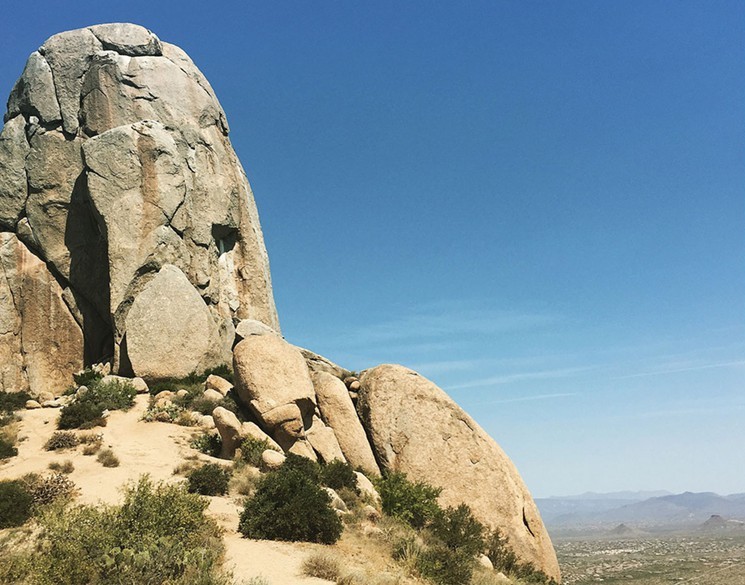
Tom's Thumb
Tom’s Thumb
Distance: 4 miles round tripLevel Of Difficulty: Moderate
Average Time: 3 hoursAt just under 2,000 feet of elevation gain, the Tom’s Thumb sits at 140 feet and can be seen throughout most of Scottsdale and the East Valley. Fun fact: This local landmark, previously called "the dork" by local climbers, has since been named for a patriarch of the climbing scene here in Phoenix, Tom Kreuser. But not to worry, you don't need to be a climber to enjoy the sheer wonder of this jutting protrusion.
Within the first half-mile, you'll ascend a steep series of switchbacks. The views are amazing and help in keeping the mind off the work you're putting in. You can look forward to stunning views of Bartlett Lake, Four Peaks and the Cave Creek Mountains. At the 1-mile marker, you're sitting at an impressive 3,680 feet. About a half-mile later, you’ll reach the saddle for another set of outstanding views. Then there's one more half-mile to the ridgeline and a proper view of Tom’s Thumb and its awe-inspiring proportions.

Echo Canyon Trail
Distance: 2.3 miles round tripLevel of Difficulty: Difficult
Average Time: 2 hoursCamelback Mountain should be hiked at least once in your life. Whether you live here or are just visiting the Valley, this summit hike offers some of the most sought-after panoramic views of Phoenix. Located in the middle of the city, this 1,264-foot climb is an intense taste of wilderness tucked within suburban limits, one that is sure to take your breath away in more ways than one.
Echo Canyon is one of two trails on Camelback, and throughout much of this hike you will endure sections of scrambling and stair-stepping. If this makes you a little skittish, know that handrails have been put in place for assistance if needed. At just under a mile, a false summit comes into view. Now while this may seem like a nasty trick after the cardio you've been putting in, the true summit is mere steps from this, and you will soon be atop the highest peak in Phoenix. Take it in, catch your breath and enjoy the sights of metro Phoenix — from downtown and South Mountain to Four Peaks, the Superstition Mountains and Chase Field. This is an absolutely outstanding approach to seeing the entire city.

Hieroglyphic Trail
Hieroglyphic Trail
Distance: 3 milesLevel of Difficulty: Easy
Average Time: 1.5 hoursThe short Hieroglyphic Trail hike offers spectacular views of the magnificent Superstition Wilderness Area, as well as a prehistoric collection of Hohokam petroglyphs. Located at the base of the Superstition Mountains, this hike is perfect for beginner hikers, families or anyone looking for a fun, easy hike. The trailhead is shared with the Lost Goldmine Trail, but make your way up a small hill and you will find two wooden signs marking where the trail forks. Stay left and continue toward the mountain.
At around a half-mile, South Mountain, Camelback Mountain and Sombrero Butte will come into view. Continue another half-mile, and you will be entering Hieroglyphic Canyon; keep along this trail and within about five to 10 minutes, you will reach a large rocky area with several small pools of water and scores of Hohokam petroglyphs. You may be wondering why it isn't called the Petroglyph Trail. It seems to be that a misunderstanding on behalf of early miners and settlers is to blame. Hohokams inhabited Central Arizona approximately 800 years ago, leaving behind large numbers of petroglyphs that early settlers mistook as Egyptian hieroglyphics.

Mormon Trail to Hidden Valley Trail
Distance: 3.9 milesLevel of Difficulty: Moderate
Average Time: 2 to 2.5 hoursLocated within the largest municipal park in the country, South Mountain’s Hidden Valley Trail lets you escape the city with exceptional rock formations and two natural rock tunnels bookending this half-mile trail. Tranquility is found within this stretch of the hike, as the city and its sounds disappear, leaving you with awe-inspiring rock formations and sandy, dry washes.
Entering the hike at the Mormon Trailhead, the ascension is immediate, but it's less than half a mile to the saddle, where there's an incredible view of downtown Phoenix. From here, you hit a steep section of the trail, which will flatten out around the one-mile mark. Shortly, you’ll come to the intersection with Mormon Loop and you’ll want to go straight, staying on Mormon Trail all the way until you run into the National Trail. From here, take a right, where you’ll be heading toward Fat Man’s Pass to enter the Hidden Valley Trail. Enjoy the scenery and exit through the second rock tunnel to head back out through Mormon Trail.
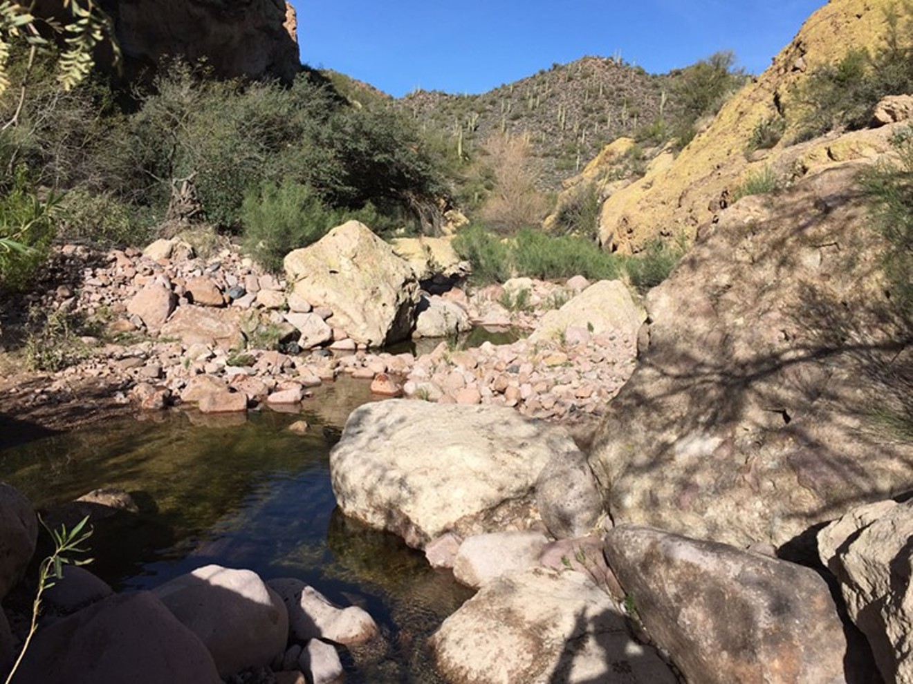
Cave Creek Trail to Skunk Tank Loop
Sara Palmer
Cave Creek Trail to Skunk Tank Loop
Distance: 10 milesLevel of Difficulty: Moderate
Average Time: 5 to 6 hours
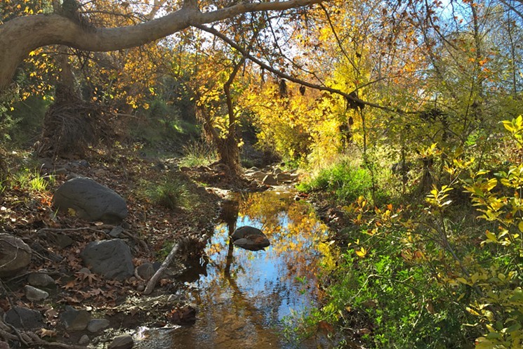
Located northeast of Phoenix in the Tonto National Forest, this trail highlights the riparian oasis that is Cave Creek. Yes, it is more than just a city; an actual creek that flows through part of Tonto National Forest, bolstering an extensive array of flora and fauna not usually found in the desert. Upon entering the Cave Creek Trail, you'll most likely forget that you are, in fact, in the desert and mere miles from the city, thanks to the lush vegetation and the sounds of the flowing creek beside you.
This loop provides a great day-hiking experience. It begins with a serene trek through short and shallow water crossings and underneath lush canopies of trees, before dropping into a narrow canyon and sending you hiking along a beautiful, rocky creek bed. Then, looping onto Skunk Tank Trail adds some cardio, with magnificent panoramic views of rolling hills and mountains as far as the eye can see. It's not a bad payoff, and at just over halfway through the hike, the long switchbacks have elevated you to 3,665 feet. At just under a mile, the trail bends and meets Quien Sabe Trail 250. This is the highest point of the hike at 4,075 feet. Continue uphill, and soon you'll arrive at Quien Sabe mine, followed by the old miner’s camp. This is a nice place to stop and enjoy a little history before completing your remaining 2 miles.

Boyce Thompson Arboretum
Distance: 3 milesLevel of Difficulty: Easy
Average Time: 2.5 hoursLocated at the base of Picketpost Mountain next to Queen Creek, Boyce Thompson Arboretum houses an expansive variety of desert plants from all over the world. This hike, more of an educational stroll actually, is a fantastic opportunity to begin recognizing what vegetation you’ve seen on the trails — or for beginning hikers, what you will commonly happen upon depending on the region of the Valley you are trekking through.
Upon arrival, take the Main Trail all the way through as it connects to the arboretum’s notable features and alluring detours. For a taste of what you might encounter on hikes near Phoenix, make sure to hit up the Sonoran Desert Trail before returning back to the Main Trail. From there, you’ll find opportunities to visit the Hummingbird Gardens and the Smith Interpretive Center, a historic framework repurposed to hold two greenhouses, showcasing succulents and cacti from around the world. As you keep traveling on, you will soon find yourself at Ayers Lake, a man-made reservoir providing water to the entire grounds and doubling as a bird sanctuary. Beyond this, you will be trekking through a riparian area, an interactive herb garden, a thicket of palms and the Eucalyptus Forest. Your journey will be complete with a walk across the Outback Bridge, ending on the walkabout trail through the Australian Desert Exhibit.

Peralta Trail to Fremont Saddle
Distance: 4.9 milesLevel of Difficulty: Moderate
Average Time: 3 to 4 hoursThere is a lot of history and mystery associated with the Superstition Wilderness Area, bringing hikers and historians by the thousands to the old mining grounds storied to be haunted by prospectors of old. Whether you believe the lore, the Peralta Trail is a great introduction to the majesty and mystery of this breathtaking area — and it heads to one of the best views of its famous landmark: the 1,220-foot-tall Weaver’s Needle.
This trail is named for a family from Sonora, Mexico, who mined the area before a great massacre, leaving behind stories of a lost map, hidden gold and hauntings. It starts with a left at the trailhead. From here, enjoy the soaring mountains around you before crossing Peralta Creek at the quarter-mile marker, where you begin your ascension. At just under a mile, you will come across a fork in the trail; keep to the right and continue through a series of switchbacks upward. At a mile and a half, looking across the canyon, Geronimo’s Cave comes into view. The trail will cross the creek bed again before sending you upward and onto some colorful volcanic terrain. Shortly, you'll pass a cave entrance. Then it's less than one-half mile to Freemont Saddle for an amazing view of Weaver’s Needle.

Reavis Falls
Sara Palmer
Reavis Falls
Distance: 14 milesLevel of Difficulty: Difficult
Average Time: 8 to 9 hoursDid you know that there's a 140-foot waterfall just minutes from the city? Reavis Falls is 30 feet taller than Niagara Falls. Located deep within the Superstition Wilderness, this hike is not for the faint of heart, but it's definitely worth the effort. The state of the waterfall varies depending on recent rainfall, so plan accordingly. Begin at Reavis Trailhead, with a beautiful view of Apache Lake behind you as well as a great visual upon your return. From here, you'll bend and climb through Reavis Trail for just over two miles, reaching a saddle at 4,000 feet. A quick turn to look behind you yields a great view of Four Peaks. In a little over a mile, Castle Dome will come into view; this is a steep part of the trek landing at a saddle at 4,675 feet. In less than a mile, the trail begins to descend.
The descent is 1,625 feet and it's important to remember that this will be a climb on your way out. At 6 miles, you'll reach Reavis Creek and follow it upstream, where you'll cross over the creek several times. This involves much boulder-hopping and often very cold water. If the flow is good, you'll definitely hear the waterfall before you see it. The sounds will beckon you closer, until finally you're face to face with this unbelievable sight right in the middle of the desert.
This article originally appeared in 2016 and has been updated.