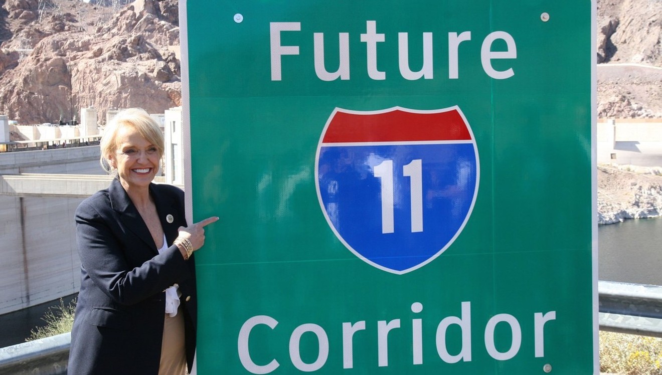

Former Governor Jan Brewer unveils new signs at a March 2014 ceremony at Hoover Dam, after Congress designated the future Interstate 11 route
Courtesy of ADOT
New long-distance freeways were a thing of the past in the United States. Most big projects in the last quarter-century involved a spur or an interchange or a loop, not a new route across virgin land for mile upon mile.
Even locally, the closest thing to an interstate highway, the South Mountain Freeway, was mired in politics, funding, and controversy since the mid-1980s before finally breaking ground.
But there is now real momentum behind I-11. And it’s more than a slick photo op of former Governor Jan Brewer planting a sign next to Hoover Dam saying so.
Earlier this month, the Arizona Department of Transportation released a study that narrows the options for likely routes and is the last step before a two-stage environmental analysis begins. That work will result in ADOT picking the preferred route by late 2019.
Courtesy ADOT
The details are where opportunities and fortunes lie.
The latest study, called an Alternatives Selection Report, evaluates numerous possible routes, and eliminates a handful.
Courtesy ADOT
That is not irrelevant.
Congress has earmarked no money to actually build I-11, and the Phoenix bypass alone would easily top $1 billion. The South Mountain Freeway, a 22-mile bypass, costs closer to double that.
Moreover, the feds don’t pay a dime toward a detailed environmental study – the last hurdle before final approval – until some source of money has been found for construction. It sounds shocking, but Congress doesn’t like to throw good money after bad.
If somebody else can pony up that front money, that makes Uncle Sam happy. This is where the landowners come in.
One unusual quirk of the I-11 planning: ADOT is studying in the first phase of environmental review a 2,000-foot-wide right-of-way corridor. Historically freeway plans consider 300-foot or maybe 400-foot swaths. Bear in mind, ADOT’s standard width for a freeway lane is 12 feet.
One theory is that the Colangelos and Gateses of the world could donate right of way, giving ADOT a fighting chance at the funding trough whenever Congress manages to pass a full transportation spending bill.
Meantime, the planning is now in its critical phase.
ADOT examined 27 braided strands of a possible I-11 route.
The study eliminated further consideration of one route south of Casa Grande, three possible alignments between Casa Grande and Buckeye, and two routes north of Buckeye closest to the White Tanks.
Courtesy ADOT
ADOT recommended further analysis for many of the surviving routes, but left intact one clear favorite to go straight into the next round of study. That would have the future route follow I-19 from Mexico and I-10 from Tucson to Casa Grande.
After that, two options are top contenders:
• A route following existing highways through Gila Bend.
• A new route roughly past the town of Maricopa running northwest behind the Estrella Mountains either via Goodyear or Buckeye.
Next in line are the favored routes connecting I-10 to US 93 near Wickenburg, which are all the ones farthest west.
Courtesy ADOT
The study focused on five criteria:
• Reduction in travel times
• Ability to serve projected population and job growth
• Proximity to industry
• Linkage to the national freeway system
• Environmental effects.
To understand why, you have to understand why the freeway was contemplated in the first place. ADOT laid that out in a previous document defining the need and purpose of I-11.
Essentially, it is a trade and freight route. ADOT defined the purpose chiefly as supporting “improved regional mobility for people, goods, and homeland security” and connecting “major metropolitan areas and markets in the Intermountain West with Mexico and Canada.”
Currently, freight from Mexico to Canada must ply congested I-5 on the West Coast or I-25 along the eastern side of the Rockies. Las Vegas and Phoenix are the largest paired cities in the country without a direct interstate connection, I-11 boosters say.
Moreover, the Intermountain West is slated for rapid growth and it's increasingly difficult getting to and from the ports of Los Angeles/Long Beach and Houston. Huge volumes of Mexican commerce enter the United States over the Arizona border, with something like half of the fresh imported Mexican produce in the country crossing at Nogales.
Hey, Boise and Salt Lake residents want fresh avocados and mangoes, too.
Long-term plans for I-11 call for extending the freeway north past Sin City, up toward Reno, and beyond toward the Great White North.
The study showed that without any improvement, average freeway speeds between Nogales and Wickenburg could drop by as much as 16 mph in some places by 2035. North of Casa Grande, average speeds would exceed 60 mph on every proposed alignment.“From a regional perspective, it’s way out there. It’s a lower priority.”
tweet this
But some routes there might carry as few as 2,300 vehicles a day. The busiest could carry a projected 48,000 vehicles a day. By comparison, between 250,000 and 280,000 vehicles a day pass through the Deck Park Tunnel.
So what’s in it for you?
Planners at the Maricopa County of Governments, a regional body that oversees regional transportation planning, have long wanted a truck bypass to take congestion through the system’s pinch point: I-10 between downtown Phoenix and Tempe.
“The benefits are statewide and nationwide,” MAG Transportation Director, Eric Anderson said, noting that it's unlikely the project could be funded regionally.
“From a regional perspective, it’s way out there. It’s a lower priority,” Anderson added.
It is way out there. The far western leg of the project would hook up with I-10 somewhere out by 371st Avenue. That’s a third the way from downtown Phoenix to California.
So why put a freeway there? You have to turn to the city planners on the west side, particularly those in Buckeye, for the answer to that.
The Buckeye General Plan calls for a city physically bigger than Phoenix, which would stretch from north of Carefree Road to well south of Riggs Road. At 600 square miles, Buckeye would be three times the size it is now. The city has approved the land use plan to convert desert into city.
MAG projected last year the population of Buckeye will grow from 73,000 to 488,000 by the middle of the century.
Courtesy: Town of Buckeye
But, says MAG and Buckeye, they will, and when they do, they’ll need a way to get around. Existing I-10 won’t cut it. The Tarteso subdivision there is the first sign of things to come.
Now consider that I-11 would be perhaps another 10 miles west of that, beyond even Buckeye’s ambitious city limits. That’s exactly where Bill Gates recently invested in about 25,000 acres in a speck called Belmont, which could grow to a community of 80,000 homes.
There’s more. Just to the north lies a huge tract of land, 37,000 acres, called Douglas Ranch. That’s owned by Scottsdale development giant El Dorado Holdings, founded by Mike Ingram. On its website, El Dorado makes no bones about the importance of I-11.
“The approved route for Interstate 11, which crosses through Douglas Ranch, creates a transcontinental freeway connecting Canada and Mexico, thus placing Arizona at the center for intermountain and international commerce,” El Dorado states, somewhat prematurely.
Courtesy ADOT
Urban planners will tell you the market drives the change and the market says people are coming. It’s better to manage that growth by planning for it, they argue.
Environmental groups would have you believe that growth is not inevitable in all places, and granting development rights only accelerates unwanted growth.
None of that can happen without a transportation network. MAG and ADOT first started thinking about I-11 when they realized I-10 would be overwhelmed by the populations expected west of the White Tanks. Something had to be done.
But those communities cannot exist until a freeway is in place. The freeway induces, rather than responds to, the growth, environmentalists believe.
Some of that is borne out in ADOT’s study released this month.
The diagonal strand of highway from near Maricopa to the Hassayampa River was the only one that ranked well in that area for adjacent job and population growth. It was projected to generate 80,000 people, more than triple the next most competitive alignment. It would create 18,000 jobs, more than double the next best contender. It would cut through mostly empty desert.
Concerns for the environment in that area and around Vulture Mountain Recreation Area near Wickenburg were among the 2,300 comments gathered by ADOT during its latest round of public outreach for the I-11 plans.
Comments ran the gamut from outright opposition to strong support. ADOT blacked out the identities of those commenting.
Wrote one online commenter in June, “I oppose this new Interstate. It will save little time for travelers, cost the taxpayers a hefty sum, and will spoil some of the best desert in AZ. I recreate in the area frequently, but once a freeway goes in I will take my business elsewhere. Don't do it!”
But others, particularly developers, had a different view.
“I am a sixth-generation Arizonan, GPEC Board Member, Pinal Partnership Executive Board Member, served on the Maricopa County Planning and Zoning Commission for 10 years, and I’m a property owner and developer...," one commenter wrote in a letter. “I applaud the effort as a region and a state to partner in making I-11 happen. This will be a massive step forward in international trade as well as a huge boost to our local economies and interconnectedness.”
For years, ADOT has been talking about I-11 in different terms. It’s a different kind of project.
For one, planners suggested, the sheer scale of the project may require deeper collaboration with private enterprise. That could mean what ADOT calls a P3 arrangement, P3 being jargon for “public-private partnership.”
The state changed the law a few years back to enable such an arrangement, which is being tried out on the South Mountain Freeway. It gives a private contractor more flexibility to design the project and that company also takes over the maintenance of the highway for a number of years after it’s built. ADOT said that saved about $300 million on the Loop 202 extension and accelerated construction by two years.Another option, still on the table, is that I-11 could become a toll road.
tweet this
Another option, still on the table, is that I-11 could become a toll road.
Also, ADOT planners envisioned something more than a freeway. I-11 could be an infrastructure pipeline, with extra room for power transmission lines, gas pipes, solar farms, maybe even high-speed rail lines. Everything a 21st-century society would need, in one place.
Environmentalists at the Sonora Institute originally liked that idea and said they could live with carving a new freeway as long as potentially 278 miles across the landscape. But only if that meant the other goodies came with it.
It was smart growth, many said, and they repeated it in comments.
But the latest plans say less about that now, and over at MAG, Eric Anderson said the vision for I-11 has become a bite more down to earth.
“Realistically, the highway is the primary use,” he said.
Maybe Arizona learned from Texas. There, planners conceived of the Trans-Texas Corridor, a spine of toll-road, rail line, and utilities from Mexico north across the state. The plan fell apart. It needed too much land and ranchers and farmers weren’t keen.
Arizona’s original vision may be one reason the story about Microsoft founder Bill Gates developing a “smart city” 40 miles west of Phoenix caught wildfire.
When Gates’ interest in the 39-square-mile Belmont tract became public, Anderson and many others said it was a potential game-changer. A smart city that far west, a marquee name like Gates, and the vision that comes with it, all suggested a different future for Arizona was possible. A smart city and I-11 could make each other a reality.
“It showed confidence that the metro Phoenix area is a good place to invest,” Anderson said, adding that a community with something like a second Amazon headquarters there would change everything.
Belmont is so remote it would need local industry to work. More recently, Anderson and others say Gates may be land-banking the property.
Whatever the case, and whichever the route, the stakes for I-11 are enormous.
“Interstate 11 is part of the larger picture when we talk about planning for Arizona’s transportation future and enhancing our state’s Key Commerce Corridors,” ADOT Director John Halikowski said in prepared remarks. “As we look to invest and prioritize needs to improve our state highway system, we must consider how to better connect people, communities, and markets.”