Best Hike with a Big Dog 2008 | Waterfall Canyon Trail | Arts & Entertainment | Phoenix
Navigation

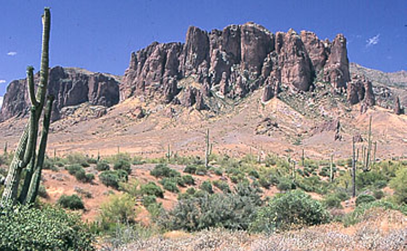
For those who don't favor their pooches large — or, God forbid, don't even own a canine or two — there's not a lot worse than getting bumped off the trail on a meditative nature hike by someone struggling to maintain control of their over-excited old Lab or fearsome-looking pit bull. But we've found a spot where big dogs (on leashes, natch) rarely bother anyone but their handlers — and it's a wonderful walk, to boot. At two easy miles in length, the trails are wide and easy to traverse, so much so that park rangers encourage wheelchair-bound hikers to come on out. We were duly impressed by the Indian petroglyphs, etched into huge boulders around 1000 A.D. After a good rain, the pot at the end of the rainbow otherwise known as the Waterfall Canyon Trail is a 75-foot waterfall that seems incongruous in the Sonoran Desert.

But back to those pups. Not long ago, we saw a lone woman, who had to be pushing 80, walking slowly through the canyon on the return trip. Jogging hard the other way was a triathlete-looking fellow with his German shepherd in tow. The jogger yanked his pooch to the side of the trail, and the woman never blinked an eye, never had to wonder whether she'd be trampled. That's what we call a happy ending.

So you love your little rugrat of a dog, and you want to expand his (we'll make him a "he" here) world to the great outdoors. And even though you know he's spunky as hell, those little legs won't do well on, say, Camelback Mountain, and you're afraid that he'll sniff too close to a rattlesnake, scorpion, or other varmit on a less-traveled trail. We've got the answer, and it's called Piestewa Peak (formerly Squaw Peak, until the city of Phoenix renamed it after Iraqi war hero Lori), officially part of the Phoenix Mountains Park and Dreamy Draw Recreation Area. Though the hike to the top on the Summit Trail is rigorous — 1.2 miles, elevation gain of 1,200 feet — the 3.75-mile Circumference Trail is much more forgiving, for humans and pooches alike. Wonderful views of downtown Phoenix await the people, and unparalleled scents of other canine cavorters await your little fluffball. We've seen more than one little love affair (G-rated, thankfully) spring up on the trail. All you need is some water for you and your best friend — and a leash.

If Piestewa Peak and Camelback Mountain had a baby, it would be Hayden Butte, a.k.a. "A" Mountain. This pint-size peak next to Arizona State University's Sun Devil Stadium provides a quick fix for nuts like us that can't stand flat ground. The best way to start the hike is to take College Avenue north toward the mountain to where the road ends at a parking lot, just west of the stadium. Keep going through the parking lot to the marked trailhead. After a nice, gentle section, hikers must trudge up an ultra-steep, asphalt service road that leads to a series of stairs and handrails. The summit area requires a tiny bit of scrambling to let you know you're on a real mountain.

In total, it's about a half-mile from base to peak — not very much distance, but the inclines are steep enough to stir our calf muscles. If we're feeling particularly energetic, we'll run up and down two or three times. Besides the workout, though, Hayden Butte offers the delights — albeit smaller-scale — of the Valley's burlier hikes. Namely, the temporary relief from urbanism and the picturesque view from on high.

True, there are those unsightly antennas and utility boxes surrounded by a chain-link fence that take up some of the space on the peak. For now, think of it as a bit of history — the equipment has been there for 60 years. But purists, take heart — that stuff is expected to be moved to the top of the new condo towers in downtown Tempe in the next year or two, allowing for a slightly more natural-looking summit.

The view of downtown Tempe and the Town Lake merits, at the very least, a one-time pilgrimage up Hayden Butte's flanks, especially for Valley newcomers and ASU students. Try it at night, when the summer heat's cooled off and you can see the lights strung over the Mill Avenue Bridge reflected in the lake. Two words describe this hike perfectly: Short and sweet.

We once knew a chick who broke an ankle hiking at night and wouldn't step off asphalt from that day forward unless there was light in the sky. What a shame for her, 'cause any knowledgeable trekker'll tell you that the best desert hiking is nocturnal, and it's twice as good in the summer. Our favorite after-dark delight is this short-but-sweet loop, which starts at the Siphon Draw trailhead near the Lost Dutchman State Park amphitheater and follows a gradual rise along the Prospector's View Trail to the base of the Superstition Mountains. Stop to drink in the silvery view at Green Boulder, which resides in the moon shadows of some lovely, snaggle-toothed pinnacles. There are several options for the return trip, but we usually head south on the Treasure Loop Trail, traversing a mile or so of bumpy washes and magical forests of jumping chollas that gleam like fresh bone in the glare of a full moon.

We're a human compass. It's innate. Until we met this befogging jaunt, no map was too complex, no maze too maze-like for our superhuman route-finding ability. Perhaps the hike's transitional setting, between lowland desert and upland scrub, had something to do with it, but after about an hour of head-scratching trekking, we felt as though we were running around in circles, holding a jerky video camera, and finding beating human hearts on the ground.

It might've been the spirit of one of the gold miners who pushed out the native Tonto Apache back in the 1870s — or an angry Apache specter seeking revenge — but whatever the spook du jour, this trail creeped us out. If you like creepy, it's a lovely place, set largely in a dry riverbed shaded by trees that wouldn't grow a mere 500 feet lower in elevation.

We know what you're thinking: "I never get lost. These people are pansies. I'll show them." Right? Well, lay in a supply of breadcrumbs, bub, 'cause this witch is hungry.

There's a moment when you reach the southwest extremity of this park's Pedersen loop trail that you stare into madness. The glimpse into the vast vacuum of central/western Arizona is the sort of horizon-less view you see in the movies, where some poor sap's got himself lost in the trackless desert, and now he's shuffling along like a zombie in the middle of nowhere. The outlook from this particular point on the Pedersen is a lot like that: Nowheresville.

Don't go that way.

Instead, trek east a couple of miles and keep going straight, even after the Pedersen bends north. We guarantee you'll have one of the times of your life — if you live. Heh heh.

The route you'll find yourself on travels straight up the gut of the least-accessible mountain range in the greater Phoenix area: the Estrella, or Star, Mountains. Whatever route you choose, it'll be random; there are no sanctioned trails to guide you to the 3,650-foot pinnacle of the range, so it's all about route-finding your way through the lush, virgin terrain. How delightful, you say! Well, that depends on whether you like being slapped across the face or bonked on the head. The going's way steep and way exposed. The vegetation's so thick you can't see your legs, and the vicious flora keeps depositing small, pointy pieces of itself in you. It's prime rattler and Gila monster country, and, as noted, you can't see your legs.

So why torture yourself this way? Here's why: A hike into the Estrellas is a trip into the past. This is what Phoenix — and the upper Sonoran Desert — looked like before we brought the jackhammer down. You'll see flora and fauna that no longer exist elsewhere, you'll drink in panoramic views that few others have seen, and you'll set your feet down in places that no one else has. Ever.

Just don't kill yourself, 'kay?

Are you one of those nauseating people who conquer Camelback Mountain in an hour-10 without breaking a sweat? Are you so filled with self-love that you then preen before the opposite sex at the bottom of the trail, flipping your hair and stretching your muscles and stuff while we lowly sweathogs are still grinding up those damned log steps? Well, meet the Flatiron, sucka. It'll kick your hubric booty.

Camelback is one nasty bee-yatch. The tallest point in the Valley, she tops out at 2,704 feet, and there's an elevation gain of about 1,200 feet from the Echo Canyon trailhead. These figures would make a Himalaya vet chortle, but they don't tell the whole story, and we'd like to see a snowhead tackle the Camel in, say, August. We'll see who chortles last.

The appropriately named formation called the Flatiron — it looks, for all the world, like an iron — rests haughtily at 4,800 feet, at the pinnacle of the Superstition Mountains. The elevation at the jumping-off point, the Siphon Draw trailhead, is about 2,000. Math says: two Camelbacks up, two Camelbacks down. Uh . . . ouch.

The trek starts near the campground at Lost Dutchman with the part of the hike we call the Tedious Trudge — 1.6 miles of rocky, irritating going on a gradual rise that leads up to and over the base of the Supes and into the maw of the Basin, a humongous natural amphitheater. This part of the hike accounts for about 1,020 feet of the total elevation gain.

The heartaches begin at the 1,021st foot. There, you're greeted by a vertical view of what's in store for the next, oh, mile and 1,800 vertical feet or so. Now, 1,800 feet in one puny mile is pretty vertical — in fact, it don't get much more straight up than that. More daunting still, the path (loosely termed) follows a natural drainage littered with giant boulders and prickly flora. It's very much like the Camelneck route on Camelback — but worse.

One more quick knock on ol' Dromedary Mountain: People say C-Back offers the best local panoramic views, but pay those unschooled people no heed. The 360 that fills the sockets from the top of the Supes puts anything else within a 100-mile radius to shame.

Bouldering is nothing more than rock climbing without a rope on short boulder faces. You don't need a lot of gear to do it — just a pair of good rock shoes and gymnasts' chalk, to dry up the sweat on your hands. Even those two items are optional, though the experience won't be as fun without them. By focusing on the climbing moves instead of futzing about with a lot of equipment — not to mention worrying about dying an untimely death — bouldering can be a wonderfully liberating experience, mentally. And it's a heck of a workout, physically. Best of all, it's free. At least, it is at Camelback Mountain, which is part of the Phoenix parks system. Quite a few bouldering options exist at Camelback, but we like the big pyramid-like boulder at the top of the trail's first long set of railroad-tie stairs.

We've spent many an hour turning our hands into ground beef on this 25-foot-high boulder, especially the east-facing corner that wraps around into an overhanging cubby with tiny finger-pockets for handholds. Another traverse near the north side is where we like to practice our heel-hooking technique. Best of all, when our arms and hands are blown, we can jog up the 1.2-mile trail to the summit of Camelback to work out the rest of our body. For climbers, this combo workout is cross-training at its best.

The Hand is a gorgeous, freestanding pinnacle of prehistoric lava in the Superstition Mountains that almost looks as if it belongs on Easter Island. It more resembles a finger as you hike toward it along Treasure Loop trail, though from the side it does really look like a hand, complete with a short thumb.

One of the reasons we love this climb is the belay perch on the space between that great thumb and the rest of the hand. It's like sitting in the saddle of a giant horse, our legs dangling over the steep cliffs on each side. Steel chains bolted into the rock provide a good anchor here, but there's certainly a high danger factor — let's just say that if you have no experience with rock-climbing techniques and equipment, the pretty view from this ledge just might be the last one you ever see.

Razor's Edge sports a moderate technical rating, but indoor-only climbers be warned — this one requires the lead climber to pack more than a medium amount of chutzpah. The two pitches of climbing have many sections with no protection for the lead climber. And, as on many climbs in the Supes, we found some loose rock that is just waiting for a careless climber to pull on.

In general, though, the pointy dacite outcroppings make good holds for hands and feet. The fun climbing and airy, heart-pounding exposure of Razor's Edge even received notice by Climbing Magazine. (www.climbing.com/exclusive/classicclimbs/razorsedge).

Also worth mentioning is the thrilling, 150-foot rappel, which is how you get down from this thing. The first climber that goes down should be ready with his or her camera to get shots of the others as they descend on the rope. A day at the Hand, especially properly photographed, will be a day to remember.

When the rocks outside get too hot to touch, climbers have two choices: Head north or head indoors. For the latter option, you can't do better than the Phoenix Rock Gym (which is actually located in Tempe, near Arizona State University). The place has a good mix of walls for beginners and advanced climbers, and a good mix of people, too. On the same afternoon you can see young couples introducing their 5-year-old to climbing and hear muscle-packed experts chat about drop-knee technique. The top-rope walls become crowded on Tuesday and Wednesday evenings, but that's the price of success. Thrill-seekers can always move into the lead wall area, where climbers practice life on the "sharp end" and sometimes fall up to 10 to 15 feet on a rope before being caught by a belayer. One of the original rock gyms in Phoenix, if not the first, the PRG recently went through a major renovation in which the owners added a second bouldering area upstairs, this one with more heavily inverted walls. If you want to see human spiders climbing upside down, this is the place. The "old" bouldering area (for the uninitiated, bouldering is the art of traversing relatively low walls without being tethered) received a summer makeover this year, and now sports murals of colorful cartoon sea creatures. If they were to add bunks and a vending machine with beer, we'd probably move in.

Best Of Phoenix®

Best Of