There are few places in downtown Phoenix where you can run unimpeded by traffic. One of those places is the Grand Canal. If you're looking for a nice three-mile jog, start at 15th Avenue and head east. Run by Brophy and Central, past the Brophy baseball field to Seventh Street. Turn around and jog back to 15th Avenue. Boom — you got your three miles in, and you had to cross only two main streets. While you're running, you might also catch a glimpse of the humongous fish that call the canal home. So, the next time you see someone fishing along the bank of the canal, you'll know with a certainty that they aren't crazy — there really are fish in there.

Best Hiking Trail
Taliesin Overlook, Lost Dog Wash Trailhead
While the point of many hikes is the scenery on the journey, that's not always the case. Sometimes, the hike itself isn't incredibly spectacular (once the beauty of the Arizona desert has sunk in), but there's a reward at the mid-point that feels so gratifying. One such hike is to the Taliesin Overlook, which is reached from the Lost Dog Wash Trailhead, at the end of 124th Street, north of Via Linda, in Scottsdale. There are a few trails up here, but this moderate hike alongside the McDowell Mountains leads to exactly what it sounds like — a view of Frank Lloyd Wright's Taliesin West. Just as a note, the overlook isn't exactly in Taliesin's backyard, and you'll see a lot of housing built into the desert. That said, if you're a nature purist whose hike is going to be ruined by seeing housing, lighten up. It's a cool view.
- 124th St. N. of Via Linda, Scottsdale, 85259 Map
- www.mcdowellsonoran.org
Best Hike for Beginners
Scenic Trail at McDowell Mountain Regional Park

There are quite a few accessible hikes for all ages and levels within the big city, including a handful at South Mountain, but for beginners to experience the best that a day hike has to offer (without feeling so much strain that it brings on feelings of loathing for the outdoors), a trip to McDowell Mountain Preserve is in order. It takes about an hour to drive to this sprawling park way out east in Scottsdale, but it's well worth the time to traverse the 40 miles of hiking, mountain biking, and horseback-riding trails. Aptly named, the Scenic Trail takes hikers through a 3.5-mile meandering path that begins in easy washes and then gently slopes up and through the Lousley Hills. As you follow the loop, you'll stumble on incredible sights like the silhouette of Four Peaks in the distance, the lush land surrounding the nearby Verde River, and classic Sonoran Desert features like fallen saguaro. After a couple hours of hiking, sprawl out for a picnic in the ramadas near the trailhead, or swing through Fountain Hills to quickly get back to civilization and stop for brunch.
- 16300 McDowell Mountain Park Dr., Scottsdale, 85255 Map
- 480-471-0173
- www.maricopa.gov/parks/mcdowell/
Best Summer Hike
West Fork Oak Creek #108
There's much more to Sedona than red rocks, New Age-y retreats, and resorts for out-of-towners. Heading north from Phoenix? Drive through the tourist-crowded city center and into Oak Creek Canyon. Although a ton of great trails surround Sedona, the ultimate must-visit is West Fork. The first portion of the trail — great for families and casual hikers — has plenty of great views of tall, colorful cliff faces, and high desert forest. And it doesn't take long to get to the popular swimming area with sloping rocks to slide down. The creek runs across the trail multiple times, so be prepared to cross over it using fallen logs and slippery stones. But, boy, does it feel good to stop and dip your toes in the cool, fresh water. The views only get better as you hike farther in, and things get pretty quiet after the first couple of miles. Spring and fall are the best seasons to hike West Fork, but summer is wonderful, too. Temperatures most likely will be in the 90s, and the trail is mostly shaded by trees.
Best Winter Hike
Siphon Draw-Flatiron
A hike of six miles, Trail 53 into Siphon Draw and onward to Flatiron is a perfect representation of the vibrant desert of the Superstitions — and the harsh reality of hiking them. Starting as a gently elevating walk through the wildflower-speckled foothills, the trail veers upward through the smooth and massive draw (which can present the hiker with occasional waterfalls) and through a scrambling, shaded canyon to the top of Flatiron. Along the trail, the scenery morphs constantly, starting from rolling hills to smooth rock surfaces, then a boulder-filled canyon, and eventually the plateau of Flatiron covered in shrubs near the fantastic rock formations at the true summit. In the winter especially, the transition is vivid; coming from the warm and dry desert at the bottom, the summit is a cold and windy place and can even have a bit of snow to offer respite and amusement after a long, tough hike. This difficult hike is a beautiful challenge for those willing to witness the dynamic qualities of the desert along the climb, most visible and most enjoyed without the summer heat weighing you down.
Best Tough Hike
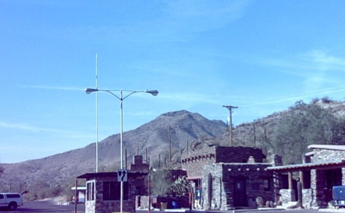
Picketpost Mountain
This monument of a mountain looms over the surrounding desert between Phoenix and Superior, offering up one of the trickiest hikes near the Valley. (Take the unmarked dirt road to the Saddleridge Trail on the left, which ends at the trailhead parking lot.) It is not the length or elevation gain that makes this hike so difficult (though at nearly four miles in length and just under 2,000 feet gained, it is no easy feat); it is the exposure and lack of trail markers that truly challenge the hiker.
Starting easy along a small section of the Arizona Trail, Picketpost veers off toward the mountain to pursue a steep, cairn-marked trail lined with some of the biggest saguaros to witness your seemingly self-guided journey. A trail beginning with steep switchbacks, the hiker confronts it eventually with an even steeper ascent up rock-scramble canyons, slippery ridges, and bare rock cliff walls. But no tough hike would be complete without a rewarding summit, and the plateau top of Picketpost gives the successful climber an old mailbox to log your accomplishment, accompanied by a spectacular view of the East Valley and the backside of the superstitions. A hard hike along a rough trail, Picketpost Mountain is an achievement to be sure, but not for the faint of heart — literally or figuratively.
Best Road Bike Ride
South Mountain Summit Ride
You'll need thighs of steel (or at least a hell of a granny gear) to complete this ride in one push. With our middling level of fitness and bike gearing set more for speed on the flats, we can't reach the summit without frequent rest stops. Yet we go back again and again. Why? This hill is the toughest — and sweetest — challenge for road biking in Phoenix. Some compare it to a shorter version of the legendary Mount Verdoux (part of the Tour de France), in terms of both scenic beauty and heart-pounding exertion. From the Central Avenue park entrance, you'll climb grades of 5 percent to 8 percent for 5.5 miles to Dobbins Lookout; it's a little farther if you go to the TV towers. The smooth asphalt makes for an E-ticket descent with treacherous drop-offs, so make sure your steed is in good shape. Eleven or 12 miles is short for a road-bike ride; most locals do the summit trail as part of a longer adventure, such as the round-the-mountain ride on Riggs Road that will add at least 40 miles to the trip. We've done that several times but also enjoy biking to the entrance and just cranking the hill. For us, it's always a major workout — and always fun.
- 10919 S. Central Ave., Phoenix, 85042 Map
- 602-262-7393
- www.phoenix.gov/parks/southmnt.html
Best Mountain Bike Ride
Trail 100
Smack in the heart of the Valley, running through one of the country's largest urban preserve lands, Trail 100 takes you past awe-inspiring desert mansions, middle-class to upscale neighborhoods, picnic areas, and, most of all, miles of near-nothingness — just the placid Sonoran Desert. Sixth-largest city? Where? We typically start at the joke of a parking lot at Tomahawk Trail and Tatum Boulevard, which has a grand total of six spaces. Get there early and prepared for a long haul across challenging single-track. Though not as technical for the hardcore among you, we have to get off the bike on one rocky hill twice — once because it's too nuts to descend, and again on the return trip going up because our legs aren't strong enough. That part's west of the Dreamy Draw Recreation Area, which passes under the Piestewa Peak freeway. To make it a full 10 miles or so one way, we ride all the way to Cave Creek and Thunderbird roads before turning around. Hours of free thrills.
- 10919 S. Central Ave., Phoenix, 85042 Map
- 602-262-7393
- www.phoenix.gov/parks/southmnt.html
Best Vintage Bowling Alley
Let It Roll Bowl
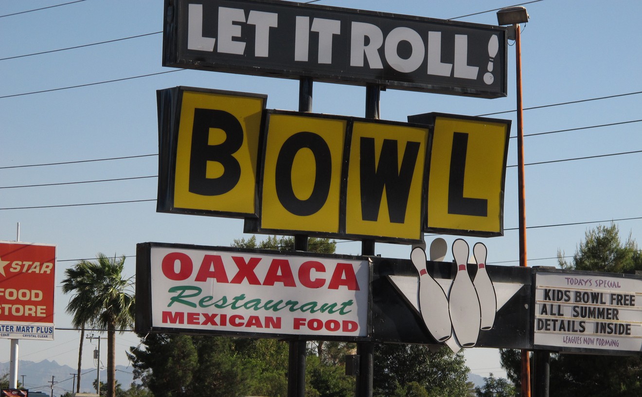
We love Let It Roll because someone was smart enough to revamp this old bowling alley (all new lanes and equipment) to make it a delightful place in which to bowl, while retaining a bit of the shabby interior to keep us comfortable. And the prices, though not exactly vintage, are way more reasonable than at those newfangled, fancy bowling alleys. Our favorite features: the vintage murals depicting partying Sunnyslopers and the fact that the bowling alley is adjacent to a better-than-decent Mexican restaurant.
- 8925 N. 12th St., Phoenix, 85020 Map
- 602-944-4401
- www.letitrollbowl.com
Best Bike Advocacy Group
Phoenix Spokes People
If you've ever ridden a bike around downtown Phoenix, you know the conditions are hostile and bumpy, at best. The city has few bike lanes, and those that do exist sporadically end and restart without warning. Drivers in the city often are unaware of cyclists, which results in a lot of close calls or worse. Not to throw around the title "hero" lightly, but earlier this year, the Phoenix Spokes People proved commitment to the cycling cause, which resulted in a budget increase for cycling infrastructure 30 times the previous years' allotment. Though tireless and dedicated attendance at 19 city budget hearings, the PSP proved that cycling exists in Phoenix and needs to be protected and encouraged to burgeon everything from local business spending to healthy living. Thus, in a heroic show of devotion to bicycles, Phoenix Spokes People, in part, got the City of Phoenix's cycling infrastructure budget raised from $50,000 to $1.5 million. Hats off to the PSP for making Phoenix that much more livable.
Best Of Phoenix®

-
La Vida
-
Best New Mexican Restaurant
Otro Cafe
-
Best Neighborhood Mexican Restaurant, Downtown Phoenix
Rito's Mexican Food
-
Best Neighborhood Mexican Restaurant, Central Phoenix
Asadero Norte De Sonora
-
Best Neighborhood Mexican Restaurant, South Phoenix
Los Dos Molinos
-
Best Neighborhood Mexican Restaurant, West Valley
Fajardo's Café
-
Best Neighborhood Mexican Restaurant, North Phoenix
La 15 y Salsas
-
Best Neighborhood Mexican Restaurant, Scottsdale
Los Sombreros
-
Best Neighborhood Mexican Restaurant, Tempe
El Tlacoyo
-
Best Neighborhood Mexican Restaurant, Southeast Valley
La Merced
-
Best Upscale Mexican Restaurant
Así es la Vida
-
Best Mexican Breakfast
El Mesquite Cocina Mexicana
-
Best Breakfast Burritos
Carolina's Mexican Food
-
Best Burritos
Cocina 10
-
Best Tacos
Tacos Atoyac
-
Best Tamales
La Piñata
-
Best Sonoran Hot Dog
El Exquisito
-
Best Tortas
Tortas Paquime
-
Best Carne Asada
Ta' Carbon, The Real Mexican Grill
-
Best Pollo a la Parrilla
Mercado y Carniceria Cuernavaca
-
Best Mariscos
San Carlos Bay Seafood Restaurant
-
Best Elote
Raspados Paradise Mexican Restaurant
-
Best Pozole
Taquitos Jalisco
-
Best Tortillas
La Sonorense Tortilla Factory
-
Best Salsa
Joyride Taco House
-
Best Guacamole
Barrio Café
-
Best Aguas Frescas
Pro's Ranch Market
-
Best Exotic Drinks
Frutilandia
-
Best Paletas
Paletas Betty
-
Best Paletas by the Case
Dulceria Arcoiris
-
Best Mexican Candy Store
Dulcería La Mexicana
-
Best Mexican Party Store
Sueños y Recuerdos
-
Best Mexican Tchotchkes
Mercado Mexico
-
Best Mexican Home Goods
Mexamigo Furniture
-
Best Mexican Market
El Rancho Mercado y Carniceria
-
Best Margarita
Margarita Especial Sierra Bonita Grill
-
Best Tequila
Senor Rio Tequila Jalisco International Imports
-
Best Tequila Selection
Blue Hound Kitchen & Cocktails
-
Best Latin DJ
DJ Kyko
-
Best Latin Night
Sabados Latinos, Saturdays at Q-Lounge
-
Best Latin Club
Sky Lounge
-
Best Mariachi
Mariachi Pasión
-
Best Lowrider
Sweet Leaf, 1963 Impala SS
-
Best Spanish-Language Journalist
Maritza Lizeth Félix, Prensa Hispana
-
Best Local Protector of the DREAM
Carmen Cornejo
-
Best Day of the Dead Remembrance
Guadalupe Cemetery
-
Best Vintage Mexican Home Goods
Antique Trove, Stall #7773
-
Best Vintage Mural
Untitled by Roberto Delgado
-
-
Food & Drink
-
Best New Restaurant
Bink's Midtown
-
Best Chef
Charleen Badman at FnB
-
Best Chef's Choice
Lucky's King Wah
-
Best Place to Take a Foodie
ShinBay
-
Best Place to Take a Scenester
SoChu House
-
Best Place to Take an Out-of-Towner
Richardson's
-
Best Neighborhood Restaurant
Cibo Urban Pizzeria Cafe
-
Best Food Truck
Taste-Rite
-
Best Sensation
Miu's Cuisine
-
Best Rise from the Ashes
Chop and Wok
-
Best Move
Beaver Choice
-
Best View
Talavera
-
Best Neighborhood Breakfast, Central Phoenix
Vovomeena
-
Best Neighborhood Breakfast, Downtown Phoenix
Matt's Big Breakfast
-
Best Neighborhood Breakfast, South Phoenix
Morning Glory Café
-
Best Neighborhood Breakfast, West Valley
New York Flavor
-
Best Neighborhood Breakfast, North Valley
Perk Eatery
-
Best Neighborhood Breakfast, Scottsdale
ZuZu
-
Best Neighborhood Breakfast, Tempe
Essence Bakery Cafe
-
Best Neighborhood Breakfast, Southeast Valley
Yoli's Cafe
-
Best Sunday Brunch
The Mission
-
Best Downtown Lunch
Duck and Decanter
-
Best Diner
Welcome Diner
-
Best Bar Food
Pomeroy's
-
Best Place to Eat at the Bar
Citizen Public House
-
Best Place to Take a First Date
Postino Central
-
Best Romantic Dinner
House of Tricks
-
Best Steak House
Ben & Jack's
-
Best Restaurant for Kids
Casa Reynoso
-
Best Place to Dine with Your Dog
The Main Ingredient Ale House & Cafe
-
Best Thing to Eat at Chase Field
Tailgate on a Plate at Extreme Loaded Dogs, Section 208
-
Best Reason to Go Out for Dinner on Sunday
Sunday Simple Supper at Noca
-
Best Late-Night Nosh
Pig & Pickle
-
Best Place to Sober Up
Philadelphia Sandwich Company
-
Best Hangover Breakfast
Yucca Tap Room
-
Best Soul Food Restaurant
Mrs. White's Golden Rule Café
-
Best Vegan Restaurant
Bragg's Factory Diner
-
Best Vegetarian Restaurant
Pomegranate Cafe
-
Best Gluten-Free Restaurant
True Food Kitchen
-
Best Authentic Arizona Restaurant
The Stockyards
-
Best English Pub
Rose & Crown
-
Best Irish Pub
Rosie McCaffrey's
-
Best French Restaurant
Amuse Bouche
-
Best German Restaurant
Brat Haüs
-
Best Latin American Restaurant
Tumi Fine Peruvian Cuisine
-
Best Cuban Restaurant
Cuban Foods Bakery & Restaurant
-
Best Hawaiian Restaurant
Leo's Island BBQ
-
Best Chinese Restaurant
New Hong Kong Restaurant
-
Best Korean Restaurant
Café Ga Hyang
-
Best Thai Restaurant
Chanpen Thai Cuisine
-
Best Vietnamese Restaurant
Pho Thanh
-
Best Japanese Restaurant
Nobuo at Teeter House
-
Best Ethiopian Restaurant
Ethiopian Famous Restaurant & Coffee
-
Best Indian Restaurant
Karaikudi Palace
-
Best Greek Restaurant
Greektown Restaurant
-
Best Mediterranean Restaurant
Hummus Xpress
-
Best Jewish Deli
Imperial Market & Deli
-
Best Italian Deli
Dolce Vita Italian Grocer
-
Best Italian Restaurant
Crudo
-
Best Corner Italian Restaurant
Andreoli Italian Grocer
-
Best Gourmet Pizza
Trattoria Bianco
-
Best Pizza Slice
Isa's Pizza
-
Best Neighborhood Pizza, Central Phoenix
Federal Pizza
-
Best Neighborhood Pizza, Downtown Phoenix
Pomo Pizzeria Napoletana
-
Best Neighborhood Pizza, South Phoenix
Amano Bistro and Wine Bar
-
Best Neighborhood Pizza, West Valley
La Piazza al Forno
-
Best Neighborhood Pizza, North Valley
Spinato's Pizzeria
-
Best Neighborhood Pizza, Scottsdale
Lamp Wood Oven Pizzeria
-
Best Neighborhood Pizza, Southeast Valley
Big Boy's Pizza
-
Best Fries
Zinc Bistro
-
Best Wings
J.T.'s Bar and Grill
-
Best Poutine
Petite Maison
-
Best Mac 'n' Cheese
Lux Central
-
Best Mac 'n' Cheese with a Twist
Zulu Caffé
-
Best Chicken & Waffles
Lo-Lo's Chicken & Waffles
-
Best Seafood
Little Cleo's Seafood Legend
-
Best Sushi
Hana Japanese Eatery
-
Best Tofu Curry
Flo's Asian Kitchen
-
Best Veggie Burger
Hillstone
-
Best Hamburger
The Attic
-
Best Hot Dog
Short Leash Sit . . . Stay
-
Best Sandwich
PBLT at Bootleggers
-
Best Grilled Cheese
Wedge & Bottle
-
Best Jerk
Jerk Hut Jamaican Grille
-
Best BBQ
Texas BBQ House
-
Best Use of PB & J
PB & J de Puerco at Milagro Grill
-
Best Milkshake
Udder Delights
-
Best Desserts
Cowboy Ciao
-
Best Vegan Desserts
Treehouse Bakery
-
Best Gluten-Free Desserts
Jewel's Bakery & Cafe
-
Best Locally Made Chocolate
Nutwhats
-
Best Marshmallows
Tracy Dempsey Originals
-
Best Polish Goodies
Polish Goodies
-
Best Cookie
Famous Cranberry Oatmeal Cookie
-
Best Cupcake
The Orange Blossom
-
Best Lemon Bar
Churn
-
Best Crepes
Crêpe Bar
-
Best Doughnut
Apple Fritter
-
Best Doughnut Shop
Arizona Donut Co.
-
Best Shaved Ice
Snoh Ice Shavery
-
Best Bread
Caffe Sarajevo
-
Best Gelato
Cool Gelato Italiano
-
Best Ice Cream
Sweet Republic
-
Best Bakery
European Bakery and Café
-
Best Candy Store
Sweeties Candy of Arizona
-
Best Baking Supplies
ABC Cake Decorating Supplies
-
Best Meat Market
The Meat Shop
-
Best Health Food Store
Healthy Habit Health Foods
-
Best Mediterranean Market
Baiz Market
-
Best Farmers Market
Downtown Phoenix Farmers Market
-
Best Farmers Market, West Valley
Citadelle Plaza Twilight Market
-
Best Farmers Market, Scottsdale
Singh Farms
-
Best Farmers Market, Southeast Valley
Gilbert Farmers Market
-
Best Resource for Local Food
www.goodfoodfinder.com
-
Best Local Food Start-Up
MealMatch
-
Best Dining Series
Duncan's Trading Company's "Farmer in the House"
-
Best Beer Series
Sonoran Chef Series at Sonoran Brewing Co.
-
Best Vintage Sodas
Rocket Burgers & Subs
-
Best Vintage Sandwich Shop
Cheese 'n Stuff
-
Best Nostalgic Soda Fountain
Bertie's Vintage
-
Best Vintage Restaurant for Kids
Sugar Bowl
-
Best Vintage Pizza Parlor
Red Devil Italian Restaurant & Pizzeria
-
-
Bars & Clubs
-
Best Place for a Twilight Drink
El Chorro
-
Best 21st Century Speakeasy
Citizen R+D
-
Best Shot
Pickle Shot, Palo Verde Lounge
-
Best Punch
Renegade by MOD
-
Best Bloody Mary
Dick's Hideaway
-
Best Martini
Durant's
-
Best Specialty Cocktails
Bar Crudo
-
Best Skinny Cocktail
Skinny Chola Margarita at Barrio Queen
-
Best Sangria
Rita's Kitchen
-
Best Wine Bar
Kazimierz World Wine Bar
-
Best Brewery
SanTan Brewing Co.
-
Best New Brewery
Fate Brewing Co.
-
Best Local Beer
Orange Blossom Ale, Papago Brewing Company
-
Best Patio Dining
The House Brasserie
-
Best Beer Cocktail
Gooseneck, Handlebar Tempe
-
Best Happy Hour, Central Phoenix
Bink's Midtown
-
Best Happy Hour, Downtown Phoenix
Bonjour Vietnam
-
Best Happy Hour, South Phoenix
The House at Secret Garden
-
Best Happy Hour, West Valley
Irish Wolfhound Pub
-
Best Happy Hour, North Valley
BLT Steak
-
Best Happy Hour, Scottsdale
Pig & Pickle
-
Best Happy Hour, Tempe
House of Tricks
-
Best Happy Hour, Southeast Valley
Barrelhouse American Kitchen & Cocktails
-
Best Poolside Happy Hour
Lustre Rooftop Garden
-
Best Place to Be Seen
The Lost Leaf
-
Best Place to People-Watch
The Firehouse
-
Best Local Band
ROAR
-
Best Tribute Band
Cowboys N Hell
-
Best House DJ
Tranzit/Juheun
-
Best DJ Duo
Collective Chaos
-
Best Hipster DJ
Boris, Saturday nights at Bikini Lounge
-
Best Goth DJ
DJ Apollynon
-
Best Dubstep DJ
Liquid Stranger
-
Best Hip-Hop DJ
DJ M2
-
Best Rave DJ
CIK
-
Best Turntablist
LES735
-
Best Non-Turntablist Turntablist
DJ Ruthless Ramsey
-
Best Place to See Turntablists
The Monarch Theatre
-
Best Dance Floor
Smashboxx
-
Best Weekly Dance Night
Foul Play, Fridays at Bar Smith
-
Best Place to Find a Rave
Arizona Event Center
-
Best Place to Hear EDM
Wild Knight
-
Best Reboot
Pub Rock
-
Best Comeback
Last Exit Live
-
Best Venue for National Acts
Crescent Ballroom
-
Best Venue for Local Acts
The Sail Inn
-
Best Place to See a Metal Show
Joe's Grotto
-
Best Club Show
Jeff Mangum
-
Best Theater Show
Jimmy Eat World
-
Best Arena Show
Taylor Swift
-
Best New Music Venue
The Western
-
Best New Nightclub
Maya Day and Nightclub
-
Best Rock Club
Yucca Tap Room
-
Best Rockabilly Bar
Rips Ales & Cocktails
-
Best Punk Bar
Ice House Tavern
-
Best Hip-Hop Club
Club Red/Red Owl
-
Best Hip-Hop Night
WTFunk? Fridays at Red Owl
-
Best Jazz Joint
The Nash
-
Best Blues Club
The Rhythm Room
-
Best Country & Western Nightclub
Denim & Diamonds
-
Best Country and Western Night
Valley Fever, Sundays at Yucca Tap Room
-
Best Country Bar
Rusty Spur Saloon
-
Best Karaoke
Brigett's Last Laugh
-
Best Karaoke with a Live Band
Toby Keith's I Love This Bar and Grill
-
Best Karaoke with Bootleg J-Pop Songs
August Karaoke Box
-
Best Open Mic Night
Fatso's Pizza
-
Best Place to See a Comedy Show
Tempe Improv
-
Best Pub Quiz
Brainstormers Pub Quiz, Tuesdays at Skeptical Chymist
-
Best Arcade with a Bar
Dave & Busters
-
Best Bar with an Arcade
Gypsy Bar
-
Best Neighborhood Pizza, Tempe
Venezia's New York Style Pizzeria
-
Best Place to Drink Guinness and Play OTB
The Turf Irish Pub
-
Best Sports Bar, Central Phoenix
Zipps Sports Bar & Grill
-
Best Sports Bar, Downtown Phoenix
Friday's Front Row
-
Best Sports Bar, West Valley
Red Embers Bar & Grill at Uptown Alley
-
Best Sports Bar, South Phoenix
CK's Tavern & Grill
-
Best Sports Bar, North Valley
Connolly's Sports Grill
-
Best Sports Bar, Scottsdale
Goldies Neighborhood Sports Cafe
-
Best Sports Bar, Tempe
Lucky Break
-
Best Sports Bar, Southeast Valley
Stadium Club
-
Best Pool Hall
BullShooters
-
Best Smoking Patio
Hazelwood's First Place Sports Grill
-
Best Go-Go Boys
BS West
-
Best Go-Go Girls
Martini Ranch
-
Best Strip Club
The Candy Store
-
Best Place to See Strippers and Rockers
Elite Cabaret at 910 Live
-
Best Gay Dance Club
Charlie's
-
Best Gay Bar
Nu-Towne Saloon
-
Best Lesbian Bar
Zoan
-
Best Place to Find a One-Night Stand
The Mint
-
Best Dive Bar
Royale Lounge
-
Best Neighborhood Bar, Central Phoenix
Chopper John's
-
Best Neighborhood Bar, Downtown Phoenix
Seamus McCaffrey's
-
Best Neighborhood Bar, South Phoenix
Cactus Jack's Ahwatukee Tavern
-
Best Neighborhood Bar, West Valley
Tony's Cocktail Lounge
-
Best Neighborhood Bar, North Valley
The Blooze Bar
-
Best Neighborhood Bar, Scottsdale
Closing Soon Saloon
-
Best Neighborhood Bar, Tempe
Baseline Pub
-
Best Neighborhood Bar, Southeast Valley
Jupe's
-
Best Place to Stay Up Late on a Sunday Night
4-2-10 Sundays at El Hefe Super Macho Taqueria
-
Best After-Hours
Karamba
-
Best Way to Get Back to Your Car
Swift Rides
-
Best Vintage Cocktails
Mabel's on Main
-
Best Vintage Bar Games
The Little Woody
-
Best Jukebox
MacAlpine's Soda Fountain
-
Best Valley Music Legend
Hans Olson
-
Best Vintage Nightclub
Apollo's Lounge
-
Best Vintage Concert Venue
Celebrity Theatre
-
Best Vintage Restaurant
Don & Charlie's
-
-
People & Places
-
Best Urban Legend
The Impending Fall of Phoenix
-
Best Rooftop View of Downtown Phoenix
The Icehouse
-
Best Poet
Alberto Rios
-
Best Hometown Girl Makes Good
Aidy Bryant
-
Best Cat
Tardar Sauce (a.k.a. Grumpy Cat)
-
Best Beer Festival
AmeriCAN Canned Craft Beer Festival
-
Best Culinary Festival
Scottsdale Culinary Festival
-
Best Arts Festival
Scottsdale Arts Festival
-
Best Craft Festival
Crafeteria
-
Best Music Festival
McDowell Mountain Music Festival
-
Best Film Festival
Phoenix Film Festival
-
Best Independent Movie Theater
FilmBar
-
Best Luxury Movie Theater
iPic Theater
-
Best Budget Movie Theater
Super Saver Cinemas 8
-
Best Drive-In Movie Theater
West Wind Glendale 9
-
Best Director
Elise Salomon
-
Best D-List Actor Freak-Out
Jason London
-
Best Actor
Devon Nickel in Equus at Nearly Naked Theatre
-
Best Actress
Shawna Franks in Uncle Vanya at Space 55
-
Best Prop
Charles Dickens' hairbrush in A Christmas Carol
-
Best Equity Theater
Arizona Theatre Company performing at Herberger Theater Center
-
Best Black Box
Space 55 Ensemble
-
Best Community Theater, East Valley
Hale Centre Theatre
-
Best Community Theater, West Valley
Theater Works/Peoria Center for the Performing Arts
-
Best Encore
Topia by Ballet Arizona
-
Best Erin Go Bragh
The Irish Cultural Center
-
Best Spoken Word Series
Lit Lounge
-
Best Tourist Attraction
Cosanti
-
Best New Gallery
Combine Studios
-
Best Gallery
Lisa Sette Gallery
-
Best Pop-Up Gallery
Apache & Honeysuckle Gallery
-
Best Public Art
James Turrell's Air Apparent
-
Best Temporary Public Art
Luster Kaboom's FunHouse at Scottsdale Public Library
-
Best Mural
Rebecca Green's Storybook Mural on The Lodge
-
Best Graffiti Artist
NAIM
-
Best Emerging Creative Duo
Cavin Costello and Claire Aton of The Ranch Mine602-571-3016 www.theranchmine.com
-
Best First Friday Hangout
The patio behind Drive-Thru Gallery and 1Spot
-
Best Letterpress Haven
Pyracantha Press at Arizona State University
-
Best Place to Buy Photography
ASU Art Auction at First Studio
-
Best Stop on Art Detour
Sarah Hurwitz's "Everything I have ever wanted to own"
-
Best Use of Bullshit
Safwat Saleem's "Pardon Me, but WTF?"
-
Best Shit Show
Amy's Baking Company
-
Best Bathroom
The Yard
-
Best Neighborhood
FQ Story
-
Best Home Tour
Willo
-
Best Modern Architecture Tour
Docomomo
-
Best Fashion Designer
Tiffe Fermaint
-
Best Fashion for a Good Cause
The Shine Project
-
Best Food for a Good Cause
The Joy Bus
-
Best Fashion Blog
Phoenix Style Collective
-
Best Lifestyle Blog
CherylStyle
-
Best Music Blog
PHX Literal Music Reviews
-
Best Food Blog
Pen & Fork
-
Best Zine
Roger Calamaio's Sour
-
Best Digital Magazine
Emma Magazine
-
Best Local to Follow on Instagram
Joe Johnston
-
Best Local to Follow on Twitter
@FakeJanBrewer
-
Best Vomit-Inducing TV Commercial
Go Daddy
-
Best Made-for-TV Trial
Jodi Arias
-
Best TV Channel for Arizona Political News
Comedy Central
-
Best TV Journalist
Dennis Welch, KTVK Channel 3
-
Best Radio Personality
Beef Vegan, KWSS 93.9 FM
-
Best TV Newscaster
Steve Irvin, KNXV Channel 15
-
Best Radio Morning Show
Holmberg's Morning Sickness
-
Best R&B/Hip-Hop Radio Station
The Beat (KNRJ 101.1 FM)
-
Best Blues/Jazz Radio Station
KJZZ 91.5 FM
-
Best Alternative/Rock Radio Station
KWSS 93.9 FM
-
Best Country Radio Station
KNIX 102.5 FM
-
Best Sports Talk Radio Show
Doug & Wolf, KTAR 620 AM
-
Best News Radio Station
KJZZ 91.5 FM
-
Best Public Information Officers
Karen Arra, Vincent Funari, and Kelly Vail, Maricopa County Superior Court
-
Best Power Couple
Greg and Nicole Stanton
-
Best Divorce
Steve Nash
-
Best Politician
Maricopa County Attorney Bill Montgomery
-
Best Political Pimp
Constantin Querard
-
Best Brain Fart
Governor Jan Brewer
-
Best Unsung Hero
Carolyn T. Lowery
-
Best Lefty Protester
Sheila Ryan
-
Best Bad News Bears-Style Soccer Coach
Sal Reza
-
Best Pro-Immigrant Activist
Lydia Guzman of Respect-Respeto and the Arizona League of United Latin American Citizens
-
Best Watershed Moment in Arizona Politics
Federal Judge G. Murray Snow's ruling in Melendres v. Arpaio
-
Best Comeback
Rebecca Jimenez
-
Best Lawman We Wish Were Sheriff
U.S. Marshal David Gonzales
-
Best DUI
Arizona Diamondbacks' Mark Grace
-
Best Suicide
Michael Marin
-
Best Phoenix Historian
Marshall Shore
-
Best Classic Rock Station
KSLX 100.7 FM
-
Best Modern Phoenix Tour Stop
The Adkins House
-
Best Vintage Downtown Building to Poke Your Head Into
Hanny's
-
Best Place to Find a Vintage Treasure
Arizona Room at Burton Barr Central Library
-
Best Place to See Vintage Music Memorabilia
Musical Instrument Museum
-
Best AM Oldies Station
KAZG 1440 AM
-
Best Vintage Film Series
Silent Sundays
-
Best Vintage Dorm
Manzanita Hall
-
Best Vintage Arms
Arizona Military Museum
-
Best FM Oldies Station
KOOL 94.5 FM
-
Best Vintage Blog
Vintage Phoenix
-
Best Vintage Sign
The Diving Lady
-
Best Vintage Hotel
Hotel Valley Ho
-
Best Architecture Legend
Frank Lloyd Wright
-
Best Vintage Architect
John Douglas
-
Best Street Time Forgot
Old Litchfield Road
-
-
Shopping & Services
-
Best Coffee Beans
Roastery of Cave Creek (ROC2)
-
Best Shot of Espresso
Giant Coffee
-
Best Coffee House, Central Phoenix
Lux Central
-
Best Coffee House, Downtown Phoenix
Shine Coffee
-
Best Coffee House, South Phoenix
Pomegranate Cafe
-
Best Coffee House, West Valley
Elevate Coffee Co.
-
Best Coffee House, North Valley
Luci's Healthy Marketplace
-
Best Coffee House, Scottsdale
Press Coffee Roasters
-
Best Coffee House, Tempe
Cartel Coffee Lab
-
Best Coffee House, Southeast Valley
The Coffee Shop
-
Best Late-Night Coffee Experience
Ethiopian Famous Restaurant and Coffee
-
Best Place to Buy a Vintage Book
VNSA Used Book Sale
-
Best Bottled Beer Selection
Gilbert Convenient Mart
-
Best Industrial Vintage Goods
Vintage Industrial
-
Best Place to Buy Wine by the Bottle
Total Wine & More
-
Best Liquor Store
Tops Liquors
-
Best Cigar Shop
Ye Olde Pipe & Tobacco Shoppe
-
Best Head Shop
Blaze Tobacco and Gifts
-
Best Vintage Clothing
Fashion by Robert Black
-
Best Place to Learn How to Fly
Altitude Aerials & Dance Co.
-
Best Homegrown Boutique
GROWop
-
Best Online Vintage/Resale
Klury
-
Best Antiques Mall
Zinnias at Melrose
-
Best Place to Learn How to Take It Off
Burlesque University
-
Best Place to Learn How to DJ
Turntableology 101 at Cyphers: The Center for Urban Arts
-
Best New Vintage Boutique
Annie Boomer Vintage
-
Best Vintage Denim
The Blue Jean Buyer
-
Best Vintage Watch Restoration
Vintage Watch Restoration
-
Best Costume Store
Easley's Fun Shop
-
Best Nail Art Salon
Terés
-
Best Beauty School Drop-In
Aveda Institute Phoenix
-
Best Spa
The Spa at Camelback Inn
-
Best Vintage Boutique
Vintage by Misty
-
Best Pet Groomer
Wag 'N Wash
-
Best Place for Your Kid to Learn How to be a Vet
Arizona Animal Welfare League & SPCA
-
Best Place to Buy a Dangerous Animal
Reptile Mogul Exotics
-
Best Place to Buy High-End Antiques
Sweet Salvage
-
Best Place to Relive Your Childhood
Arizona Collectors Marketplace
-
Best Vintage T-Shirts
Cellar Door Vintage
-
Best Place to Buy a Live Chicken
Pratt's Pets & Pet Supplies
-
Best Nursery
Baker Nursery
-
Best CD Store
Stinkweeds
-
Best Vinyl Store
The Record Room
-
Best Bookstore
Changing Hands
-
Best Midcentury Modern Furniture
Modern Manor
-
Best Used Bookstore
Lawn Gnome Publishing
-
Best Comic Book Shop
Ash Avenue Comics & Books
-
Best Art Supply Store
Arizona Art Supply
-
Best Vintage Comic Book Store
All About Books and Comics
-
Best Fabric Store
SAS Fabrics by the Pound
-
Best Knitting Supplies
Tempe Yarn & Fiber
-
Best Running Store
Runner's Den
-
Best Bicycle Shop
Landis Cyclery
-
Best Shopping on Grand Avenue
Jackalope Trading Post
-
Best Shopping on Mill Avenue
Meat Market Vintage
-
Best Place to Buy Antiques on a Budget
Historic District Resale Mall
-
Best New Boutique
Cleo & Clementine
-
Best Boutique
Frances
-
Best Men's Boutique
Bonafide Goods
-
Best Used Clothes for Kids
Love Child Style Exchange
-
Best Discount Store
Last Chance
-
Best Denim
Hub Clothing
-
Best Leather Goods
Bison Made
-
Best Home Goods
Handmade Riot
-
Best Department Store
Barneys
-
Best Mall
Biltmore Fashion Park
-
Best Retail Gem
MADE art boutique
-
Best Sign of Retail End Times
Walmart on Campus
-
Best Shopping on Roosevelt Row
GreenHaüs Gallery & Boutique
-
-
Sports & Recreation
-
Best Downtown Run
Grand Canal
-
Best Hiking Trail
Taliesin Overlook, Lost Dog Wash Trailhead
-
Best Hike for Beginners
Scenic Trail at McDowell Mountain Regional Park
-
Best Summer Hike
West Fork Oak Creek #108
-
Best Winter Hike
Siphon Draw-Flatiron
-
Best Tough Hike
Picketpost Mountain
-
Best Road Bike Ride
South Mountain Summit Ride
-
Best Mountain Bike Ride
Trail 100
-
Best Vintage Bowling Alley
Let It Roll Bowl
-
Best Bike Advocacy Group
Phoenix Spokes People
-
Best Dog Park, East Valley
Mitchell Park
-
Best Dog Park, West Valley
Rose Mofford Dog Park
-
Best Water Park
Wet 'n' Wild
-
Best Urban Kayaking
Tempe Town Lake
-
Best Public Pool
McDowell Mountain Ranch Aquatic Center
-
Best Hotel Pool
Paradise Pool at Arizona Biltmore
-
Best Casino
Talking Stick Resort
-
Best Video Game Event
ZapCon
-
Best Place to Hang With Gamers
Midnight Release Launches at the Microsoft Store
-
Best Pinball Machines
Castles -n- Coasters
-
Best Go Karts
K1 Speed
-
Best Batting Cages
Home Run Stadium
-
Best Place to See a Spring Training Game
Camelback Ranch
-
Best Golf Course
Arizona Grand Golf Course
-
Best Summer Golf Course
Shalimar Country Club
-
Best Summer Day Trip
Lava River Cave, 14 miles north of Flagstaff
-
Best Mexico Day Trip
Nogales, Mexico
-
Best Mexico Weekend Trip
Rocky Point, Sonora, Mexico
-
Best Off-the-Beaten-Path Drive
Route 66 to Holbrook
-
Best Vintage Amusement Park
Enchanted Island Amusement Park at Encanto Park
-
Best Scrambling
Papago Park
-
Best Bouldering
Camelback Mountain
-
Best Rock Climbing
West Corner of Tom's Thumb, McDowell Mountains
-
Best Rock Climbing Gym
Climbmax Climbing Gym
-
Best Gym for Everyone
Virginia G. Piper Sports and Fitness Center for Persons with Disabilities
-
Best Male Athlete
Larry Fitzgerald, Arizona Cardinals
-
Best Female Athlete
Brittney Griner, Phoenix Mercury
-
Best Head Coach
Todd Graham, ASU Football
-
Best Coaching Hopeful
Jeff Hornacek, Phoenix Suns
-
Best Sports Team Owners
Michael and Bill Bidwill, Arizona Cardinals
-
Best Vintage Steamboat
The Dolly Steamboat
-
Best Sports Brawl
Arizona Diamondbacks and Los Angeles Dodgers
-
Best Bogeyman
Golfer Phil Mickelson
-
Most Exotic Sports Guy
DiDi Gregorius, Arizona Diamondbacks
-
Best Sports Comeback Kid
Kurt Warner, Ex-Arizona Cardinals
-
Best Pitching Phenom
Patrick Corbin, Arizona Diamondbacks
-
Best Vintage Train
Pioneer Park Train
-
Best Hockey Player
Mike Ribeiro, Phoenix Coyotes
-
Best Exciting Football Player
Patrick Peterson, Arizona Cardinals
-
Best Human Honey Badger
Tyrann Mathieu, Arizona Cardinals
-
Best Sports Strategist
Kevin Towers, Arizona Diamondbacks
-
Best All-Around Baseball Player
Aaron Hill , Arizona Diamondbacks
-
Best Sports Motivator
Kirk Gibson, Arizona Diamondbacks
-
Best Catcher
Wil Nieves, Arizona Diamondbacks
-
Best Basketball Player
Goran Dragic, Phoenix Suns
-
Best Sports Choker
Heath Bell, Arizona Diamondbacks
-
Best Sports Nice Guy
Shane Doan, Phoenix Coyotes
-
Best Defender in Sports
Mike Smith, Phoenix Coyotes
-
Best Sports Savior
Alex Len, Phoenix Suns
-
Best Sports Legend
Joe Garagiola
-
-
Bars & Nightlife
-
Best of Phoenix 2013: Vintage Phoenix
-
Best of Phoenix 2013: Vintage Phoenix
-
Vintage Phoenix Artifact: WPA Murals at Downtown Phoenix Post Office
-
Vintage Phoenix Artifact: Arizona Falls
-
Vintage Phoenix Business: Tovrea Castle
-
Vintage Phoenix Q&A: Halldor Hjalmarson
-
Vintage Phoenix Business: Durant's
-
Vintage Phoenix Q&A: Phil Barrett
-
Vintage Phoenix Q&A: Brandi Kvetko
-
Vintage Phoenix Business: Big Surf
-
Vintage Phoenix Collection: Jenny Kuller's Kitchen Goods
-
Vintage Phoenix Q&A: Czarina Cays
-
Vintage Phoenix Collection: Heidi Abrahamson's Native American Jewelry
-
Vintage Phoenix Q&A: Monica Heizenrader
-
Vintage Phoenix Memory: Monkey House Shines
-
Vintage Phoenix Artifact: Leona Caldwell's Patio Wear
-
Vintage Phoenix Artifact: Bill Johnson's Trailer
-
Vintage Phoenix Memory: Out to Eat
-
Vintage Phoenix Artifact: Sagrado Corazón
-
Vintage Phoenix Collection: Gary Gauthier's Phoenix Suns Memorabilia
-
Vintage Phoenix Business: Guidon Books
-
Vintage Phoenix Collection: Phoenix Art Museum's Philip C. Curtis Paintings
-
Vintage Phoenix Memory: Final Vinyl
-
Vintage Phoenix Memory: From the Ashes
-
Vintage Phoenix Artifact: Mr. Lucky's Sign
-
Vintage Phoenix Collection: Danny Zelisko's Concert Memorabilia
-
Vintage Phoenix Business: The Bikini Lounge
-
Vintage Phoenix Memory: Dance Hall Days
-
Vintage Phoenix Memory: My First Mexican
-
Vintage Phoenix Business: Azteca Bridal
-
Vintage Phoenix Collection: Steve Davis' Mexican Folk Art
-
-
Readers' Choice
Best Of
-
La Vida
-
Best New Mexican Restaurant
Otro Cafe
-
Best Neighborhood Mexican Restaurant, Downtown Phoenix
Rito's Mexican Food
-
Best Neighborhood Mexican Restaurant, Central Phoenix
Asadero Norte De Sonora
-
Best Neighborhood Mexican Restaurant, South Phoenix
Los Dos Molinos
-
Best Neighborhood Mexican Restaurant, West Valley
Fajardo's Café
-
Best Neighborhood Mexican Restaurant, North Phoenix
La 15 y Salsas
-
Best Neighborhood Mexican Restaurant, Scottsdale
Los Sombreros
-
Best Neighborhood Mexican Restaurant, Tempe
El Tlacoyo
-
Best Neighborhood Mexican Restaurant, Southeast Valley
La Merced
-
Best Upscale Mexican Restaurant
Así es la Vida
-
Best Mexican Breakfast
El Mesquite Cocina Mexicana
-
Best Breakfast Burritos
Carolina's Mexican Food
-
Best Burritos
Cocina 10
-
Best Tacos
Tacos Atoyac
-
Best Tamales
La Piñata
-
Best Sonoran Hot Dog
El Exquisito
-
Best Tortas
Tortas Paquime
-
Best Carne Asada
Ta' Carbon, The Real Mexican Grill
-
Best Pollo a la Parrilla
Mercado y Carniceria Cuernavaca
-
Best Mariscos
San Carlos Bay Seafood Restaurant
-
Best Elote
Raspados Paradise Mexican Restaurant
-
Best Pozole
Taquitos Jalisco
-
Best Tortillas
La Sonorense Tortilla Factory
-
Best Salsa
Joyride Taco House
-
Best Guacamole
Barrio Café
-
Best Aguas Frescas
Pro's Ranch Market
-
Best Exotic Drinks
Frutilandia
-
Best Paletas
Paletas Betty
-
Best Paletas by the Case
Dulceria Arcoiris
-
Best Mexican Candy Store
Dulcería La Mexicana
-
Best Mexican Party Store
Sueños y Recuerdos
-
Best Mexican Tchotchkes
Mercado Mexico
-
Best Mexican Home Goods
Mexamigo Furniture
-
Best Mexican Market
El Rancho Mercado y Carniceria
-
Best Margarita
Margarita Especial Sierra Bonita Grill
-
Best Tequila
Senor Rio Tequila Jalisco International Imports
-
Best Tequila Selection
Blue Hound Kitchen & Cocktails
-
Best Latin DJ
DJ Kyko
-
Best Latin Night
Sabados Latinos, Saturdays at Q-Lounge
-
Best Latin Club
Sky Lounge
-
Best Mariachi
Mariachi Pasión
-
Best Lowrider
Sweet Leaf, 1963 Impala SS
-
Best Spanish-Language Journalist
Maritza Lizeth Félix, Prensa Hispana
-
Best Local Protector of the DREAM
Carmen Cornejo
-
Best Day of the Dead Remembrance
Guadalupe Cemetery
-
Best Vintage Mexican Home Goods
Antique Trove, Stall #7773
-
Best Vintage Mural
Untitled by Roberto Delgado
-
-
Food & Drink
-
Best New Restaurant
Bink's Midtown
-
Best Chef
Charleen Badman at FnB
-
Best Chef's Choice
Lucky's King Wah
-
Best Place to Take a Foodie
ShinBay
-
Best Place to Take a Scenester
SoChu House
-
Best Place to Take an Out-of-Towner
Richardson's
-
Best Neighborhood Restaurant
Cibo Urban Pizzeria Cafe
-
Best Food Truck
Taste-Rite
-
Best Sensation
Miu's Cuisine
-
Best Rise from the Ashes
Chop and Wok
-
Best Move
Beaver Choice
-
Best View
Talavera
-
Best Neighborhood Breakfast, Central Phoenix
Vovomeena
-
Best Neighborhood Breakfast, Downtown Phoenix
Matt's Big Breakfast
-
Best Neighborhood Breakfast, South Phoenix
Morning Glory Café
-
Best Neighborhood Breakfast, West Valley
New York Flavor
-
Best Neighborhood Breakfast, North Valley
Perk Eatery
-
Best Neighborhood Breakfast, Scottsdale
ZuZu
-
Best Neighborhood Breakfast, Tempe
Essence Bakery Cafe
-
Best Neighborhood Breakfast, Southeast Valley
Yoli's Cafe
-
Best Sunday Brunch
The Mission
-
Best Downtown Lunch
Duck and Decanter
-
Best Diner
Welcome Diner
-
Best Bar Food
Pomeroy's
-
Best Place to Eat at the Bar
Citizen Public House
-
Best Place to Take a First Date
Postino Central
-
Best Romantic Dinner
House of Tricks
-
Best Steak House
Ben & Jack's
-
Best Restaurant for Kids
Casa Reynoso
-
Best Place to Dine with Your Dog
The Main Ingredient Ale House & Cafe
-
Best Thing to Eat at Chase Field
Tailgate on a Plate at Extreme Loaded Dogs, Section 208
-
Best Reason to Go Out for Dinner on Sunday
Sunday Simple Supper at Noca
-
Best Late-Night Nosh
Pig & Pickle
-
Best Place to Sober Up
Philadelphia Sandwich Company
-
Best Hangover Breakfast
Yucca Tap Room
-
Best Soul Food Restaurant
Mrs. White's Golden Rule Café
-
Best Vegan Restaurant
Bragg's Factory Diner
-
Best Vegetarian Restaurant
Pomegranate Cafe
-
Best Gluten-Free Restaurant
True Food Kitchen
-
Best Authentic Arizona Restaurant
The Stockyards
-
Best English Pub
Rose & Crown
-
Best Irish Pub
Rosie McCaffrey's
-
Best French Restaurant
Amuse Bouche
-
Best German Restaurant
Brat Haüs
-
Best Latin American Restaurant
Tumi Fine Peruvian Cuisine
-
Best Cuban Restaurant
Cuban Foods Bakery & Restaurant
-
Best Hawaiian Restaurant
Leo's Island BBQ
-
Best Chinese Restaurant
New Hong Kong Restaurant
-
Best Korean Restaurant
Café Ga Hyang
-
Best Thai Restaurant
Chanpen Thai Cuisine
-
Best Vietnamese Restaurant
Pho Thanh
-
Best Japanese Restaurant
Nobuo at Teeter House
-
Best Ethiopian Restaurant
Ethiopian Famous Restaurant & Coffee
-
Best Indian Restaurant
Karaikudi Palace
-
Best Greek Restaurant
Greektown Restaurant
-
Best Mediterranean Restaurant
Hummus Xpress
-
Best Jewish Deli
Imperial Market & Deli
-
Best Italian Deli
Dolce Vita Italian Grocer
-
Best Italian Restaurant
Crudo
-
Best Corner Italian Restaurant
Andreoli Italian Grocer
-
Best Gourmet Pizza
Trattoria Bianco
-
Best Pizza Slice
Isa's Pizza
-
Best Neighborhood Pizza, Central Phoenix
Federal Pizza
-
Best Neighborhood Pizza, Downtown Phoenix
Pomo Pizzeria Napoletana
-
Best Neighborhood Pizza, South Phoenix
Amano Bistro and Wine Bar
-
Best Neighborhood Pizza, West Valley
La Piazza al Forno
-
Best Neighborhood Pizza, North Valley
Spinato's Pizzeria
-
Best Neighborhood Pizza, Scottsdale
Lamp Wood Oven Pizzeria
-
Best Neighborhood Pizza, Southeast Valley
Big Boy's Pizza
-
Best Fries
Zinc Bistro
-
Best Wings
J.T.'s Bar and Grill
-
Best Poutine
Petite Maison
-
Best Mac 'n' Cheese
Lux Central
-
Best Mac 'n' Cheese with a Twist
Zulu Caffé
-
Best Chicken & Waffles
Lo-Lo's Chicken & Waffles
-
Best Seafood
Little Cleo's Seafood Legend
-
Best Sushi
Hana Japanese Eatery
-
Best Tofu Curry
Flo's Asian Kitchen
-
Best Veggie Burger
Hillstone
-
Best Hamburger
The Attic
-
Best Hot Dog
Short Leash Sit . . . Stay
-
Best Sandwich
PBLT at Bootleggers
-
Best Grilled Cheese
Wedge & Bottle
-
Best Jerk
Jerk Hut Jamaican Grille
-
Best BBQ
Texas BBQ House
-
Best Use of PB & J
PB & J de Puerco at Milagro Grill
-
Best Milkshake
Udder Delights
-
Best Desserts
Cowboy Ciao
-
Best Vegan Desserts
Treehouse Bakery
-
Best Gluten-Free Desserts
Jewel's Bakery & Cafe
-
Best Locally Made Chocolate
Nutwhats
-
Best Marshmallows
Tracy Dempsey Originals
-
Best Polish Goodies
Polish Goodies
-
Best Cookie
Famous Cranberry Oatmeal Cookie
-
Best Cupcake
The Orange Blossom
-
Best Lemon Bar
Churn
-
Best Crepes
Crêpe Bar
-
Best Doughnut
Apple Fritter
-
Best Doughnut Shop
Arizona Donut Co.
-
Best Shaved Ice
Snoh Ice Shavery
-
Best Bread
Caffe Sarajevo
-
Best Gelato
Cool Gelato Italiano
-
Best Ice Cream
Sweet Republic
-
Best Bakery
European Bakery and Café
-
Best Candy Store
Sweeties Candy of Arizona
-
Best Baking Supplies
ABC Cake Decorating Supplies
-
Best Meat Market
The Meat Shop
-
Best Health Food Store
Healthy Habit Health Foods
-
Best Mediterranean Market
Baiz Market
-
Best Farmers Market
Downtown Phoenix Farmers Market
-
Best Farmers Market, West Valley
Citadelle Plaza Twilight Market
-
Best Farmers Market, Scottsdale
Singh Farms
-
Best Farmers Market, Southeast Valley
Gilbert Farmers Market
-
Best Resource for Local Food
www.goodfoodfinder.com
-
Best Local Food Start-Up
MealMatch
-
Best Dining Series
Duncan's Trading Company's "Farmer in the House"
-
Best Beer Series
Sonoran Chef Series at Sonoran Brewing Co.
-
Best Vintage Sodas
Rocket Burgers & Subs
-
Best Vintage Sandwich Shop
Cheese 'n Stuff
-
Best Nostalgic Soda Fountain
Bertie's Vintage
-
Best Vintage Restaurant for Kids
Sugar Bowl
-
Best Vintage Pizza Parlor
Red Devil Italian Restaurant & Pizzeria
-
-
Bars & Clubs
-
Best Place for a Twilight Drink
El Chorro
-
Best 21st Century Speakeasy
Citizen R+D
-
Best Shot
Pickle Shot, Palo Verde Lounge
-
Best Punch
Renegade by MOD
-
Best Bloody Mary
Dick's Hideaway
-
Best Martini
Durant's
-
Best Specialty Cocktails
Bar Crudo
-
Best Skinny Cocktail
Skinny Chola Margarita at Barrio Queen
-
Best Sangria
Rita's Kitchen
-
Best Wine Bar
Kazimierz World Wine Bar
-
Best Brewery
SanTan Brewing Co.
-
Best New Brewery
Fate Brewing Co.
-
Best Local Beer
Orange Blossom Ale, Papago Brewing Company
-
Best Patio Dining
The House Brasserie
-
Best Beer Cocktail
Gooseneck, Handlebar Tempe
-
Best Happy Hour, Central Phoenix
Bink's Midtown
-
Best Happy Hour, Downtown Phoenix
Bonjour Vietnam
-
Best Happy Hour, South Phoenix
The House at Secret Garden
-
Best Happy Hour, West Valley
Irish Wolfhound Pub
-
Best Happy Hour, North Valley
BLT Steak
-
Best Happy Hour, Scottsdale
Pig & Pickle
-
Best Happy Hour, Tempe
House of Tricks
-
Best Happy Hour, Southeast Valley
Barrelhouse American Kitchen & Cocktails
-
Best Poolside Happy Hour
Lustre Rooftop Garden
-
Best Place to Be Seen
The Lost Leaf
-
Best Place to People-Watch
The Firehouse
-
Best Local Band
ROAR
-
Best Tribute Band
Cowboys N Hell
-
Best House DJ
Tranzit/Juheun
-
Best DJ Duo
Collective Chaos
-
Best Hipster DJ
Boris, Saturday nights at Bikini Lounge
-
Best Goth DJ
DJ Apollynon
-
Best Dubstep DJ
Liquid Stranger
-
Best Hip-Hop DJ
DJ M2
-
Best Rave DJ
CIK
-
Best Turntablist
LES735
-
Best Non-Turntablist Turntablist
DJ Ruthless Ramsey
-
Best Place to See Turntablists
The Monarch Theatre
-
Best Dance Floor
Smashboxx
-
Best Weekly Dance Night
Foul Play, Fridays at Bar Smith
-
Best Place to Find a Rave
Arizona Event Center
-
Best Place to Hear EDM
Wild Knight
-
Best Reboot
Pub Rock
-
Best Comeback
Last Exit Live
-
Best Venue for National Acts
Crescent Ballroom
-
Best Venue for Local Acts
The Sail Inn
-
Best Place to See a Metal Show
Joe's Grotto
-
Best Club Show
Jeff Mangum
-
Best Theater Show
Jimmy Eat World
-
Best Arena Show
Taylor Swift
-
Best New Music Venue
The Western
-
Best New Nightclub
Maya Day and Nightclub
-
Best Rock Club
Yucca Tap Room
-
Best Rockabilly Bar
Rips Ales & Cocktails
-
Best Punk Bar
Ice House Tavern
-
Best Hip-Hop Club
Club Red/Red Owl
-
Best Hip-Hop Night
WTFunk? Fridays at Red Owl
-
Best Jazz Joint
The Nash
-
Best Blues Club
The Rhythm Room
-
Best Country & Western Nightclub
Denim & Diamonds
-
Best Country and Western Night
Valley Fever, Sundays at Yucca Tap Room
-
Best Country Bar
Rusty Spur Saloon
-
Best Karaoke
Brigett's Last Laugh
-
Best Karaoke with a Live Band
Toby Keith's I Love This Bar and Grill
-
Best Karaoke with Bootleg J-Pop Songs
August Karaoke Box
-
Best Open Mic Night
Fatso's Pizza
-
Best Place to See a Comedy Show
Tempe Improv
-
Best Pub Quiz
Brainstormers Pub Quiz, Tuesdays at Skeptical Chymist
-
Best Arcade with a Bar
Dave & Busters
-
Best Bar with an Arcade
Gypsy Bar
-
Best Neighborhood Pizza, Tempe
Venezia's New York Style Pizzeria
-
Best Place to Drink Guinness and Play OTB
The Turf Irish Pub
-
Best Sports Bar, Central Phoenix
Zipps Sports Bar & Grill
-
Best Sports Bar, Downtown Phoenix
Friday's Front Row
-
Best Sports Bar, West Valley
Red Embers Bar & Grill at Uptown Alley
-
Best Sports Bar, South Phoenix
CK's Tavern & Grill
-
Best Sports Bar, North Valley
Connolly's Sports Grill
-
Best Sports Bar, Scottsdale
Goldies Neighborhood Sports Cafe
-
Best Sports Bar, Tempe
Lucky Break
-
Best Sports Bar, Southeast Valley
Stadium Club
-
Best Pool Hall
BullShooters
-
Best Smoking Patio
Hazelwood's First Place Sports Grill
-
Best Go-Go Boys
BS West
-
Best Go-Go Girls
Martini Ranch
-
Best Strip Club
The Candy Store
-
Best Place to See Strippers and Rockers
Elite Cabaret at 910 Live
-
Best Gay Dance Club
Charlie's
-
Best Gay Bar
Nu-Towne Saloon
-
Best Lesbian Bar
Zoan
-
Best Place to Find a One-Night Stand
The Mint
-
Best Dive Bar
Royale Lounge
-
Best Neighborhood Bar, Central Phoenix
Chopper John's
-
Best Neighborhood Bar, Downtown Phoenix
Seamus McCaffrey's
-
Best Neighborhood Bar, South Phoenix
Cactus Jack's Ahwatukee Tavern
-
Best Neighborhood Bar, West Valley
Tony's Cocktail Lounge
-
Best Neighborhood Bar, North Valley
The Blooze Bar
-
Best Neighborhood Bar, Scottsdale
Closing Soon Saloon
-
Best Neighborhood Bar, Tempe
Baseline Pub
-
Best Neighborhood Bar, Southeast Valley
Jupe's
-
Best Place to Stay Up Late on a Sunday Night
4-2-10 Sundays at El Hefe Super Macho Taqueria
-
Best After-Hours
Karamba
-
Best Way to Get Back to Your Car
Swift Rides
-
Best Vintage Cocktails
Mabel's on Main
-
Best Vintage Bar Games
The Little Woody
-
Best Jukebox
MacAlpine's Soda Fountain
-
Best Valley Music Legend
Hans Olson
-
Best Vintage Nightclub
Apollo's Lounge
-
Best Vintage Concert Venue
Celebrity Theatre
-
Best Vintage Restaurant
Don & Charlie's
-
-
People & Places
-
Best Urban Legend
The Impending Fall of Phoenix
-
Best Rooftop View of Downtown Phoenix
The Icehouse
-
Best Poet
Alberto Rios
-
Best Hometown Girl Makes Good
Aidy Bryant
-
Best Cat
Tardar Sauce (a.k.a. Grumpy Cat)
-
Best Beer Festival
AmeriCAN Canned Craft Beer Festival
-
Best Culinary Festival
Scottsdale Culinary Festival
-
Best Arts Festival
Scottsdale Arts Festival
-
Best Craft Festival
Crafeteria
-
Best Music Festival
McDowell Mountain Music Festival
-
Best Film Festival
Phoenix Film Festival
-
Best Independent Movie Theater
FilmBar
-
Best Luxury Movie Theater
iPic Theater
-
Best Budget Movie Theater
Super Saver Cinemas 8
-
Best Drive-In Movie Theater
West Wind Glendale 9
-
Best Director
Elise Salomon
-
Best D-List Actor Freak-Out
Jason London
-
Best Actor
Devon Nickel in Equus at Nearly Naked Theatre
-
Best Actress
Shawna Franks in Uncle Vanya at Space 55
-
Best Prop
Charles Dickens' hairbrush in A Christmas Carol
-
Best Equity Theater
Arizona Theatre Company performing at Herberger Theater Center
-
Best Black Box
Space 55 Ensemble
-
Best Community Theater, East Valley
Hale Centre Theatre
-
Best Community Theater, West Valley
Theater Works/Peoria Center for the Performing Arts
-
Best Encore
Topia by Ballet Arizona
-
Best Erin Go Bragh
The Irish Cultural Center
-
Best Spoken Word Series
Lit Lounge
-
Best Tourist Attraction
Cosanti
-
Best New Gallery
Combine Studios
-
Best Gallery
Lisa Sette Gallery
-
Best Pop-Up Gallery
Apache & Honeysuckle Gallery
-
Best Public Art
James Turrell's Air Apparent
-
Best Temporary Public Art
Luster Kaboom's FunHouse at Scottsdale Public Library
-
Best Mural
Rebecca Green's Storybook Mural on The Lodge
-
Best Graffiti Artist
NAIM
-
Best Emerging Creative Duo
Cavin Costello and Claire Aton of The Ranch Mine602-571-3016 www.theranchmine.com
-
Best First Friday Hangout
The patio behind Drive-Thru Gallery and 1Spot
-
Best Letterpress Haven
Pyracantha Press at Arizona State University
-
Best Place to Buy Photography
ASU Art Auction at First Studio
-
Best Stop on Art Detour
Sarah Hurwitz's "Everything I have ever wanted to own"
-
Best Use of Bullshit
Safwat Saleem's "Pardon Me, but WTF?"
-
Best Shit Show
Amy's Baking Company
-
Best Bathroom
The Yard
-
Best Neighborhood
FQ Story
-
Best Home Tour
Willo
-
Best Modern Architecture Tour
Docomomo
-
Best Fashion Designer
Tiffe Fermaint
-
Best Fashion for a Good Cause
The Shine Project
-
Best Food for a Good Cause
The Joy Bus
-
Best Fashion Blog
Phoenix Style Collective
-
Best Lifestyle Blog
CherylStyle
-
Best Music Blog
PHX Literal Music Reviews
-
Best Food Blog
Pen & Fork
-
Best Zine
Roger Calamaio's Sour
-
Best Digital Magazine
Emma Magazine
-
Best Local to Follow on Instagram
Joe Johnston
-
Best Local to Follow on Twitter
@FakeJanBrewer
-
Best Vomit-Inducing TV Commercial
Go Daddy
-
Best Made-for-TV Trial
Jodi Arias
-
Best TV Channel for Arizona Political News
Comedy Central
-
Best TV Journalist
Dennis Welch, KTVK Channel 3
-
Best Radio Personality
Beef Vegan, KWSS 93.9 FM
-
Best TV Newscaster
Steve Irvin, KNXV Channel 15
-
Best Radio Morning Show
Holmberg's Morning Sickness
-
Best R&B/Hip-Hop Radio Station
The Beat (KNRJ 101.1 FM)
-
Best Blues/Jazz Radio Station
KJZZ 91.5 FM
-
Best Alternative/Rock Radio Station
KWSS 93.9 FM
-
Best Country Radio Station
KNIX 102.5 FM
-
Best Sports Talk Radio Show
Doug & Wolf, KTAR 620 AM
-
Best News Radio Station
KJZZ 91.5 FM
-
Best Public Information Officers
Karen Arra, Vincent Funari, and Kelly Vail, Maricopa County Superior Court
-
Best Power Couple
Greg and Nicole Stanton
-
Best Divorce
Steve Nash
-
Best Politician
Maricopa County Attorney Bill Montgomery
-
Best Political Pimp
Constantin Querard
-
Best Brain Fart
Governor Jan Brewer
-
Best Unsung Hero
Carolyn T. Lowery
-
Best Lefty Protester
Sheila Ryan
-
Best Bad News Bears-Style Soccer Coach
Sal Reza
-
Best Pro-Immigrant Activist
Lydia Guzman of Respect-Respeto and the Arizona League of United Latin American Citizens
-
Best Watershed Moment in Arizona Politics
Federal Judge G. Murray Snow's ruling in Melendres v. Arpaio
-
Best Comeback
Rebecca Jimenez
-
Best Lawman We Wish Were Sheriff
U.S. Marshal David Gonzales
-
Best DUI
Arizona Diamondbacks' Mark Grace
-
Best Suicide
Michael Marin
-
Best Phoenix Historian
Marshall Shore
-
Best Classic Rock Station
KSLX 100.7 FM
-
Best Modern Phoenix Tour Stop
The Adkins House
-
Best Vintage Downtown Building to Poke Your Head Into
Hanny's
-
Best Place to Find a Vintage Treasure
Arizona Room at Burton Barr Central Library
-
Best Place to See Vintage Music Memorabilia
Musical Instrument Museum
-
Best AM Oldies Station
KAZG 1440 AM
-
Best Vintage Film Series
Silent Sundays
-
Best Vintage Dorm
Manzanita Hall
-
Best Vintage Arms
Arizona Military Museum
-
Best FM Oldies Station
KOOL 94.5 FM
-
Best Vintage Blog
Vintage Phoenix
-
Best Vintage Sign
The Diving Lady
-
Best Vintage Hotel
Hotel Valley Ho
-
Best Architecture Legend
Frank Lloyd Wright
-
Best Vintage Architect
John Douglas
-
Best Street Time Forgot
Old Litchfield Road
-
-
Shopping & Services
-
Best Coffee Beans
Roastery of Cave Creek (ROC2)
-
Best Shot of Espresso
Giant Coffee
-
Best Coffee House, Central Phoenix
Lux Central
-
Best Coffee House, Downtown Phoenix
Shine Coffee
-
Best Coffee House, South Phoenix
Pomegranate Cafe
-
Best Coffee House, West Valley
Elevate Coffee Co.
-
Best Coffee House, North Valley
Luci's Healthy Marketplace
-
Best Coffee House, Scottsdale
Press Coffee Roasters
-
Best Coffee House, Tempe
Cartel Coffee Lab
-
Best Coffee House, Southeast Valley
The Coffee Shop
-
Best Late-Night Coffee Experience
Ethiopian Famous Restaurant and Coffee
-
Best Place to Buy a Vintage Book
VNSA Used Book Sale
-
Best Bottled Beer Selection
Gilbert Convenient Mart
-
Best Industrial Vintage Goods
Vintage Industrial
-
Best Place to Buy Wine by the Bottle
Total Wine & More
-
Best Liquor Store
Tops Liquors
-
Best Cigar Shop
Ye Olde Pipe & Tobacco Shoppe
-
Best Head Shop
Blaze Tobacco and Gifts
-
Best Vintage Clothing
Fashion by Robert Black
-
Best Place to Learn How to Fly
Altitude Aerials & Dance Co.
-
Best Homegrown Boutique
GROWop
-
Best Online Vintage/Resale
Klury
-
Best Antiques Mall
Zinnias at Melrose
-
Best Place to Learn How to Take It Off
Burlesque University
-
Best Place to Learn How to DJ
Turntableology 101 at Cyphers: The Center for Urban Arts
-
Best New Vintage Boutique
Annie Boomer Vintage
-
Best Vintage Denim
The Blue Jean Buyer
-
Best Vintage Watch Restoration
Vintage Watch Restoration
-
Best Costume Store
Easley's Fun Shop
-
Best Nail Art Salon
Terés
-
Best Beauty School Drop-In
Aveda Institute Phoenix
-
Best Spa
The Spa at Camelback Inn
-
Best Vintage Boutique
Vintage by Misty
-
Best Pet Groomer
Wag 'N Wash
-
Best Place for Your Kid to Learn How to be a Vet
Arizona Animal Welfare League & SPCA
-
Best Place to Buy a Dangerous Animal
Reptile Mogul Exotics
-
Best Place to Buy High-End Antiques
Sweet Salvage
-
Best Place to Relive Your Childhood
Arizona Collectors Marketplace
-
Best Vintage T-Shirts
Cellar Door Vintage
-
Best Place to Buy a Live Chicken
Pratt's Pets & Pet Supplies
-
Best Nursery
Baker Nursery
-
Best CD Store
Stinkweeds
-
Best Vinyl Store
The Record Room
-
Best Bookstore
Changing Hands
-
Best Midcentury Modern Furniture
Modern Manor
-
Best Used Bookstore
Lawn Gnome Publishing
-
Best Comic Book Shop
Ash Avenue Comics & Books
-
Best Art Supply Store
Arizona Art Supply
-
Best Vintage Comic Book Store
All About Books and Comics
-
Best Fabric Store
SAS Fabrics by the Pound
-
Best Knitting Supplies
Tempe Yarn & Fiber
-
Best Running Store
Runner's Den
-
Best Bicycle Shop
Landis Cyclery
-
Best Shopping on Grand Avenue
Jackalope Trading Post
-
Best Shopping on Mill Avenue
Meat Market Vintage
-
Best Place to Buy Antiques on a Budget
Historic District Resale Mall
-
Best New Boutique
Cleo & Clementine
-
Best Boutique
Frances
-
Best Men's Boutique
Bonafide Goods
-
Best Used Clothes for Kids
Love Child Style Exchange
-
Best Discount Store
Last Chance
-
Best Denim
Hub Clothing
-
Best Leather Goods
Bison Made
-
Best Home Goods
Handmade Riot
-
Best Department Store
Barneys
-
Best Mall
Biltmore Fashion Park
-
Best Retail Gem
MADE art boutique
-
Best Sign of Retail End Times
Walmart on Campus
-
Best Shopping on Roosevelt Row
GreenHaüs Gallery & Boutique
-
-
Sports & Recreation
-
Best Downtown Run
Grand Canal
-
Best Hiking Trail
Taliesin Overlook, Lost Dog Wash Trailhead
-
Best Hike for Beginners
Scenic Trail at McDowell Mountain Regional Park
-
Best Summer Hike
West Fork Oak Creek #108
-
Best Winter Hike
Siphon Draw-Flatiron
-
Best Tough Hike
Picketpost Mountain
-
Best Road Bike Ride
South Mountain Summit Ride
-
Best Mountain Bike Ride
Trail 100
-
Best Vintage Bowling Alley
Let It Roll Bowl
-
Best Bike Advocacy Group
Phoenix Spokes People
-
Best Dog Park, East Valley
Mitchell Park
-
Best Dog Park, West Valley
Rose Mofford Dog Park
-
Best Water Park
Wet 'n' Wild
-
Best Urban Kayaking
Tempe Town Lake
-
Best Public Pool
McDowell Mountain Ranch Aquatic Center
-
Best Hotel Pool
Paradise Pool at Arizona Biltmore
-
Best Casino
Talking Stick Resort
-
Best Video Game Event
ZapCon
-
Best Place to Hang With Gamers
Midnight Release Launches at the Microsoft Store
-
Best Pinball Machines
Castles -n- Coasters
-
Best Go Karts
K1 Speed
-
Best Batting Cages
Home Run Stadium
-
Best Place to See a Spring Training Game
Camelback Ranch
-
Best Golf Course
Arizona Grand Golf Course
-
Best Summer Golf Course
Shalimar Country Club
-
Best Summer Day Trip
Lava River Cave, 14 miles north of Flagstaff
-
Best Mexico Day Trip
Nogales, Mexico
-
Best Mexico Weekend Trip
Rocky Point, Sonora, Mexico
-
Best Off-the-Beaten-Path Drive
Route 66 to Holbrook
-
Best Vintage Amusement Park
Enchanted Island Amusement Park at Encanto Park
-
Best Scrambling
Papago Park
-
Best Bouldering
Camelback Mountain
-
Best Rock Climbing
West Corner of Tom's Thumb, McDowell Mountains
-
Best Rock Climbing Gym
Climbmax Climbing Gym
-
Best Gym for Everyone
Virginia G. Piper Sports and Fitness Center for Persons with Disabilities
-
Best Male Athlete
Larry Fitzgerald, Arizona Cardinals
-
Best Female Athlete
Brittney Griner, Phoenix Mercury
-
Best Head Coach
Todd Graham, ASU Football
-
Best Coaching Hopeful
Jeff Hornacek, Phoenix Suns
-
Best Sports Team Owners
Michael and Bill Bidwill, Arizona Cardinals
-
Best Vintage Steamboat
The Dolly Steamboat
-
Best Sports Brawl
Arizona Diamondbacks and Los Angeles Dodgers
-
Best Bogeyman
Golfer Phil Mickelson
-
Most Exotic Sports Guy
DiDi Gregorius, Arizona Diamondbacks
-
Best Sports Comeback Kid
Kurt Warner, Ex-Arizona Cardinals
-
Best Pitching Phenom
Patrick Corbin, Arizona Diamondbacks
-
Best Vintage Train
Pioneer Park Train
-
Best Hockey Player
Mike Ribeiro, Phoenix Coyotes
-
Best Exciting Football Player
Patrick Peterson, Arizona Cardinals
-
Best Human Honey Badger
Tyrann Mathieu, Arizona Cardinals
-
Best Sports Strategist
Kevin Towers, Arizona Diamondbacks
-
Best All-Around Baseball Player
Aaron Hill , Arizona Diamondbacks
-
Best Sports Motivator
Kirk Gibson, Arizona Diamondbacks
-
Best Catcher
Wil Nieves, Arizona Diamondbacks
-
Best Basketball Player
Goran Dragic, Phoenix Suns
-
Best Sports Choker
Heath Bell, Arizona Diamondbacks
-
Best Sports Nice Guy
Shane Doan, Phoenix Coyotes
-
Best Defender in Sports
Mike Smith, Phoenix Coyotes
-
Best Sports Savior
Alex Len, Phoenix Suns
-
Best Sports Legend
Joe Garagiola
-
-
Bars & Nightlife
-
Best of Phoenix 2013: Vintage Phoenix
-
Best of Phoenix 2013: Vintage Phoenix
-
Vintage Phoenix Artifact: WPA Murals at Downtown Phoenix Post Office
-
Vintage Phoenix Artifact: Arizona Falls
-
Vintage Phoenix Business: Tovrea Castle
-
Vintage Phoenix Q&A: Halldor Hjalmarson
-
Vintage Phoenix Business: Durant's
-
Vintage Phoenix Q&A: Phil Barrett
-
Vintage Phoenix Q&A: Brandi Kvetko
-
Vintage Phoenix Business: Big Surf
-
Vintage Phoenix Collection: Jenny Kuller's Kitchen Goods
-
Vintage Phoenix Q&A: Czarina Cays
-
Vintage Phoenix Collection: Heidi Abrahamson's Native American Jewelry
-
Vintage Phoenix Q&A: Monica Heizenrader
-
Vintage Phoenix Memory: Monkey House Shines
-
Vintage Phoenix Artifact: Leona Caldwell's Patio Wear
-
Vintage Phoenix Artifact: Bill Johnson's Trailer
-
Vintage Phoenix Memory: Out to Eat
-
Vintage Phoenix Artifact: Sagrado Corazón
-
Vintage Phoenix Collection: Gary Gauthier's Phoenix Suns Memorabilia
-
Vintage Phoenix Business: Guidon Books
-
Vintage Phoenix Collection: Phoenix Art Museum's Philip C. Curtis Paintings
-
Vintage Phoenix Memory: Final Vinyl
-
Vintage Phoenix Memory: From the Ashes
-
Vintage Phoenix Artifact: Mr. Lucky's Sign
-
Vintage Phoenix Collection: Danny Zelisko's Concert Memorabilia
-
Vintage Phoenix Business: The Bikini Lounge
-
Vintage Phoenix Memory: Dance Hall Days
-
Vintage Phoenix Memory: My First Mexican
-
Vintage Phoenix Business: Azteca Bridal
-
Vintage Phoenix Collection: Steve Davis' Mexican Folk Art
-
-
Readers' Choice


Use of this website constitutes acceptance of our
terms of use,
our cookies policy, and our
privacy policy
The Phoenix New Times may earn a portion of sales from products & services purchased through links on our site from our affiliate partners.
©2024
Phoenix New Times, LLC. All rights reserved.
Do Not Sell or Share My Information
Do Not Sell or Share My Information
