Holbert Trail at South Mountain
Distance: 5 miles round tripLevel of Difficulty: Intermediate
Average Time: 2 to 2.5 hours
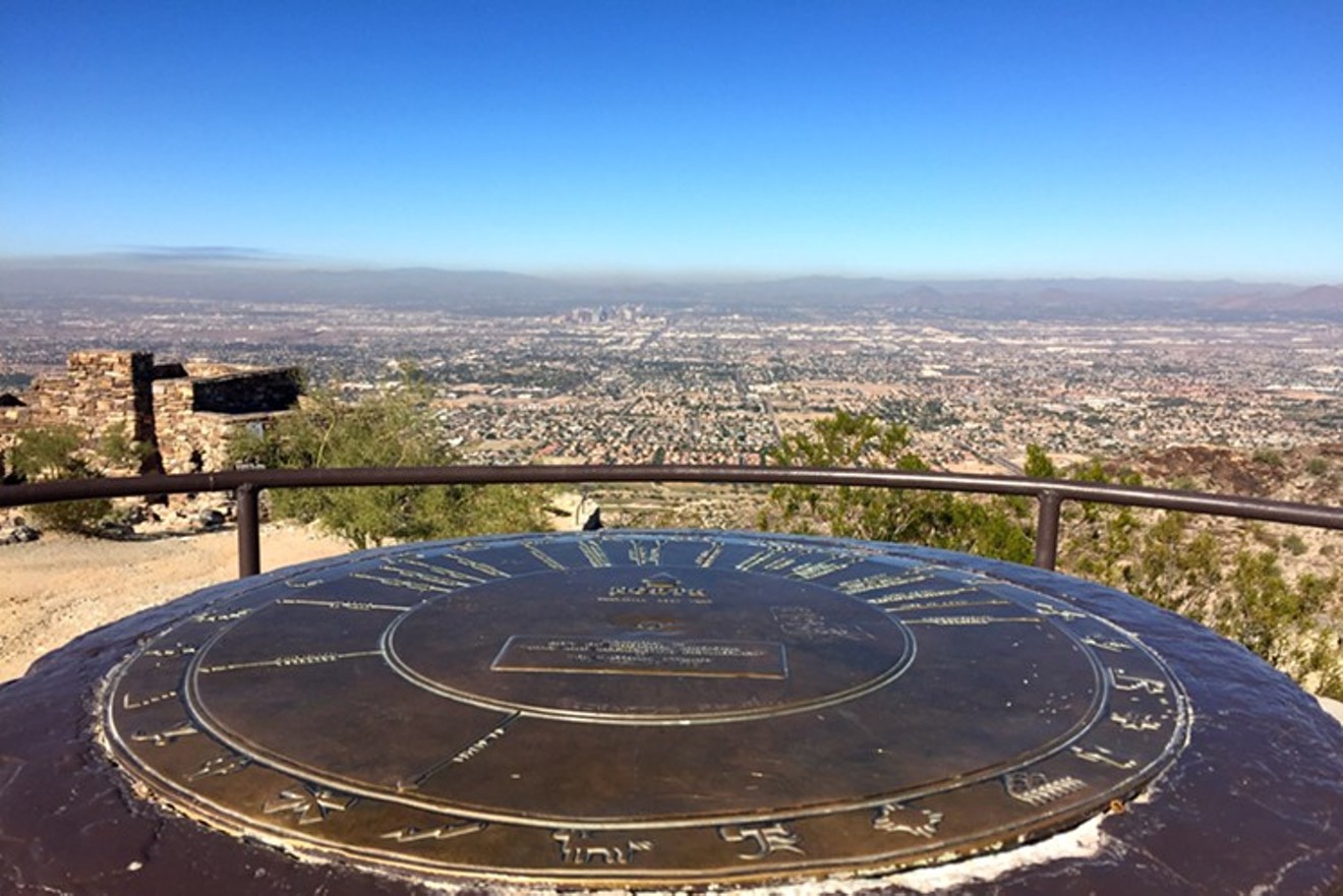
Though it's often thought of as one of the best sunset hikes in Phoenix, this trail offers up gorgeous views any time of the day. Holbert Trail is rated intermediate due to its gradual uphill climb, which is a little over 1,000 feet. This trail is well maintained to a point where each step is almost calculated for you, making the trek just that much more forgiving. Once at the top, the 360-degree view of the city is incredible. The peak also offers benches to sit and enjoy the view, the remnants of an old stone ramada built back in the 1930s, and a large compass pointing out different landmarks across the Valley. At just above 2,300 feet, this hike is a great way to show out-of-town guests an amazing view of the city while familiarizing yourself with Phoenix's major landmarks.
Enjoy the nice Arizona weather on the Miners Needle Loop.
Sara Palmer
Miners Needle Loop at Superstition Wilderness
Distance: 9 miles round tripLevel of Difficulty: Moderate to intermediate
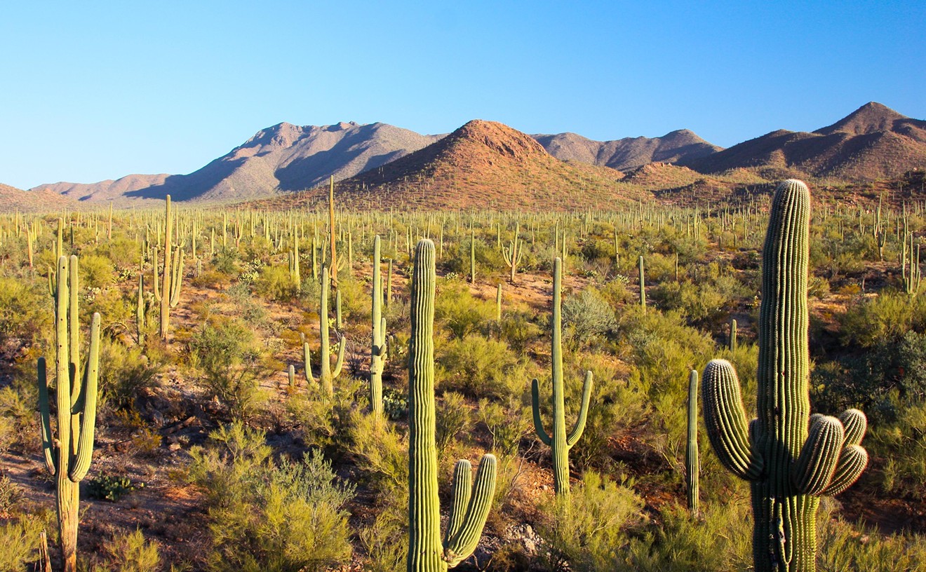
Average Time: 5 hoursMiners Needle Loop begins on the Dutchman Trail #104, just east of the Peralta Trailhead. The hike is a great way to experience terrain ranging from rocky mountainside trails to creek beds and cholla-filled meadows. In one section, the cholla create a canopy, resulting in a strange, fairytale-esque scene. From there, the trail twists and turns, leading to some large boulders hiding pockets of water that make for a small amount of easy bouldering or rock hopping. The views on this trail are spectacular to say the least. You'll catch a peek through Miners Needle, see the tall, colorful canyon walls at Bluff Springs Trail #235 and be able to look out as far as the eye can see during the last two miles. Superstition Wilderness Area never fails to offer up a great supply of color and plant life. Cactuses are abundant, and when the desert is in bloom, this area is home to some real desert beauty.

A rare crested saguaro cactus on the San Tan Trail.
Sara Palmer
San Tan Trail at San Tan Mountain Regional Park
Distance: 6.4 milesLevel of Difficulty: Beginner
Average Time: 2.5 to 3 hoursThis is an ideal trail for beginners and those looking for great scenery without a lot of climbing. At 6.4 miles, it is the longest loop trail in San Tan Mountain Regional Park. The trail takes you in a loop that features wide trails, rolling hills, and a rare crested Saguaro that looks as if it’s giving the “hang-ten” sign. Thanks to all the vegetation, this is a great spring and fall hike, as well as one that can be enjoyed throughout the winter. The trail is often shared with mountain bikers and horseback riders, so remember to be aware of your surroundings and yield accordingly. While this hike does not require a lot of strenuous elevation gain, it is still important to stay hydrated and dress appropriately.

Cave Creek Trail to Skunk Tank Loop
Sara Palmer
Seven Springs Cave Creek/Skunk Tank Loop
Distance: 10 miles round tripLevel of Difficulty: Intermediate
Average Time: 5 hoursNot only is there an actual Cave Creek, but there's also a beautiful trail that runs alongside and across it. The first section of this trail is nothing if not mesmerizing. You'll find plenty of color, water and easy boulder hopping as you make your way along the creek, across the creek and then down into the canyon. You’ll want to bring your camera with you on this hike, as you'll find it hard to believe you are still in Phoenix. At just under the four-mile mark, you will turn onto Skunk Tank Trail, which is the section of the trail where you will begin to take on 1,100 feet of elevation gain. And the payoff at the summit is more than worth it, with panoramic views and green rolling hills. We suggest stopping for a moment and taking in the view because from there, you'll have only a couple of miles left on this beautiful trek.

The view from Mormon Loop at South Mountain.
Sara Palmer
Mormon Loop
Distance: 5 milesLevel of Difficulty: Intermediate
Average Time: 2 to 2.5 hoursTouted as a great workout hike, this trail is ideal for winter mornings in Phoenix, when the air is crisp and the Valley is just starting to come alive. This trail starts with a one-mile climb to the Mormon Loop Junction that will definitely get your heart rate going while serving up views of downtown Phoenix. The trail mellows out a bit after the initial climb, with the entire hike gaining just around 700 feet of elevation. Consisting of rolling hills, rock piles and steps, there's a constant flow of ascending and descending stints that make for a fun and fairly cardio-driven experience. This is a popular trail that can become very busy on weekends, so it's best to enjoy this trail early in the day or during the week to avoid the crowds. Given the rocky and often rugged trail, wearing proper footwear is crucial. And while it is not necessarily a long hike, it can be taxing and you'll want to be properly hydrated.

Black Top Mesa in the western Superstitions.
Sara Palmer
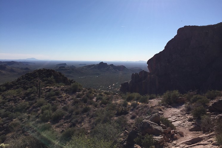
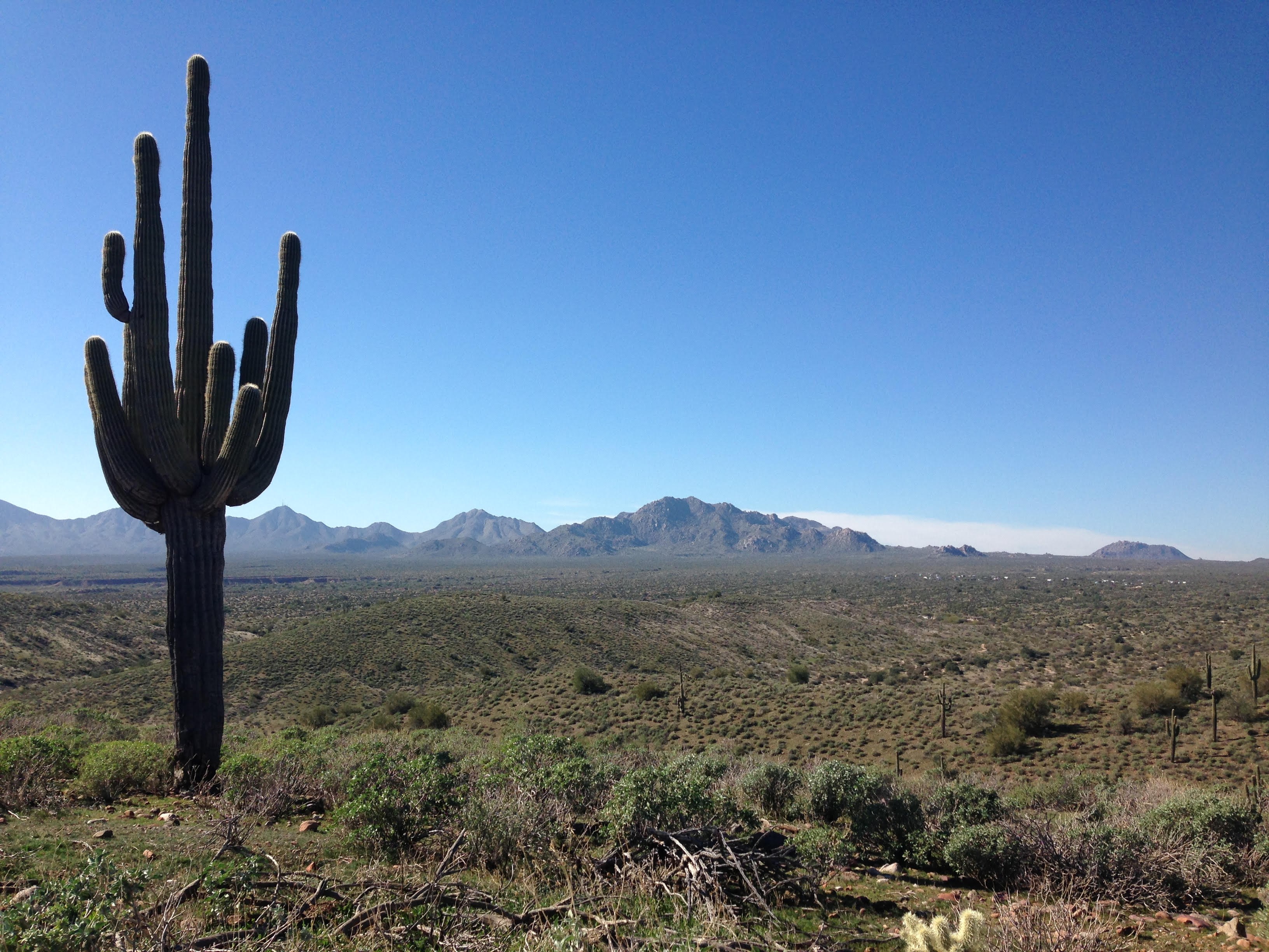
Black Top Mesa at Superstition Wilderness Area
Distance: 11.5 milesLevel of Difficulty: Intermediate to advanced
Average Time: 6 to 7 hoursBlack Top Mesa is a great way to get elevated and see some of the most amazing views of the western Superstition Wilderness. This wilderness area is home to some of the most beautiful terrain that's close to the city. With lots of greenery and cactuses of many species, this area offers a magnificent display of desert vegetation and wildlife. You will trek through the landscape for about 4.5 miles before reaching the Dutchman/Black Mesa junction. The ascent is just over a mile. But a word of caution for both the ascent and the ultimate descent: The trail thins out at times, and can be a little precarious occasionally with encroaching cactuses. Use extra caution, as fatigue may set in.
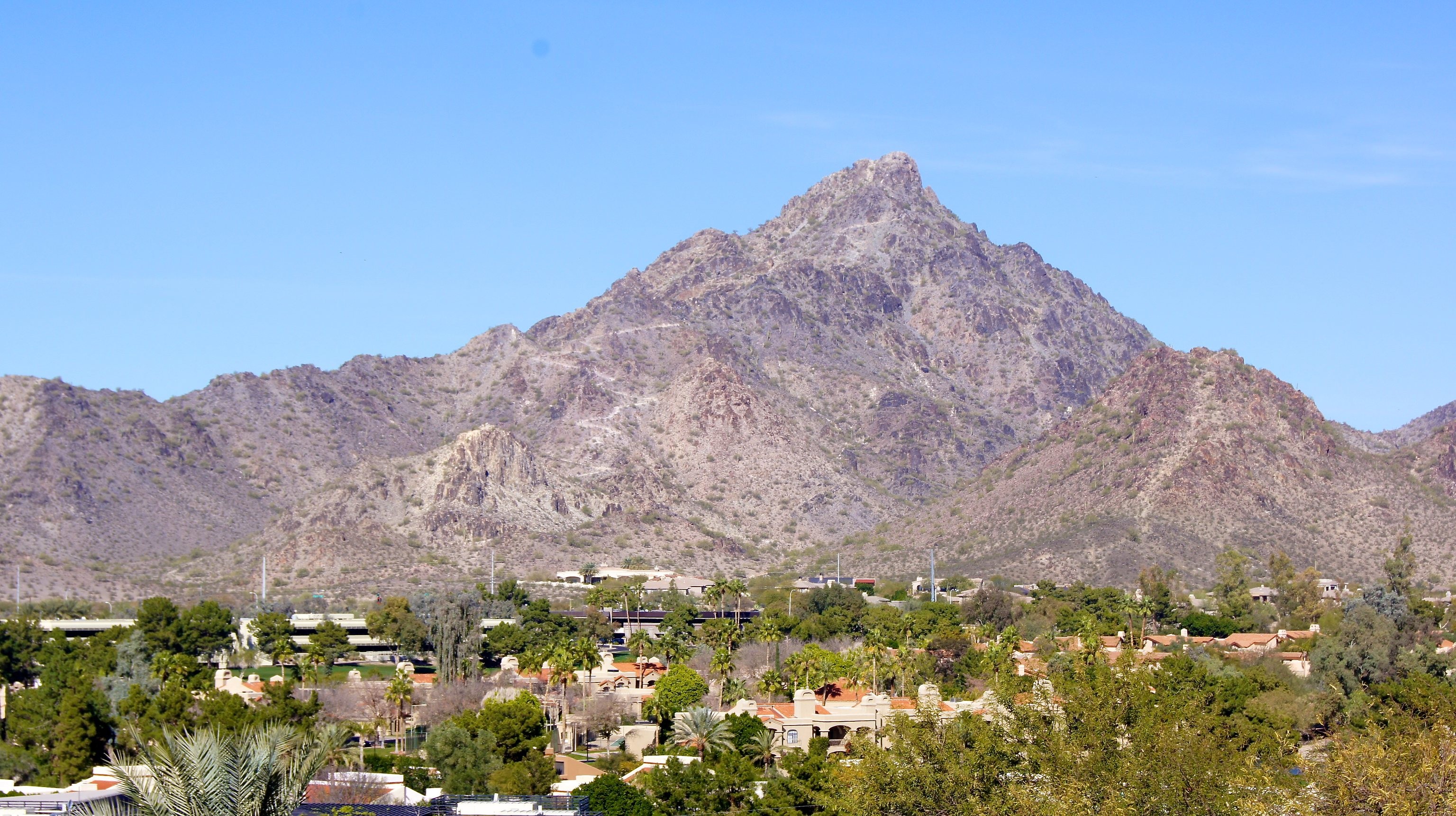
Camelback Mountain's Echo Canyon Trail
Distance: 2.4 milesLevel of Difficulty: Intermediate to advanced
Average Time: 2 hours
Whether you are new to the city or have lived in Phoenix for years, this prominent landmark resembling the head and hump of a kneeling camel is hard to miss. The views from the ground are nice, but they're nothing compared to the views from the top. It's a sight so magnificent, you just might forget the heart-pumping climb it takes to get there. On the Echo Canyon Trail, expect dirt trails that send you traveling over and across boulders and ascents steep enough to warrant a handrail. The easy accessibility from most anywhere in the Valley and the rewarding challenge of this mountain give it a habitual sort of charm.

Peralta Trail to Fremont Saddle
Distance: 4.4 miles round tripLevel of Difficulty: Moderate
Average Time: 3 to 4 hoursIf you're looking for a short trail with incredible views, here's the one for you. This canyon hike is the result of the area’s turbulent volcanic past. In short, you will be hiking inside the heart of a volcanic pit created millions of years ago. In the short 2.2 miles to the Fremont Saddle, you will gain just over 1,300 feet in elevation, but don’t let this scare you off. The views throughout are beautiful and a great introduction to all types of desert vegetation with colorful organ pipe canyon walls. It’s worth taking your time and taking in the view. The trail ends on top of the Fremont Saddle, where you will be surrounded by brilliant views of Weavers Needle and an array of peaks, mesas, and washes throughout the wilderness area. Which means, don't leave your camera at home.
Summit Trail at Piestewa Peak
Level of Difficulty: IntermediateDistance: 2.5 miles round trip
Average Time: 1.5 to 2 hoursThe Summit Trail, a popular winter trail, is often crowded — and for good reason. For starters, it offers an amazing workout. At only 2.5 miles round trip, this trail can get you out into nature and into a cardio workout in no time. Put simply, this trek is nothing less than the ultimate outdoor stair stepper and often seen as a great mountain to train on. Measured as the second-highest peak in Phoenix, just behind Camelback Mountain, this summit hike is said to be slightly easier, despite its relentless switchbacks. As with Camelback, you'll get remarkable 360-degree views of the city as a reward for all your hard work. The Summit Trail is a great way to escape the gym scene, prepare yourself for more intense hikes and get ready for backpacking trips down the road. Early mornings and weekends are your best bets for avoiding the crowds.
Scenic Trail at McDowell Mountain Regional Park
Distance: 4.5 miles round tripLevel of Difficulty: Beginner
Average Time: 2.5 hours
This hike on the east side of the McDowell Mountains is a great introduction to this area of the Valley. Bordering Fountain Hills and Scottsdale, this loop is great for beginners and an excellent way to catch some fantastic views. With little elevation gain at a gradual, easy-to-handle grade, this trail offers an abundance of desert life, from plants to birds to lizards. And the desert landscape is breathtaking. Once at the summit, you will be surrounded by outstanding views of the Verde Valley and Four Peaks, which during the winter months are often capped with snow. This hike is a great way to enjoy an easy trek out into nature and into the mountains.
This article originally appeared in 2015 and has been updated.