
If you haven't hiked Picacho Peak yet this year, this is the time.
Two reasons for your haste: weather, and flowers.
The difficult, adventurous, two-mile Hunter Trail to the top is most comfortably done in cooler weather. It'll be a whole different hike in a few months. Now, it's all sweetness and joy — relative to one's fitness level, that is.
Phoenicians who enjoy local calf-burners like Camelback Mountain and Piestewa Peak will love it, guaranteed.
Less-burly hikers may experience a love/hate relationship with it. They'll struggle with the trail's sustained inclines and vertical climbing sections augmented by steel cables, but remember it fondly, once the soreness fades. For the latter perspective, check out former Phoenix New Times writer Lilia Menconi's exciting 2010 article, "Picacho Peak Hike, a.k.a. Hell Hike" (Menconi's hiking skills improved considerably after that slog — she now writes books on Phoenix-area trails).
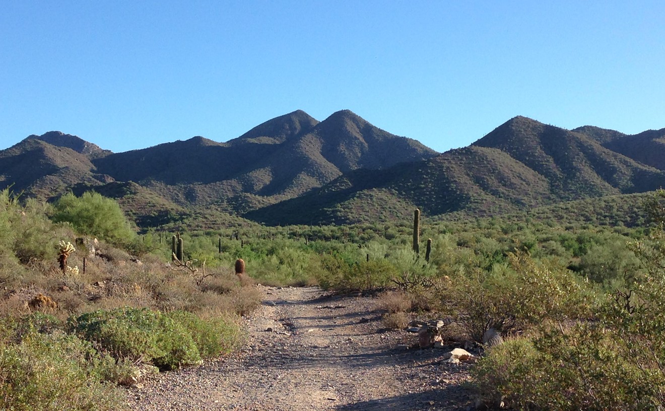
Conveniently located right off the Interstate 10 East, Picacho Peak jabs into the sky with pride between Phoenix and Tucson, with 1,000 feet of sheer rock face on one side. From the highway, take Exit 219, Picacho Peak Road, and you're almost ready to hike.
First, you have to pay a fee to Arizona State Parks, which goes to things like trail maintenance and ongoing investigations of the recently fired Parks director, Sue Black. The cost is $7 for a vehicle with up to four people, and $3 for walk-ups and bicyclists. Follow signs to the Hunter Trail parking area.
Hunter Trail is steep and relentless, like a good mountain trail should be. I've hiked it a couple of dozen times. On a cool, overcast weekend day earlier this month, I made it to the 3,704-foot summit in 57 minutes with a brisk hiking pace. That's about 15 minutes slower than my Echo Canyon pace has been lately, but I lost a few minutes to rock climbing.
As usual, Hunter gave the old legs a workout straight from the green flag, starting with long stair-steps like those on Piestewa Peak before reaching a number of short, uphill, patches of bare rock, which require more cautious foot placements. The rapid elevation gain reveals a breathtaking scenic view of the desert, and I'm breathing hard at this point, too, but feeling good.
The trail hits the Great Wall of the main part of the peak, goes left, up and around a cliff, then right to the saddle. Online info says the elevation gain is just under 1,000 feet up to this point. The real fun begins here, with a descent of nearly 300 feet before turning uphill again. Steel cables can help your downward progress here and on several upper sections to come. These bits turn Picacho into an adventure, more than a hike. If you like to add a touch of jungle gym to your walks, you've found the right place. A couple spots are near-vertical for a few feet, requiring the use of hands, and two small bridge-like structures attached to the rock wall allow hikers to complete these areas safely.
As Menconi's 2010 article explains, this mini-via ferrata was put up by the Civilian Conservation Corps in 1932 to service a light beacon on the summit that no longer exists.
I find that none of these areas exceed Class Three in the Yosemite Decimal System for rating rock climbs — in other words, the climbing is easier than 5.0. These are fun scrambles even for a beginning (or, ahem, less-fit) climber, none longer than about 40 feet, with lots of jugs and footholds and the cables an arm's length away. In my monkey brain, I imagine this prepares me for the next mountain, which likely won't have pre-installed metal gear.
That said, whether using the rock, the cables and bridges, or a combo of both, exercise extreme caution in these areas. If someone fell here and snapped bones, it would likely take hours before a rescue team could remove the patient off this remote mountain.
I'm always ready to be done once the scrambly sections are finished, but another few hundred vertical feet of trail remain to be traversed. I love the view from this summit. It's a pointy, high peak with a relatively small summit space, which means incredible 360-degree views. On this clear day, I can see perhaps 40 or 50 miles across the pristine desert of the Ironwood Forest National Monument to the mountainous southern horizon. Seeing the I-10 like this is another treat, after driving it. This is one of the views that make me know why I love Arizona. To the northeast are more mountains of the Picacho range, with their high point of Newman Peak (a longer hike, but on my bucket list).
The stretch of cactus and sand between Newman and Picacho peaks is also a historical site. Somewhere down there, in the pass between Newman and Picacho peaks now inhabited by I-10 and freight-train tracks, a small group of Confederate and Union soldiers fought the Civil War's westernmost battle on April 15, 1862. Civil War buffs occasionally hold re-enactments of the battle in February, but we checked — none are scheduled this year.
Picacho has a total elevation gain of 1,880 feet, according to HikeArizona.com's Picacho page, anyway. That's about 500 feet more than the gains of Piestewa or Camelback.
I was sweating at the top from my exertion, even though it was only about 65 degrees, and gulped down half a bottle of water. Daytime temperatures could reach 100 here as early as April. From May to September, this hike is best done in the early morning. Even in mild heat, a hiker who doesn't drink enough water can die on this trail in a few hours, even though it's only two miles in each direction. Slower hikers may take three to five hours to get up and down Hunter Trail, and experts recommend taking and consuming as much as two to four liters per hour in extreme heat.
It took me about an hour to get down. Back at the trailhead, I walked back up the beginning slope to check out the wildflowers I'd noticed on the way up. Sometimes, the lower slopes of Picacho look like a colorful carpet. On this trip, the crop seemed lighter and less varied than in past years, with the Mexican gold poppy most prevalent. A park ranger I talked with later said he didn't know whether peak wildflower season had already come and gone, adding that a good spring rain could bring out more flowers.
Why are you still reading when you could be hiking?
[
        {
          "name": "Air - MediumRectangle - Inline Content - Mobile Display Size",
          "component": "18478561",
          "insertPoint": "2",
          "requiredCountToDisplay": "2"
        },{
          "name": "Editor Picks",
          "component": "16759093",
          "insertPoint": "4",
          "requiredCountToDisplay": "1"
        },{
          "name": "Inline Links",
          "component": "17980324",
          "insertPoint": "8th",
          "startingPoint": 8,
          "requiredCountToDisplay": "7",
          "maxInsertions": 25
        },{
          "name": "Air - MediumRectangle - Combo - Inline Content",
          "component": "16759092",
          "insertPoint": "8th",
          "startingPoint": 8,
          "requiredCountToDisplay": "7",
          "maxInsertions": 25
        },{
          "name": "Inline Links",
          "component": "17980324",
          "insertPoint": "8th",
          "startingPoint": 12,
          "requiredCountToDisplay": "11",
          "maxInsertions": 24
        },{
          "name": "Air - Leaderboard Tower - Combo - Inline Content",
          "component": "16759094",
          "insertPoint": "8th",
          "startingPoint": 12,
          "requiredCountToDisplay": "11",
          "maxInsertions": 24
        }
      ]


BEFORE YOU GO...
Can you help us continue to share our stories? Since the beginning, Phoenix New Times has been defined as the free, independent voice of Phoenix — and we'd like to keep it that way. Our members allow us to continue offering readers access to our incisive coverage of local news, food, and culture with no paywalls.
Can you help us continue to share our stories? Since the beginning, Phoenix New Times has been defined as the free, independent voice of Phoenix — and we'd like to keep it that way. Our members allow us to continue offering readers access to our incisive coverage of local news, food, and culture with no paywalls.

Trending


Use of this website constitutes acceptance of our
terms of use,
our cookies policy, and our
privacy policy
The Phoenix New Times may earn a portion of sales from products & services purchased through links on our site from our affiliate partners.
©2024
Phoenix New Times, LLC. All rights reserved.
Do Not Sell or Share My Information
Do Not Sell or Share My Information
