Sueño, a Spanish word for "dream," is exactly that when it comes to pickup BB at this west-side park. Students and alumni from neighboring high school basketball powers Trevor Browne and Carl Hayden flock to the lighted courts, which makes for some serious games. The park is infamous for hosting games with the ankle-breaking skills of the Brown family — most notable is professional basketball player Gerald Brown, who suited up with the Suns for a season. Hours are from 5:30 a.m. to 11 p.m.

Best Place for Pickup Basketball, West Valley
Sueño Park
- 4401 W. Encanto Blvd., Phoenix, 85035 Map
- 602-262-6575
- www.phoenix.gov
Best Skateboard Park
Chandler Skate Park at the Snedigar Sportsplex

To the uninitiated, Chandler's Snedigar Park looks like an abandoned water park in post-apocalyptic-drought Phoenix. There's an empty swimming pool with a ladder, giant concrete steps to nowhere, and what appear to be several kiddy pools surrounded by towering palms. But to anyone with a worn left sneaker and a full deck, this is a playground of the imagination. Those "swimming pools" are bowls where seasoned skaters try sick tricks like the 540-degree McTwist, named for modern legend Mike McGill. The park also features k-rail obstacles, a flat bar, and several ledges and rails for sliding and grinding. With 35,000 square feet of cement, this place sure beats faking it on the Xbox.
- 4500 S. Basha Rd., Sun Lakes, 85248 Map
- 480-782-2640
- www.chandleraz.gov/default.aspx?pageid=291
Best Lappy Hour
Duck and Decanter
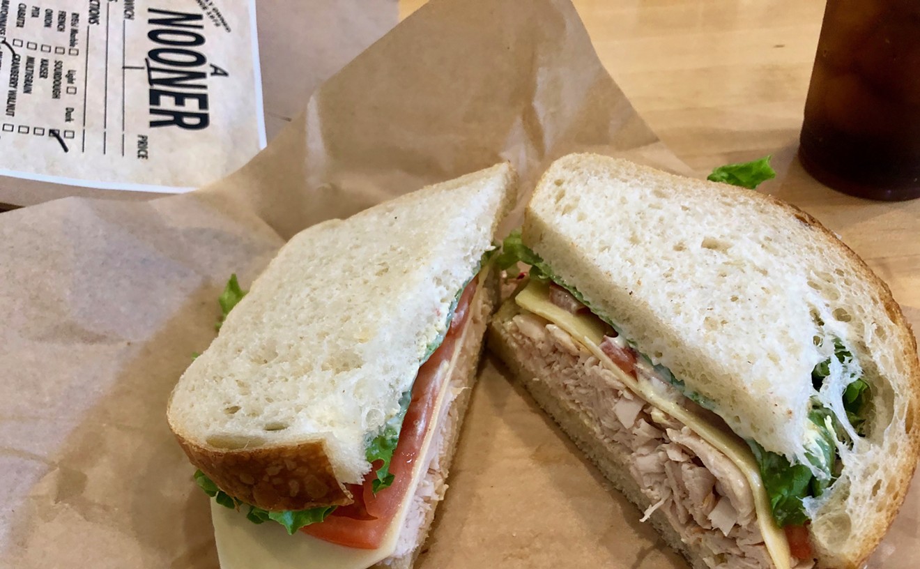
Lauren Cusimano
Remember that time you spilled beer on the floor and Spot got totally wasted? Yeah, that isn't going to happen at Duck and Decanter's Lappy Hour. On the other hand, if you're tired of meeting new friends who turn out to be — gasp! — cat people, then this once-monthly event might be for you. Guests are invited to bring their well-behaved pooches along for a meet and greet over sandwiches and drinks. It's a great way to network with like-minded folks, but don't be surprised if the girl you bring home afterwards is a little on the hairy side. Local animal shelters usually bring unwanted pups ready for adoption to Lappy Hour, and it can be awfully hard to resist those puppy-dog eyes.
- 1651 E. Camelback Rd., Phoenix, 85016 Map
- 602-274-5429
- www.duckanddecanter.com
Best Place to Cool Off Your Dog
Fountains at Arizona State University
Even when it's hot, our retriever-Lab mix Rosy still needs exercise and something to relieve the boredom of the same old smells coming from the patch of grass in the backyard. But taking her for a walk in the summer is a form of animal abuse unless you adhere to certain rules.
Like the vampire dogs in I Am Legend, our pup doesn't touch sidewalk if there's sunlight on it. And we let her splash around in whatever water may be available — which is part of what makes the Tempe campus of Arizona State University so attractive for canine recreation.Not only is the campus a beautiful place for a walk — you'll see throngs of busy young people, cool architecture, art, flowers, feral cats, and more — but it's got great water features to cool off Rosy's paws.
We love watching her romp through the stepped fountain with mini-canals near the Business School. The circular fountain near the Memorial Union is just deep enough to cool her lower body when she lies down in it.Once soaking wet, her black fur probably feels a whole lot better when we resume the walk in 100-plus-degree evening heat.
No signs are posted saying we can't take our dog for a dip, but it seems like a good idea to limit the splashing to just a few minutes, out of courtesy to this fine institution.And, of course, leave the dog shampoo at home.
Best Hike with a Big Dog
Waterfall Canyon Trail
For those who don't favor their pooches large — or, God forbid, don't even own a canine or two — there's not a lot worse than getting bumped off the trail on a meditative nature hike by someone struggling to maintain control of their over-excited old Lab or fearsome-looking pit bull. But we've found a spot where big dogs (on leashes, natch) rarely bother anyone but their handlers — and it's a wonderful walk, to boot. At two easy miles in length, the trails are wide and easy to traverse, so much so that park rangers encourage wheelchair-bound hikers to come on out. We were duly impressed by the Indian petroglyphs, etched into huge boulders around 1000 A.D. After a good rain, the pot at the end of the rainbow otherwise known as the Waterfall Canyon Trail is a 75-foot waterfall that seems incongruous in the Sonoran Desert.
But back to those pups. Not long ago, we saw a lone woman, who had to be pushing 80, walking slowly through the canyon on the return trip. Jogging hard the other way was a triathlete-looking fellow with his German shepherd in tow. The jogger yanked his pooch to the side of the trail, and the woman never blinked an eye, never had to wonder whether she'd be trampled. That's what we call a happy ending.
- 13025 N. White Tank Mountain Rd., Waddell, 85355 Map
- 623-935-2505
- www.maricopa.gov/parks/white%5Ftank/
Best Hike with a Little Dog
Piestewa Peak, south entrance
So you love your little rugrat of a dog, and you want to expand his (we'll make him a "he" here) world to the great outdoors. And even though you know he's spunky as hell, those little legs won't do well on, say, Camelback Mountain, and you're afraid that he'll sniff too close to a rattlesnake, scorpion, or other varmit on a less-traveled trail. We've got the answer, and it's called Piestewa Peak (formerly Squaw Peak, until the city of Phoenix renamed it after Iraqi war hero Lori), officially part of the Phoenix Mountains Park and Dreamy Draw Recreation Area. Though the hike to the top on the Summit Trail is rigorous — 1.2 miles, elevation gain of 1,200 feet — the 3.75-mile Circumference Trail is much more forgiving, for humans and pooches alike. Wonderful views of downtown Phoenix await the people, and unparalleled scents of other canine cavorters await your little fluffball. We've seen more than one little love affair (G-rated, thankfully) spring up on the trail. All you need is some water for you and your best friend — and a leash.
Best Micro Hike
Hayden Butte
If Piestewa Peak and Camelback Mountain had a baby, it would be Hayden Butte, a.k.a. "A" Mountain. This pint-size peak next to Arizona State University's Sun Devil Stadium provides a quick fix for nuts like us that can't stand flat ground. The best way to start the hike is to take College Avenue north toward the mountain to where the road ends at a parking lot, just west of the stadium. Keep going through the parking lot to the marked trailhead. After a nice, gentle section, hikers must trudge up an ultra-steep, asphalt service road that leads to a series of stairs and handrails. The summit area requires a tiny bit of scrambling to let you know you're on a real mountain.
In total, it's about a half-mile from base to peak — not very much distance, but the inclines are steep enough to stir our calf muscles. If we're feeling particularly energetic, we'll run up and down two or three times. Besides the workout, though, Hayden Butte offers the delights — albeit smaller-scale — of the Valley's burlier hikes. Namely, the temporary relief from urbanism and the picturesque view from on high.
True, there are those unsightly antennas and utility boxes surrounded by a chain-link fence that take up some of the space on the peak. For now, think of it as a bit of history — the equipment has been there for 60 years. But purists, take heart — that stuff is expected to be moved to the top of the new condo towers in downtown Tempe in the next year or two, allowing for a slightly more natural-looking summit.
The view of downtown Tempe and the Town Lake merits, at the very least, a one-time pilgrimage up Hayden Butte's flanks, especially for Valley newcomers and ASU students. Try it at night, when the summer heat's cooled off and you can see the lights strung over the Mill Avenue Bridge reflected in the lake. Two words describe this hike perfectly: Short and sweet.
Best Moonlight Hike
Green Boulder Trail
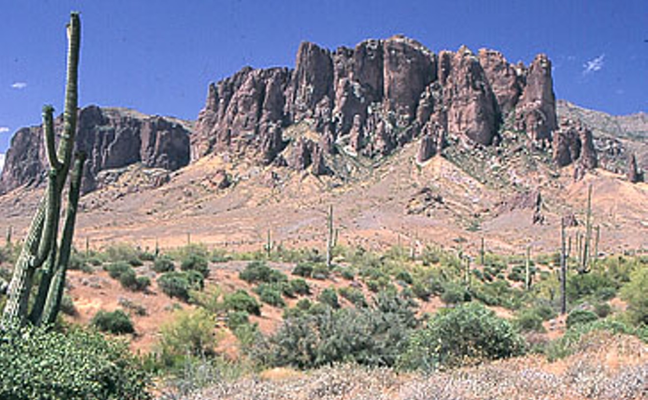
We once knew a chick who broke an ankle hiking at night and wouldn't step off asphalt from that day forward unless there was light in the sky. What a shame for her, 'cause any knowledgeable trekker'll tell you that the best desert hiking is nocturnal, and it's twice as good in the summer. Our favorite after-dark delight is this short-but-sweet loop, which starts at the Siphon Draw trailhead near the Lost Dutchman State Park amphitheater and follows a gradual rise along the Prospector's View Trail to the base of the Superstition Mountains. Stop to drink in the silvery view at Green Boulder, which resides in the moon shadows of some lovely, snaggle-toothed pinnacles. There are several options for the return trip, but we usually head south on the Treasure Loop Trail, traversing a mile or so of bumpy washes and magical forests of jumping chollas that gleam like fresh bone in the glare of a full moon.
- 6109 N. Apache Trail, Apache Junction, 85219 Map
- 480-982-4485
- azstateparks.com/lost-dutchman
Best Blair Witch Hike
Flume Trail

We're a human compass. It's innate. Until we met this befogging jaunt, no map was too complex, no maze too maze-like for our superhuman route-finding ability. Perhaps the hike's transitional setting, between lowland desert and upland scrub, had something to do with it, but after about an hour of head-scratching trekking, we felt as though we were running around in circles, holding a jerky video camera, and finding beating human hearts on the ground.
It might've been the spirit of one of the gold miners who pushed out the native Tonto Apache back in the 1870s — or an angry Apache specter seeking revenge — but whatever the spook du jour, this trail creeped us out. If you like creepy, it's a lovely place, set largely in a dry riverbed shaded by trees that wouldn't grow a mere 500 feet lower in elevation.
We know what you're thinking: "I never get lost. These people are pansies. I'll show them." Right? Well, lay in a supply of breadcrumbs, bub, 'cause this witch is hungry.
- 37019 N. Lava Lane, Cave Creek, 85331 Map
- 623-465-0431
- www.maricopa.gov/parks/cave%5Fcreek/
Best Off-Trail Hikes
Estrella Mountain Regional Park
There's a moment when you reach the southwest extremity of this park's Pedersen loop trail that you stare into madness. The glimpse into the vast vacuum of central/western Arizona is the sort of horizon-less view you see in the movies, where some poor sap's got himself lost in the trackless desert, and now he's shuffling along like a zombie in the middle of nowhere. The outlook from this particular point on the Pedersen is a lot like that: Nowheresville.
Don't go that way.
Instead, trek east a couple of miles and keep going straight, even after the Pedersen bends north. We guarantee you'll have one of the times of your life — if you live. Heh heh.
The route you'll find yourself on travels straight up the gut of the least-accessible mountain range in the greater Phoenix area: the Estrella, or Star, Mountains. Whatever route you choose, it'll be random; there are no sanctioned trails to guide you to the 3,650-foot pinnacle of the range, so it's all about route-finding your way through the lush, virgin terrain. How delightful, you say! Well, that depends on whether you like being slapped across the face or bonked on the head. The going's way steep and way exposed. The vegetation's so thick you can't see your legs, and the vicious flora keeps depositing small, pointy pieces of itself in you. It's prime rattler and Gila monster country, and, as noted, you can't see your legs.
So why torture yourself this way? Here's why: A hike into the Estrellas is a trip into the past. This is what Phoenix — and the upper Sonoran Desert — looked like before we brought the jackhammer down. You'll see flora and fauna that no longer exist elsewhere, you'll drink in panoramic views that few others have seen, and you'll set your feet down in places that no one else has. Ever.
Just don't kill yourself, 'kay?
- 14805 W. Vineyard Ave., Goodyear, 85338 Map
- 623-932-3811
- www.maricopa.gov/parks/estrella/rodeo.aspx
Best Of Phoenix®

-
La Vida
-
Best Place to Buy Mexican Candy
Dulceria Pico Rico
-
Best Raspado
Realeza Michoacana
-
Best Place to See Mutant Piñatas
Bragg's Pie Factory
-
Best Over-the-Top Swap Meet
El Gran Mercado
-
Best Amigos
Friends of Mexican Art
-
Best Mirror on the City
"The Mexican American Mirror/El Espejo México Americano: Reflections of Our City's Heritage"
-
Best Glitter
Kathy Cano-Murillo, the Crafty Chica
-
Best Mexican Folk Art Mural
MJ Mini Mart
-
Best Place to See Day of the Dead Ofrendas
Arizona Historical Society Museum at Papago Park, Tempe
-
Best Place to Snag Day of the Dead Stuff
Mesa Arts Center
-
Best Place to Take the Kids on Day of the Dead
Dr. A.J. Chandler Park, November 1
-
Best Authentic Mexican Dining Experience
Tradiciones
-
Best Authentic Mexico City Dining Experience
Plaza Grill
-
Best Neighborhood Mexican Restaurant, Central Phoenix
Rosita's Place
-
Best Neighborhood Mexican Restaurant, South Phoenix
Poncho's
-
Best Neighborhood Mexican Restaurant, West Valley
La Perla Café
-
Best Neighborhood Mexican Restaurant, East Valley
Rancho de Tia Rosa
-
Best Neighborhood Mexican Restaurant, Tempe
Restaurant Mexico
-
Best Neighborhood Mexican Restaurant, Scottsdale
La Fonda del Sol
-
Best Modern Mexican Restaurant
Barrio Café
-
Best South American Cuisine
Mi Cocina Mi País
-
Best New Mexican Brunch
Richardson's
-
Best Mexican Patio Dining
El Zocalo Mexican Grille
-
Best Mexican Takeout
Rito's Market & Mexican Takeout
-
Best Tortillas
Carolina's
-
Best Mole
Los Sombreros
-
Best Mariscos (Mexican Seafood)
Mariscos Sinaloa
-
Best Tortas
Tortas El Güero
-
Best Tacos
El Nopalito
-
Best Machaca
Los Dos Molinos
-
Best Flan
Sabor Cubano
-
Best Paletas
Flor de Michoacan
-
Best Aguas Frescas
Los Reyes de la Torta
-
Best Mexican Market
Phoenix Ranch Market
-
Best Panadería (Bakery)
La Tolteca
-
Best Religious Shrine in a Grocery Store
Mini Mercado Oaxaca
-
Best Place to Buy Hubcaps and Quesadillas
Precision Auto
-
Best Piñatas
Arizona Piñatas
-
Best Mexican Imports
Mexican Arts-Imports
-
Best Boutique with a Latin Flair
Purple Lizard
-
Best Place to Buy a Quinceañera Dress
I Do! I Do! Bridal
-
Best Place to Buy Quinceañera Accessories
Azteca Bridal
-
Best Latina Designers
Lola y Lola
-
Best Place to Buy Narcocorridos
El Idolo de Oro
-
Best Mexican Radio Station
La Campesina
-
Best Latino Radio Station
95.1-FM Latino Vibe KVIB
-
Best Jump to FM Radio
El Break on 95.1 Latino Vibe
-
Best Latin DJ
DJ Melo
-
Best Latin Club DJ
DJ Big Latin
-
Best Latin Nightspot
Club DWNTWN
-
Best Latin Dance Night
Caliente Chica Fridays
-
Best Gay Latin Dance Night
Vaquero Thursdays
-
Best Place to Worship Carlos Santana
Maria Maria: La Cantina
-
Best Place to Hear Happy Mariachi Music
La Casa del Mariachi
-
Best Place to Hear Sad Mariachi Music
Oaxaca
-
Best South American Wine Bar
Bomberos Café & Wine Bar
-
Best Mi/Chelada
Taxi Inn
-
-
Food & Drink
-
Arts & Entertainment
-
Food & Drink
-
Arts & Entertainment
-
Food & Drink
-
Arts & Entertainment
-
Food & Drink
-
Arts & Entertainment
-
Food & Drink
-
Arts & Entertainment
-
Food & Drink
-
Arts & Entertainment
-
Food & Drink
-
Arts & Entertainment
-
Food & Drink
-
Arts & Entertainment
-
Food & Drink
-
Arts & Entertainment
-
Food & Drink
-
Arts & Entertainment
-
Food & Drink
-
Arts & Entertainment
-
Food & Drink
-
Arts & Entertainment
-
Food & Drink
-
Arts & Entertainment
-
Food & Drink
-
Arts & Entertainment
-
Food & Drink
-
Arts & Entertainment
-
Food & Drink
-
Arts & Entertainment
-
Food & Drink
-
Arts & Entertainment
-
Food & Drink
-
Arts & Entertainment
-
Food & Drink
-
Arts & Entertainment
-
Food & Drink
-
Arts & Entertainment
-
Food & Drink
-
Arts & Entertainment
-
Food & Drink
-
Arts & Entertainment
-
Food & Drink
-
Arts & Entertainment
-
Food & Drink
-
Arts & Entertainment
-
Food & Drink
-
Arts & Entertainment
-
Food & Drink
-
Arts & Entertainment
-
Food & Drink
-
Arts & Entertainment
-
Food & Drink
-
Arts & Entertainment
-
Food & Drink
-
Arts & Entertainment
-
Food & Drink
-
Arts & Entertainment
-
Food & Drink
-
Arts & Entertainment
-
Food & Drink
-
Arts & Entertainment
-
Food & Drink
-
Arts & Entertainment
-
Food & Drink
-
Arts & Entertainment
-
Food & Drink
-
Arts & Entertainment
-
Food & Drink
-
Arts & Entertainment
-
Food & Drink
-
Arts & Entertainment
-
Food & Drink
-
Arts & Entertainment
-
Food & Drink
-
Arts & Entertainment
-
Food & Drink
-
Arts & Entertainment
-
Food & Drink
-
Arts & Entertainment
-
Food & Drink
-
Arts & Entertainment
-
Food & Drink
-
Arts & Entertainment
-
Food & Drink
-
Arts & Entertainment
-
Food & Drink
-
Arts & Entertainment
-
Food & Drink
-
Arts & Entertainment
-
Food & Drink
-
Arts & Entertainment
-
Food & Drink
-
Arts & Entertainment
-
Food & Drink
-
Arts & Entertainment
-
Food & Drink
-
Arts & Entertainment
-
Food & Drink
-
Arts & Entertainment
-
Food & Drink
-
Arts & Entertainment
-
Food & Drink
-
Arts & Entertainment
-
Food & Drink
-
Arts & Entertainment
-
Food & Drink
-
Arts & Entertainment
-
Food & Drink
-
Arts & Entertainment
-
Food & Drink
-
Arts & Entertainment
-
Food & Drink
-
Arts & Entertainment
-
Food & Drink
-
Arts & Entertainment
-
Food & Drink
-
Arts & Entertainment
-
Food & Drink
-
Arts & Entertainment
-
Food & Drink
-
Arts & Entertainment
-
Food & Drink
-
Arts & Entertainment
-
Food & Drink
-
Arts & Entertainment
-
Food & Drink
-
Best Tapas
Lola Tapas
-
Best Tasting Menu
Sea Saw
-
Best Seasonal Cuisine
Quiessence
-
Best Use of a Chickpea
Bombay Spice
-
Best Use of Grape-Nuts
The Breadfruit
-
Best Sticky Buns
El Chorro Lodge
-
Best Croissants
Au Petit Four
-
Best Pastries
Scratch Pastries
-
Best Cupcakes
Wicked Bakery
-
Best Bakery
Barb's Bakery
-
Best Jewish Bakery
Karsh's Bakery
-
Best Bread
Simply Bread
-
Best Pretzels
Tammie Coe Cakes
-
Best Bagels
NY Bagels 'N Bialys
-
Best Spelt Bread
Bread Basket Bakery
-
Best Chocolate
Chatham's Fine Chocolates
-
Best Treat Boxes
Essence Bakery Café
-
Best Ice Cream
Sweet Republic
-
Best Gelato
Arlecchino Gelateria
-
Best Frozen Yogurt
Ice Tango
-
Best Popcorn
Poppa Maize Gourmet Popcorn
-
Best Potato Chips
Poore Brothers
-
Best Veggies
Carl Seacat, Seacat Gardens
-
Best Olive Oil
Queen Creek Olive Mill
-
Best Homegrown Goat Cheese
Black Mesa Ranch
-
Best Cheese Selection
Whole Foods
-
Best Asian Market
Lee Lee Oriental Supermarket
-
Best British Import
fresh & easy
-
Best Middle Eastern Grocery Store
Baiz Market
-
-
Bars & Clubs
-
Best Place to Shoot Darts
Clicks Billiards
-
Best Arcade
Golfland SunSplash
-
Best Countercultural Carnival
Sadisco*
-
Best Musical Carousel
Celebrity Theatre
-
Best Place to Catch a House Show
Mitchell Park Neighborhood, Tempe
-
Best Place to Find a Rave
AzEDM
-
Best Hipster Dance Night
Shake! With William Fucking Reed
-
Best Place to Party on a Yacht Without Getting Seasick
Yacht Rock Sundays
-
Best Bull Ride
Saddle Ranch Chop House
-
Best Dance Floor
Bar Smith's Rooftop
-
Best Local Vaudeville Show
Romantasy Cabaret
-
Best Karaoke
Bullock's Cocktail Lounge
-
Best Karaoke for Introverts
Geisha A Go Go
-
Best Open Mic Night
Mondays at Yucca Tap Room
-
Best Place to Play Cornhole
R.T. O'Sullivan's Sports Grill
-
Best Place for Guitar Hero Tournaments
Uncle Monkeys
-
Best Place to Play Rock Band
Sandbar Mexican Grill
-
Best Hookah Bar
Layalena Restaurant
-
Best Brew Pub
Papago Brewing Co.
-
Best Neighborhood Bar, Downtown Phoenix
The Roosevelt
-
Best Neighborhood Bar, Central Phoenix
Shady's
-
Best Neighborhood Bar, Scottsdale
Coach House
-
Best Neighborhood Bar, Arcadia
JT's Bar & Grill
-
Best Neighborhood Bar, Tempe
Casey Moore's Oyster House and Seafood Restaurant
-
Best Neighborhood Bar, Southeast Valley
Crabby Don's Bar & Grill
-
Best Neighborhood Bar, West Valley
Exit 7 Bar And Grill
-
Best Place to See the Main Events
R.T. O'Sullivan's Sports Bar and Grill
-
Best Sports Bar, Downtown Phoenix
Networks Bar & Grill
-
Best Sports Bar, Central Phoenix
Half Moon Sports Grill
-
Best Sports Bar, West Valley
Santisi Brothers Pizzeria Sports Bar
-
Best Sports Bar, Northwest Valley
McDuffy's
-
Best Sports Bar, East Valley
Woodshed II
-
Best Sports Bar, Scottsdale
Upper Deck Sports Grill
-
Best Sports Bar, Tempe
Four Peaks Brewery
-
Best Pool Hall
Kolby's Corner Pocket
-
Best Lesbian Bar
Cash Inn Country
-
Best Gay Bar
Amsterdam
-
Best New Gay Bar
Retrobar
-
Best Dive Bar
Dilly Dally
-
Best Place to Turn Green — Without Envy
Skeptical Chymist Irish Restaurant & Pub
-
Best Place to See and Be Seen
SkyBar at the Mondrian
-
Best Bar to Run into Old Phoenix
Feeney's
-
Best Hotel Bar
Wright Bar at the Biltmore
-
Best Place to Lounge
Vocé Ristoranté & Lounge
-
Best New Bar
Chez Nous
-
Best New Nightclub
PHX Nightclub
-
Best Strip Club
Centerfold's Cabaret
-
Best Rock Club
Joe's Grotto
-
Best Place to See Jam-Rock Bands
The Goat Head Saloon
-
Best Blues Club
The Rhythm Room
-
Best Country Nightclub
Handlebar-J
-
Best Country-Western Bar
Spirits Bar & Grill
-
Best Texas Jukebox
Texaz Grill
-
Best Venue for National Music Acts
Marquee Theatre
-
Best Music Venue for Local Acts
The Sets
-
Best Local Band Destined for the Big Time
Digital Summer
-
Best Cover Band
The Chadwicks
-
Best Tribute Band
UnSkinny Bop
-
Best Jam Band
Ten Dollar Outfit
-
Best SXSW Buzz for a Local Band
What Laura Says Thinks and Feels
-
Best Local Supergroup
Los Guys
-
Best Live Karaoke Band
The Instant Classics
-
Best Band Revival
Hellen
-
Best Band Featuring a Random Assortment of Instruments
Dry River Yacht Club
-
Best Battle of the Bands
98 KUPD's Rock Fight
-
Best Stage Show
Peachcake
-
Best House DJ
DJ Tranzit
-
Best Hip-Hop Weekly
Blunt Club
-
Best Place to Rub Shoulders with Future Hip-Hop Breakouts
Groove Candy
-
Best Local Hip-Hop Radio Program
Friday Night Flavas on Power 98.3
-
Best Collaboration
Justus and KRS-One
-
Best Monthly Blues Jam
Rhythm Room All-Stars
-
Best Place to Hear Jazz in Downtown Phoenix
The Lost Leaf
-
Best Place to Hear Jazz in Scottsdale
Nello's
-
Best Happy Hour
Mickey's Hangover
-
Best Place to Drink Agwa
Big Fish Pub
-
Best Cosmopolitan
Merc Bar
-
Best Martini
Durant's
-
Best Daiquiri
Padre's Modern Mexican Cuisine
-
Best Tequila Selection
Barrio Café
-
Best Mojito
Fuego Bistro
-
Best Sangria
Ticoz Resto-Bar
-
Best Margarita
Cien Agaves
-
Best Local Beer
Cordillera Blanca White Chocolate Ale
-
Best Beer for Wine Snobs
Hopsquatch Barleywine at Four Peaks Grill & Tap
-
Best Drinking Story
Mary Cope at Yucca Tap Room
-
-
People & Places
-
Best Place to Dress Like a Freak
Easley's Fun Shop
-
Best Bygone Theme Park
Legend City
-
Best High-Flying Book Cover
The Idiot Girl and the Flaming Tantrum of Death
-
Best Political Sideshow
Maricopa County's attempt to prosecute New Times
-
Best Roller Coaster
Desert Storm at Castles-n-Coasters
-
Best Hair Fit for a Fair
Rose Mofford
-
Best People Watching
Julian and Suzanne Walking
-
Best View of Phoenix from a Moving Car
1-10 east from 19th Avenue to Seventh Avenue
-
Best Way to Avoid a Photo Radar Ticket Without Slowing Down
Speed Trap Exchange
-
Best All-Day Ride
Valley Metro buses
-
Best Anticipated Ride
METRO Light Rail
-
Best Description of Phoenix Weather
Judas Priest singer Rob Halford
-
Best Perfect Phoenix Sunday in Foul Weather
Matt's Big Breakfast + Phoenix Art Museum
-
Best Perfect Phoenix Sunday in Fair Weather
South Mountain Park and Preserve + Los Dos Molinos
-
Best Alternative to Mill Avenue
Tempe Marketplace
-
Best Walkable Downtown
Old Town Scottsdale
-
Best Strip Mall
1250 East Apache Boulevard, Tempe
-
Best Strip Mall to Keep Your Eye On
4700 North Central Avenue
-
Best Unintentionally Themed Strip Mall
Southwest corner of 59th Avenue and Olive Avenue, Glendale
-
Best Hotel Lobby to Poke Your Head Into
W Scottsdale Hotel
-
Best Downtown Building to Poke Your Head Into
Children's Museum of Phoenix
-
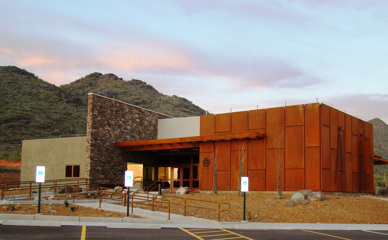
Best Will Bruder Building No One Knows About
The Deer Valley Rock Art Center
-
Best Restoration
Yum Yum Tree
-
Best Relocation
The O'Connor House Project
-
Best Hang
"The Oasis" at the Clarendon
-
Best Tunnel
Biltmore Fashion Park + Esplanade
-
Best Grass
Scottsdale Civic Center Mall
-
Best Corner
Northwest corner of Central Avenue and Camelback Road
-
Best Block
.anti_space
-
Best Block Party
Roosevelt Row's monthly First Friday block party
-
Best Parade
Phoenix Annual Parade of the Arts
-
Best Bathroom
Geisha A Go Go
-
Best Graffiti
Miranda's Custom Cars
-
Best Use of Graffiti
1700 Curry
-
Best Public Art
Phoenix Forensics Crime Laboratory
-
Best Anticipated Public Art
The as-yet unfinished sculpture by artist Janet Echelman for Civic Space Park
-
Best Cards
five15 Gallery
-
Best Buttons
Gregory Sale
-
Best New Art Shindig
Theonix Arts Showcase at Hollywood Alley
-
Best New Art Gallery
Eric Firestone Gallery
-
Best Stop on Art Detour
The Icehouse
-
Best Move
Pravus Gallery
-
Best Reason to Go to Madison Street
LAS Gallery
-
Best Downtown Arts Venue That's Not Downtown
Chyro Arts Venue
-
Best Thing to Do on a First Wednesday
First Wednesday Downtown Chandler Art Walk
-
Best Thing to Do on a Third Thursday
Melrose Crawl
-
Best First Friday Experience for Grownups
Adult's Night Out at the Arizona Science Center
-
Best Place to See and Be Seen on a First Friday
eye lounge
-
Best Place to See and Be Seen on a Third Friday
The Lost Leaf
-
Best Local 'Zine
hoozdo
-
Best Local Art Blog
www.hearsight.com
-
Best Blog Idea
mccainblogette.com
-
Best Local Political Blog
www.espressopundit.com
-
Best Local Satirical Blog
The Arizona Report
-
Best Sign That Local Democrats Just Might Have a Sense of Humor
CrAZyspace.org
-
Best Local YouTube Series
Satanic Views
-
Best Local Podcast
Phoenix Mars Mission on iTunes
-
Best Locally Produced Indie Film
NetherBeast Incorporated
-
Best TV Show Hyping the Phoenix Music Scene
Television Noir
-
Best Parody Song
"Scottsdale Bars" by The Blobots
-
Best Local Record Label
Modern Art Records
-
Best Local Recording Studio for Hip-Hop
5fith Coast Records
-
Best Local Recording Studio for Rock
Full Well Recording Studios
-
Best Radio Station for Local Music
Blaze 1260-AM
-
Best Video Game Gurus
ChatterBox Video Game Radio
-
Best Idea for a Radio Show
Ridin' Dirty
-
Best Local Radio Comedy Show
Chillin' with B and Gas
-
Best Local Rock Radio Personality
Jonathan L, KUPD 98-FM
-
Best Local Hip-Hop Radio Personality
Strawberry at 101.5 Jamz FM
-
Best Local Country Radio Personality
Dave Pratt, KMLE Country 108-FM
-
Best Radio Talk Show Host
Steve Goldstein, Here and Now
-
Best News Radio
KJZZ 91.5-FM
-
Best Place to Hear Left-Wing Nuts
KPHX 1480-AM
-
Best Place to Hear Right-Wing Nuts
KFYI 550-AM
-
Best Television News Reporter
Mike Watkiss
-
Best Television News Show
Horizon
-
Best Local Law Firm Commercials
Lerner & Rowe
-
Best Billboard
PoopDoc.com
-
Best Pun, Not Intended
Statewide Erectors
-
Best "O" Face
Chuey the Rock 'n' Roll Midget
-
Best Super Bowl Massacre Plot
Kurt William Havelock
-
Best Celebrity Temper Tantrum
Crispin Glover at Chandler Cinemas
-
Best Bigot
Darrell Ankarlo
-
Best Political Coward
State Representative Russell Pearce
-
Best Pro-Immigration Activist
Salvador Reza
-
Best Top Cop
Mesa Police Chief George Gascón
-
Best David and Goliath Moment
Rebecca Jimenez, former Guadalupe mayor
-
Best Valley Political Moment
Barack Obama at the Coliseum
-
Best Example of Local Corruption
David Hendershott in Honduras
-
Best Lawsuit
The Goldwater Institute v. the City of Phoenix
-
Best Schmuck
Frank Schmuck
-
Best Public Information Officer
Michael Murphy
-
Best Promotion
Toni Maccarone
-
Best Example of Brain Drain
The Arizona Republic
-
Best Power Couple
Bill and Barbara Mundell
-
Best Politician
Phoenix Mayor Phil Gordon
-
Best Librarians
Burton Barr Central Library
-
Best Public Library Speaker
Magda Herzberger, Holocaust survivor and author
-
Best Public Library Speaker Series
Glendale Public Library
-
Best Reason to Go Back to School
ASU Noontime Lectures
-
Best New Spoken-Word Series
Poet Bar
-
Best Entertainment for the Kids
Childsplay
-
Best Welcome From a Theater Company
Nearly Naked Theatre
-
Best New Playhouse
Peoria Center for the Performing Arts
-
Best Rehearsal Space in Which to Watch a Play
Herberger Theater Center's Rehearsal Hall
-
Best Theater Lobby for Schmoozing
Herberger Theater Center
-
Best Drive-In Movie Theater
West Wind Drive-Ins
-
Best Art-Film Theater
Harkins Camelview 5
-
Best Grindhouse Cinema
Chandler Cinemas
-
Best Place to Learn How to Make a Bike-Tube Wallet
Bike Saviours Co-op
-
Best Place to Get Crafty
Blissful Living Studio
-
Best Place to Clean Up
AZ Soap and Candlemaker'sGathering
-
Best Place to Hang with YIMBYs
Certified Local! Festival
-
Best Place to Learn How to be a Pickup Artist
Arizona Pick-Up Artist
-
Best Halloween Scare
Rawhide's Doomtown
-
Best Pretend Ghost Chasers
Arizona Ghostbusters
-
Best Place to See a Hindu Wedding
Discover India/Diwali: A Festival of Lights
-
Best Summer Vacation
Phoenix Sister Cities Youth Ambassador Program
-
Best Getaway
The Rosenclaire House
-
Best Ride That's Outta This World
Challenger Space Center
-
Best Place to "Be"
Knightrise skyspace by James Turrell
-
-
Shopping & Services
-
Best Place to Buy Carnival Chalkware
Historic District Antique Mall
-
Best Soda Selection
Pop the Soda Shop
-
Best Souvenirs
Francine Sumner Jewelry
-
Best New Coffee House
Toshi's Roast
-
Best Neighborhood Coffee House, Downtown Phoenix
Conspire
-
Best Neighborhood Coffee House, South of the Ballpark
Royal Coffee Bar
-
Best Neighborhood Coffee House, North Phoenix
Fiddler's Dream
-
Best Neighborhood Coffee House, West Valley
Mighty Cup & Spoon Coffee House & Gallery
-
Best Neighborhood Coffee House, East Valley
Ground Central
-
Best Neighborhood Coffee House, Scottsdale
The Orange Table
-
Best Neighborhood Coffee House, Tempe
Cartel Coffee Lab
-
Best Neighborhood Coffee House, Southeast Valley
The Coffee Shop
-
Best Tea Room
Souvia
-
Best Head Shop
Graffiti Shop
-
Best Smoke
Churchill's Fine Cigars
-
Best Place to Buy Thunderbird Wine
V.A. Market Liquors
-
Best Wine Selection
Total Wine & More
-
Best Beer Selection
Sun Devil Liquors
-
Best Place to Buy Agwa
Top's Liquor
-
Best Drive-Thru Liquor Store
Jerry's Liquors
-
Best Car Wash
Los Olivos Car Wash
-
Best Cab Company
Yellow Cab
-
Best Free Designated Driver in a Mercedes
Idle Inc. Exclusive Chauffeur Service
-
Best Place to Ogle a $200,000 Car
Scottsdale Ferrari/Maseratti
-
Best Free Car Show
Scottsdale Pavilions Car Show
-
Best Bike Shop
Wayne Frank's Bicycle Repair Center
-
Best Bike Co-Op
Bike Saviours
-
Best Skateboard Shop
Cowtown Skateboards
-
Best Toy Store for Adults
Synthetic Compound
-
Best Comic Book Store
Drawn to Comics
-
Best Place to Get Your Game On
Arizona Arcade and Pinball Store
-
Best Library for DVD Rentals
Scottsdale Public Library system
-
Best Magazine Rack
MADE art boutique
-
Best Bookstore
Changing Hands Bookstore
-
Best Place to Buy a First-Edition Zane Grey
Pages
-
Best Place to Find Mystery
The Poisoned Pen
-
Best High-Stress Used-Book Sale
VNSA Charity Used Book Sale
-
Best Low-Stress Used-Book Sale
Heard Museum Guild Library Book & Treasure Market
-
Best Place to Find a Typewriter
Mesa Typewriter Exchange
-
Best Boutique
Frances
-
Best Shopping in the Roosevelt District
Bunky Boutique
-
Best Shopping on Grand
Shop Devious
-
Best Boutique for Kids
Garage, A Body Shop for Kids
-
Best Kids' Accessories
Lollilocks
-
Best Kids' Used Clothing
Small Change
-
Best Vintage Clothing
Mint Vintage
-
Best Place to Buy Designer Jeans for Cheap
Goodwill
-
Best Place to Buy an Old Angora Sweater
Hollywood Regency
-
Best Place to Buy a Gas Mask and a Pair of High Heels
Fetish Falls
-
Best Place to Buy Spy Gear
Spy Headquarters
-
Best Spa
Golden Door Spa at the Boulders
-
Best Budget Spa Event
Spa Week
-
Best Boutique Pedicure
Sundrops Nailspot
-
Best Alternative to Sending Flowers
Nothing Bundt Cakes
-
Best Trophy Shop
Award Mart
-
Best Wedding Supplies
Wedding Accessory Superstore
-
Best Resource for the Home Chef
Sweet Basil Gourmetware and Cooking School Inc.
-
Best Resource for the Professional Chef
Phoenix Knife House
-
Best Baking Supplies
ABC Baking Cake Decorating & Party Supplies
-
Best Art Supplies
Arizona Art Supply
-
Best Graffiti Art Supplies
Just Blazed Hip-Hop Smoke Shop & Gallery
-
Best Scrapbook Supplies
Scrapbooks, Etc.
-
Best Paper Store
The Paper Studio
-
Best Bead Store
Beads Galore
-
Best Place for Creative Inspiration
Diane Ribbon & Notion Co.
-
Best Etsy Shop
jasonhilldesign.etsy.com
-
Best Artist's Sale
Joe Willie Smith at Lizabel's Treasures
-
Best Home Accessories
Embellish Home
-
Best High-End Antiques
Antiques on Central
-
Best Antiques on a Budget
Rust and Roses
-
Best Place to Buy Swell '60s Décor
Vintage Solutions
-
Best Place to Snag an Authentic All About Eve Poster
Femmes Fatales & Fantasies Art Museum & Gallery
-
Best Place to Buy a Guitar
Musicians Discount
-
Best Place to Exchange a Guitar
Ziggie's Music
-
Best Place to Buy CDs
Eastside Records
-
Best Place to Sell CDs
Zia Record Exchange
-
Best Place to Buy Vinyl and a Turntable to Play It On
Revolver Records
-
Best Record Swap Meet
Arizona American Italian Club
-
Best Addition to a Strip Mall
Hoodlums
-
Best DIY Dog Wash
Wag N' Wash Healthy Pet Center
-
Best Place to Find Stuff for Your Fish
Pets Inc.
-
Best Place to Buy a Plastic Worm
Bass Pro Shops Outdoor World
-
Best Place to Help Your Pet Go Green
Bonnie's Barkery
-
-
Readers' Choice
Best Of
-
La Vida
-
Best Place to Buy Mexican Candy
Dulceria Pico Rico
-
Best Raspado
Realeza Michoacana
-
Best Place to See Mutant Piñatas
Bragg's Pie Factory
-
Best Over-the-Top Swap Meet
El Gran Mercado
-
Best Amigos
Friends of Mexican Art
-
Best Mirror on the City
"The Mexican American Mirror/El Espejo México Americano: Reflections of Our City's Heritage"
-
Best Glitter
Kathy Cano-Murillo, the Crafty Chica
-
Best Mexican Folk Art Mural
MJ Mini Mart
-
Best Place to See Day of the Dead Ofrendas
Arizona Historical Society Museum at Papago Park, Tempe
-
Best Place to Snag Day of the Dead Stuff
Mesa Arts Center
-
Best Place to Take the Kids on Day of the Dead
Dr. A.J. Chandler Park, November 1
-
Best Authentic Mexican Dining Experience
Tradiciones
-
Best Authentic Mexico City Dining Experience
Plaza Grill
-
Best Neighborhood Mexican Restaurant, Central Phoenix
Rosita's Place
-
Best Neighborhood Mexican Restaurant, South Phoenix
Poncho's
-
Best Neighborhood Mexican Restaurant, West Valley
La Perla Café
-
Best Neighborhood Mexican Restaurant, East Valley
Rancho de Tia Rosa
-
Best Neighborhood Mexican Restaurant, Tempe
Restaurant Mexico
-
Best Neighborhood Mexican Restaurant, Scottsdale
La Fonda del Sol
-
Best Modern Mexican Restaurant
Barrio Café
-
Best South American Cuisine
Mi Cocina Mi País
-
Best New Mexican Brunch
Richardson's
-
Best Mexican Patio Dining
El Zocalo Mexican Grille
-
Best Mexican Takeout
Rito's Market & Mexican Takeout
-
Best Tortillas
Carolina's
-
Best Mole
Los Sombreros
-
Best Mariscos (Mexican Seafood)
Mariscos Sinaloa
-
Best Tortas
Tortas El Güero
-
Best Tacos
El Nopalito
-
Best Machaca
Los Dos Molinos
-
Best Flan
Sabor Cubano
-
Best Paletas
Flor de Michoacan
-
Best Aguas Frescas
Los Reyes de la Torta
-
Best Mexican Market
Phoenix Ranch Market
-
Best Panadería (Bakery)
La Tolteca
-
Best Religious Shrine in a Grocery Store
Mini Mercado Oaxaca
-
Best Place to Buy Hubcaps and Quesadillas
Precision Auto
-
Best Piñatas
Arizona Piñatas
-
Best Mexican Imports
Mexican Arts-Imports
-
Best Boutique with a Latin Flair
Purple Lizard
-
Best Place to Buy a Quinceañera Dress
I Do! I Do! Bridal
-
Best Place to Buy Quinceañera Accessories
Azteca Bridal
-
Best Latina Designers
Lola y Lola
-
Best Place to Buy Narcocorridos
El Idolo de Oro
-
Best Mexican Radio Station
La Campesina
-
Best Latino Radio Station
95.1-FM Latino Vibe KVIB
-
Best Jump to FM Radio
El Break on 95.1 Latino Vibe
-
Best Latin DJ
DJ Melo
-
Best Latin Club DJ
DJ Big Latin
-
Best Latin Nightspot
Club DWNTWN
-
Best Latin Dance Night
Caliente Chica Fridays
-
Best Gay Latin Dance Night
Vaquero Thursdays
-
Best Place to Worship Carlos Santana
Maria Maria: La Cantina
-
Best Place to Hear Happy Mariachi Music
La Casa del Mariachi
-
Best Place to Hear Sad Mariachi Music
Oaxaca
-
Best South American Wine Bar
Bomberos Café & Wine Bar
-
Best Mi/Chelada
Taxi Inn
-
-
Food & Drink
-
Arts & Entertainment
-
Food & Drink
-
Arts & Entertainment
-
Food & Drink
-
Arts & Entertainment
-
Food & Drink
-
Arts & Entertainment
-
Food & Drink
-
Arts & Entertainment
-
Food & Drink
-
Arts & Entertainment
-
Food & Drink
-
Arts & Entertainment
-
Food & Drink
-
Arts & Entertainment
-
Food & Drink
-
Arts & Entertainment
-
Food & Drink
-
Arts & Entertainment
-
Food & Drink
-
Arts & Entertainment
-
Food & Drink
-
Arts & Entertainment
-
Food & Drink
-
Arts & Entertainment
-
Food & Drink
-
Arts & Entertainment
-
Food & Drink
-
Arts & Entertainment
-
Food & Drink
-
Arts & Entertainment
-
Food & Drink
-
Arts & Entertainment
-
Food & Drink
-
Arts & Entertainment
-
Food & Drink
-
Arts & Entertainment
-
Food & Drink
-
Arts & Entertainment
-
Food & Drink
-
Arts & Entertainment
-
Food & Drink
-
Arts & Entertainment
-
Food & Drink
-
Arts & Entertainment
-
Food & Drink
-
Arts & Entertainment
-
Food & Drink
-
Arts & Entertainment
-
Food & Drink
-
Arts & Entertainment
-
Food & Drink
-
Arts & Entertainment
-
Food & Drink
-
Arts & Entertainment
-
Food & Drink
-
Arts & Entertainment
-
Food & Drink
-
Arts & Entertainment
-
Food & Drink
-
Arts & Entertainment
-
Food & Drink
-
Arts & Entertainment
-
Food & Drink
-
Arts & Entertainment
-
Food & Drink
-
Arts & Entertainment
-
Food & Drink
-
Arts & Entertainment
-
Food & Drink
-
Arts & Entertainment
-
Food & Drink
-
Arts & Entertainment
-
Food & Drink
-
Arts & Entertainment
-
Food & Drink
-
Arts & Entertainment
-
Food & Drink
-
Arts & Entertainment
-
Food & Drink
-
Arts & Entertainment
-
Food & Drink
-
Arts & Entertainment
-
Food & Drink
-
Arts & Entertainment
-
Food & Drink
-
Arts & Entertainment
-
Food & Drink
-
Arts & Entertainment
-
Food & Drink
-
Arts & Entertainment
-
Food & Drink
-
Arts & Entertainment
-
Food & Drink
-
Arts & Entertainment
-
Food & Drink
-
Arts & Entertainment
-
Food & Drink
-
Arts & Entertainment
-
Food & Drink
-
Arts & Entertainment
-
Food & Drink
-
Arts & Entertainment
-
Food & Drink
-
Arts & Entertainment
-
Food & Drink
-
Arts & Entertainment
-
Food & Drink
-
Arts & Entertainment
-
Food & Drink
-
Arts & Entertainment
-
Food & Drink
-
Arts & Entertainment
-
Food & Drink
-
Arts & Entertainment
-
Food & Drink
-
Arts & Entertainment
-
Food & Drink
-
Arts & Entertainment
-
Food & Drink
-
Arts & Entertainment
-
Food & Drink
-
Arts & Entertainment
-
Food & Drink
-
Arts & Entertainment
-
Food & Drink
-
Arts & Entertainment
-
Food & Drink
-
Best Tapas
Lola Tapas
-
Best Tasting Menu
Sea Saw
-
Best Seasonal Cuisine
Quiessence
-
Best Use of a Chickpea
Bombay Spice
-
Best Use of Grape-Nuts
The Breadfruit
-
Best Sticky Buns
El Chorro Lodge
-
Best Croissants
Au Petit Four
-
Best Pastries
Scratch Pastries
-
Best Cupcakes
Wicked Bakery
-
Best Bakery
Barb's Bakery
-
Best Jewish Bakery
Karsh's Bakery
-
Best Bread
Simply Bread
-
Best Pretzels
Tammie Coe Cakes
-
Best Bagels
NY Bagels 'N Bialys
-
Best Spelt Bread
Bread Basket Bakery
-
Best Chocolate
Chatham's Fine Chocolates
-
Best Treat Boxes
Essence Bakery Café
-
Best Ice Cream
Sweet Republic
-
Best Gelato
Arlecchino Gelateria
-
Best Frozen Yogurt
Ice Tango
-
Best Popcorn
Poppa Maize Gourmet Popcorn
-
Best Potato Chips
Poore Brothers
-
Best Veggies
Carl Seacat, Seacat Gardens
-
Best Olive Oil
Queen Creek Olive Mill
-
Best Homegrown Goat Cheese
Black Mesa Ranch
-
Best Cheese Selection
Whole Foods
-
Best Asian Market
Lee Lee Oriental Supermarket
-
Best British Import
fresh & easy
-
Best Middle Eastern Grocery Store
Baiz Market
-
-
Bars & Clubs
-
Best Place to Shoot Darts
Clicks Billiards
-
Best Arcade
Golfland SunSplash
-
Best Countercultural Carnival
Sadisco*
-
Best Musical Carousel
Celebrity Theatre
-
Best Place to Catch a House Show
Mitchell Park Neighborhood, Tempe
-
Best Place to Find a Rave
AzEDM
-
Best Hipster Dance Night
Shake! With William Fucking Reed
-
Best Place to Party on a Yacht Without Getting Seasick
Yacht Rock Sundays
-
Best Bull Ride
Saddle Ranch Chop House
-
Best Dance Floor
Bar Smith's Rooftop
-
Best Local Vaudeville Show
Romantasy Cabaret
-
Best Karaoke
Bullock's Cocktail Lounge
-
Best Karaoke for Introverts
Geisha A Go Go
-
Best Open Mic Night
Mondays at Yucca Tap Room
-
Best Place to Play Cornhole
R.T. O'Sullivan's Sports Grill
-
Best Place for Guitar Hero Tournaments
Uncle Monkeys
-
Best Place to Play Rock Band
Sandbar Mexican Grill
-
Best Hookah Bar
Layalena Restaurant
-
Best Brew Pub
Papago Brewing Co.
-
Best Neighborhood Bar, Downtown Phoenix
The Roosevelt
-
Best Neighborhood Bar, Central Phoenix
Shady's
-
Best Neighborhood Bar, Scottsdale
Coach House
-
Best Neighborhood Bar, Arcadia
JT's Bar & Grill
-
Best Neighborhood Bar, Tempe
Casey Moore's Oyster House and Seafood Restaurant
-
Best Neighborhood Bar, Southeast Valley
Crabby Don's Bar & Grill
-
Best Neighborhood Bar, West Valley
Exit 7 Bar And Grill
-
Best Place to See the Main Events
R.T. O'Sullivan's Sports Bar and Grill
-
Best Sports Bar, Downtown Phoenix
Networks Bar & Grill
-
Best Sports Bar, Central Phoenix
Half Moon Sports Grill
-
Best Sports Bar, West Valley
Santisi Brothers Pizzeria Sports Bar
-
Best Sports Bar, Northwest Valley
McDuffy's
-
Best Sports Bar, East Valley
Woodshed II
-
Best Sports Bar, Scottsdale
Upper Deck Sports Grill
-
Best Sports Bar, Tempe
Four Peaks Brewery
-
Best Pool Hall
Kolby's Corner Pocket
-
Best Lesbian Bar
Cash Inn Country
-
Best Gay Bar
Amsterdam
-
Best New Gay Bar
Retrobar
-
Best Dive Bar
Dilly Dally
-
Best Place to Turn Green — Without Envy
Skeptical Chymist Irish Restaurant & Pub
-
Best Place to See and Be Seen
SkyBar at the Mondrian
-
Best Bar to Run into Old Phoenix
Feeney's
-
Best Hotel Bar
Wright Bar at the Biltmore
-
Best Place to Lounge
Vocé Ristoranté & Lounge
-
Best New Bar
Chez Nous
-
Best New Nightclub
PHX Nightclub
-
Best Strip Club
Centerfold's Cabaret
-
Best Rock Club
Joe's Grotto
-
Best Place to See Jam-Rock Bands
The Goat Head Saloon
-
Best Blues Club
The Rhythm Room
-
Best Country Nightclub
Handlebar-J
-
Best Country-Western Bar
Spirits Bar & Grill
-
Best Texas Jukebox
Texaz Grill
-
Best Venue for National Music Acts
Marquee Theatre
-
Best Music Venue for Local Acts
The Sets
-
Best Local Band Destined for the Big Time
Digital Summer
-
Best Cover Band
The Chadwicks
-
Best Tribute Band
UnSkinny Bop
-
Best Jam Band
Ten Dollar Outfit
-
Best SXSW Buzz for a Local Band
What Laura Says Thinks and Feels
-
Best Local Supergroup
Los Guys
-
Best Live Karaoke Band
The Instant Classics
-
Best Band Revival
Hellen
-
Best Band Featuring a Random Assortment of Instruments
Dry River Yacht Club
-
Best Battle of the Bands
98 KUPD's Rock Fight
-
Best Stage Show
Peachcake
-
Best House DJ
DJ Tranzit
-
Best Hip-Hop Weekly
Blunt Club
-
Best Place to Rub Shoulders with Future Hip-Hop Breakouts
Groove Candy
-
Best Local Hip-Hop Radio Program
Friday Night Flavas on Power 98.3
-
Best Collaboration
Justus and KRS-One
-
Best Monthly Blues Jam
Rhythm Room All-Stars
-
Best Place to Hear Jazz in Downtown Phoenix
The Lost Leaf
-
Best Place to Hear Jazz in Scottsdale
Nello's
-
Best Happy Hour
Mickey's Hangover
-
Best Place to Drink Agwa
Big Fish Pub
-
Best Cosmopolitan
Merc Bar
-
Best Martini
Durant's
-
Best Daiquiri
Padre's Modern Mexican Cuisine
-
Best Tequila Selection
Barrio Café
-
Best Mojito
Fuego Bistro
-
Best Sangria
Ticoz Resto-Bar
-
Best Margarita
Cien Agaves
-
Best Local Beer
Cordillera Blanca White Chocolate Ale
-
Best Beer for Wine Snobs
Hopsquatch Barleywine at Four Peaks Grill & Tap
-
Best Drinking Story
Mary Cope at Yucca Tap Room
-
-
People & Places
-
Best Place to Dress Like a Freak
Easley's Fun Shop
-
Best Bygone Theme Park
Legend City
-
Best High-Flying Book Cover
The Idiot Girl and the Flaming Tantrum of Death
-
Best Political Sideshow
Maricopa County's attempt to prosecute New Times
-
Best Roller Coaster
Desert Storm at Castles-n-Coasters
-
Best Hair Fit for a Fair
Rose Mofford
-
Best People Watching
Julian and Suzanne Walking
-
Best View of Phoenix from a Moving Car
1-10 east from 19th Avenue to Seventh Avenue
-
Best Way to Avoid a Photo Radar Ticket Without Slowing Down
Speed Trap Exchange
-
Best All-Day Ride
Valley Metro buses
-
Best Anticipated Ride
METRO Light Rail
-
Best Description of Phoenix Weather
Judas Priest singer Rob Halford
-
Best Perfect Phoenix Sunday in Foul Weather
Matt's Big Breakfast + Phoenix Art Museum
-
Best Perfect Phoenix Sunday in Fair Weather
South Mountain Park and Preserve + Los Dos Molinos
-
Best Alternative to Mill Avenue
Tempe Marketplace
-
Best Walkable Downtown
Old Town Scottsdale
-
Best Strip Mall
1250 East Apache Boulevard, Tempe
-
Best Strip Mall to Keep Your Eye On
4700 North Central Avenue
-
Best Unintentionally Themed Strip Mall
Southwest corner of 59th Avenue and Olive Avenue, Glendale
-
Best Hotel Lobby to Poke Your Head Into
W Scottsdale Hotel
-
Best Downtown Building to Poke Your Head Into
Children's Museum of Phoenix
-
Best Will Bruder Building No One Knows About
The Deer Valley Rock Art Center
-
Best Restoration
Yum Yum Tree
-
Best Relocation
The O'Connor House Project
-
Best Hang
"The Oasis" at the Clarendon
-
Best Tunnel
Biltmore Fashion Park + Esplanade
-
Best Grass
Scottsdale Civic Center Mall
-
Best Corner
Northwest corner of Central Avenue and Camelback Road
-
Best Block
.anti_space
-
Best Block Party
Roosevelt Row's monthly First Friday block party
-
Best Parade
Phoenix Annual Parade of the Arts
-
Best Bathroom
Geisha A Go Go
-
Best Graffiti
Miranda's Custom Cars
-
Best Use of Graffiti
1700 Curry
-
Best Public Art
Phoenix Forensics Crime Laboratory
-
Best Anticipated Public Art
The as-yet unfinished sculpture by artist Janet Echelman for Civic Space Park
-
Best Cards
five15 Gallery
-
Best Buttons
Gregory Sale
-
Best New Art Shindig
Theonix Arts Showcase at Hollywood Alley
-
Best New Art Gallery
Eric Firestone Gallery
-
Best Stop on Art Detour
The Icehouse
-
Best Move
Pravus Gallery
-
Best Reason to Go to Madison Street
LAS Gallery
-
Best Downtown Arts Venue That's Not Downtown
Chyro Arts Venue
-
Best Thing to Do on a First Wednesday
First Wednesday Downtown Chandler Art Walk
-
Best Thing to Do on a Third Thursday
Melrose Crawl
-
Best First Friday Experience for Grownups
Adult's Night Out at the Arizona Science Center
-
Best Place to See and Be Seen on a First Friday
eye lounge
-
Best Place to See and Be Seen on a Third Friday
The Lost Leaf
-
Best Local 'Zine
hoozdo
-
Best Local Art Blog
www.hearsight.com
-
Best Blog Idea
mccainblogette.com
-
Best Local Political Blog
www.espressopundit.com
-
Best Local Satirical Blog
The Arizona Report
-
Best Sign That Local Democrats Just Might Have a Sense of Humor
CrAZyspace.org
-
Best Local YouTube Series
Satanic Views
-
Best Local Podcast
Phoenix Mars Mission on iTunes
-
Best Locally Produced Indie Film
NetherBeast Incorporated
-
Best TV Show Hyping the Phoenix Music Scene
Television Noir
-
Best Parody Song
"Scottsdale Bars" by The Blobots
-
Best Local Record Label
Modern Art Records
-
Best Local Recording Studio for Hip-Hop
5fith Coast Records
-
Best Local Recording Studio for Rock
Full Well Recording Studios
-
Best Radio Station for Local Music
Blaze 1260-AM
-
Best Video Game Gurus
ChatterBox Video Game Radio
-
Best Idea for a Radio Show
Ridin' Dirty
-
Best Local Radio Comedy Show
Chillin' with B and Gas
-
Best Local Rock Radio Personality
Jonathan L, KUPD 98-FM
-
Best Local Hip-Hop Radio Personality
Strawberry at 101.5 Jamz FM
-
Best Local Country Radio Personality
Dave Pratt, KMLE Country 108-FM
-
Best Radio Talk Show Host
Steve Goldstein, Here and Now
-
Best News Radio
KJZZ 91.5-FM
-
Best Place to Hear Left-Wing Nuts
KPHX 1480-AM
-
Best Place to Hear Right-Wing Nuts
KFYI 550-AM
-
Best Television News Reporter
Mike Watkiss
-
Best Television News Show
Horizon
-
Best Local Law Firm Commercials
Lerner & Rowe
-
Best Billboard
PoopDoc.com
-
Best Pun, Not Intended
Statewide Erectors
-
Best "O" Face
Chuey the Rock 'n' Roll Midget
-
Best Super Bowl Massacre Plot
Kurt William Havelock
-
Best Celebrity Temper Tantrum
Crispin Glover at Chandler Cinemas
-
Best Bigot
Darrell Ankarlo
-
Best Political Coward
State Representative Russell Pearce
-
Best Pro-Immigration Activist
Salvador Reza
-
Best Top Cop
Mesa Police Chief George Gascón
-
Best David and Goliath Moment
Rebecca Jimenez, former Guadalupe mayor
-
Best Valley Political Moment
Barack Obama at the Coliseum
-
Best Example of Local Corruption
David Hendershott in Honduras
-
Best Lawsuit
The Goldwater Institute v. the City of Phoenix
-
Best Schmuck
Frank Schmuck
-
Best Public Information Officer
Michael Murphy
-
Best Promotion
Toni Maccarone
-
Best Example of Brain Drain
The Arizona Republic
-
Best Power Couple
Bill and Barbara Mundell
-
Best Politician
Phoenix Mayor Phil Gordon
-
Best Librarians
Burton Barr Central Library
-
Best Public Library Speaker
Magda Herzberger, Holocaust survivor and author
-
Best Public Library Speaker Series
Glendale Public Library
-
Best Reason to Go Back to School
ASU Noontime Lectures
-
Best New Spoken-Word Series
Poet Bar
-
Best Entertainment for the Kids
Childsplay
-
Best Welcome From a Theater Company
Nearly Naked Theatre
-
Best New Playhouse
Peoria Center for the Performing Arts
-
Best Rehearsal Space in Which to Watch a Play
Herberger Theater Center's Rehearsal Hall
-
Best Theater Lobby for Schmoozing
Herberger Theater Center
-
Best Drive-In Movie Theater
West Wind Drive-Ins
-
Best Art-Film Theater
Harkins Camelview 5
-
Best Grindhouse Cinema
Chandler Cinemas
-
Best Place to Learn How to Make a Bike-Tube Wallet
Bike Saviours Co-op
-
Best Place to Get Crafty
Blissful Living Studio
-
Best Place to Clean Up
AZ Soap and Candlemaker'sGathering
-
Best Place to Hang with YIMBYs
Certified Local! Festival
-
Best Place to Learn How to be a Pickup Artist
Arizona Pick-Up Artist
-
Best Halloween Scare
Rawhide's Doomtown
-
Best Pretend Ghost Chasers
Arizona Ghostbusters
-
Best Place to See a Hindu Wedding
Discover India/Diwali: A Festival of Lights
-
Best Summer Vacation
Phoenix Sister Cities Youth Ambassador Program
-
Best Getaway
The Rosenclaire House
-
Best Ride That's Outta This World
Challenger Space Center
-
Best Place to "Be"
Knightrise skyspace by James Turrell
-
-
Shopping & Services
-
Best Place to Buy Carnival Chalkware
Historic District Antique Mall
-
Best Soda Selection
Pop the Soda Shop
-
Best Souvenirs
Francine Sumner Jewelry
-
Best New Coffee House
Toshi's Roast
-
Best Neighborhood Coffee House, Downtown Phoenix
Conspire
-
Best Neighborhood Coffee House, South of the Ballpark
Royal Coffee Bar
-
Best Neighborhood Coffee House, North Phoenix
Fiddler's Dream
-
Best Neighborhood Coffee House, West Valley
Mighty Cup & Spoon Coffee House & Gallery
-
Best Neighborhood Coffee House, East Valley
Ground Central
-
Best Neighborhood Coffee House, Scottsdale
The Orange Table
-
Best Neighborhood Coffee House, Tempe
Cartel Coffee Lab
-
Best Neighborhood Coffee House, Southeast Valley
The Coffee Shop
-
Best Tea Room
Souvia
-
Best Head Shop
Graffiti Shop
-
Best Smoke
Churchill's Fine Cigars
-
Best Place to Buy Thunderbird Wine
V.A. Market Liquors
-
Best Wine Selection
Total Wine & More
-
Best Beer Selection
Sun Devil Liquors
-
Best Place to Buy Agwa
Top's Liquor
-
Best Drive-Thru Liquor Store
Jerry's Liquors
-
Best Car Wash
Los Olivos Car Wash
-
Best Cab Company
Yellow Cab
-
Best Free Designated Driver in a Mercedes
Idle Inc. Exclusive Chauffeur Service
-
Best Place to Ogle a $200,000 Car
Scottsdale Ferrari/Maseratti
-
Best Free Car Show
Scottsdale Pavilions Car Show
-
Best Bike Shop
Wayne Frank's Bicycle Repair Center
-
Best Bike Co-Op
Bike Saviours
-
Best Skateboard Shop
Cowtown Skateboards
-
Best Toy Store for Adults
Synthetic Compound
-
Best Comic Book Store
Drawn to Comics
-
Best Place to Get Your Game On
Arizona Arcade and Pinball Store
-
Best Library for DVD Rentals
Scottsdale Public Library system
-
Best Magazine Rack
MADE art boutique
-
Best Bookstore
Changing Hands Bookstore
-
Best Place to Buy a First-Edition Zane Grey
Pages
-
Best Place to Find Mystery
The Poisoned Pen
-
Best High-Stress Used-Book Sale
VNSA Charity Used Book Sale
-
Best Low-Stress Used-Book Sale
Heard Museum Guild Library Book & Treasure Market
-
Best Place to Find a Typewriter
Mesa Typewriter Exchange
-
Best Boutique
Frances
-
Best Shopping in the Roosevelt District
Bunky Boutique
-
Best Shopping on Grand
Shop Devious
-
Best Boutique for Kids
Garage, A Body Shop for Kids
-
Best Kids' Accessories
Lollilocks
-
Best Kids' Used Clothing
Small Change
-
Best Vintage Clothing
Mint Vintage
-
Best Place to Buy Designer Jeans for Cheap
Goodwill
-
Best Place to Buy an Old Angora Sweater
Hollywood Regency
-
Best Place to Buy a Gas Mask and a Pair of High Heels
Fetish Falls
-
Best Place to Buy Spy Gear
Spy Headquarters
-
Best Spa
Golden Door Spa at the Boulders
-
Best Budget Spa Event
Spa Week
-
Best Boutique Pedicure
Sundrops Nailspot
-
Best Alternative to Sending Flowers
Nothing Bundt Cakes
-
Best Trophy Shop
Award Mart
-
Best Wedding Supplies
Wedding Accessory Superstore
-
Best Resource for the Home Chef
Sweet Basil Gourmetware and Cooking School Inc.
-
Best Resource for the Professional Chef
Phoenix Knife House
-
Best Baking Supplies
ABC Baking Cake Decorating & Party Supplies
-
Best Art Supplies
Arizona Art Supply
-
Best Graffiti Art Supplies
Just Blazed Hip-Hop Smoke Shop & Gallery
-
Best Scrapbook Supplies
Scrapbooks, Etc.
-
Best Paper Store
The Paper Studio
-
Best Bead Store
Beads Galore
-
Best Place for Creative Inspiration
Diane Ribbon & Notion Co.
-
Best Etsy Shop
jasonhilldesign.etsy.com
-
Best Artist's Sale
Joe Willie Smith at Lizabel's Treasures
-
Best Home Accessories
Embellish Home
-
Best High-End Antiques
Antiques on Central
-
Best Antiques on a Budget
Rust and Roses
-
Best Place to Buy Swell '60s Décor
Vintage Solutions
-
Best Place to Snag an Authentic All About Eve Poster
Femmes Fatales & Fantasies Art Museum & Gallery
-
Best Place to Buy a Guitar
Musicians Discount
-
Best Place to Exchange a Guitar
Ziggie's Music
-
Best Place to Buy CDs
Eastside Records
-
Best Place to Sell CDs
Zia Record Exchange
-
Best Place to Buy Vinyl and a Turntable to Play It On
Revolver Records
-
Best Record Swap Meet
Arizona American Italian Club
-
Best Addition to a Strip Mall
Hoodlums
-
Best DIY Dog Wash
Wag N' Wash Healthy Pet Center
-
Best Place to Find Stuff for Your Fish
Pets Inc.
-
Best Place to Buy a Plastic Worm
Bass Pro Shops Outdoor World
-
Best Place to Help Your Pet Go Green
Bonnie's Barkery
-
-
Readers' Choice


Use of this website constitutes acceptance of our
terms of use,
our cookies policy, and our
privacy policy
The Phoenix New Times may earn a portion of sales from products & services purchased through links on our site from our affiliate partners.
©2024
Phoenix New Times, LLC. All rights reserved.
Do Not Sell or Share My Information
Do Not Sell or Share My Information
