There are a lot of killer bicycle rides in the Valley, but the one along Usery Pass Road is our absolute favorite, thanks to the backdrop of desert plant life unharmed by the gated communities that swallow up the land to the east and south. Plus, there are super-spacious bike lanes on each side of the windy route, so you won't feel like you're about to get steamrolled by a boat-towing pickup truck. A good and challenging way to tackle the blacktop is to head west from Red Mountain Park, 7745 East Brown Road in Mesa, then north up Power Road along the Salt River until it turns into Bush Highway before finally looping back south on Usery Pass/Ellsworth roads. If you take this 21-mile route, which gains/loses more than 1,000 feet in elevation along the way, the stretch between the 12- and 16-mile markers is the biggest leg-burner. However, once you get through that, it's a smooth coast.

Best Mountain Bike Trail
Desert Classic
What goes up must come down — at least, that's what mountain bikers count on. The South Mountain Desert Classic Trail is not the most grueling trail in our neck of the desert, but it's close, it's scenic — and full of ups and downs. Phoenix South Mountain Park is over 16,000 acres of desert landscape overlooking downtown Phoenix to the north and urban sprawl to the south. The trail is about 18 miles long and runs along the southern face of the mountain. If you don't have a mountain bike, get one.
- 10919 S. Central Ave., Phoenix, 85042 Map
- 602-262-7393
- www.phoenix.gov/parks/southmnt.html
Best Central Phoenix Hike
Piestewa Peak Trail #304 (1.52-mile Nature Trail)
Don't just take our word for it — recent research suggests that spending time in nature will improve cognitive function. Scientists say the human brain has two types of attention: directed attention (which we use when we work, drive, Facebook) and involuntary attention (like that triggered by the call of a bird or the shape of rock formation). The problem is most of us are using our directed attentions past the point of fatigue. One way to restore the circuits is by taking a walk. That's why we're damn lucky to live in a city with thousands of acres of nature trails.
The best place to get away and give your brain a reboot is the 304 Loop Trail at Piestewa Peak. Just drive right on past those over-achievers at the summit trail and head all the way back to the final parking area. The walk is an easy-to-moderate loop, takes about 45 minutes, and is located right in the middle of the city. Go ahead and contemplate the cuddly appeal of Teddy Bear chollas, the migratory patterns of birds, and the new limbs growing on an octogenarian saguaro.
Best South Phoenix Hike
Alta "Alt" Trail
There are two things you need to know about this hike, and they're both supercool: 1) the Alta Trail is situated on the front range at South Mountain Park, and we're betting that many of you didn't even know there was a front range; 2) the "Alt" section of this trail is not maintained and does not appear on any of the park's maps. Translation: It's not choked with other hikers and it's completely badass.
If you want to hike the "official" Alta Trail, drive about two miles down the San Juan Road and park in a gravel lot at mile marker 2.5 and the Bajada Trailhead, where you connect with a well-maintained trail to the top. That's fine, but you'll miss most of the eastern section of the range and a helluva lot of stellar trekking if you choose that route. Better to do it our way.
After you pass through the headquarters section on the park's main road, turn right at the sign that says Big Ramada and Little Ramada picnic areas. Drive as far as the road will take you and then park. Aim for the nearest rise to the west, and follow the dirt tracks that lead inexorably to the summit of the range. After a brief but leg-frying up, you'll find yourself atop a panorama-saturated, dragon-back ridge that follows the crest of the range all the way to its terminus at San Juan Lookout, about four miles away.
When you get to San Juan, turn around and do it in reverse.
You'll regret it — but you won't.
- 10919 S. Central Ave., Phoenix, 85042 Map
- 602-262-7393
- www.phoenix.gov/parks/southmnt.html
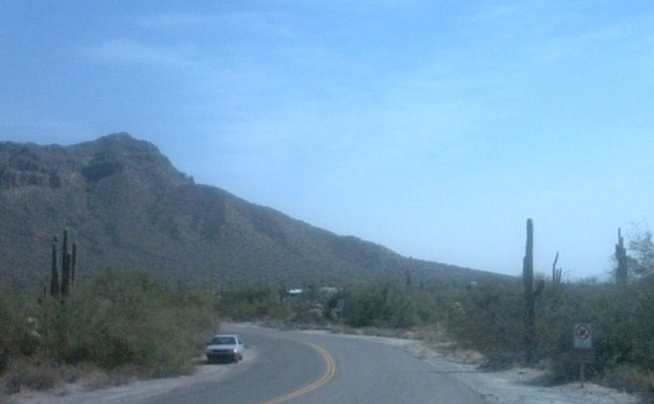
Best West Valley Hike
Quartz Peak Trail
The Sierra Estrellas are the most maddening mountains in our midst. The southwest Valley chain is within shouting distance of civilization, and its craggy spires scream to be summited, but the formidable range gets more redoubtable the closer you get to it. So much so that there's only one legal point of access to its long crest and six striking peaks (Hayes, Montezuma, Montezuma Sleeping, Montezuma Head, Butterfly, and Quartz).
The Quartz Peak Trail — such as it is — is it.
Finding the trailhead on the far side of the Earth in Rainbow Valley is a challenge in itself, but tracking the footpath to the summit can be even more cryptic. Then there's the actual hiking of the thing, which has caused many a veteran hiker to swear like Blackbeard, thanks to the iffy footing and 2,500-foot elevation gain (about two trips up Camelback Mountain on an even nastier path).
Worth it? Absolutely. Summiting the Estrella is a badge of honor for hiking hardcores, and the views of desolate basin-and-range western Arizona and the bustling Valley to the east make it all worthwhile.
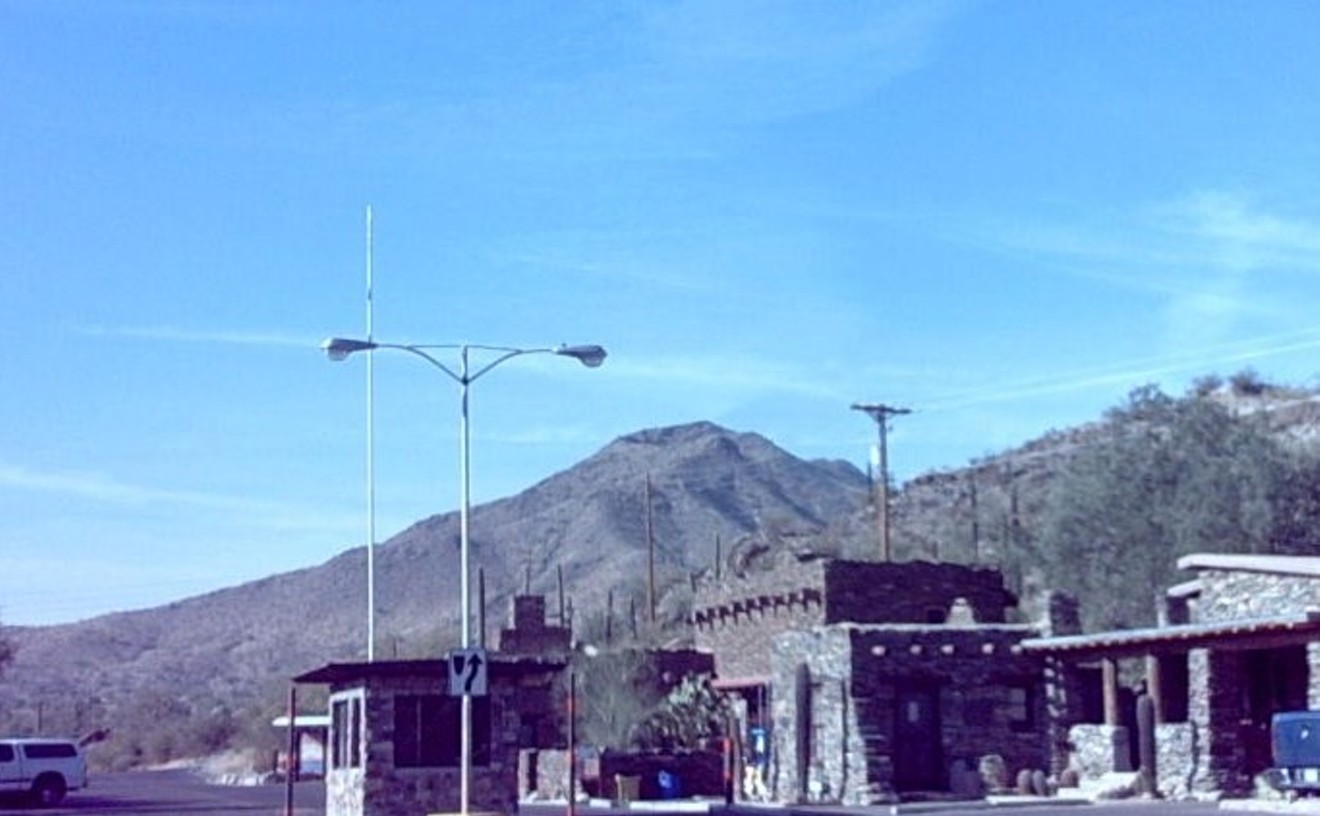
Best East Valley Hike
Pass Mountain Trail
Like some of the exceptional backcountry hikes at the Phoenix Mountains Preserve that are eclipsed by the gravitational pull of Piestewa Peak, this phenomenal hike is often lost in the glare of Usery's popular Wind Cave Trail. But you don't always have to go up to get to the top; sometimes, as with Pass Mountain, you can go around.
The 7.4-mile loop offers a circumnavigation of its namesake peak — the one with the distinctive scar that's visible from almost anywhere in the Valley — as well as lush Sonoran flora, dazzling views of Four Peaks and the Superstitions, and a saddle link-up with the Goldfield Mountains. If you're up to it, you can freelance into the Goldfields before closing the loop on Pass Mountain.
- 3939 N. Usery Pass Rd., Mesa, 85207 Map
- 480-984-0032
- www.maricopa.gov/parks/usery/
Best Guided Hike
Elephant Mountain Fortress Hike

True hikers view guided hikes as literate Parisians view ushered tours of the Louvre: dimly.
This excellent seven-miler is the exception. A relatively difficult trek over primitive trails, the ranger-led hybrid hike takes participants into the park's achingly beautiful backcountry for sublime views and solid interpretation. The ranger du jour will fill you in on the newest, and most unusual, entry in the Maricopa County Regional Park system, which is set in a high-desert riparian area dotted with numerous archaeological sites.
The hike is scheduled regularly. See the Web site for more info.
- 44000 N. Spur Cross Rd., Cave Creek, 85331 Map
- 480-488-6601
- www.maricopa.gov/parks/spur%5Fcross/
Best Hike for Speed Freaks
San Tan Trail
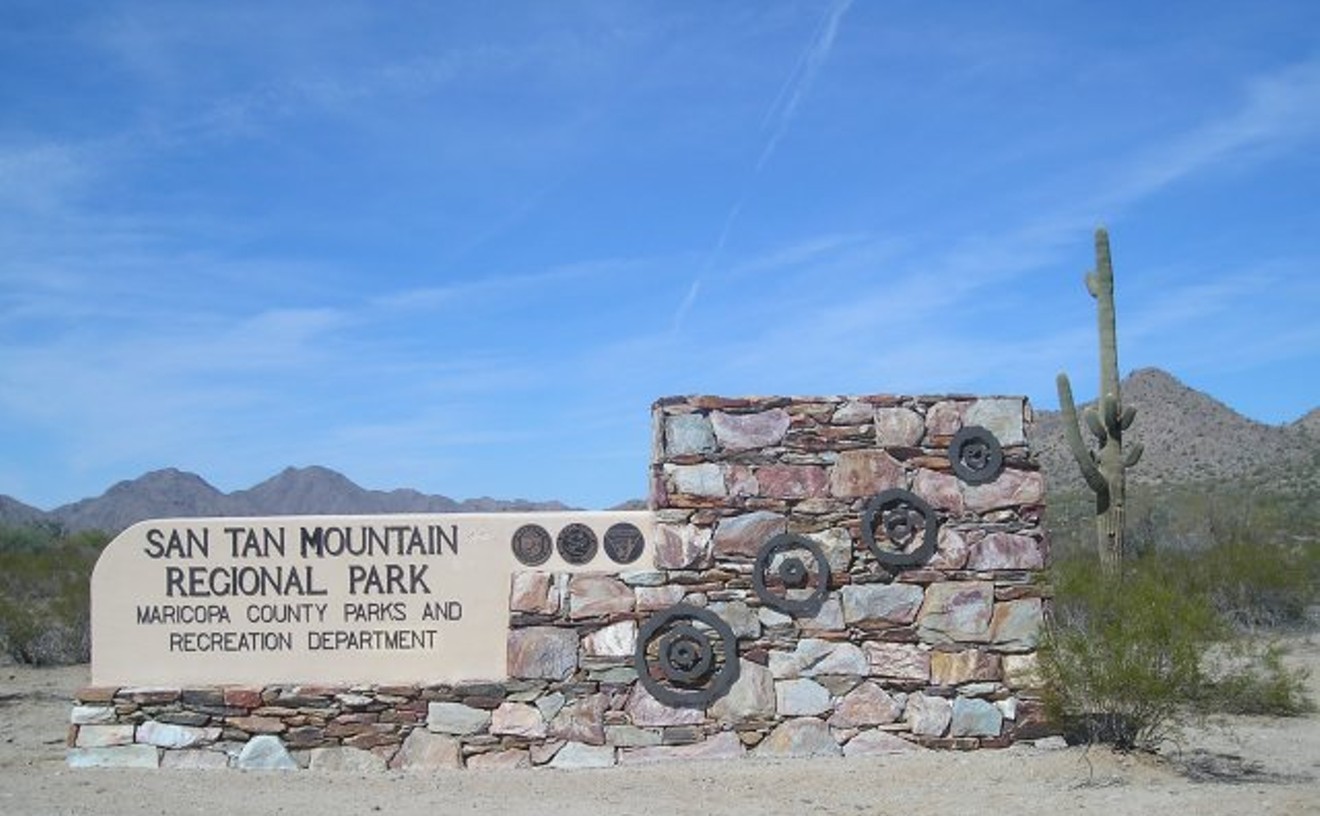
Despite the word "Mountain" in its name, this park is located in the eastern molehills of the San Tans, with the 3,054-foot namesake peak looming far off in the westerly distance.
Translation: It's flat and it's fast.
There are some mild ups available, but most of the park's trail system, and especially the centerpiece San Tan Trail, cuts through hard-pan lower Sonoran Desert. Hikers accustomed to the topographical arrhythmia of South Mountain, Camelback, and the Phoenix Mountains Preserve, or even other regional parks such as Estrella and Usery, will be amazed at the dirt-churning pace of the place. We conquered the 5.7-mile San Tan loop in just under two hours, without sacrificing any views or even breaking a sweat.
- 6533 W. Phillips Rd., Queen Creek, 85242 Map
- 480-655-5554
- www.maricopa.gov/parks/santan/
Best 10-Mile Hike
Black Mesa Loop, Superstition Mountains
There aren't a lot of cities in this country where you can throw off your business-casual garb after your workday, zip onto a freeway, and be knee-deep in miles of wild desert. If you're into hiking, Phoenix totally rocks. And when you can really take your time with an all-day hike, we recommend you ditch your weekday trail and head to the outskirts for some of the most breathtaking beauty you can imagine. The Black Mesa Loop in the Superstition Mountains is an absolute must. Be sure to do it in the cool month of February. That is your best chance to catch the trail when it's at its most stunning, with rushing, rocky streams and a healthy green desert. The trail features awesome views of Four Peaks, Weaver's Needle rock formation, a cholla forest, Boulder Canyon, and dramatic rock cliffs. So fill that CamelBak bladder on your day off and get going, because you'll need the entire day.
Best Place to Encounter Tenderfeet
The Big Buttes at Papago Park
For a hiker, it seems counterintuitive that going up should be easier than getting down. Down is good. Down is always better.
Well, not at the Big Buttes, humongous sandcastles of petrified mud that must look tame, even comic, to someone from Indiana who's in town for Cactus League.
Here's how the scenario invariably unfolds: Dad and two kids — it's always a dad and two kids — toodle by the Buttes in their rental and decide to have a spontaneous encounter with the Wild West. Dad rings mom at the resort. Hi, honey. We're gonna climb one of these cute rocky things. Should be back in 20. Twenty minutes later, you've got a dad and two kids from Muncie frantically clinging to a badass butte.
In defense of tenderfeet, these mountainous molehills can be deceiving, even deadly, with their slick-rock downs. Ups are a breeze, even for people in shopping-mall sneakers — and especially for kids, who bound up the rock faces like fresh-fed goats. Inevitably, Dad's forced to bound to their rescue, and the trap is sprung. You can almost hear the buttes chortling: Wah-ha-ha-ha-ha.
To date, we've herded two clans of chastened climbers down these building-size boulders — and no thanks required. Just do us a favor. If one of you Indy types sees a poor stranger gazing fretfully at a map of Muncie, show some compassion. We desert dwellers are nothing without our mountains to guide us.
Best Of Phoenix®
-
La Vida
-
Best Piñatas
Arizona Piñatas
-
Best Old-School Mural
El Mural Bar (defunct)
-
Best Day of the Dead Festival
Desert Botanical Garden
-
Best Place to Buy a Quinceañera Dress
Bridals by Ofelia
-
Best Mexican Imports
Mexican Arts — Imports
-
Best March Leader
Zack de la Rocha
-
Best Videographer
Dennis Gilman
-
Best Bilingual Web Site
lafronteratimes.com
-
Best Meal in a Parking Lot
Nogales Hot Dogs #2, Sonoran-Style Hot Dogs
-
Best Place to Get Drive-Thru on a Bicycle
Antonio's Mexican Food
-
Best Tamales to Go
The Tamale Store
-
Best Tortillas
Carolina's Mexican Food
-
Best Panadería
La Tolteca
-
Best Neighborhood Mexican, Central Phoenix
Los Compadres
-
Best Neighborhood Mexican, South Phoenix
Comedor Guadalajara
-
Best Neighborhood Mexican, West Valley
Pedro's Mexican Restaurant
-
Best Neighborhood Mexican, Scottsdale
El Molino Mexican Café
-
Best Neighborhood Mexican, Tempe
Restaurant Mexico
-
Best Neighborhood Mexican, Southeast Valley
El Zocalo Mexican Grille
-
Best Latin Brunch
The Mission
-
Best Mariscos
Mariscos Playa Hermosa
-
Best Ceviche
Deseo
-
Best Fish Tacos
Las Glorias Grill
-
Best Quesadillas
Huauchinango Mexican Grill
-
Best Red Chili
Si Señor Restaurant
-
Best Green Chili
Rito's Market & Mexican Takeout
-
Best Carne Adovada
Los Dos Molinos
-
Best Birria
La Barquita
-
Best Huitlacoche
Sierra Bonita Grill
-
Best Pupusas
Restaurante Salvadoreño #1
-
Best Mole
Barrio Café
-
Best Elote
Gallo Blanco Café at the Clarendon Hotel
-
Best Tortas
Tortas El Güero
-
Best Tacos
El Nopalito
-
Best Carne Asada
America's Taco Shop
-
Best Tequila Selection
Cien Agaves Tacos & Tequila
-
Best White Sangria
Lola Tapas
-
Best Red Sangria
Ticoz Resto-Bar
-
Best Mojito
Trader Vic's
-
Best Specialty Margarita
Olive & Ivy
-
Best Budget Margaritas
Mi Patio
-
Best Pitcher Margaritas
Oaxaca
-
Best Use of Horchata
The White Rabbit at SideBar
-
Best Latin Club
Club Rain
-
Best Latin Dance Night
Latin Ladies Saturday Night
-
Best Gay Latin Dance Night
Vertigo Fridays
-
Best Rock 'n' Roll Road Trip
Circus Mexicus with Roger Clyne
-
Best Mexican Market
Phoenix Pro's Market
-
Best Dream Act
James Garcia
-
Best Imitation of a Mayan Temple
Macayo's Mexican Kitchen
-
Best Guadalupe Activist
William Robles
-
Best Pro-Immigrant Activist
Lydia Guzman
-
Best Wordsmith
Alberto Rios
-
Best Heroine Worship
Phoenix Fridas
-
Best Badass Chef
Silvana Salcido Esparza
-
-
Arts & Entertainment
-
Food & Drink
-
Arts & Entertainment
-
Food & Drink
-
Arts & Entertainment
-
Food & Drink
-
Arts & Entertainment
-
Food & Drink
-
Arts & Entertainment
-
Food & Drink
-
Arts & Entertainment
-
Food & Drink
-
Arts & Entertainment
-
Food & Drink
-
Arts & Entertainment
-
Food & Drink
-
Arts & Entertainment
-
Food & Drink
-
Arts & Entertainment
-
Food & Drink
-
Arts & Entertainment
-
Food & Drink
-
Arts & Entertainment
-
Food & Drink
-
Arts & Entertainment
-
Food & Drink
-
Arts & Entertainment
-
Food & Drink
-
Arts & Entertainment
-
Food & Drink
-
Arts & Entertainment
-
Food & Drink
-
Arts & Entertainment
-
Food & Drink
-
Arts & Entertainment
-
Food & Drink
-
Arts & Entertainment
-
Food & Drink
-
Arts & Entertainment
-
Food & Drink
-
Arts & Entertainment
-
Food & Drink
-
Arts & Entertainment
-
Food & Drink
-
Arts & Entertainment
-
Food & Drink
-
Arts & Entertainment
-
Food & Drink
-
Arts & Entertainment
-
Food & Drink
-
Arts & Entertainment
-
Food & Drink
-
Arts & Entertainment
-
Food & Drink
-
Arts & Entertainment
-
Food & Drink
-
Arts & Entertainment
-
Food & Drink
-
Arts & Entertainment
-
Food & Drink
-
Arts & Entertainment
-
Food & Drink
-
Arts & Entertainment
-
Food & Drink
-
Arts & Entertainment
-
Food & Drink
-
Arts & Entertainment
-
Food & Drink
-
Arts & Entertainment
-
Food & Drink
-
Arts & Entertainment
-
Food & Drink
-
Arts & Entertainment
-
Food & Drink
-
Arts & Entertainment
-
Food & Drink
-
Arts & Entertainment
-
Food & Drink
-
Arts & Entertainment
-
Food & Drink
-
Arts & Entertainment
-
Food & Drink
-
Arts & Entertainment
-
Food & Drink
-
Arts & Entertainment
-
Food & Drink
-
Arts & Entertainment
-
Food & Drink
-
Arts & Entertainment
-
Food & Drink
-
Arts & Entertainment
-
Food & Drink
-
Arts & Entertainment
-
Food & Drink
-
Arts & Entertainment
-
Food & Drink
-
Arts & Entertainment
-
Food & Drink
-
Arts & Entertainment
-
Food & Drink
-
Arts & Entertainment
-
Food & Drink
-
Arts & Entertainment
-
Food & Drink
-
Arts & Entertainment
-
Food & Drink
-
Arts & Entertainment
-
Food & Drink
-
Arts & Entertainment
-
Food & Drink
-
Arts & Entertainment
-
Food & Drink
-
Arts & Entertainment
-
Food & Drink
-
Arts & Entertainment
-
Food & Drink
-
Arts & Entertainment
-
Food & Drink
-
Arts & Entertainment
-
Food & Drink
-
Arts & Entertainment
-
Food & Drink
-
Arts & Entertainment
-
Food & Drink
-
Arts & Entertainment
-
Food & Drink
-
Arts & Entertainment
-
Food & Drink
-
Arts & Entertainment
-
Food & Drink
-
Arts & Entertainment
-
Food & Drink
-
Arts & Entertainment
-
Food & Drink
-
Arts & Entertainment
-
Food & Drink
-
Arts & Entertainment
-
Food & Drink
-
Best Cupcakes
Bertha's Café
-
Best Bread
MJ Bread
-
Best Bread for Dessert
Chocolate Cherry Sourdough Bread
-
Best Bagels
Back East Bagels
-
Best Jewish Deli
Scott's Generations
-
Best Italian Deli
DeFalco's Italian Grocery
-
Best Asian Market
Lee Lee Oriental Supermarket
-
Best Middle Eastern Grocery Store
Baiz Market
-
Best Indian Market
India Plaza
-
Best Russian Market
Yasha from Russia
-
Best Market We Wish Would Come to Our Neighborhood
La Grande Orange
-
Best New Farmers Market
Old Town Farmers Market, Scottsdale
-
Best Farmers Market for Gourmets
Vincent's Saturday Market
-
Best Farmers Market for Grazing
Ahwatukee Farmers Market
-
Best Farmers Market for Produce
Roadrunner Park Farmers Market
-
Best Farmers Market for Petting Baby Goats
Mesa Community Farmers Market
-
Best Farmers Market for Dog Flirting
Downtown Phoenix Community Market
-
Best Thing to Ever Happen to Gilbert
Joe Johnston
-
Best Sign of Urban Renewal
Hanny's
-
Best Renaissance Man
Martin Antonelli
-
Best Chip
Poore Brothers
-
Best Ice Cream
Sweet Republic
-
Best Brand
Vincent Guerithault
-
Best Place to Meet a Stranger
Welcome Diner
-
Best Macarons
Essence Bakery Café
-
Best Hippies
Andy and Jan Goldstein
-
Best Late-Night Nosh
Sens
-
-
Bars & Clubs
-
Best Drinks on Ice
Ice House Tavern
-
Best Place to Drink While Roasting Marshmallows
San Tan Flat Saloon and Grill
-
Best People Watching
Postino Central's back patio
-
Best Comeback
The Sail Inn
-
Best New Club
Cream Stereo Lounge
-
Best New-School Martini
Cashmere Martini
-
Best Old-School Martini
Hanny's
-
Best Artisanal Cocktails
Digestif
-
Best Local Beer for a Novice Drinker
Four Peaks' Peach Ale
-
Best Local for a Pro Drinker
Sonoran Brewing Company's The Inebriator
-
Best Bottled Beer Selection
The Lost Leaf
-
Best Beer Festival
Arizona Strong Beer Festival
-
Best Place to Drink PBR
Brigett's Last Laugh
-
Best Wine on a Budget
The Vig
-
Best Happy Hour
Wildfish Seafood Grille
-
Best Ladies Night
Hurricane Bay
-
Best Girl Power
Muff Mondays at The Ruby Room
-
Best Strip Clubs for Ladies
Dick's Cabaret and II Dick's
-
Best Strip Club
Babylon Show Club
-
Best Strip Club for Narcissists
Pink Cabaret
-
Best Place to See Girls Behaving Badly on the Dance Floor
Pussycat Lounge
-
Best Dance Floor
Norton's Country Corner
-
Best Glam Replacement
Party Foul! Fridays at Homme Lounge
-
Best Place for Drunken Distractions
Marc's Sports Grill & Nightlife
-
Best Sports Bar, Downtown Phoenix
Coach & Willie's
-
Best Sports Bar, Central Phoenix
Hazelwood's First Place Sports Grill
-
Best Sports Bar, West Valley
Lighthouse Sports Bar
-
Best Sports Bar, Glendale
Max's Sports Restaurant
-
Best Sports Bar, Southeast Valley
Teakwood's Gilbert
-
Best Sports Bar, Mesa
Diamond's Sports Grille
-
Best Sports Bar, Tempe
Doc & Eddy's
-
Best Sports Bar, Scottsdale
American Junkie
-
Best Family Sports Bar
Mac's Broiler and Tap
-
Best Place to See Real Football Fans
Harold's Cave Creek Corral
-
Best Place to Get Your Game On
Paradise Lounge
-
Best Bar Trivia Night
Boulders on Broadway
-
Best Place to Shoot Darts
Stinger's Sports Bar
-
Best Pool Party
Adult Swim
-
Best Pool Hall
Main Street Billiards
-
Best Neighborhood Bar, Downtown Phoenix
Philthy Phil's
-
Best Neighborhood Bar, Central Phoenix
Roxy's Great Escape
-
Best Neighborhood Bar, West Valley
Stinger's
-
Best Neighborhood Bar, Southeast Valley
Lilly's Grill & Bar
-
Best Neighborhood Bar, Mesa
Pub 'N' Grub
-
Best Neighborhood Bar, Tempe
Time Out Lounge
-
Best Neighborhood Bar, Scottsdale
El Dorado Bar & Grill
-
Best Place to Drink a Pint and See a Ghost
Casey Moore's Oyster House
-
Best Kid-Friendly Place to Get Your Drink On
The Patio at Aunt Chilada's
-
Best Dance Night for Grownups Pretending to be Kids
Cheap Thrills at Black Forest Mill Restaurant
-
Best 18-and-Over Night
Twist Thursdays at Myst
-
Best Rock Club Without a Liquor License
Chyro Arts
-
Best Big Show
Calexico at Heritage Square
-
Best Small Show
No Age at Modified Arts
-
Best Local Band Made Good
Miniature Tigers
-
Best Tour by a Local Band
Jimmy Eat World's Clarity x 10
-
Best SxSW Buzz for a Local Band
Dear and the Headlights
-
Best Grammy-Winning Group You May Have Never Heard (or Heard Of)
Phoenix Chorale
-
Best Band Breakup
The Medic Droid
-
Best Open Mic Night
Tuesdays at Goat Head Saloon
-
Best Karaoke
Korean BBQ
-
Best Karaoke with a Live Band
Rockaroke at Yucca Tap Room
-
Best Cover Band
Hairforce
-
Best Tribute Band
UnSkinny Bop
-
Best Tribute Song
"Hey Jordan" by Dierks Bentley
-
Best Country & Western Nightclub
Graham Central Station
-
Best Country & Western Bar
Tom Ryan's
-
Best Place for Rockabilly Shows
The Blooze Bar
-
Best Punk Bar
Jugheads
-
Best Place to Find an Underground Hardcore Show
Arizona Hardcore
-
Best Place to Catch a House Show
The Tribe House
-
Best House DJ
DJ Senbad
-
Best Electro DJ
Death to the Throne
-
Best Gay Bar
Homme Lounge
-
Best Lesbian Bar
zGirl Club
-
Best Dive Bar
Roadrunner Lounge
-
Best Lounge
The Crown Room
-
Best Hotel Bar
The Living Room at the W Scottsdale
-
Best Fire
Lon's at the Hermosa
-
Best Smoking Patio
Smokey's Bar & Grill
-
Best Hookah Bar
Harem Lounge
-
Best Bar to Avoid Downtown Drama
Renee's Grand Avenue Tavern
-
Best Bouncer
Ami Johnson of Modified Arts
-
Best After-Hours
Afterlife
-
Best Night Light
The Icehouse
-
Best Prankster
DJ Chromatest
-
Best DJ
DJ Z-Trip
-
Best New Bar
SideBar
-
Best Gin and Tonic
Tuck Shop
-
Best Rock Club
Hollywood Alley
-
Best Hip-Hop Night
The Blunt Club
-
Best Art House
Alwun House
-
Best Blues Man
Bob Corritore
-
Best Drink That'll End Your Night
The Trashcan at the Rogue Bar
-
-
People & Places
-
Best Urban Legend
Cake Lady
-
Best Phoenix Season
Summer
-
Best June
June 2009
-
Best Map
Small Wonders
-
Best Billion-Dollar View
Metro Tempe Town Lake Bridge
-
Best Street of Dreams
Mill Avenue
-
Best Roundabout
The Loop 202 Red Mountain Freeway interchange at McKellips Road, Mesa
-
Best Twist
Seventh Avenue, between Indian School and Camelback Roads
-
Best Corner
19th Avenue and Montebello Drive
-
Best Strip Mall
Dana Park Village Square
-
Best Home Tour
The Modern Phoenix Annual Tour
-
Best Historic Neighborhood
Del Norte Place
-
Best Place to Trace Your Roots
Mesa Regional Family History Center
-
Best Building Restoration
Memorial Hall at Steele Indian School Park
-
Best Repurposed Buildings
PaisleyTown at The Paisley Violin
-
Best Downtown Building to Poke Your Head Into
Sapna Café at Bragg's Pie Factory
-
Best Building That Looks Like Baked Goods
Islamic Community Center Mosque at ASU
-
Best Post Office
The Federal Building United States Post Office
-
Best Post Office That Used to Be Something Else
North Scottsdale Post Office
-
Best Elevator
Compass Restaurant, Hyatt Regency Phoenix
-
Best Bathrooms
Liberty Market
-
Best Budget Boutique Hotel
Aloft
-
Best Bang for the Buck
Phx Bux
-
Best Free Culture
Culture Pass
-
Best Free Art in Phoenix
Phoenix Art Museum, Wednesdays 3 to 9 p.m.
-
Best Free Art in Scottsdale
Scottsdale Museum of Contemporary Art, Thursdays 10 a.m. to 8 p.m.
-
Best Free Classical Music
Glendale Community College
-
Best Way to Hear Phoenix Symphony Members Play on the Cheap
Downtown Chamber Series
-
Best Stage Bargain
Actors Theatre Flex Pass
-
Best Free Outdoor Movies
Movies in the Park
-
Best Budget Movies
Pollack Tempe Cinemas
-
Best Bake Sale
Bake for Hope
-
Best Geeks with a Cause
Arizona Browncoats
-
Best Nerds with a Cause
Dune Sea Garrison
-
Best Volunteer Gig
TOPS (Team of Physicians for Students)
-
Best Place to Get Help in Tough Times
Fresh Start Women's Center
-
Best Escape Act
Pamela Slim
-
Best Ambassadors
Copper Square Ambassadors
-
Best Small-Business Incubator
.anti_space
-
Best Neighborhood Street Festival
Melrose on Seventh Avenue Street Fair
-
Best Cultural Festival
Matsuri
-
Best Music Festival
McDowell Mountain Music Festival
-
Best Fight for the Right to Paaaaarty
Carrie Schnepf
-
Best DUI
Charles Barkley
-
Best Way to Avoid a DUI
Zingo Arizona
-
Best Reinvented Police Department
El Mirage Police Department
-
Best Monthly Coffee Klatch
Downtown Monthly Coffee with Mayor Phil Gordon
-
Best Local Blog about Coffee
Arizona Coffee
-
Best Bacon Lady
Heather Lauer
-
Best Social Butterfly
Raven Valdes
-
Best Meet-Up
The Arizona WineBats
-
Best Tweet-Up
East Valley Friday Nights
-
Best Shameless Tweeting
P.F. Chang's China Bistro and "superfan" Adam Aponte
-
Best Twitter Drama
RealSheriffJoe versus JoeArpaio
-
Best Twitter for a History Buff
@azhistory
-
Best Facebook Update
Christa Severns
-
Best Old-School Bulletin Board
Fifth Street Community Board
-
Best Lo-Fi Way to Get Answers
Phoenix Public Library, Telephone Reference Line
-
Best Stickers
"Sticker Phiends" Art Show
-
Best New Art Gallery
Alta Space Gallery at Alta Phoenix Lofts
-
Best Addition to the East Valley Arts Scene
SunDust Gallery
-
Best Move
Perihelion Arts
-
Best Stop on Art Detour
Studio+
-
Best Place to Be Seen on First Friday
Fifth Street, between Roosevelt and Garfield
-
Best Place to Be Seen on Third Friday
The Firehouse
-
Best Place to See Photography
Northlight Gallery at Matthews Hall
-
Best Place for Culture-Starved Insomniacs
Phoenix Airport Museum
-
Best Artist Who Colors Outside the Lines
Kyle Jordre of Jordre Studio
-
Best Zombie-Inspired Art
Sock Zombies by Erin Glaser
-
Best Rapper Turned Preacher
Ma$e
-
Best Place to See Atheists Debating Christians
Mill Avenue in Tempe
-
Best Rebel Stickin' It to the Man
Fronzo "The Fonz" West
-
Best Power Couple
Jack and Connie Harris
-
Best Disappearing Act
Janet Napolitano
-
Best Public Information Officer
Richard de Uriarte, Maricopa County
-
Best Government Customer Service
Maricopa County Superior Court records room
-
Best Letter
High school student Ana Garcia to State Senator Linda Gray
-
Best Pimp
Jason Rose
-
Best Coup
The East Valley Tribune's Pulitzer Prize
-
Best News Radio Station
KJZZ 91.5 FM
-
Best Radio News Reporter
Jim Cross
-
Best Television Reporter
Mike Watkiss
-
Best Television Host
Ted Simons, Horizon
-
Best Television Show Hyping Local Music
Indie Music Phoenix
-
Best Radio Station for Local Music
The Blaze 1330 AM
-
Best Online Music Station That Should Be a Radio Station
-
Best Archive of Old-School Arizona Punk
Shavedneck
-
Best Rock Radio Personality
Tim Virgin
-
Best Hip-Hop Radio Personality
DJ Strawberry, 101.5 JAMZ FM
-
Best Hip-Hop Radio Station
KNRJ ("The Beat of AZ")
-
Best Country Radio Personalities
Ben Campbell and Matt McAllister
-
Best Country Radio Station
KSWG 96.3 FM
-
Best Country Music Pilgrimage
The grave of Waylon Jennings
-
Best Kids Music Blog
Zooglobble
-
Best Place to Take a 2-Year-Old
The Noodle Forest at the Children's Museum of Phoenix
-
Best Place for Kids to Act Up
Childsplay
-
Best One-Man Show
David Barker's Dodging Bullets
-
Best Contemporary Dance Company
Scorpius Dance Theatre
-
Best Traditional Art-Film Theater
Harkins Camelview 5
-
Best Microcinema
No Festival Required
-
Best Bite-Size Lecture Series
Ignite Phoenix at The Tempe Center for the Arts (usually)
-
Best Entertainment on the Light Rail
The Train Tracks
-
Best Light-Rail Resource
The Rail Life Web site and blog
-
Best Video Magazine
CenPho TV
-
Best Local Vidcast
binary-chaos.net
-
Best Webcast That Should Be a Radio Show
The Jeff Farias Show
-
Best Appearance in an Australian Bank's TV Commercial
The Cover Up
-
Best 'Zine
hoozdo
-
Best Web Comic
Monster Commute
-
Best Comic Relief
"Arizona State Snubs Obama" on The Daily Show
-
Best Snowman in July
July 28, 2009
-
Best Graffiti
Behind La Piñata
-
Best Invasion
Robots in Flight by Atticus Fraley, at Scottsdale Civic Center Bell Tower
-
Best Castle
Tovrea Castle
-
Best Public Art
Her Secret Is Patience by Janet Echelman
-
Best Performance Art
"Angela Ellsworth: Underpinnings"
-
Best Craft as Art
Hyperbolic Crochet Coral Reef Project
-
Best Street Party
Martha + Mary Fundraiser
-
Best Visionary
Paolo Soleri
-
Best-Named Park
Evelyn Hallman Park
-
Best Politician
Barry Goldwater
-
Best Goddess of the Sisterhood
Fatimah Halim
-
Best Landmark
Arizona Biltmore Resort and Spa
-
Best Second Act
Gerda Weissmann Klein
-
Best Modernist
Will Bruder
-
Best Booster
Phil Gordon
-
Best Salesman for a Good Cause
Nate Anderson
-
Best Street of Dreams Come True
Roosevelt Row
-
Best Dreamer
Jack Pfister
-
-
Shopping & Services
-
Best Letterpressers
See Saw Designs
-
Best Art Supplies
Wet Paint Artist Supply
-
Best "Out of the Box" Art Supplies
The Town Dump
-
Best Place to Get Creative on the Cheap
Dollar Tree
-
Best Place to Prep for Your Project Runway Audition
Bernina Connection
-
Best Fabric Store
Tempe Sales
-
Best Bead Store
Beads Galore
-
Best Scrapbook Supplies
Crop Girls
-
Best Late-Night Arts and Crafts
The Craft Retreat
-
Best Place to Buy Art You Can Manhandle
Practical Art
-
Best Place to Buy Art You Can Afford
Art One
-
Best Budget Flowers
Half-price loose stems on Fridays
-
Best Alternative to Sending Flowers
Urban Cookies
-
Best Baking Supplies
ABC Cake Decorating Supplies
-
Best Cooking Supplies
Le Gourmet Chef
-
Best Knife Shop
Phoenix Knife House
-
Best Spice Shop
Penzeys Spices
-
Best Place to Buy Bulk Herbs
Chakra 4
-
Best Oil and Vinegar
Cucina Olive Oils
-
Best Coffee Beans
Cartel Coffee Lab
-
Best New Coffee House
Lola Coffee
-
Best Coffee House, Central Phoenix
Hob Nobs
-
Best Coffee House, West Valley
Cabin Coffee
-
Best Coffee House, Northeast Valley
Cave Creek Coffee Company and Wine Bar
-
Best Coffee House, Southeast Valley
Bergie's Coffee Roast House
-
Best Coffee House, Mesa
Inside the Bungalow
-
Best Coffee House, Tempe
SOLO Café
-
Best Coffee House, Scottsdale
Village Coffee Roastery
-
Best Japanese Convenience Store
Fujiya Market
-
Best Place to Give the Dog a Bath — and a Treat
Wag N' Wash
-
Best Pet Boutique
Oliver & Annie
-
Best Boutique
Frances
-
Best Retail Vision
The Duce
-
Best Retail Bliss
Domestic Bliss
-
Best Retail Co-Op
Pink House
-
Best Reason to Shop in a Down Economy
Bag Dayz at Rowdy Boutique
-
Best Shopping on Roosevelt Row
MADE Art Boutique
-
Best Shopping on Grand Avenue
Devious Wigs & Things
-
Best T-Shirts
Brand X
-
Best Ruffles
Contagious Boutique
-
Best Kid Boutique for Moms
Loveland
-
Best Resource for Phoenix Parents
Raising Arizona Kids
-
Best College Aid
College Depot
-
Best Supplies for an Earth Mama
Healthy Baby Happy Earth
-
Best Secondhand Clothes for Kids
Kid to Kid
-
Best Vintage Boy Toys
Smilin' Jack's Pedal Cars
-
Best Vintage Girl Toys
Auntie Em's Miniatures
-
Best Vintage Clothing
Retro Ranch
-
Best Vintage Jeans
Blue Jean Buyer
-
Best Clothing Exchange
Sunset Clothing Xchange
-
Best Retro Cocktailwear
Hollywood Regency
-
Best High-End Antiques
Antique Trove
-
Best Antiques on a Budget
Fat Cat Antiques
-
Best Overhaul of an Old Favorite Antique Shop
Historic District Antique Mall
-
Best Mid-Century Furnishings
Red Modern Furniture
-
Best Modern Living
haus modern living
-
Best French Connection
Paris Envy
-
Best Dry Cleaner
Krisply Kleen
-
Best Vintage Stove Repair
805 Stoveworks
-
Best Place to Get Your Time Machine Fixed
Classic Automotive
-
Best Car Wash
Lindstrom's Family Car Wash
-
Best Place to Buy E-85 (Ethanol) for Your Flex-Fuel Vehicle
Western States Petroleum
-
Best Cab Company
Yellow Cab Company
-
Best Drive-Thru Liquor Store
Melrose Liquors
-
Best Old-School Liquor Store
Tops Liquor
-
Best Selection of Airplane-Sized Liquors
Chandler Liquors
-
Best Cigars
Habanos Torres Cigar Factory
-
Best Head Shop
Paraphernalia Boutique
-
Best Place to Stop and Smell the Patchouli
Hippie Gypsy
-
Best Nursery
Harper's Nursery
-
Best Exotic Nursery
Tropica Mango
-
Best Place to Spruce Up Your Porch
Figs Home & Garden
-
Best Gardener
Dave Owens
-
Best Bookstore
Changing Hands
-
Best Collectible Bookstore
Book Gallery
-
Best Budget Bookstore
Thrifty Joe's Books & Music
-
Best Magazine Rack
Borders
-
Best Budget Magazine Rack
Bookmans Entertainment Exchange
-
Best Place to Buy a Graphic Novel
Samurai Comics
-
Best Place to Buy a Comic Book
Ash Ave. Comics
-
Best Adult Toy Store
Red Hot Robot
-
Best S&M Supplies
Fetish Falls
-
Best Selection of Cheeky Greeting Cards
Unique On Central
-
Best Party Favors
Mona the Magnet Lady
-
Best Nail Art
Quality Nails
-
Best Skateboard Shop
Cowtown Skateboards
-
Best Bike Shop
Slippery Pig Bike Shop
-
Best Place to Sell CDs
Zia Records
-
Best Place to Buy CDs
Stinkweeds
-
Best Vinyl
Revolver Records
-
Best Way to Get a Quick-and-Easy Demo
Ray Reeves
-
Best Dude Who Will Fix Your Broken Music Gear
Matthew Averill of Field Services Audio
-
Best Place to Do Your Laundry and Hear Live Music
Washouse
-
Best Advertising
Michael Little
-
Best-Looking Bank
JP Morgan Chase Bank
-
Best Green Thumb
Maya Dailey
-
Best Use of Vintage Bump Chenille
Beatrice Moore, Kooky Krafts Shop
-
Best Collector
Vyle Raven-Greyv, Curiouser & Curiouser
-
Best Indie Spirit
Hoodlums Music and Movies
-
Best New Shop
Smeeks
-
Best Style
Rachel Richards and Jim Malloy, Bunky Boutique
-
Best Boutique for Kids
Garage
-
Best Retail Legend
Last Chance Bargain Shoes & Apparel
-
-
Readers' Choice
Best Of
-
La Vida
-
Best Piñatas
Arizona Piñatas
-
Best Old-School Mural
El Mural Bar (defunct)
-
Best Day of the Dead Festival
Desert Botanical Garden
-
Best Place to Buy a Quinceañera Dress
Bridals by Ofelia
-
Best Mexican Imports
Mexican Arts — Imports
-
Best March Leader
Zack de la Rocha
-
Best Videographer
Dennis Gilman
-
Best Bilingual Web Site
lafronteratimes.com
-
Best Meal in a Parking Lot
Nogales Hot Dogs #2, Sonoran-Style Hot Dogs
-
Best Place to Get Drive-Thru on a Bicycle
Antonio's Mexican Food
-
Best Tamales to Go
The Tamale Store
-
Best Tortillas
Carolina's Mexican Food
-
Best Panadería
La Tolteca
-
Best Neighborhood Mexican, Central Phoenix
Los Compadres
-
Best Neighborhood Mexican, South Phoenix
Comedor Guadalajara
-
Best Neighborhood Mexican, West Valley
Pedro's Mexican Restaurant
-
Best Neighborhood Mexican, Scottsdale
El Molino Mexican Café
-
Best Neighborhood Mexican, Tempe
Restaurant Mexico
-
Best Neighborhood Mexican, Southeast Valley
El Zocalo Mexican Grille
-
Best Latin Brunch
The Mission
-
Best Mariscos
Mariscos Playa Hermosa
-
Best Ceviche
Deseo
-
Best Fish Tacos
Las Glorias Grill
-
Best Quesadillas
Huauchinango Mexican Grill
-
Best Red Chili
Si Señor Restaurant
-
Best Green Chili
Rito's Market & Mexican Takeout
-
Best Carne Adovada
Los Dos Molinos
-
Best Birria
La Barquita
-
Best Huitlacoche
Sierra Bonita Grill
-
Best Pupusas
Restaurante Salvadoreño #1
-
Best Mole
Barrio Café
-
Best Elote
Gallo Blanco Café at the Clarendon Hotel
-
Best Tortas
Tortas El Güero
-
Best Tacos
El Nopalito
-
Best Carne Asada
America's Taco Shop
-
Best Tequila Selection
Cien Agaves Tacos & Tequila
-
Best White Sangria
Lola Tapas
-
Best Red Sangria
Ticoz Resto-Bar
-
Best Mojito
Trader Vic's
-
Best Specialty Margarita
Olive & Ivy
-
Best Budget Margaritas
Mi Patio
-
Best Pitcher Margaritas
Oaxaca
-
Best Use of Horchata
The White Rabbit at SideBar
-
Best Latin Club
Club Rain
-
Best Latin Dance Night
Latin Ladies Saturday Night
-
Best Gay Latin Dance Night
Vertigo Fridays
-
Best Rock 'n' Roll Road Trip
Circus Mexicus with Roger Clyne
-
Best Mexican Market
Phoenix Pro's Market
-
Best Dream Act
James Garcia
-
Best Imitation of a Mayan Temple
Macayo's Mexican Kitchen
-
Best Guadalupe Activist
William Robles
-
Best Pro-Immigrant Activist
Lydia Guzman
-
Best Wordsmith
Alberto Rios
-
Best Heroine Worship
Phoenix Fridas
-
Best Badass Chef
Silvana Salcido Esparza
-
-
Arts & Entertainment
-
Food & Drink
-
Arts & Entertainment
-
Food & Drink
-
Arts & Entertainment
-
Food & Drink
-
Arts & Entertainment
-
Food & Drink
-
Arts & Entertainment
-
Food & Drink
-
Arts & Entertainment
-
Food & Drink
-
Arts & Entertainment
-
Food & Drink
-
Arts & Entertainment
-
Food & Drink
-
Arts & Entertainment
-
Food & Drink
-
Arts & Entertainment
-
Food & Drink
-
Arts & Entertainment
-
Food & Drink
-
Arts & Entertainment
-
Food & Drink
-
Arts & Entertainment
-
Food & Drink
-
Arts & Entertainment
-
Food & Drink
-
Arts & Entertainment
-
Food & Drink
-
Arts & Entertainment
-
Food & Drink
-
Arts & Entertainment
-
Food & Drink
-
Arts & Entertainment
-
Food & Drink
-
Arts & Entertainment
-
Food & Drink
-
Arts & Entertainment
-
Food & Drink
-
Arts & Entertainment
-
Food & Drink
-
Arts & Entertainment
-
Food & Drink
-
Arts & Entertainment
-
Food & Drink
-
Arts & Entertainment
-
Food & Drink
-
Arts & Entertainment
-
Food & Drink
-
Arts & Entertainment
-
Food & Drink
-
Arts & Entertainment
-
Food & Drink
-
Arts & Entertainment
-
Food & Drink
-
Arts & Entertainment
-
Food & Drink
-
Arts & Entertainment
-
Food & Drink
-
Arts & Entertainment
-
Food & Drink
-
Arts & Entertainment
-
Food & Drink
-
Arts & Entertainment
-
Food & Drink
-
Arts & Entertainment
-
Food & Drink
-
Arts & Entertainment
-
Food & Drink
-
Arts & Entertainment
-
Food & Drink
-
Arts & Entertainment
-
Food & Drink
-
Arts & Entertainment
-
Food & Drink
-
Arts & Entertainment
-
Food & Drink
-
Arts & Entertainment
-
Food & Drink
-
Arts & Entertainment
-
Food & Drink
-
Arts & Entertainment
-
Food & Drink
-
Arts & Entertainment
-
Food & Drink
-
Arts & Entertainment
-
Food & Drink
-
Arts & Entertainment
-
Food & Drink
-
Arts & Entertainment
-
Food & Drink
-
Arts & Entertainment
-
Food & Drink
-
Arts & Entertainment
-
Food & Drink
-
Arts & Entertainment
-
Food & Drink
-
Arts & Entertainment
-
Food & Drink
-
Arts & Entertainment
-
Food & Drink
-
Arts & Entertainment
-
Food & Drink
-
Arts & Entertainment
-
Food & Drink
-
Arts & Entertainment
-
Food & Drink
-
Arts & Entertainment
-
Food & Drink
-
Arts & Entertainment
-
Food & Drink
-
Arts & Entertainment
-
Food & Drink
-
Arts & Entertainment
-
Food & Drink
-
Arts & Entertainment
-
Food & Drink
-
Arts & Entertainment
-
Food & Drink
-
Arts & Entertainment
-
Food & Drink
-
Arts & Entertainment
-
Food & Drink
-
Arts & Entertainment
-
Food & Drink
-
Arts & Entertainment
-
Food & Drink
-
Arts & Entertainment
-
Food & Drink
-
Arts & Entertainment
-
Food & Drink
-
Arts & Entertainment
-
Food & Drink
-
Arts & Entertainment
-
Food & Drink
-
Arts & Entertainment
-
Food & Drink
-
Best Cupcakes
Bertha's Café
-
Best Bread
MJ Bread
-
Best Bread for Dessert
Chocolate Cherry Sourdough Bread
-
Best Bagels
Back East Bagels
-
Best Jewish Deli
Scott's Generations
-
Best Italian Deli
DeFalco's Italian Grocery
-
Best Asian Market
Lee Lee Oriental Supermarket
-
Best Middle Eastern Grocery Store
Baiz Market
-
Best Indian Market
India Plaza
-
Best Russian Market
Yasha from Russia
-
Best Market We Wish Would Come to Our Neighborhood
La Grande Orange
-
Best New Farmers Market
Old Town Farmers Market, Scottsdale
-
Best Farmers Market for Gourmets
Vincent's Saturday Market
-
Best Farmers Market for Grazing
Ahwatukee Farmers Market
-
Best Farmers Market for Produce
Roadrunner Park Farmers Market
-
Best Farmers Market for Petting Baby Goats
Mesa Community Farmers Market
-
Best Farmers Market for Dog Flirting
Downtown Phoenix Community Market
-
Best Thing to Ever Happen to Gilbert
Joe Johnston
-
Best Sign of Urban Renewal
Hanny's
-
Best Renaissance Man
Martin Antonelli
-
Best Chip
Poore Brothers
-
Best Ice Cream
Sweet Republic
-
Best Brand
Vincent Guerithault
-
Best Place to Meet a Stranger
Welcome Diner
-
Best Macarons
Essence Bakery Café
-
Best Hippies
Andy and Jan Goldstein
-
Best Late-Night Nosh
Sens
-
-
Bars & Clubs
-
Best Drinks on Ice
Ice House Tavern
-
Best Place to Drink While Roasting Marshmallows
San Tan Flat Saloon and Grill
-
Best People Watching
Postino Central's back patio
-
Best Comeback
The Sail Inn
-
Best New Club
Cream Stereo Lounge
-
Best New-School Martini
Cashmere Martini
-
Best Old-School Martini
Hanny's
-
Best Artisanal Cocktails
Digestif
-
Best Local Beer for a Novice Drinker
Four Peaks' Peach Ale
-
Best Local for a Pro Drinker
Sonoran Brewing Company's The Inebriator
-
Best Bottled Beer Selection
The Lost Leaf
-
Best Beer Festival
Arizona Strong Beer Festival
-
Best Place to Drink PBR
Brigett's Last Laugh
-
Best Wine on a Budget
The Vig
-
Best Happy Hour
Wildfish Seafood Grille
-
Best Ladies Night
Hurricane Bay
-
Best Girl Power
Muff Mondays at The Ruby Room
-
Best Strip Clubs for Ladies
Dick's Cabaret and II Dick's
-
Best Strip Club
Babylon Show Club
-
Best Strip Club for Narcissists
Pink Cabaret
-
Best Place to See Girls Behaving Badly on the Dance Floor
Pussycat Lounge
-
Best Dance Floor
Norton's Country Corner
-
Best Glam Replacement
Party Foul! Fridays at Homme Lounge
-
Best Place for Drunken Distractions
Marc's Sports Grill & Nightlife
-
Best Sports Bar, Downtown Phoenix
Coach & Willie's
-
Best Sports Bar, Central Phoenix
Hazelwood's First Place Sports Grill
-
Best Sports Bar, West Valley
Lighthouse Sports Bar
-
Best Sports Bar, Glendale
Max's Sports Restaurant
-
Best Sports Bar, Southeast Valley
Teakwood's Gilbert
-
Best Sports Bar, Mesa
Diamond's Sports Grille
-
Best Sports Bar, Tempe
Doc & Eddy's
-
Best Sports Bar, Scottsdale
American Junkie
-
Best Family Sports Bar
Mac's Broiler and Tap
-
Best Place to See Real Football Fans
Harold's Cave Creek Corral
-
Best Place to Get Your Game On
Paradise Lounge
-
Best Bar Trivia Night
Boulders on Broadway
-
Best Place to Shoot Darts
Stinger's Sports Bar
-
Best Pool Party
Adult Swim
-
Best Pool Hall
Main Street Billiards
-
Best Neighborhood Bar, Downtown Phoenix
Philthy Phil's
-
Best Neighborhood Bar, Central Phoenix
Roxy's Great Escape
-
Best Neighborhood Bar, West Valley
Stinger's
-
Best Neighborhood Bar, Southeast Valley
Lilly's Grill & Bar
-
Best Neighborhood Bar, Mesa
Pub 'N' Grub
-
Best Neighborhood Bar, Tempe
Time Out Lounge
-
Best Neighborhood Bar, Scottsdale
El Dorado Bar & Grill
-
Best Place to Drink a Pint and See a Ghost
Casey Moore's Oyster House
-
Best Kid-Friendly Place to Get Your Drink On
The Patio at Aunt Chilada's
-
Best Dance Night for Grownups Pretending to be Kids
Cheap Thrills at Black Forest Mill Restaurant
-
Best 18-and-Over Night
Twist Thursdays at Myst
-
Best Rock Club Without a Liquor License
Chyro Arts
-
Best Big Show
Calexico at Heritage Square
-
Best Small Show
No Age at Modified Arts
-
Best Local Band Made Good
Miniature Tigers
-
Best Tour by a Local Band
Jimmy Eat World's Clarity x 10
-
Best SxSW Buzz for a Local Band
Dear and the Headlights
-
Best Grammy-Winning Group You May Have Never Heard (or Heard Of)
Phoenix Chorale
-
Best Band Breakup
The Medic Droid
-
Best Open Mic Night
Tuesdays at Goat Head Saloon
-
Best Karaoke
Korean BBQ
-
Best Karaoke with a Live Band
Rockaroke at Yucca Tap Room
-
Best Cover Band
Hairforce
-
Best Tribute Band
UnSkinny Bop
-
Best Tribute Song
"Hey Jordan" by Dierks Bentley
-
Best Country & Western Nightclub
Graham Central Station
-
Best Country & Western Bar
Tom Ryan's
-
Best Place for Rockabilly Shows
The Blooze Bar
-
Best Punk Bar
Jugheads
-
Best Place to Find an Underground Hardcore Show
Arizona Hardcore
-
Best Place to Catch a House Show
The Tribe House
-
Best House DJ
DJ Senbad
-
Best Electro DJ
Death to the Throne
-
Best Gay Bar
Homme Lounge
-
Best Lesbian Bar
zGirl Club
-
Best Dive Bar
Roadrunner Lounge
-
Best Lounge
The Crown Room
-
Best Hotel Bar
The Living Room at the W Scottsdale
-
Best Fire
Lon's at the Hermosa
-
Best Smoking Patio
Smokey's Bar & Grill
-
Best Hookah Bar
Harem Lounge
-
Best Bar to Avoid Downtown Drama
Renee's Grand Avenue Tavern
-
Best Bouncer
Ami Johnson of Modified Arts
-
Best After-Hours
Afterlife
-
Best Night Light
The Icehouse
-
Best Prankster
DJ Chromatest
-
Best DJ
DJ Z-Trip
-
Best New Bar
SideBar
-
Best Gin and Tonic
Tuck Shop
-
Best Rock Club
Hollywood Alley
-
Best Hip-Hop Night
The Blunt Club
-
Best Art House
Alwun House
-
Best Blues Man
Bob Corritore
-
Best Drink That'll End Your Night
The Trashcan at the Rogue Bar
-
-
People & Places
-
Best Urban Legend
Cake Lady
-
Best Phoenix Season
Summer
-
Best June
June 2009
-
Best Map
Small Wonders
-
Best Billion-Dollar View
Metro Tempe Town Lake Bridge
-
Best Street of Dreams
Mill Avenue
-
Best Roundabout
The Loop 202 Red Mountain Freeway interchange at McKellips Road, Mesa
-
Best Twist
Seventh Avenue, between Indian School and Camelback Roads
-
Best Corner
19th Avenue and Montebello Drive
-
Best Strip Mall
Dana Park Village Square
-
Best Home Tour
The Modern Phoenix Annual Tour
-
Best Historic Neighborhood
Del Norte Place
-
Best Place to Trace Your Roots
Mesa Regional Family History Center
-
Best Building Restoration
Memorial Hall at Steele Indian School Park
-
Best Repurposed Buildings
PaisleyTown at The Paisley Violin
-
Best Downtown Building to Poke Your Head Into
Sapna Café at Bragg's Pie Factory
-
Best Building That Looks Like Baked Goods
Islamic Community Center Mosque at ASU
-
Best Post Office
The Federal Building United States Post Office
-
Best Post Office That Used to Be Something Else
North Scottsdale Post Office
-
Best Elevator
Compass Restaurant, Hyatt Regency Phoenix
-
Best Bathrooms
Liberty Market
-
Best Budget Boutique Hotel
Aloft
-
Best Bang for the Buck
Phx Bux
-
Best Free Culture
Culture Pass
-
Best Free Art in Phoenix
Phoenix Art Museum, Wednesdays 3 to 9 p.m.
-
Best Free Art in Scottsdale
Scottsdale Museum of Contemporary Art, Thursdays 10 a.m. to 8 p.m.
-
Best Free Classical Music
Glendale Community College
-
Best Way to Hear Phoenix Symphony Members Play on the Cheap
Downtown Chamber Series
-
Best Stage Bargain
Actors Theatre Flex Pass
-
Best Free Outdoor Movies
Movies in the Park
-
Best Budget Movies
Pollack Tempe Cinemas
-
Best Bake Sale
Bake for Hope
-
Best Geeks with a Cause
Arizona Browncoats
-
Best Nerds with a Cause
Dune Sea Garrison
-
Best Volunteer Gig
TOPS (Team of Physicians for Students)
-
Best Place to Get Help in Tough Times
Fresh Start Women's Center
-
Best Escape Act
Pamela Slim
-
Best Ambassadors
Copper Square Ambassadors
-
Best Small-Business Incubator
.anti_space
-
Best Neighborhood Street Festival
Melrose on Seventh Avenue Street Fair
-
Best Cultural Festival
Matsuri
-
Best Music Festival
McDowell Mountain Music Festival
-
Best Fight for the Right to Paaaaarty
Carrie Schnepf
-
Best DUI
Charles Barkley
-
Best Way to Avoid a DUI
Zingo Arizona
-
Best Reinvented Police Department
El Mirage Police Department
-
Best Monthly Coffee Klatch
Downtown Monthly Coffee with Mayor Phil Gordon
-
Best Local Blog about Coffee
Arizona Coffee
-
Best Bacon Lady
Heather Lauer
-
Best Social Butterfly
Raven Valdes
-
Best Meet-Up
The Arizona WineBats
-
Best Tweet-Up
East Valley Friday Nights
-
Best Shameless Tweeting
P.F. Chang's China Bistro and "superfan" Adam Aponte
-
Best Twitter Drama
RealSheriffJoe versus JoeArpaio
-
Best Twitter for a History Buff
@azhistory
-
Best Facebook Update
Christa Severns
-
Best Old-School Bulletin Board
Fifth Street Community Board
-
Best Lo-Fi Way to Get Answers
Phoenix Public Library, Telephone Reference Line
-
Best Stickers
"Sticker Phiends" Art Show
-
Best New Art Gallery
Alta Space Gallery at Alta Phoenix Lofts
-
Best Addition to the East Valley Arts Scene
SunDust Gallery
-
Best Move
Perihelion Arts
-
Best Stop on Art Detour
Studio+
-
Best Place to Be Seen on First Friday
Fifth Street, between Roosevelt and Garfield
-
Best Place to Be Seen on Third Friday
The Firehouse
-
Best Place to See Photography
Northlight Gallery at Matthews Hall
-
Best Place for Culture-Starved Insomniacs
Phoenix Airport Museum
-
Best Artist Who Colors Outside the Lines
Kyle Jordre of Jordre Studio
-
Best Zombie-Inspired Art
Sock Zombies by Erin Glaser
-
Best Rapper Turned Preacher
Ma$e
-
Best Place to See Atheists Debating Christians
Mill Avenue in Tempe
-
Best Rebel Stickin' It to the Man
Fronzo "The Fonz" West
-
Best Power Couple
Jack and Connie Harris
-
Best Disappearing Act
Janet Napolitano
-
Best Public Information Officer
Richard de Uriarte, Maricopa County
-
Best Government Customer Service
Maricopa County Superior Court records room
-
Best Letter
High school student Ana Garcia to State Senator Linda Gray
-
Best Pimp
Jason Rose
-
Best Coup
The East Valley Tribune's Pulitzer Prize
-
Best News Radio Station
KJZZ 91.5 FM
-
Best Radio News Reporter
Jim Cross
-
Best Television Reporter
Mike Watkiss
-
Best Television Host
Ted Simons, Horizon
-
Best Television Show Hyping Local Music
Indie Music Phoenix
-
Best Radio Station for Local Music
The Blaze 1330 AM
-
Best Online Music Station That Should Be a Radio Station
-
Best Archive of Old-School Arizona Punk
Shavedneck
-
Best Rock Radio Personality
Tim Virgin
-
Best Hip-Hop Radio Personality
DJ Strawberry, 101.5 JAMZ FM
-
Best Hip-Hop Radio Station
KNRJ ("The Beat of AZ")
-
Best Country Radio Personalities
Ben Campbell and Matt McAllister
-
Best Country Radio Station
KSWG 96.3 FM
-
Best Country Music Pilgrimage
The grave of Waylon Jennings
-
Best Kids Music Blog
Zooglobble
-
Best Place to Take a 2-Year-Old
The Noodle Forest at the Children's Museum of Phoenix
-
Best Place for Kids to Act Up
Childsplay
-
Best One-Man Show
David Barker's Dodging Bullets
-
Best Contemporary Dance Company
Scorpius Dance Theatre
-
Best Traditional Art-Film Theater
Harkins Camelview 5
-
Best Microcinema
No Festival Required
-
Best Bite-Size Lecture Series
Ignite Phoenix at The Tempe Center for the Arts (usually)
-
Best Entertainment on the Light Rail
The Train Tracks
-
Best Light-Rail Resource
The Rail Life Web site and blog
-
Best Video Magazine
CenPho TV
-
Best Local Vidcast
binary-chaos.net
-
Best Webcast That Should Be a Radio Show
The Jeff Farias Show
-
Best Appearance in an Australian Bank's TV Commercial
The Cover Up
-
Best 'Zine
hoozdo
-
Best Web Comic
Monster Commute
-
Best Comic Relief
"Arizona State Snubs Obama" on The Daily Show
-
Best Snowman in July
July 28, 2009
-
Best Graffiti
Behind La Piñata
-
Best Invasion
Robots in Flight by Atticus Fraley, at Scottsdale Civic Center Bell Tower
-
Best Castle
Tovrea Castle
-
Best Public Art
Her Secret Is Patience by Janet Echelman
-
Best Performance Art
"Angela Ellsworth: Underpinnings"
-
Best Craft as Art
Hyperbolic Crochet Coral Reef Project
-
Best Street Party
Martha + Mary Fundraiser
-
Best Visionary
Paolo Soleri
-
Best-Named Park
Evelyn Hallman Park
-
Best Politician
Barry Goldwater
-
Best Goddess of the Sisterhood
Fatimah Halim
-
Best Landmark
Arizona Biltmore Resort and Spa
-
Best Second Act
Gerda Weissmann Klein
-
Best Modernist
Will Bruder
-
Best Booster
Phil Gordon
-
Best Salesman for a Good Cause
Nate Anderson
-
Best Street of Dreams Come True
Roosevelt Row
-
Best Dreamer
Jack Pfister
-
-
Shopping & Services
-
Best Letterpressers
See Saw Designs
-
Best Art Supplies
Wet Paint Artist Supply
-
Best "Out of the Box" Art Supplies
The Town Dump
-
Best Place to Get Creative on the Cheap
Dollar Tree
-
Best Place to Prep for Your Project Runway Audition
Bernina Connection
-
Best Fabric Store
Tempe Sales
-
Best Bead Store
Beads Galore
-
Best Scrapbook Supplies
Crop Girls
-
Best Late-Night Arts and Crafts
The Craft Retreat
-
Best Place to Buy Art You Can Manhandle
Practical Art
-
Best Place to Buy Art You Can Afford
Art One
-
Best Budget Flowers
Half-price loose stems on Fridays
-
Best Alternative to Sending Flowers
Urban Cookies
-
Best Baking Supplies
ABC Cake Decorating Supplies
-
Best Cooking Supplies
Le Gourmet Chef
-
Best Knife Shop
Phoenix Knife House
-
Best Spice Shop
Penzeys Spices
-
Best Place to Buy Bulk Herbs
Chakra 4
-
Best Oil and Vinegar
Cucina Olive Oils
-
Best Coffee Beans
Cartel Coffee Lab
-
Best New Coffee House
Lola Coffee
-
Best Coffee House, Central Phoenix
Hob Nobs
-
Best Coffee House, West Valley
Cabin Coffee
-
Best Coffee House, Northeast Valley
Cave Creek Coffee Company and Wine Bar
-
Best Coffee House, Southeast Valley
Bergie's Coffee Roast House
-
Best Coffee House, Mesa
Inside the Bungalow
-
Best Coffee House, Tempe
SOLO Café
-
Best Coffee House, Scottsdale
Village Coffee Roastery
-
Best Japanese Convenience Store
Fujiya Market
-
Best Place to Give the Dog a Bath — and a Treat
Wag N' Wash
-
Best Pet Boutique
Oliver & Annie
-
Best Boutique
Frances
-
Best Retail Vision
The Duce
-
Best Retail Bliss
Domestic Bliss
-
Best Retail Co-Op
Pink House
-
Best Reason to Shop in a Down Economy
Bag Dayz at Rowdy Boutique
-
Best Shopping on Roosevelt Row
MADE Art Boutique
-
Best Shopping on Grand Avenue
Devious Wigs & Things
-
Best T-Shirts
Brand X
-
Best Ruffles
Contagious Boutique
-
Best Kid Boutique for Moms
Loveland
-
Best Resource for Phoenix Parents
Raising Arizona Kids
-
Best College Aid
College Depot
-
Best Supplies for an Earth Mama
Healthy Baby Happy Earth
-
Best Secondhand Clothes for Kids
Kid to Kid
-
Best Vintage Boy Toys
Smilin' Jack's Pedal Cars
-
Best Vintage Girl Toys
Auntie Em's Miniatures
-
Best Vintage Clothing
Retro Ranch
-
Best Vintage Jeans
Blue Jean Buyer
-
Best Clothing Exchange
Sunset Clothing Xchange
-
Best Retro Cocktailwear
Hollywood Regency
-
Best High-End Antiques
Antique Trove
-
Best Antiques on a Budget
Fat Cat Antiques
-
Best Overhaul of an Old Favorite Antique Shop
Historic District Antique Mall
-
Best Mid-Century Furnishings
Red Modern Furniture
-
Best Modern Living
haus modern living
-
Best French Connection
Paris Envy
-
Best Dry Cleaner
Krisply Kleen
-
Best Vintage Stove Repair
805 Stoveworks
-
Best Place to Get Your Time Machine Fixed
Classic Automotive
-
Best Car Wash
Lindstrom's Family Car Wash
-
Best Place to Buy E-85 (Ethanol) for Your Flex-Fuel Vehicle
Western States Petroleum
-
Best Cab Company
Yellow Cab Company
-
Best Drive-Thru Liquor Store
Melrose Liquors
-
Best Old-School Liquor Store
Tops Liquor
-
Best Selection of Airplane-Sized Liquors
Chandler Liquors
-
Best Cigars
Habanos Torres Cigar Factory
-
Best Head Shop
Paraphernalia Boutique
-
Best Place to Stop and Smell the Patchouli
Hippie Gypsy
-
Best Nursery
Harper's Nursery
-
Best Exotic Nursery
Tropica Mango
-
Best Place to Spruce Up Your Porch
Figs Home & Garden
-
Best Gardener
Dave Owens
-
Best Bookstore
Changing Hands
-
Best Collectible Bookstore
Book Gallery
-
Best Budget Bookstore
Thrifty Joe's Books & Music
-
Best Magazine Rack
Borders
-
Best Budget Magazine Rack
Bookmans Entertainment Exchange
-
Best Place to Buy a Graphic Novel
Samurai Comics
-
Best Place to Buy a Comic Book
Ash Ave. Comics
-
Best Adult Toy Store
Red Hot Robot
-
Best S&M Supplies
Fetish Falls
-
Best Selection of Cheeky Greeting Cards
Unique On Central
-
Best Party Favors
Mona the Magnet Lady
-
Best Nail Art
Quality Nails
-
Best Skateboard Shop
Cowtown Skateboards
-
Best Bike Shop
Slippery Pig Bike Shop
-
Best Place to Sell CDs
Zia Records
-
Best Place to Buy CDs
Stinkweeds
-
Best Vinyl
Revolver Records
-
Best Way to Get a Quick-and-Easy Demo
Ray Reeves
-
Best Dude Who Will Fix Your Broken Music Gear
Matthew Averill of Field Services Audio
-
Best Place to Do Your Laundry and Hear Live Music
Washouse
-
Best Advertising
Michael Little
-
Best-Looking Bank
JP Morgan Chase Bank
-
Best Green Thumb
Maya Dailey
-
Best Use of Vintage Bump Chenille
Beatrice Moore, Kooky Krafts Shop
-
Best Collector
Vyle Raven-Greyv, Curiouser & Curiouser
-
Best Indie Spirit
Hoodlums Music and Movies
-
Best New Shop
Smeeks
-
Best Style
Rachel Richards and Jim Malloy, Bunky Boutique
-
Best Boutique for Kids
Garage
-
Best Retail Legend
Last Chance Bargain Shoes & Apparel
-
-
Readers' Choice


Do Not Sell or Share My Information
