
Best Mine Tour
Goldfield
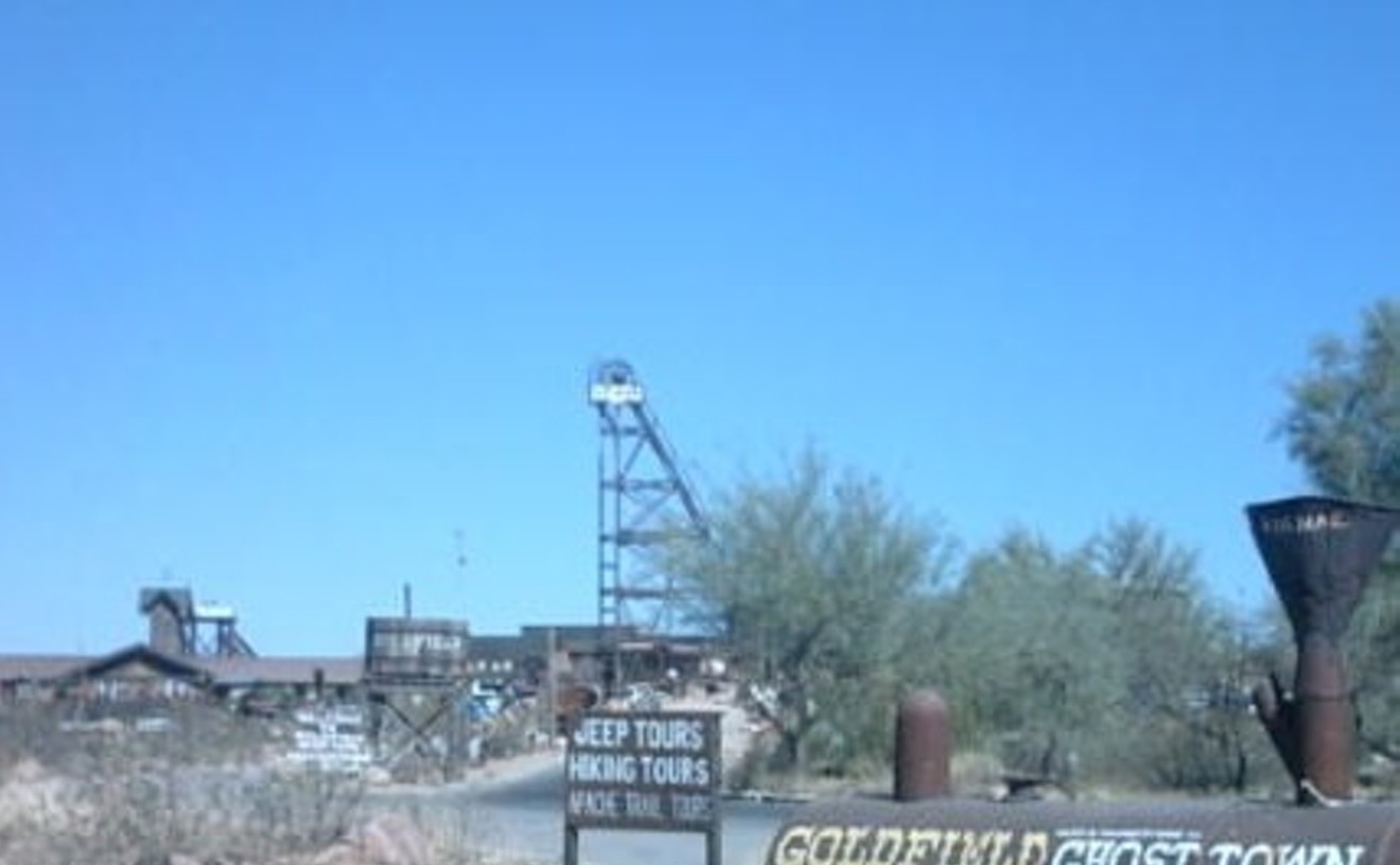
We'll admit — Goldfield isn't for everyone. But if you are the type of person who loves a little kitsch, then you might find a place in your heart for the campy town of Goldfield. According to our tour guide, the tourist trap was once a booming mining town — until one of the most productive mines in the West was flooded. (Unless you had some high-tech scuba equipment, there was no way you were pulling gold outta there.) Learn all about the workings of the mines and the demise of the town after you travel, via a bumpy elevator ride, into the cool mine shaft below. Once underground, your gritty prospector will take you on a journey through the cavernous tunnel, where you will learn all about life in a mine. Be sure to watch the little kids' faces as the "widowmaker" and the "honeybucket" are explained. Those priceless looks alone are worth every penny of the $5 tour. Don't forget to tip the prospector — without him you would just be wandering around a boring hole in ground.
- 4650 N. Mammoth Mine Rd., Apache Junction, 85219 Map
- 480-983-0333
- www.goldfieldghosttown.com
Best Ruins
Willow Spring Trail
There's something exciting about coming across the remnants of a human settlement while on a long hike through an otherwise barren landscape. Who lived here? Why this spot? Where'd they go? How the hell did they get up all that stuff up here? In the case of the abandoned ranch just off the Willow Springs Trail through the White Tank Mountains on the Valley's western edge, at least one of these questions is easy to answer. The men who settled here — from the looks of it, cattle ranchers — picked the shadiest spot around, near a deep spring. The White Tanks are named for the granite pools that collect water on their face, reserves that have drawn human inhabitants for thousands of years, as demonstrated by the petroglyphs that line these peaks like graffiti in a rail yard, left by the seven villages of Hohokam who once settled here. Yet this little riparian spot is still uniquely captivating. Barbed wire, several long rock fences, a rusty water tank, and the ruins of what looks like a house give a glimpse into the hardscrabble lives of the people who settled this town before the advent of air conditioning and 10-lane freeways. Explore for a bit before heading back down into society — or moving on to The Black Rock Trail, which takes you to less-preserved Indian ruins.
- 13025 N. White Tank Mountain Rd., Waddell, 85355 Map
- 623-935-2505
- www.maricopa.gov/parks/white%5Ftank/
Best Cave
Phoenix Bat Cave
Beginning each spring and continuing until the temperatures really start to climb in the summer, thousands of bats migrate to the so-called "Phoenix Bat Cave" near the Arizona Biltmore. The "cave" is actually a Maricopa County Flood Control ditch, but it has the proper temperatures and protection for these tiny flying creatures. During bat season, visitors to the cave (which is marked by a plaque from the Arizona Department of Game & Fish) can see dozens of bats flying out at dusk, hunting insects. There are two types of bats who make their home here: the western pipistrelle, which is the smaller of the two groups and the first to fly out of the cave in the evenings in fluttery flight patterns, and the Mexican free-tailed bat, which is a female colony that comes to the cave to birth and raise their young (the highest number are believed to be in the cave in July and August). Accessing the cave requires parking near 40th Street and Camelback, then walking along the north side of the Arizona Canal for about half a mile. The entrance to the cave is behind Phoenix Country Day School, north of the canal.
Best Hiking Trail
Camelback Mountain's Cholla Trail
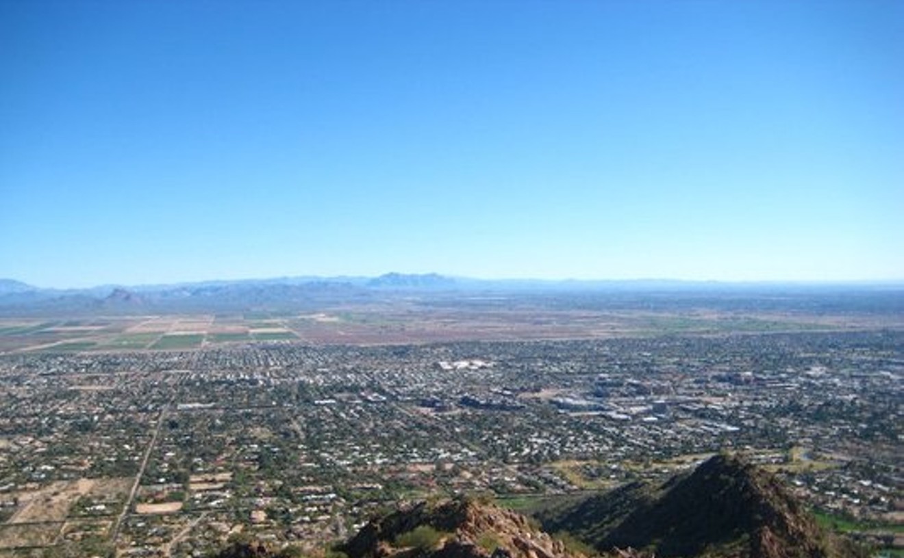
It's easy to see why Camelback Mountain has some of the most popular trails in the Valley, as the top of the red sandstone "hump" provides an unparalleled view of Phoenix. Most people are familiar with the Echo Canyon trail, but we like the slightly easier Cholla Trail. We say slightly easier because while you'll still end up sweating like a whore in church, it's a bit less steep. The last eighth of a mile before the summit does require a bit of rock scrambling — so leave Rover at home if you plan on reaching the top. And whatever you do, bring plenty of water and know your limits. Hiking should be fun, not harrowing. Nobody wants to be the dingbat who gets airlifted off Camelback.
- 6200 E. Cholla Way, Scottsdale, 85254 Map
- www.phoenix.gov/recreation/rec/parks/preserves/locations/camelback/cholla/index.html
Best Place to Find an Underground Bike Race
AZ Fixed
For most folks, an alley cat is that annoying feline that roots through your garbage and causes endless caterwauling at all hours of the night. For local cyclists or riders of fixed-gear two-wheelers, however, alley cats are under-the-radar urban bike races that are ultra-competitive and ultra-fun. Best described as a cycling scavenger hunt, alley cat races feature riders zipping around a certain area of the Valley as fast as their muscular legs can carry them in between various checkpoints. These events usually feature a theme, as well as pimp after-parties, where the winners are toasted and the losers get roasted. Due to their quasi-legal and DIY nature, alley cats are announced on the down-low. In fact, the only way you can find out about the next race is by checking out local cycling message board AZ Fixed. Populated by local cyclists and fixed-gear aficionados, the site is also a place to learn of more subdued jaunts like a weekly ride by the Tempe Bicycle Action Group or the Critical Mass excursion on the final Friday of every month. As one AZ Fixed user by the name of Zap states, the site's raison d'être is simple: "It's all about having a good ol' time on your bike."
Best Hike Through the Heart of the City
Christiansen Trail #100 to North Mountain Park

Phoenix's city park system is one of the largest and best in the world, and the Christiansen Trail gives a nice crash course on what it has to offer. This marathon 10.7-mile trail stretches the width of the Phoenix Mountains Preserve, from Tatum Boulevard on the east to Seventh Avenue on the west. You'll traverse much of the city on foot — mostly off the grid, with a few glimpses into posh neighborhoods. It's thrilling, and a little odd, to be in the middle of the sixth-largest city in the country yet totally immersed in the outdoors. Though the trail's long, there is only about 200 feet of elevation gain, so it's also pretty easy. Don't worry about playing Frogger on busy roads, either, as you'll take tunnels under State Route 51, Cave Creek Road, and Seventh Street. We recommend starting early at the tiny eastern trailhead at Tatum and Tomahawk so you begin the day looking up at Camelback before making your way west, slipping around Piestewa Peak and over toward North Mountain. The scenery gets less impressive as you head west. Arrange a ride from the other side after you've ended in a developed city park with restrooms and full cell coverage.
- 10600 N. Seventh St., Phoenix, 85020 Map
- 602-495-5540
- www.phoenix.gov/PARKS/northmnt.html
Best Thing to Do By the Light of the Silvery Moon
McDowell Mountain Ranch Longboard Rides
Imagine surfing, but picture doing it downhill on a hard, smooth surface at speeds up to 55 miles per hour. In the dark. With a bunch of other people flying down the hill around you. In a nutshell, that's downhill longboarding in the Valley, where rides and timed races take place every month during the full moon at McDowell Mountain Ranch.Longboarding was developed on the West Coast in the 1950s and requires the use of a wheeled board that is generally up to 59 inches long. The downhill aspect, in which riders fly downhill as fast as they can while trying to maintain control of the board, has a large following in Phoenix but has stayed pretty quiet while growing over the past two years. Anywhere from a dozen to 25 people participate in the full-moon rides, as well as at downhill longboarding events at South Mountain, but the events are so under wraps that they're almost impossible to catch. (In fact, they eluded the Best Of team all summer!) The full-moon rides at McDowell Mountain Ranch are organized by former NAU student Ryan Chopko, who announces monthly events only to members of a longboarding group on Facebook. He says the moonlit rides are "pretty intense.""It's dark. There's not much light, except the light from the full moon. And we move down the hill really, really fast," Chopko says. Generally, boarders meet at a location near McDowell Mountain Ranch around 9:30 p.m. Riders are shuttled to the top of a hill and dropped off. Speeds are clocked by timekeepers at the top and bottom of the hill, and if everybody's pitched in some money, winners can get prizes. (Chopko generally asks for a $5 buy-in per boarder.)You can only keep a good secret for so long. What started as an underground event is quickly moving into the mainstream. "Our full moon event is . . . becoming so well known it almost doesn't require advertisement," Chopko says. "Which is so crazy to me, because two years ago, it was something so small and private. No one knew what the heck it was."
Best Hike in Immigrant-Smuggling Territory
Table Top Mountain Wilderness
Until a couple of years ago, online trip reports about the two main trails cutting through the 34,400-acre Table Top Mountain Wilderness area detailed nothing but the pleasures of hiking in the rugged, cactus-filled terrain located 20 miles or so south of Maricopa. These days, it's more common to hear warnings about the federal preserve. "I'd be very careful," a ranger with the Bureau of Land Management's field office tells us (you can call them at the number listed above) when we inquire about a planned trip to wilderness within the now-infamous Vekol Valley, south of Interstate 8. Not only do signs warn outdoors enthusiasts that they're entering an area rife with human- and drug-smuggling activity, but earlier this year, the BLM completed work on a 1.3-mile "Normandy-style" vehicle barrier between the Table Top Wilderness and the northern edge of the Tohono O'odham reservation. Many illegal immigrants and their guides filter through the BLM land every year, often using the distinct Table Top Mountain as a navigational guide. Gun battles are not uncommon. No hikers have been messed with — yet. We're holding off on the summit trail hike until we find a small herd of fellow risk-takers willing to accompany us.
Best Place for Info on Arizona Caves and Caving
Arizona Cave Survey
There are more than 1,600 documented caves in Arizona, and much of that documentation has come from Arizona Cave Survey, a group of caving enthusiasts who've built up an impressive library and database on the subject. The library consists of books, maps, photos, and even a cave location GIS system, making it an incredible resource for cave researchers. From Lava River Cave in northern Arizona to Colossal Cave in Tucson, ACS has all the information a researcher needs. But novices beware: ACS is also concerned with the preservation of our state caves and will not give out cave locations to the general public, referring inexperienced cavers to local chapters of the National Speleological Caving Clubs for some background and education first. But seasoned cavers who contact them might get some assistance (after their references are checked), and provided they're not looking to explore a "sensitive" cave — i.e., a cave that may be hazardous or is easily damaged, for which ACS divulges no information.
Best Hike to See the Sonoran Desert
Spring Valley Trail, Hells Canyon Wilderness
Despite the hellacious name of this wilderness area just north of Lake Pleasant, the Spring Valley Trail is a kid-friendly hike, according to some Internet guides. We found it well defined and maintained, but it's not all that cushy, thanks to the climbs into and out of the many arroyos, or desert washes. From Lake Pleasant Drive or Highway 74, take Castle Hot Springs Road north a short way to the trailhead parking lot. Most people end their hike in one of the washes about 2.5 miles from the start, though would-be explorers can bushwhack down the wash or elsewhere. Even if you go in only a mile or so, you'll have a quintessential desert experience that pulls you into a pristine wonderland of healthy-looking saguaros, cholla, palo verdes, wildflowers (in February), and other desert flora. The place was a regular Serengeti on our outing: We encountered several wild burros, range cattle, and — best of all — a fully grown desert tortoise nestled in a shady cubbyhole of dried mud. We left him alone, as you should do if you find him or his siblings. No doubt, other Sonoran creatures — like rattlesnakes — can be found in this still-wild spot, so keep your finger on the shutter button. And get ready to run like hell.
Best Of Phoenix®
-
La Vida
-
Best Hidden Reminder That Borders Don't Last
Monument Hill
-
Best Cultural Event You Never Knew About
Deer Dance in Guadalupe
-
Best "Forbidden" Grain
Amaranth
-
Best Place to Hide an Undocumented Immigrant
Turf Paradise
-
Best Nativity in a Garage
Father Jorge Rodríguez Eagar, spiritual director
-
Best Place to Buy Edible Crickets
Oaxaca Restaurant
-
Best Sonora-Meets-Scottsdale Hot Dog
El Hefe
-
Best Sonoran Hot Dog
Nogales Hot Dogs
-
Best Quickie Mexican Breakfast
Guerrero's Mexican Food
-
Best Latin Brunch
Ticoz Resto-Bar
-
Best Mexican Lunch
Los Compadres
-
Best Upscale Mexican Restaurant
The Mission
-
Best Use of Indigenous Ingredients
Kai
-
Best Mexican Fusion
Chino Bandido
-
Best Neighborhood Mexican Restaurant, Central Phoenix
Tacos Atoyac
-
Best Neighborhood Mexican Restaurant, Downtown Phoenix
Tacos de Juarez
-
Best Neighborhood Mexican Restaurant, South Phoenix
Pitic
-
Best Neighborhood Mexican Restaurant, North Phoenix
Los Reyes de la Torta
-
Best Neighborhood Mexican Restaurant, West Valley
Pedro's
-
Best Neighborhood Mexican Restaurant, Southeast Valley
Maria's Mexican Food
-
Best Neighborhood Mexican Restaurant, Tempe
Casa Reynoso
-
Best Neighborhood Mexican Restaurant, Scottsdale
Huauchinango Mexican Grill
-
Best Salsa
La Condesa Gourmet Taco Shop
-
Best Tamales
Molly's Tamales
-
Best Tortillas
Carolina's
-
Best Chiles Rellenos
Dick's Hideaway
-
Best Pollo Asado
El Pollo Supremo
-
Best Tacos
La Salsita
-
Best Carne Asada
Sonora Mesquite Grill
-
Best Burritos
La Frontera
-
Best Carne Adovada
Los Dos Molinos
-
Best Cochinita Pibil
Barrio Café
-
Best Mariscos
Mariscos Playa Hermosa
-
Best Tortas
Tortas Paquime
-
Best Mexican Grilled Cheese
El Nopalito
-
Best Mexican Caldos
Comedor Guadalajara
-
Best Huitlacoche
Los Sombreros
-
Best Elote
Gallo Blanco
-
Best Pupusas
Salvadoreño Restaurant #3
-
Best Nopales
El Tlacoyo
-
Best Mole
Asi Es La Vida
-
Best Panadería
La Tolteca
-
Best Raspados
Oasis Raspados
-
Best Old-School Paletas
Realeza Michoacana
-
Best New-School Paletas
Paletas Betty
-
Best Aguas Frescas
Los Reyes de la Torta
-
Best Spiked Aguas Frescas
Gallo Blanco
-
Best Margarita
Los Dos Molinos
-
Best Specialty Margaritas
Cien Agaves
-
Best Margaritas by the Pitcher
Mi Patio
-
Best Illegal Double-Fisted Margarita
Z'Tejas
-
Best Tequila
Cruz Tequila
-
Best Tequila Selection
Canteen Modern Tequila Bar
-
Best Latin Club
Sky Lounge
-
Best Latin Night
Privileged Fridays at Club Silver
-
Best Latin DJ
DJ Enigma
-
Best Discoteca
El Capri
-
Best Mariachi
Orgullo de Mexico
-
Best Banda
La Llegadora Banda Sinaloense
-
Best Place to See Lucha Libre
Club Deportivo Coliseo
-
Best Place to Prepare for a Quinceañera
Azteca Wedding Plaza
-
Best Piñatas con Dulces
Dulcería Pico Rico
-
Best Place to Buy Mexican Imports
Mercado Mexico
-
Best Mexican Swap Meet
El Gran Mercado
-
Best Yerbería
Yerberia San Francisco
-
Best Mexican Market
Pro's Ranch Market
-
Best Day of the Dead Festival
Desert Botanical Garden
-
-
Food & Drink
-
Arts & Entertainment
-
Food & Drink
-
Arts & Entertainment
-
Food & Drink
-
Arts & Entertainment
-
Food & Drink
-
Arts & Entertainment
-
Food & Drink
-
Arts & Entertainment
-
Food & Drink
-
Arts & Entertainment
-
Food & Drink
-
Arts & Entertainment
-
Food & Drink
-
Arts & Entertainment
-
Food & Drink
-
Arts & Entertainment
-
Food & Drink
-
Arts & Entertainment
-
Food & Drink
-
Arts & Entertainment
-
Food & Drink
-
Arts & Entertainment
-
Food & Drink
-
Arts & Entertainment
-
Food & Drink
-
Arts & Entertainment
-
Food & Drink
-
Arts & Entertainment
-
Food & Drink
-
Arts & Entertainment
-
Food & Drink
-
Arts & Entertainment
-
Food & Drink
-
Arts & Entertainment
-
Food & Drink
-
Arts & Entertainment
-
Food & Drink
-
Arts & Entertainment
-
Food & Drink
-
Arts & Entertainment
-
Food & Drink
-
Arts & Entertainment
-
Food & Drink
-
Arts & Entertainment
-
Food & Drink
-
Arts & Entertainment
-
Food & Drink
-
Arts & Entertainment
-
Food & Drink
-
Arts & Entertainment
-
Food & Drink
-
Arts & Entertainment
-
Food & Drink
-
Arts & Entertainment
-
Food & Drink
-
Arts & Entertainment
-
Food & Drink
-
Arts & Entertainment
-
Food & Drink
-
Arts & Entertainment
-
Food & Drink
-
Arts & Entertainment
-
Food & Drink
-
Arts & Entertainment
-
Food & Drink
-
Arts & Entertainment
-
Food & Drink
-
Arts & Entertainment
-
Food & Drink
-
Arts & Entertainment
-
Food & Drink
-
Arts & Entertainment
-
Food & Drink
-
Arts & Entertainment
-
Food & Drink
-
Arts & Entertainment
-
Food & Drink
-
Arts & Entertainment
-
Food & Drink
-
Arts & Entertainment
-
Food & Drink
-
Arts & Entertainment
-
Food & Drink
-
Arts & Entertainment
-
Food & Drink
-
Arts & Entertainment
-
Food & Drink
-
Arts & Entertainment
-
Food & Drink
-
Arts & Entertainment
-
Food & Drink
-
Arts & Entertainment
-
Food & Drink
-
Arts & Entertainment
-
Food & Drink
-
Arts & Entertainment
-
Food & Drink
-
Arts & Entertainment
-
Food & Drink
-
Arts & Entertainment
-
Food & Drink
-
Arts & Entertainment
-
Food & Drink
-
Arts & Entertainment
-
Food & Drink
-
Arts & Entertainment
-
Food & Drink
-
Arts & Entertainment
-
Food & Drink
-
Arts & Entertainment
-
Food & Drink
-
Arts & Entertainment
-
Food & Drink
-
Arts & Entertainment
-
Food & Drink
-
Arts & Entertainment
-
Food & Drink
-
Arts & Entertainment
-
Food & Drink
-
Arts & Entertainment
-
Food & Drink
-
Arts & Entertainment
-
Food & Drink
-
Arts & Entertainment
-
Food & Drink
-
Arts & Entertainment
-
Food & Drink
-
Arts & Entertainment
-
Food & Drink
-
Arts & Entertainment
-
Food & Drink
-
Arts & Entertainment
-
Food & Drink
-
Arts & Entertainment
-
Food & Drink
-
Arts & Entertainment
-
Food & Drink
-
Arts & Entertainment
-
Food & Drink
-
Arts & Entertainment
-
Food & Drink
-
Arts & Entertainment
-
Food & Drink
-
Arts & Entertainment
-
Food & Drink
-
Arts & Entertainment
-
Food & Drink
-
Arts & Entertainment
-
Food & Drink
-
Arts & Entertainment
-
Food & Drink
-
Arts & Entertainment
-
Food & Drink
-
Arts & Entertainment
-
Food & Drink
-
Arts & Entertainment
-
Food & Drink
-
Arts & Entertainment
-
Food & Drink
-
Arts & Entertainment
-
Food & Drink
-
Arts & Entertainment
-
Food & Drink
-
Arts & Entertainment
-
Food & Drink
-
Best Ice Cream
Crave Artisan Ice Cream
-
Best Ice Cream Sandwich
Cookiez on Mill
-
Best Beer for an Ice Cream Float
Sonoran Brewing Company
-
Best Spiked Ice Cream
Lee's Cream Liqueur
-
Best Place to Eat at the Bar
Dick's Hideaway
-
Best Bar Food
JT's Bar & Grill
-
Best Gastropub
Windsor
-
Best English Pub
Rose and Crown
-
Best Irish Pub
Rosie McCaffrey's
-
Best BYOB
Atlas
-
Best Place to Hang with the (Food Network) Stars
"Lunch & Learn"
-
Best Place to Play with Your Food
Fondue from Le Chalet
-
Best Restaurant for Kids
Rita's Kitchen
-
Best Kids-Eat-Free Deal
St. Francis
-
Best Free Carbs
Vincent Market Bistro
-
Best Way to Be Gluten-Free
Rikki Cupcake
-
Best Airport Food
Hangar Cafe
-
Best Ballpark Food
ReyGloria's Tamales
-
Best Food Challenge
Maui Dog Big Kahuna Challenge
-
Best Food Challenge You'll Never Want to Do Again
Hot Chili Pepper Eating Contest, The Arizona Taco Festival (October 15)
-
Best Culinary Event Redux
Arizona Spring Restaurant Week
-
Best Late-Night Nosh
Taco Migo
-
-
People & Places
-
Best Dirt
Phoenix
-
Best Place to Dig Up the Past
Pueblo Grande Museum and Archaeological Park
-
Best Use of an Empty Dirt Lot
Valley of the Sunflowers
-
Best Digger
Donald Johanson
-
Best Buried Treasure Story
Buried gold at Sierra Estrella
-
Best Buried Indian Treasures Best Secret
Heard Museum
-
Best Mural
Blue Ooze by David Quan
-
Best Underground Artist
"Ike"
-
Best Graffiti Artist
KENO
-
Best Place to Spot a Stencil
Northeast corner of Fourth and Garfield streets
-
Best Bicycle in a Tree
10th Street and Farmer Avenue, Tempe
-
Best Rainbow
Tempe Light Rail Transit Bridge
-
Best Sign of Design
Phoenix Design Week
-
Best Letterpress
gallery HAZEL
-
Best Letterpress Series
Home Suite Home: PHX
-
Best Comic Book Artist
Shelby Robertson
-
Best Local Comic Book
John Layman's Chew Series
-
Best Web Comic
Epic Tales of the Mundane by Brad Dwyer
-
Best Club for Misfits
The Dark Ones
-
Best Place to Let Your Nerd Flag Fly
Nerd Nite, Carly's Bistro
-
Best Local Presentation Series
Ignite Phoenix
-
Best Unofficial Phoenix Historian
Marshall Shore
-
Best Beer and Wings
Birds n' Beer
-
Best Beer Museum
Scottsdale Beer Museum
-
Best Beer Festival
Strong Beer Festival
-
Best Culinary Festival
Devoured Culinary Festival, Phoenix Art Museum
-
Best Free Festival
Certified Local Fall Festival, Duck & Decanter
-
Best Cultural Festival
Arizona Aloha Festival, Tempe Beach Park
-
Best Arts Festival
Crafeteria, Medlock Plaza
-
Best Music Festival
McDowell Mountain Music Festival
-
Best Music Festival for Kids
Hoodstock, Hoodlums Music and Movies
-
Best Theater Festival
Phoenix Fringe Festival
-
Best Concert Series
Pinnacle Presbyterian Church
-
Best Gospel Treasure
Reverend Louis Overstreet
-
Best Obnoxious Display of Patriotism
KOOL 94.5 FM
-
Best Christmas Spirit
Sepanek Home
-
Best Glimpse of Wonderland
"Curiouser and Curiouser," Arizona Science Center
-
Best Urban Legend
UFO crash site, Dreamy Draw Recreation Area
-
Best Keeper of Secrets
Mountain Vault
-
Best Underground Haunting
Main Street Tunnels in Mesa
-
Best Place to Find Famous People
Underground
-
Best Place to Urinate in Public
The Blarney Stone, Casey Moore's Oyster House
-
Best Way to See the Art You Missed on First Friday
Third Friday
-
Best Stop on Art Detour
Modified Arts
-
Best New Gallery
Art Intersection
-
Best Pop-Up Gallery, Downtown Phoenix
Poolside Gallery, The Lexington Hotel
-
Best Pop-Up Gallery, Scottsdale
Scottsdale InFlux
-
Best Underground Museum
ASU Art Museum
-
Best Underground Wardrobe
Dennita Sewell and the Phoenix Art Museum
-
Best First Friday Hangout
Bragg's Pie Factory
-
Best Place to See Photography
Tilt Gallery
-
Best Art Gallery When You've Gotta Fly
Phoenix Airport Museum
-
Best Public Art as Tourist Attraction
Robert Indiana's Love sculpture, Scottsdale Civic Center Mall
-
Best Latte Art
Lola Coffee
-
Best Coffee Shop Gallery
Lux
-
Best Mall
Scottsdale Fashion Square
-
Best Green Building
DC Ranch
-
Best Oasis
Optima Camelview Village
-
Best Home Tour
Modern Phoenix Home Tour of Sunnyslope
-
Best Hunt for Evidence of an Underground Bowling Alley
The Gold Spot
-
Best People-Watching on a Home Tour
Willo Historic Home Tour
-
Best Downtown Building to Poke Your Head Into
Westward Ho
-
Best Warehouse Face Lift
Phoenix Seed & Feed Building
-
Best Swastikas Hidden in Plain Sight
Arizona Department of Agriculture
-
Best Haboob
July 5, 2011
-
Best Power Couple
Larry Black and Joel Fox
-
Best Right Hook
Aubry Ballard
-
Best Mugshot of the Day
Jeffery Hendershott
-
Best Jan Brewer Moment
Challenging the State Constitution
-
Best Sex Scandal
The Brock Family Circus
-
Best Death Row Pig-Out
Donald Beaty
-
Best Naked Meth-Head Story
Theodore "Come and Suck It" Ruiz
-
Best Way to Sneak Weed into Tent City
Over the fence
-
Best Medical Marijuana Signs
Man Cave Signs
-
Best Place to Find or Become a Medical Marijuana Caregiver
AzGrowPro
-
Best Way to Keep the Streets Safe
Driving MBA
-
Best Real-Life Crime Memoir
The Two-Edged Sword by Donald W. Tucker
-
Best Strip Mall
Southwest corner of University Drive and Ash Avenue, Tempe
-
Best Cop Shop
Phoenix Police Museum
-
Best Cop
Robert Taylor, Pinal County Sheriff's Deputy
-
Best Intern
Daniel Hernandez
-
Best Politician
U.S. Senator Jon Kyl
-
Best Public Information Officer
Cari Gerchick
-
Best TV Host
Ted Simons, Horizon
-
Best TV Newscaster
John Hook
-
Best TV Journalist
Mike Watkiss
-
Best Spanish-Language Journalist
Valeria Fernandez
-
Best Underground Radio Station
KCDX 103.1 FM
-
Best News Radio Station
KJZZ 91.5 FM
-
Best Hip-Hop Radio Station
The Beat 92.7/99.3/101.1 FM
-
Best Jazz and Blues Radio Station
KJZZ 91.5 FM
-
Best Alternative/Rock Radio Station
KWSS 106.7 FM
-
Best Country Radio Station
KMLE 108 FM
-
Best Old-School Radio Station
KAJM 104.3
-
Best Morning Radio Show
Holmberg's Morning Sickness
-
Best Indie Radio Personality
Beef Vegan, The Morning Fidelity
-
Best Ancient Chinese Secret
Opium dens in Downtown Phoenix
-
Best Rock Radio Personality
Westley Allen,
-
Best Country Radio Personality
Jacy Shepherd, KSWG 96.3 FM
-
Best Grassroots Political Movement
Marijuana Policy Project
-
Best (Worst) Lie by a Political Candidate
Gary "Gaby" Whalen
-
Best Corporate Cellar
Chase Tower's Underground Concourse
-
Best Activists
The Puente Movement
-
Best Anarchist
Drew Sullivan
-
Best Underground Missile Site
The Titan Missile Museum
-
Best Bigot
State Senator Lori Klein
-
Best Pain in the Ass to Local Politicians
Carlos Galindo
-
Best Attempt to Arrest a War Criminal
End the War Coalition's attempt to "arrest" Karl Rove
-
Best Sissy Preacher
"Pastor" Steven Anderson
-
Best Tribune of the People
Stephen Montoya
-
Best Local Lefty Icon
State Senator Kyrsten Sinema
-
Best Voice Against Racial, Ethnic, and Religious Hatred
Bill Straus
-
Best Pro-Civil Rights Pastor
Dr. Warren H. Stewart Sr.
-
Best Street Chalker with a Social Conscience
Peggy Plews
-
Best Eyes on the Street
Phoenix Copwatch
-
Best Keeper of the Peace
Sergeant Al Ramirez
-
Best Political Transition
Bill Montgomery
-
Best Example of a Last Laugh After a Public Humiliation
Jack Harris, Phoenix's ex-"public safety director"
-
Best Underground Escape Route for the Mayor of Phoenix
Tunnel under City Hall
-
Best Big-City Tunnel
Camelback Pedestrian Underpass
-
Best Way to Humiliate Arizona
Representative Carl Seele's "Birther Bill"
-
Best Place to Find a New Friend
Maricopa County Animal Care Control
-
Best Government Customer Service
Maricopa County Vital Records
-
Best Do-Gooders
Arizona Coalition for Military Families
-
Best Children's Theater
Childsplay
-
Best Theater for Adults with Disabilities
Detour Company Theatre
-
Best Community Theater
Stray Cat Theatre
-
Best Equity House
Actors Theatre
-
Best Tunnel Vision
The Chandler Aqueduct
-
Best Arts Center
Tempe Center for the Arts
-
Best Theater Venue
Kax Stage, Herberger Theater Center
-
Best (Dramatic) Ghost Story
The ghosts of Phoenix Theatre
-
Best Actress
Shari Watts in Grey Gardens: The Musical
-
Best Actor
D. Scott Withers in Hairspray: The Musical
-
Best Improv Collective
The Torch Theatre
-
Best Contemporary Dance Company
CONDER/Dance
-
Best Independent Film Theater
The FilmBar
-
Best Luxury Movie Theater
iPic Theatre
-
Best Salt Mine
Morton Salt's Glendale plant
-
Best Basement
Robrt L. Pela
-
Best Budget Movie Theater
Pollack Tempe Cinemas
-
Best Haunted Basement
Hotel San Carlos
-
Best Horror Movie Show
Dr. Zombie's Movie Lab of Terror
-
Best Place to Find New(ish) Homes with Basements
Mesa's Grove District
-
Best Nightlife Videos
Pheosia Films
-
Best Underground House
Earth House, Cosanti
-
Best 'Zine
Tempe Starving Artist
-
Best Dirty 'Zine
PoolBoy Magazine
-
Best Dance Music Blog
The Get Downnn
-
Best Indie Music Blog
Waved Rumor
-
Best Food Blog
Pen & Fork
-
Best Secret Treasures at the Library
Burton Barr Central Library
-
Best Secret Bathroom
Four Peaks Brewing Company
-
Best Style Blog
Kitten Paws Vintage
-
Best Underground Water Delivery System
Salt River Project's Canals
-
Best Place to be at Sunset
Knight Rise
-
Best Place to Chase Fireflies
You Who Are Getting Obliterated in the Dancing Swarm of Fireflies at Phoenix Art Museum
-
Best Place to Catch a Meteor Shower
ASU's Astronomy Open House
-
Best Time Capsule
The Golden Jubilee Capsule at Theodore Roosevelt Dam
-
Best Underground Parking
Scottsdale Fashion Square
-
Best Abandoned Transit Project
Papago Intermodal Transfer Station
-
Best Underground Cool
NRG Energy Phoenix
-
-
Shopping & Services
-
Best Hidden Gems
Four Peaks Amethyst Mine
-
Best Place to Buy a Chicken
The Western Ranchman
-
Best Wine Cellar
Sun Devil Liquors Cellar & Pub
-
Best Gold Mines in the Middle of Town
South Mountain Park and Preserve
-
Best Place to Rent a Jackhammer
A to Z Equipment Rental and Sales
-
Best Underground Shoppers
Garage sale pickers
-
Best Secret Word
Savant Day Spa
-
Best Secret Private Shopper
"The Book" at Zinnias at Melrose
-
Best Place to Stock Your Underground Bunker
Allied Surplus
-
Best Bargain Basement
Last Chance
-
Best Coffee House, Central Phoenix
Copper Star Coffee
-
Best Coffee House, Downtown Phoenix
Jobot Coffee
-
Best Coffee House, South Phoenix
Cupz N' Crepes
-
Best Coffee House, North Phoenix
Cave Creek Coffee Company
-
Best Coffee House, West Valley
Ground Control
-
Best Coffee House, Southeast Valley
Coffee Rush
-
Best Coffee House, Tempe
Cartel Coffee Lab
-
Best Coffee House, Scottsdale
Echo
-
Best Coffee House with a Heart
Cup O' Karma
-
Best Food Co-Op
Bountiful Baskets Food Co-Op
-
Best CSA
Desert Roots Farm
-
Best Family Farm
Schnepf Farms
-
Best Farmers Market
Vincent on Camelback
-
Best Indoor Farmers Market
SuperFarm Market
-
Best Farmers Market Samples
Great Harvest Bread Company
-
Best Health Food Store
Healthy Habit Health Foods
-
Best Little Asia
Mekong Plaza
-
Best Little Japan
Southeast corner of Priest and University drives, Tempe
-
Best Mediterranean Market
Haji Baba
-
Best Spice Shop
Penzeys Spices
-
Best Oil and Vinegar
Queen Creek Olive Mill
-
Best Candy Store
Rocket Fizz
-
Best Custom Candy Buffets
Couture Candy Co.
-
Best Cupcake Accessories
Cake Hole Project
-
Best Baking Supplies
ABC Cake Decorating
-
Best Place to Sell Your Cake (Plate) and Buy One, Too
Kitchen Switchin'
-
Best Housewares on a Budget
Tuesday Morning's monthly sales
-
Best Knife Shop
Phoenix Knife House
-
Best Home Brewing Supplies
Brewers Connection
-
Best Beer for Liquor Lovers
Sonoran 200
-
Best Bottled Beer Selection
Whole Foods
-
Best Drive-Thru Liquor Store, East Valley
Jerry's Liquor
-
Best Drive-Thru Liquor Store, West Valley
Mike's Market
-
Best Drive-Thru Cigarette Store
On-Auk-Mor Indian Smoke Shop
-
Best Cigar Shop
Tinder Box
-
Best Head Shop, East Valley
The Headquarters
-
Best Head Shop, West Valley
Herb N' Legend 2
-
Best Place to Find Desert Plants
Succulentia
-
Best Nursery
Baker Nursery
-
Best Garden Shop
Relics Architectural Home and Garden
-
Best Plantscapers
Pearson & Company
-
Best Movers and Packers
Creative Moving and Packing
-
Best Car Wash
Clean Freak Carwash
-
Best Spa
Jurlique Spa
-
Best Pet Boutique
Mackie's Parlour
-
Best Pet Groomer
Wag 'n' Wash Healthy Pet Center
-
Best Boutique
Frances Vintage
-
Best New Boutique
Saint 22
-
Best Boutique Service
Muse Apparel
-
Best Shopping on Roosevelt Row
MADE
-
Best Shopping on Grand Avenue
Devious Wigs & Things
-
Best Novelty Shop
Smeeks
-
Best Vintage Couture
Fashion by Robert Black
-
Best New Vintage Boutique
Vintage by Misty
-
Best Vintage Clothing
Antique Sugar at Zinnias
-
Best Bargain Vintage Clothing
Butter Toast Boutique
-
Best Antique Mall
Zinnias on Melrose
-
Best Antiques on a Budget
Cherry Street Antiques
-
Best High-End Antiques
Willo Historic District Antiques
-
Best Antique Rugs
QCumberz
-
Best Antique Store to Buy Jewelry for Your Girlfriend
Rare Lion Antiques & Jewelry
-
Best Place to Find Jadite
Antique Marketplace
-
Best Boutique Thrift Store
Flo's on Seventh
-
Best Non-Boutique Thrift Store
Goodwill
-
Best Thrift Store for Vintage Glassware
Sun Health Resale Shop
-
Best Thrift Store That Was Never Meant to Be a Thrift Store
Eclectic Monkey Emporium (formally Good Thrift)
-
Best Places to Find Yard Sales
Sun City and Sun City West
-
Best Used Clothing for Kids
Hissyfits
-
Best Alternative to Last Chance
Dillard's Clearance Center
-
Best Teen Girls Clothing Store Where Grown-Up Gals Can Shop
Urban Angels
-
Best Costume Jewelry
The M. Jeweler
-
Best Eyeglasses on a Budget
Lesco
-
Best High-End Jewelry at Low-End Prices
C & G Jewelers
-
Best Design-It- Yourself T-Shirts
Brand X
-
Best Place to Blow a Paycheck on Toys
Red Hot Robot
-
Best Bookstore
Changing Hands
-
Best Specialty Bookstore
The Poisoned Pen
-
Best Used Bookstore
Half Price Books and Records
-
Best Collectible Bookstore
Book Gallery
-
Best Magazine Rack
Bookmans Entertainment Exchange
-
Best Comic Book Shop
Ash Avenue Comics
-
Best Porn Rentals for Regular Folks
Fascinations
-
Best Vinyl
Revolver Records
-
Best CD Store
Bookmans Entertainment Exchange
-
Best Skateboard Shop
Cowtown
-
Best Bike Shop
Bike Barn
-
Best Place to Get Your Bike Fixed
The Garage Bike Shop
-
Best Bike Shop for Hard-to-Find Parts
Try Me Bicycle Shop
-
Best Place to Buy Vintage Craft Supplies
Kooky Krafts
-
Best Place to Buy Teaching Supplies
Treasures4Teachers
-
Best Art Supply Store
Wet Paint
-
Best Art Supplies on a Budget
Aaron Bros. Clearance Aisle
-
Best Bead Store
D&I Beads
-
Best Scrapbook Supplies
Scrapbooks Etc.
-
Best Stamp Supplies
The Creative Quest
-
Best Fabric Store
Quiltz
-
Best Fabric Store on a Budget
SAS Fabrics by the Pound
-
Best Knitting Supplies
Family Arts Needlework Shop
-
-
Sports & Recreation
-
Best Secret Garden
Idylwilde Park
-
Best Hidden Spot to Touch History
South Mountain Park
-
Best Not-So-Secret Garden
Secret Garden at Arizona State University
-
Best Little Mountain
"A" Mountain, Tempe
-
Best Place to Dig Dinosaurs
Arizona Museum of Natural History
-
Best Summer Jog
Parking garage southwest of Sun Angel Stadium
-
Best Easy Trail Running
Pima Canyon, South Mountain
-
Best Mine Tour
Goldfield
-
Best Ruins
Willow Spring Trail
-
Best Cave
Phoenix Bat Cave
-
Best Hiking Trail
Camelback Mountain's Cholla Trail
-
Best Place to Find an Underground Bike Race
AZ Fixed
-
Best Hike Through the Heart of the City
Christiansen Trail #100 to North Mountain Park
-
Best Thing to Do By the Light of the Silvery Moon
McDowell Mountain Ranch Longboard Rides
-
Best Hike in Immigrant-Smuggling Territory
Table Top Mountain Wilderness
-
Best Place for Info on Arizona Caves and Caving
Arizona Cave Survey
-
Best Hike to See the Sonoran Desert
Spring Valley Trail, Hells Canyon Wilderness
-
Best Bike Parts
Unnamed Super-Secret Bike Gang
-
Best Hike to Petroglyphs
Hieroglyphic Trail
-
Best Place to Get in Deep Waters
Phoenix Scuba
-
Best Hike in the Heat
Brown's Cave at Apache Lake
-
Best View from the Trail
Top of the Flatiron on Superstition Mountain
-
Best Trail That Isn't a Hike
Wildflower Trail
-
Best Underground Arcade
Castles-N-Coasters
-
Best Scramble
The real summit of Piestewa Peak
-
Best Bouldering
Oak Flat
-
Best Rock Climbing
Camelback Mountain
-
Best Rock Climbing Gym
Phoenix Rock Gym
-
Best Place to Learn About Backyard Pump Tracks
Rage Cycles
-
Best Road Bike Ride
Bartlett Dam Road to Bartlett Lake
-
Best Urban(ish) Bike Ride
Arizona Canal Path
-
Best Mountain Bike Ride
Fantasy Island North Singletrack
-
Best Nighttime Mountain Bike Ride
Papago Park
-
Best Place to Ride Your Bike Among Lions, Tigers, and Bears
Phoenix Zoo
-
Best Haunted House
13th Floor Haunted House
-
Best Carousel
Superstition Springs Center
-
Best Free Place for a Kids' Outdoor Birthday Party
Scottsdale Civic Center Mall
-
Best (Almost) Free Place for a Kids' Indoor Birthday Party
Michaels Arts and Crafts
-
Best Place to Rent a Hula Dancer for Your Kid's Birthday Party
La Fiamma Entertainment
-
Best Place to Hold a Wedding in July
Inspirador
-
Best Boutique Hotel
Hotel Valley Ho
-
Best Luxury Hotel
The Royal Palms
-
Best Hotel Pool
The Clarendon Hotel
-
Best Family Staycation
Arizona Biltmore Resort & Spa
-
Best Casino
Wild Horse Pass Hotel & Casino
-
Best Day Trip
Jerome, Arizona
-
Best Activity for Out-of-Town Guests
Drive the Apache Trail
-
Best Lake Camping
Rim Lakes, Woods Canyon Group Campground
-
Best Swimming Hole
Fossil Springs
-
Best Urban Kayaking
Dobson Ranch
-
Best Place to Swim If You're Training for a Triathlon
McDowell Mountain Ranch Park and Aquatic Center
-
Best Splash Pad
South bank of Tempe Town Lake
-
Best Water Park
Golfland Sunsplash
-
Best Skateboard Park
Desert West Skatepark
-
Best Indoor Skate Park
Xtreme Air Jump 'N Skate
-
Best Dog Park, East Valley
P. Ben Arredondo Sports Complex
-
Best Dog Park, West Valley
Foothills Park
-
Best Playground
Playtopia at Tumbleweed Park
-
Best Place to Jump Up and Down
Jumpstreet Indoor Trampoline Park
-
Best Place to Tag Someone with a Rubber Ball
AZ Dodgeball League
-
Best Public Lifelong Game You've Never Heard Of
Birdman
-
Best Way to Compete While in Costume
Urban Dare
-
Best Bowling
Let It Roll Bowl
-
Best Go-Kart Racing
K1 Speed
-
Best Place to Go Quadding
Harquahala Mountain Summit Road
-
Best Off-Road Drive
Table Mesa Road, from Interstate 17 to Seven Springs Road
-
Best Sunset Drive
South Mountain
-
Best Golf Course
We-Ko-Pa's Cholla Course
-
Best Summer Golf Course
The Phoenician
-
Best Winter Golf Course
Ken McDonald Golf Course
-
Best Golf Course Face Lift
Vistal Golf Club
-
Best Golf Course at Which to Get Mauled by a Mountain Lion
Desert Mountain Golf Club's Cochise Course
-
Best Batting Cages
Kiwanis Park Batting Range
-
Best Place to See a Spring Training Game
Salt River Fields
-
Best Way to See Women Play Football
Arizona Assassins
-
Best College Athlete
Dallas Escobedo
-
Best Male Pro Athlete
Larry Fitzgerald, Arizona Cardinals
-
Best Female Pro Athlete
Diana Taurasi, Phoenix Mercury
-
Best Way to Ruin a Perfectly Decent Team
Robert Sarver, Phoenix Suns owner
-
Best-Hitting Pitcher in the Bigs
Daniel Hudson, Arizona Diamondbacks
-
Best Comeback Kid in Baseball
Chris Young, Arizona Diamondbacks outfielder
-
Best Reason to Believe the Diamondbacks Can Contend
Ian Kennedy, Arizona Diamondbacks pitcher
-
Best Field Boss of a Local Sports Franchise
Kirk Gibson, Arizona Diamondbacks manager
-
Best Baseball Star
Justin Upton, Arizona Diamondbacks outfielder
-
Best-Hitting Second Baseman in Baseball
Dustin Pedroia, ASU alumnus and current Red Sox
-
Best All-Around Baseball Player
Miguel Montero, Arizona Diamondbacks catcher
-
Best Glove Man in Valley Baseball
Stephen Drew, Arizona Diamondbacks shortstop
-
Best Tattoos in Local Sports
Ryan Roberts, Arizona Diamondbacks infielder
-
Best General in Local Sports
Kevin Towers, Arizona Diamondbacks
-
Best Hope for the Arizona Cardinals
Kevin Kolb, quarterback
-
Best Monsters in Local Sports
Calais Campbell and Darnell Dockett, Arizona Cardinals defensive linemen
-
Best Stoic in Local Sports
Ken Whisenhunt, Arizona Cardinals head coach
-
Best Sports Clown
Deuce Lutui
-
Best DUI in Local Sports
Mark Grace
-
Best Giant in Valley Basketball
Marcin Gortat, Phoenix Suns
-
Best Local Boy Does Good in Pro Sports
Andre Ethier, Los Angeles Dodgers
-
Best Local Guy Does Bad in Pro Sports
Channing Frye, Phoenix Suns
-
Best Cheerleader in Local Sports
Alvin Gentry, Phoenix Suns
-
Best Elder Statesmen in the NBA
Steve Nash and Grant Hill, Phoenix Suns
-
-
Readers' Choice
Best Of
-
La Vida
-
Best Hidden Reminder That Borders Don't Last
Monument Hill
-
Best Cultural Event You Never Knew About
Deer Dance in Guadalupe
-
Best "Forbidden" Grain
Amaranth
-
Best Place to Hide an Undocumented Immigrant
Turf Paradise
-
Best Nativity in a Garage
Father Jorge Rodríguez Eagar, spiritual director
-
Best Place to Buy Edible Crickets
Oaxaca Restaurant
-
Best Sonora-Meets-Scottsdale Hot Dog
El Hefe
-
Best Sonoran Hot Dog
Nogales Hot Dogs
-
Best Quickie Mexican Breakfast
Guerrero's Mexican Food
-
Best Latin Brunch
Ticoz Resto-Bar
-
Best Mexican Lunch
Los Compadres
-
Best Upscale Mexican Restaurant
The Mission
-
Best Use of Indigenous Ingredients
Kai
-
Best Mexican Fusion
Chino Bandido
-
Best Neighborhood Mexican Restaurant, Central Phoenix
Tacos Atoyac
-
Best Neighborhood Mexican Restaurant, Downtown Phoenix
Tacos de Juarez
-
Best Neighborhood Mexican Restaurant, South Phoenix
Pitic
-
Best Neighborhood Mexican Restaurant, North Phoenix
Los Reyes de la Torta
-
Best Neighborhood Mexican Restaurant, West Valley
Pedro's
-
Best Neighborhood Mexican Restaurant, Southeast Valley
Maria's Mexican Food
-
Best Neighborhood Mexican Restaurant, Tempe
Casa Reynoso
-
Best Neighborhood Mexican Restaurant, Scottsdale
Huauchinango Mexican Grill
-
Best Salsa
La Condesa Gourmet Taco Shop
-
Best Tamales
Molly's Tamales
-
Best Tortillas
Carolina's
-
Best Chiles Rellenos
Dick's Hideaway
-
Best Pollo Asado
El Pollo Supremo
-
Best Tacos
La Salsita
-
Best Carne Asada
Sonora Mesquite Grill
-
Best Burritos
La Frontera
-
Best Carne Adovada
Los Dos Molinos
-
Best Cochinita Pibil
Barrio Café
-
Best Mariscos
Mariscos Playa Hermosa
-
Best Tortas
Tortas Paquime
-
Best Mexican Grilled Cheese
El Nopalito
-
Best Mexican Caldos
Comedor Guadalajara
-
Best Huitlacoche
Los Sombreros
-
Best Elote
Gallo Blanco
-
Best Pupusas
Salvadoreño Restaurant #3
-
Best Nopales
El Tlacoyo
-
Best Mole
Asi Es La Vida
-
Best Panadería
La Tolteca
-
Best Raspados
Oasis Raspados
-
Best Old-School Paletas
Realeza Michoacana
-
Best New-School Paletas
Paletas Betty
-
Best Aguas Frescas
Los Reyes de la Torta
-
Best Spiked Aguas Frescas
Gallo Blanco
-
Best Margarita
Los Dos Molinos
-
Best Specialty Margaritas
Cien Agaves
-
Best Margaritas by the Pitcher
Mi Patio
-
Best Illegal Double-Fisted Margarita
Z'Tejas
-
Best Tequila
Cruz Tequila
-
Best Tequila Selection
Canteen Modern Tequila Bar
-
Best Latin Club
Sky Lounge
-
Best Latin Night
Privileged Fridays at Club Silver
-
Best Latin DJ
DJ Enigma
-
Best Discoteca
El Capri
-
Best Mariachi
Orgullo de Mexico
-
Best Banda
La Llegadora Banda Sinaloense
-
Best Place to See Lucha Libre
Club Deportivo Coliseo
-
Best Place to Prepare for a Quinceañera
Azteca Wedding Plaza
-
Best Piñatas con Dulces
Dulcería Pico Rico
-
Best Place to Buy Mexican Imports
Mercado Mexico
-
Best Mexican Swap Meet
El Gran Mercado
-
Best Yerbería
Yerberia San Francisco
-
Best Mexican Market
Pro's Ranch Market
-
Best Day of the Dead Festival
Desert Botanical Garden
-
-
Food & Drink
-
Arts & Entertainment
-
Food & Drink
-
Arts & Entertainment
-
Food & Drink
-
Arts & Entertainment
-
Food & Drink
-
Arts & Entertainment
-
Food & Drink
-
Arts & Entertainment
-
Food & Drink
-
Arts & Entertainment
-
Food & Drink
-
Arts & Entertainment
-
Food & Drink
-
Arts & Entertainment
-
Food & Drink
-
Arts & Entertainment
-
Food & Drink
-
Arts & Entertainment
-
Food & Drink
-
Arts & Entertainment
-
Food & Drink
-
Arts & Entertainment
-
Food & Drink
-
Arts & Entertainment
-
Food & Drink
-
Arts & Entertainment
-
Food & Drink
-
Arts & Entertainment
-
Food & Drink
-
Arts & Entertainment
-
Food & Drink
-
Arts & Entertainment
-
Food & Drink
-
Arts & Entertainment
-
Food & Drink
-
Arts & Entertainment
-
Food & Drink
-
Arts & Entertainment
-
Food & Drink
-
Arts & Entertainment
-
Food & Drink
-
Arts & Entertainment
-
Food & Drink
-
Arts & Entertainment
-
Food & Drink
-
Arts & Entertainment
-
Food & Drink
-
Arts & Entertainment
-
Food & Drink
-
Arts & Entertainment
-
Food & Drink
-
Arts & Entertainment
-
Food & Drink
-
Arts & Entertainment
-
Food & Drink
-
Arts & Entertainment
-
Food & Drink
-
Arts & Entertainment
-
Food & Drink
-
Arts & Entertainment
-
Food & Drink
-
Arts & Entertainment
-
Food & Drink
-
Arts & Entertainment
-
Food & Drink
-
Arts & Entertainment
-
Food & Drink
-
Arts & Entertainment
-
Food & Drink
-
Arts & Entertainment
-
Food & Drink
-
Arts & Entertainment
-
Food & Drink
-
Arts & Entertainment
-
Food & Drink
-
Arts & Entertainment
-
Food & Drink
-
Arts & Entertainment
-
Food & Drink
-
Arts & Entertainment
-
Food & Drink
-
Arts & Entertainment
-
Food & Drink
-
Arts & Entertainment
-
Food & Drink
-
Arts & Entertainment
-
Food & Drink
-
Arts & Entertainment
-
Food & Drink
-
Arts & Entertainment
-
Food & Drink
-
Arts & Entertainment
-
Food & Drink
-
Arts & Entertainment
-
Food & Drink
-
Arts & Entertainment
-
Food & Drink
-
Arts & Entertainment
-
Food & Drink
-
Arts & Entertainment
-
Food & Drink
-
Arts & Entertainment
-
Food & Drink
-
Arts & Entertainment
-
Food & Drink
-
Arts & Entertainment
-
Food & Drink
-
Arts & Entertainment
-
Food & Drink
-
Arts & Entertainment
-
Food & Drink
-
Arts & Entertainment
-
Food & Drink
-
Arts & Entertainment
-
Food & Drink
-
Arts & Entertainment
-
Food & Drink
-
Arts & Entertainment
-
Food & Drink
-
Arts & Entertainment
-
Food & Drink
-
Arts & Entertainment
-
Food & Drink
-
Arts & Entertainment
-
Food & Drink
-
Arts & Entertainment
-
Food & Drink
-
Arts & Entertainment
-
Food & Drink
-
Arts & Entertainment
-
Food & Drink
-
Arts & Entertainment
-
Food & Drink
-
Arts & Entertainment
-
Food & Drink
-
Arts & Entertainment
-
Food & Drink
-
Arts & Entertainment
-
Food & Drink
-
Arts & Entertainment
-
Food & Drink
-
Arts & Entertainment
-
Food & Drink
-
Arts & Entertainment
-
Food & Drink
-
Arts & Entertainment
-
Food & Drink
-
Arts & Entertainment
-
Food & Drink
-
Arts & Entertainment
-
Food & Drink
-
Arts & Entertainment
-
Food & Drink
-
Arts & Entertainment
-
Food & Drink
-
Arts & Entertainment
-
Food & Drink
-
Arts & Entertainment
-
Food & Drink
-
Arts & Entertainment
-
Food & Drink
-
Arts & Entertainment
-
Food & Drink
-
Arts & Entertainment
-
Food & Drink
-
Best Ice Cream
Crave Artisan Ice Cream
-
Best Ice Cream Sandwich
Cookiez on Mill
-
Best Beer for an Ice Cream Float
Sonoran Brewing Company
-
Best Spiked Ice Cream
Lee's Cream Liqueur
-
Best Place to Eat at the Bar
Dick's Hideaway
-
Best Bar Food
JT's Bar & Grill
-
Best Gastropub
Windsor
-
Best English Pub
Rose and Crown
-
Best Irish Pub
Rosie McCaffrey's
-
Best BYOB
Atlas
-
Best Place to Hang with the (Food Network) Stars
"Lunch & Learn"
-
Best Place to Play with Your Food
Fondue from Le Chalet
-
Best Restaurant for Kids
Rita's Kitchen
-
Best Kids-Eat-Free Deal
St. Francis
-
Best Free Carbs
Vincent Market Bistro
-
Best Way to Be Gluten-Free
Rikki Cupcake
-
Best Airport Food
Hangar Cafe
-
Best Ballpark Food
ReyGloria's Tamales
-
Best Food Challenge
Maui Dog Big Kahuna Challenge
-
Best Food Challenge You'll Never Want to Do Again
Hot Chili Pepper Eating Contest, The Arizona Taco Festival (October 15)
-
Best Culinary Event Redux
Arizona Spring Restaurant Week
-
Best Late-Night Nosh
Taco Migo
-
-
People & Places
-
Best Dirt
Phoenix
-
Best Place to Dig Up the Past
Pueblo Grande Museum and Archaeological Park
-
Best Use of an Empty Dirt Lot
Valley of the Sunflowers
-
Best Digger
Donald Johanson
-
Best Buried Treasure Story
Buried gold at Sierra Estrella
-
Best Buried Indian Treasures Best Secret
Heard Museum
-
Best Mural
Blue Ooze by David Quan
-
Best Underground Artist
"Ike"
-
Best Graffiti Artist
KENO
-
Best Place to Spot a Stencil
Northeast corner of Fourth and Garfield streets
-
Best Bicycle in a Tree
10th Street and Farmer Avenue, Tempe
-
Best Rainbow
Tempe Light Rail Transit Bridge
-
Best Sign of Design
Phoenix Design Week
-
Best Letterpress
gallery HAZEL
-
Best Letterpress Series
Home Suite Home: PHX
-
Best Comic Book Artist
Shelby Robertson
-
Best Local Comic Book
John Layman's Chew Series
-
Best Web Comic
Epic Tales of the Mundane by Brad Dwyer
-
Best Club for Misfits
The Dark Ones
-
Best Place to Let Your Nerd Flag Fly
Nerd Nite, Carly's Bistro
-
Best Local Presentation Series
Ignite Phoenix
-
Best Unofficial Phoenix Historian
Marshall Shore
-
Best Beer and Wings
Birds n' Beer
-
Best Beer Museum
Scottsdale Beer Museum
-
Best Beer Festival
Strong Beer Festival
-
Best Culinary Festival
Devoured Culinary Festival, Phoenix Art Museum
-
Best Free Festival
Certified Local Fall Festival, Duck & Decanter
-
Best Cultural Festival
Arizona Aloha Festival, Tempe Beach Park
-
Best Arts Festival
Crafeteria, Medlock Plaza
-
Best Music Festival
McDowell Mountain Music Festival
-
Best Music Festival for Kids
Hoodstock, Hoodlums Music and Movies
-
Best Theater Festival
Phoenix Fringe Festival
-
Best Concert Series
Pinnacle Presbyterian Church
-
Best Gospel Treasure
Reverend Louis Overstreet
-
Best Obnoxious Display of Patriotism
KOOL 94.5 FM
-
Best Christmas Spirit
Sepanek Home
-
Best Glimpse of Wonderland
"Curiouser and Curiouser," Arizona Science Center
-
Best Urban Legend
UFO crash site, Dreamy Draw Recreation Area
-
Best Keeper of Secrets
Mountain Vault
-
Best Underground Haunting
Main Street Tunnels in Mesa
-
Best Place to Find Famous People
Underground
-
Best Place to Urinate in Public
The Blarney Stone, Casey Moore's Oyster House
-
Best Way to See the Art You Missed on First Friday
Third Friday
-
Best Stop on Art Detour
Modified Arts
-
Best New Gallery
Art Intersection
-
Best Pop-Up Gallery, Downtown Phoenix
Poolside Gallery, The Lexington Hotel
-
Best Pop-Up Gallery, Scottsdale
Scottsdale InFlux
-
Best Underground Museum
ASU Art Museum
-
Best Underground Wardrobe
Dennita Sewell and the Phoenix Art Museum
-
Best First Friday Hangout
Bragg's Pie Factory
-
Best Place to See Photography
Tilt Gallery
-
Best Art Gallery When You've Gotta Fly
Phoenix Airport Museum
-
Best Public Art as Tourist Attraction
Robert Indiana's Love sculpture, Scottsdale Civic Center Mall
-
Best Latte Art
Lola Coffee
-
Best Coffee Shop Gallery
Lux
-
Best Mall
Scottsdale Fashion Square
-
Best Green Building
DC Ranch
-
Best Oasis
Optima Camelview Village
-
Best Home Tour
Modern Phoenix Home Tour of Sunnyslope
-
Best Hunt for Evidence of an Underground Bowling Alley
The Gold Spot
-
Best People-Watching on a Home Tour
Willo Historic Home Tour
-
Best Downtown Building to Poke Your Head Into
Westward Ho
-
Best Warehouse Face Lift
Phoenix Seed & Feed Building
-
Best Swastikas Hidden in Plain Sight
Arizona Department of Agriculture
-
Best Haboob
July 5, 2011
-
Best Power Couple
Larry Black and Joel Fox
-
Best Right Hook
Aubry Ballard
-
Best Mugshot of the Day
Jeffery Hendershott
-
Best Jan Brewer Moment
Challenging the State Constitution
-
Best Sex Scandal
The Brock Family Circus
-
Best Death Row Pig-Out
Donald Beaty
-
Best Naked Meth-Head Story
Theodore "Come and Suck It" Ruiz
-
Best Way to Sneak Weed into Tent City
Over the fence
-
Best Medical Marijuana Signs
Man Cave Signs
-
Best Place to Find or Become a Medical Marijuana Caregiver
AzGrowPro
-
Best Way to Keep the Streets Safe
Driving MBA
-
Best Real-Life Crime Memoir
The Two-Edged Sword by Donald W. Tucker
-
Best Strip Mall
Southwest corner of University Drive and Ash Avenue, Tempe
-
Best Cop Shop
Phoenix Police Museum
-
Best Cop
Robert Taylor, Pinal County Sheriff's Deputy
-
Best Intern
Daniel Hernandez
-
Best Politician
U.S. Senator Jon Kyl
-
Best Public Information Officer
Cari Gerchick
-
Best TV Host
Ted Simons, Horizon
-
Best TV Newscaster
John Hook
-
Best TV Journalist
Mike Watkiss
-
Best Spanish-Language Journalist
Valeria Fernandez
-
Best Underground Radio Station
KCDX 103.1 FM
-
Best News Radio Station
KJZZ 91.5 FM
-
Best Hip-Hop Radio Station
The Beat 92.7/99.3/101.1 FM
-
Best Jazz and Blues Radio Station
KJZZ 91.5 FM
-
Best Alternative/Rock Radio Station
KWSS 106.7 FM
-
Best Country Radio Station
KMLE 108 FM
-
Best Old-School Radio Station
KAJM 104.3
-
Best Morning Radio Show
Holmberg's Morning Sickness
-
Best Indie Radio Personality
Beef Vegan, The Morning Fidelity
-
Best Ancient Chinese Secret
Opium dens in Downtown Phoenix
-
Best Rock Radio Personality
Westley Allen,
-
Best Country Radio Personality
Jacy Shepherd, KSWG 96.3 FM
-
Best Grassroots Political Movement
Marijuana Policy Project
-
Best (Worst) Lie by a Political Candidate
Gary "Gaby" Whalen
-
Best Corporate Cellar
Chase Tower's Underground Concourse
-
Best Activists
The Puente Movement
-
Best Anarchist
Drew Sullivan
-
Best Underground Missile Site
The Titan Missile Museum
-
Best Bigot
State Senator Lori Klein
-
Best Pain in the Ass to Local Politicians
Carlos Galindo
-
Best Attempt to Arrest a War Criminal
End the War Coalition's attempt to "arrest" Karl Rove
-
Best Sissy Preacher
"Pastor" Steven Anderson
-
Best Tribune of the People
Stephen Montoya
-
Best Local Lefty Icon
State Senator Kyrsten Sinema
-
Best Voice Against Racial, Ethnic, and Religious Hatred
Bill Straus
-
Best Pro-Civil Rights Pastor
Dr. Warren H. Stewart Sr.
-
Best Street Chalker with a Social Conscience
Peggy Plews
-
Best Eyes on the Street
Phoenix Copwatch
-
Best Keeper of the Peace
Sergeant Al Ramirez
-
Best Political Transition
Bill Montgomery
-
Best Example of a Last Laugh After a Public Humiliation
Jack Harris, Phoenix's ex-"public safety director"
-
Best Underground Escape Route for the Mayor of Phoenix
Tunnel under City Hall
-
Best Big-City Tunnel
Camelback Pedestrian Underpass
-
Best Way to Humiliate Arizona
Representative Carl Seele's "Birther Bill"
-
Best Place to Find a New Friend
Maricopa County Animal Care Control
-
Best Government Customer Service
Maricopa County Vital Records
-
Best Do-Gooders
Arizona Coalition for Military Families
-
Best Children's Theater
Childsplay
-
Best Theater for Adults with Disabilities
Detour Company Theatre
-
Best Community Theater
Stray Cat Theatre
-
Best Equity House
Actors Theatre
-
Best Tunnel Vision
The Chandler Aqueduct
-
Best Arts Center
Tempe Center for the Arts
-
Best Theater Venue
Kax Stage, Herberger Theater Center
-
Best (Dramatic) Ghost Story
The ghosts of Phoenix Theatre
-
Best Actress
Shari Watts in Grey Gardens: The Musical
-
Best Actor
D. Scott Withers in Hairspray: The Musical
-
Best Improv Collective
The Torch Theatre
-
Best Contemporary Dance Company
CONDER/Dance
-
Best Independent Film Theater
The FilmBar
-
Best Luxury Movie Theater
iPic Theatre
-
Best Salt Mine
Morton Salt's Glendale plant
-
Best Basement
Robrt L. Pela
-
Best Budget Movie Theater
Pollack Tempe Cinemas
-
Best Haunted Basement
Hotel San Carlos
-
Best Horror Movie Show
Dr. Zombie's Movie Lab of Terror
-
Best Place to Find New(ish) Homes with Basements
Mesa's Grove District
-
Best Nightlife Videos
Pheosia Films
-
Best Underground House
Earth House, Cosanti
-
Best 'Zine
Tempe Starving Artist
-
Best Dirty 'Zine
PoolBoy Magazine
-
Best Dance Music Blog
The Get Downnn
-
Best Indie Music Blog
Waved Rumor
-
Best Food Blog
Pen & Fork
-
Best Secret Treasures at the Library
Burton Barr Central Library
-
Best Secret Bathroom
Four Peaks Brewing Company
-
Best Style Blog
Kitten Paws Vintage
-
Best Underground Water Delivery System
Salt River Project's Canals
-
Best Place to be at Sunset
Knight Rise
-
Best Place to Chase Fireflies
You Who Are Getting Obliterated in the Dancing Swarm of Fireflies at Phoenix Art Museum
-
Best Place to Catch a Meteor Shower
ASU's Astronomy Open House
-
Best Time Capsule
The Golden Jubilee Capsule at Theodore Roosevelt Dam
-
Best Underground Parking
Scottsdale Fashion Square
-
Best Abandoned Transit Project
Papago Intermodal Transfer Station
-
Best Underground Cool
NRG Energy Phoenix
-
-
Shopping & Services
-
Best Hidden Gems
Four Peaks Amethyst Mine
-
Best Place to Buy a Chicken
The Western Ranchman
-
Best Wine Cellar
Sun Devil Liquors Cellar & Pub
-
Best Gold Mines in the Middle of Town
South Mountain Park and Preserve
-
Best Place to Rent a Jackhammer
A to Z Equipment Rental and Sales
-
Best Underground Shoppers
Garage sale pickers
-
Best Secret Word
Savant Day Spa
-
Best Secret Private Shopper
"The Book" at Zinnias at Melrose
-
Best Place to Stock Your Underground Bunker
Allied Surplus
-
Best Bargain Basement
Last Chance
-
Best Coffee House, Central Phoenix
Copper Star Coffee
-
Best Coffee House, Downtown Phoenix
Jobot Coffee
-
Best Coffee House, South Phoenix
Cupz N' Crepes
-
Best Coffee House, North Phoenix
Cave Creek Coffee Company
-
Best Coffee House, West Valley
Ground Control
-
Best Coffee House, Southeast Valley
Coffee Rush
-
Best Coffee House, Tempe
Cartel Coffee Lab
-
Best Coffee House, Scottsdale
Echo
-
Best Coffee House with a Heart
Cup O' Karma
-
Best Food Co-Op
Bountiful Baskets Food Co-Op
-
Best CSA
Desert Roots Farm
-
Best Family Farm
Schnepf Farms
-
Best Farmers Market
Vincent on Camelback
-
Best Indoor Farmers Market
SuperFarm Market
-
Best Farmers Market Samples
Great Harvest Bread Company
-
Best Health Food Store
Healthy Habit Health Foods
-
Best Little Asia
Mekong Plaza
-
Best Little Japan
Southeast corner of Priest and University drives, Tempe
-
Best Mediterranean Market
Haji Baba
-
Best Spice Shop
Penzeys Spices
-
Best Oil and Vinegar
Queen Creek Olive Mill
-
Best Candy Store
Rocket Fizz
-
Best Custom Candy Buffets
Couture Candy Co.
-
Best Cupcake Accessories
Cake Hole Project
-
Best Baking Supplies
ABC Cake Decorating
-
Best Place to Sell Your Cake (Plate) and Buy One, Too
Kitchen Switchin'
-
Best Housewares on a Budget
Tuesday Morning's monthly sales
-
Best Knife Shop
Phoenix Knife House
-
Best Home Brewing Supplies
Brewers Connection
-
Best Beer for Liquor Lovers
Sonoran 200
-
Best Bottled Beer Selection
Whole Foods
-
Best Drive-Thru Liquor Store, East Valley
Jerry's Liquor
-
Best Drive-Thru Liquor Store, West Valley
Mike's Market
-
Best Drive-Thru Cigarette Store
On-Auk-Mor Indian Smoke Shop
-
Best Cigar Shop
Tinder Box
-
Best Head Shop, East Valley
The Headquarters
-
Best Head Shop, West Valley
Herb N' Legend 2
-
Best Place to Find Desert Plants
Succulentia
-
Best Nursery
Baker Nursery
-
Best Garden Shop
Relics Architectural Home and Garden
-
Best Plantscapers
Pearson & Company
-
Best Movers and Packers
Creative Moving and Packing
-
Best Car Wash
Clean Freak Carwash
-
Best Spa
Jurlique Spa
-
Best Pet Boutique
Mackie's Parlour
-
Best Pet Groomer
Wag 'n' Wash Healthy Pet Center
-
Best Boutique
Frances Vintage
-
Best New Boutique
Saint 22
-
Best Boutique Service
Muse Apparel
-
Best Shopping on Roosevelt Row
MADE
-
Best Shopping on Grand Avenue
Devious Wigs & Things
-
Best Novelty Shop
Smeeks
-
Best Vintage Couture
Fashion by Robert Black
-
Best New Vintage Boutique
Vintage by Misty
-
Best Vintage Clothing
Antique Sugar at Zinnias
-
Best Bargain Vintage Clothing
Butter Toast Boutique
-
Best Antique Mall
Zinnias on Melrose
-
Best Antiques on a Budget
Cherry Street Antiques
-
Best High-End Antiques
Willo Historic District Antiques
-
Best Antique Rugs
QCumberz
-
Best Antique Store to Buy Jewelry for Your Girlfriend
Rare Lion Antiques & Jewelry
-
Best Place to Find Jadite
Antique Marketplace
-
Best Boutique Thrift Store
Flo's on Seventh
-
Best Non-Boutique Thrift Store
Goodwill
-
Best Thrift Store for Vintage Glassware
Sun Health Resale Shop
-
Best Thrift Store That Was Never Meant to Be a Thrift Store
Eclectic Monkey Emporium (formally Good Thrift)
-
Best Places to Find Yard Sales
Sun City and Sun City West
-
Best Used Clothing for Kids
Hissyfits
-
Best Alternative to Last Chance
Dillard's Clearance Center
-
Best Teen Girls Clothing Store Where Grown-Up Gals Can Shop
Urban Angels
-
Best Costume Jewelry
The M. Jeweler
-
Best Eyeglasses on a Budget
Lesco
-
Best High-End Jewelry at Low-End Prices
C & G Jewelers
-
Best Design-It- Yourself T-Shirts
Brand X
-
Best Place to Blow a Paycheck on Toys
Red Hot Robot
-
Best Bookstore
Changing Hands
-
Best Specialty Bookstore
The Poisoned Pen
-
Best Used Bookstore
Half Price Books and Records
-
Best Collectible Bookstore
Book Gallery
-
Best Magazine Rack
Bookmans Entertainment Exchange
-
Best Comic Book Shop
Ash Avenue Comics
-
Best Porn Rentals for Regular Folks
Fascinations
-
Best Vinyl
Revolver Records
-
Best CD Store
Bookmans Entertainment Exchange
-
Best Skateboard Shop
Cowtown
-
Best Bike Shop
Bike Barn
-
Best Place to Get Your Bike Fixed
The Garage Bike Shop
-
Best Bike Shop for Hard-to-Find Parts
Try Me Bicycle Shop
-
Best Place to Buy Vintage Craft Supplies
Kooky Krafts
-
Best Place to Buy Teaching Supplies
Treasures4Teachers
-
Best Art Supply Store
Wet Paint
-
Best Art Supplies on a Budget
Aaron Bros. Clearance Aisle
-
Best Bead Store
D&I Beads
-
Best Scrapbook Supplies
Scrapbooks Etc.
-
Best Stamp Supplies
The Creative Quest
-
Best Fabric Store
Quiltz
-
Best Fabric Store on a Budget
SAS Fabrics by the Pound
-
Best Knitting Supplies
Family Arts Needlework Shop
-
-
Sports & Recreation
-
Best Secret Garden
Idylwilde Park
-
Best Hidden Spot to Touch History
South Mountain Park
-
Best Not-So-Secret Garden
Secret Garden at Arizona State University
-
Best Little Mountain
"A" Mountain, Tempe
-
Best Place to Dig Dinosaurs
Arizona Museum of Natural History
-
Best Summer Jog
Parking garage southwest of Sun Angel Stadium
-
Best Easy Trail Running
Pima Canyon, South Mountain
-
Best Mine Tour
Goldfield
-
Best Ruins
Willow Spring Trail
-
Best Cave
Phoenix Bat Cave
-
Best Hiking Trail
Camelback Mountain's Cholla Trail
-
Best Place to Find an Underground Bike Race
AZ Fixed
-
Best Hike Through the Heart of the City
Christiansen Trail #100 to North Mountain Park
-
Best Thing to Do By the Light of the Silvery Moon
McDowell Mountain Ranch Longboard Rides
-
Best Hike in Immigrant-Smuggling Territory
Table Top Mountain Wilderness
-
Best Place for Info on Arizona Caves and Caving
Arizona Cave Survey
-
Best Hike to See the Sonoran Desert
Spring Valley Trail, Hells Canyon Wilderness
-
Best Bike Parts
Unnamed Super-Secret Bike Gang
-
Best Hike to Petroglyphs
Hieroglyphic Trail
-
Best Place to Get in Deep Waters
Phoenix Scuba
-
Best Hike in the Heat
Brown's Cave at Apache Lake
-
Best View from the Trail
Top of the Flatiron on Superstition Mountain
-
Best Trail That Isn't a Hike
Wildflower Trail
-
Best Underground Arcade
Castles-N-Coasters
-
Best Scramble
The real summit of Piestewa Peak
-
Best Bouldering
Oak Flat
-
Best Rock Climbing
Camelback Mountain
-
Best Rock Climbing Gym
Phoenix Rock Gym
-
Best Place to Learn About Backyard Pump Tracks
Rage Cycles
-
Best Road Bike Ride
Bartlett Dam Road to Bartlett Lake
-
Best Urban(ish) Bike Ride
Arizona Canal Path
-
Best Mountain Bike Ride
Fantasy Island North Singletrack
-
Best Nighttime Mountain Bike Ride
Papago Park
-
Best Place to Ride Your Bike Among Lions, Tigers, and Bears
Phoenix Zoo
-
Best Haunted House
13th Floor Haunted House
-
Best Carousel
Superstition Springs Center
-
Best Free Place for a Kids' Outdoor Birthday Party
Scottsdale Civic Center Mall
-
Best (Almost) Free Place for a Kids' Indoor Birthday Party
Michaels Arts and Crafts
-
Best Place to Rent a Hula Dancer for Your Kid's Birthday Party
La Fiamma Entertainment
-
Best Place to Hold a Wedding in July
Inspirador
-
Best Boutique Hotel
Hotel Valley Ho
-
Best Luxury Hotel
The Royal Palms
-
Best Hotel Pool
The Clarendon Hotel
-
Best Family Staycation
Arizona Biltmore Resort & Spa
-
Best Casino
Wild Horse Pass Hotel & Casino
-
Best Day Trip
Jerome, Arizona
-
Best Activity for Out-of-Town Guests
Drive the Apache Trail
-
Best Lake Camping
Rim Lakes, Woods Canyon Group Campground
-
Best Swimming Hole
Fossil Springs
-
Best Urban Kayaking
Dobson Ranch
-
Best Place to Swim If You're Training for a Triathlon
McDowell Mountain Ranch Park and Aquatic Center
-
Best Splash Pad
South bank of Tempe Town Lake
-
Best Water Park
Golfland Sunsplash
-
Best Skateboard Park
Desert West Skatepark
-
Best Indoor Skate Park
Xtreme Air Jump 'N Skate
-
Best Dog Park, East Valley
P. Ben Arredondo Sports Complex
-
Best Dog Park, West Valley
Foothills Park
-
Best Playground
Playtopia at Tumbleweed Park
-
Best Place to Jump Up and Down
Jumpstreet Indoor Trampoline Park
-
Best Place to Tag Someone with a Rubber Ball
AZ Dodgeball League
-
Best Public Lifelong Game You've Never Heard Of
Birdman
-
Best Way to Compete While in Costume
Urban Dare
-
Best Bowling
Let It Roll Bowl
-
Best Go-Kart Racing
K1 Speed
-
Best Place to Go Quadding
Harquahala Mountain Summit Road
-
Best Off-Road Drive
Table Mesa Road, from Interstate 17 to Seven Springs Road
-
Best Sunset Drive
South Mountain
-
Best Golf Course
We-Ko-Pa's Cholla Course
-
Best Summer Golf Course
The Phoenician
-
Best Winter Golf Course
Ken McDonald Golf Course
-
Best Golf Course Face Lift
Vistal Golf Club
-
Best Golf Course at Which to Get Mauled by a Mountain Lion
Desert Mountain Golf Club's Cochise Course
-
Best Batting Cages
Kiwanis Park Batting Range
-
Best Place to See a Spring Training Game
Salt River Fields
-
Best Way to See Women Play Football
Arizona Assassins
-
Best College Athlete
Dallas Escobedo
-
Best Male Pro Athlete
Larry Fitzgerald, Arizona Cardinals
-
Best Female Pro Athlete
Diana Taurasi, Phoenix Mercury
-
Best Way to Ruin a Perfectly Decent Team
Robert Sarver, Phoenix Suns owner
-
Best-Hitting Pitcher in the Bigs
Daniel Hudson, Arizona Diamondbacks
-
Best Comeback Kid in Baseball
Chris Young, Arizona Diamondbacks outfielder
-
Best Reason to Believe the Diamondbacks Can Contend
Ian Kennedy, Arizona Diamondbacks pitcher
-
Best Field Boss of a Local Sports Franchise
Kirk Gibson, Arizona Diamondbacks manager
-
Best Baseball Star
Justin Upton, Arizona Diamondbacks outfielder
-
Best-Hitting Second Baseman in Baseball
Dustin Pedroia, ASU alumnus and current Red Sox
-
Best All-Around Baseball Player
Miguel Montero, Arizona Diamondbacks catcher
-
Best Glove Man in Valley Baseball
Stephen Drew, Arizona Diamondbacks shortstop
-
Best Tattoos in Local Sports
Ryan Roberts, Arizona Diamondbacks infielder
-
Best General in Local Sports
Kevin Towers, Arizona Diamondbacks
-
Best Hope for the Arizona Cardinals
Kevin Kolb, quarterback
-
Best Monsters in Local Sports
Calais Campbell and Darnell Dockett, Arizona Cardinals defensive linemen
-
Best Stoic in Local Sports
Ken Whisenhunt, Arizona Cardinals head coach
-
Best Sports Clown
Deuce Lutui
-
Best DUI in Local Sports
Mark Grace
-
Best Giant in Valley Basketball
Marcin Gortat, Phoenix Suns
-
Best Local Boy Does Good in Pro Sports
Andre Ethier, Los Angeles Dodgers
-
Best Local Guy Does Bad in Pro Sports
Channing Frye, Phoenix Suns
-
Best Cheerleader in Local Sports
Alvin Gentry, Phoenix Suns
-
Best Elder Statesmen in the NBA
Steve Nash and Grant Hill, Phoenix Suns
-
-
Readers' Choice

Use of this website constitutes acceptance of our
terms of use,
our cookies policy, and our
privacy policy
The Phoenix New Times may earn a portion of sales from products & services purchased through links on our site from our affiliate partners.
©2024
Phoenix New Times, LLC. All rights reserved.
Do Not Sell or Share My Information
Do Not Sell or Share My Information
