Notorious for lousy treatment of cyclists, metro Phoenix has been making up for lost time in recent years by connecting trails all over town to create long stretches where bikes and cars don't meet. Recently, a bike path opened south of the Salt River and west of Priest Drive in Tempe, stretching west to another trail that extends west of Central Avenue in Phoenix. We like this for lots of reasons, but mainly because it gives us a bird's-eye view of the inner workings of Phoenix Sky Harbor International Airport — if a bird were riding a bicycle, that is. Our favorite spot is a shaded bench near 40th Street, which offers a terrific view of jumbo jets taking off and landing. It kind of makes us want to trade in the Schwinn for a Boeing, but for now, we'll settle for some good, old-fashioned voyeurism.

Best Hiking Trail
Echo Canyon at Camelback Mountain

It may be the hike everyone does, but it's the hike everyone does for a reason. There are two ways to climb Camelback, and both are crazy challenging. The Echo Canyon Trail is slightly shorter, but that just means your scramble up the rocky terrain will be even steeper. The out-and-back trail is roughly 2.4 miles round trip with a 1,423-foot elevation gain (though the always crowded parking lot may mean you'll have to add to your trip by parking far away). The trail is extremely steep; handrails are installed in the rocks in some areas to keep you from falling backward. There's basically no shade on the path, so be sure to bring plenty of water, even if that means fueling up at the fountain that has been taken over by bees at the start of the trail. The view from the top is nice, but the feeling of accomplishment after you get there — even if you had to get on your hands and knees at some points to do it — is even better.
- 5950 N. Echo Canyon Parkway, Paradise Valley, 85253 Map
- 602-261-8318
- www.phoenix.gov/recreation/rec/parks/preserves/locations/camelback/index.html
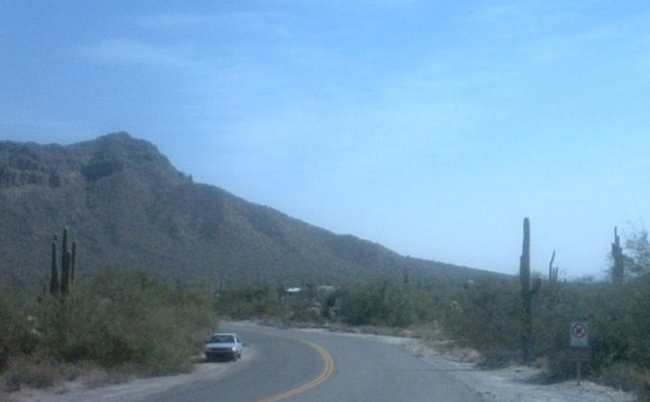
Best New Hiking Trail
T-Bone Trail
There's a new challenge for hikers on South Mountain: the T-Bone Trail, which goes almost straight up to the peak of the Ma-Ha-Tauk Range, climbing in elevation from 1,331 feet in the parking lot to 2,311 feet at its zenith. At the top, the trail, which begins near the landmark T-Bone Steakhouse off South 19th Avenue, loops east across the range, where you can join the Ma-Ha-Tauk Trail and descend back to the parking area. The new trail opened in January after six weeks of bulldozing work. If you're not up to the steep climb, Phoenix Parks and Recreation also has graded an extension of the Ma-Ha-Tauk Trail for a couple of miles west to Laveen. It's a scenic hike among hundreds of saguaros, and also a highly recommended alternative if you're accompanied by a dog; the T-Bone Trail has some sharp drop-offs and there's no room for confrontations between our four-legged friends. One note: Parking at the 19th Avenue Trailhead is limited and prohibited on the street until you are more than a quarter-mile from the entrance. But what the hell, you're there for the exercise anyway, so walk a little farther.
Best 5K Run
Papago Park Fitness Trail
Some people were angry about this trail when it was first installed in 2016. It's 3.1 miles of crushed granite, with several concrete drainage support structures, slicing through a wide swath of the 1,500-acre Papago Park. In the end, it's worked out as a multiuse trail, allowing for easy hiking, jogging, and cycling. (We've even seen off-road-style wheelchairs on the trail.) The park is situated conveniently on the borders of Phoenix, Tempe, and Scottsdale, and the trail has become one of our favorite features in it. The Fitness Trail is the perfect place to train for a 5K — well, you said you like hills, right? This ain't no sidewalk jog. Start at the West Buttes parking lot off Galvin Parkway, just west of the Phoenix Zoo. The trail rolls like a gray ribbon across pink, cactus-covered hills, never flat for too long, but with nothing steep enough to blow out your knees. Up and down, twisting and turning, taking you the long way around the golf course but always west of Galvin Parkway — it all adds up to a deliciously full workout, like eating half the leftovers as well as the main meal. The next time you do a flat 5K, it'll feel like a snack.
Best Trail Run
Fat Turkey
Not all turkey trots are created equal. Ditch the neighborhood Thanksgiving Day dawdle for some serious trail running on the Saturday after Turkey Day. Fat Turkey offers both a 5K and a 10K, with plenty of scenery as you hit the rocky red ups and downs of Papago Park. As an extra incentive, the race organizers bring in an extra-fast pacesetter dressed in a turkey suit to run the course. Yeah, he looks silly. And he's probably going to kick your ass. One of our jogging partners actually beat the turkey last year, winning a shot glass — and knee pain he complained about for the next two months. As moderate trail runners, we don't try to go that fast. But after sampling the 5K version a couple of years ago, we did the 10K after last Turkey Day. Maybe it was the residual tryptophan, or maybe it was that the race begins with tough hills on a gravelly, uneven desert single-track trail, but we were fighting every instinct to give up and sneak away from the whole damned thing within the first mile. Fortunately, we worked past that nonsense and the next five miles were pure, fat-burning bliss. Everyone gets a T-shirt and a finisher's medal. Our two medals hang proudly at home — and the next one's coming up soon.
Best Place to Go Climbing Without a Partner
Focus Climbing Center
As much as we love bouldering, the art of rock climbing while staying relatively low to the ground, sometimes we need to get high. But without a partner and rope for a belay, climbing high on technically difficult terrain isn't a rational option, unless you're Alex Honnold. Or, that is, unless you have access to an auto-belayer. If so, while the rope is still mandatory, the partner isn't. Focus is the better of two gyms that we're aware of that employ auto-belayers. We like the vibe there from both the laid-back, though professional, employees, and the clientele of mostly young, ripped, personable bouldering aficionados. Opposite the top-notch bouldering walls, the climbing walls are served by six auto-belayers, which are box-like machines affixed near the ceiling. A climbing rope dangles from the center of the boxes to near the floor. Climbers clip into the end of that rope and begin scaling the wall. In a fall, the auto-belayer doesn't let the climber plunge to the ground. Instead, it pays out the rope slowly and places the climber on the floor gently. This system allows us to climb the wall's 30 feet again and again, racking up hundreds of vertical feet in minutes with no belayer, and no fear of crashing to the ground. It's even safer than bouldering higher than five or six feet, since a fall even on padded ground could result in a sprain or break, while the auto-belayer acts as a guardian angel, always depositing climbers on the ground at the same, slow speed. What it won't do is talk to you. While they won't help your social life, the auto-belayers at Focus will get you ready for the next big wall.
- 2150 W. Broadway Rd., Mesa, 85202 Map
- 480-718-5258
- focusclimbingcenter.com/
Best Bouldering Gym
Black Rock Bouldering Gym
Come for the bouldering, stay for the weights, yoga, wine, and massages. Dozens of routes that sprawl over the gym's two cavernous sections range from the beginner-friendly V-basic rating to the rip-skin-off-your fingers V8s and above. Build strength by scaling overhangs and gripping tiny, crimpy holds as you practice footwork and train your mind to "read" routes before you hop on the wall. Veteran-owned and -operated, Black Rock is staunchly a bouldering gym — leave your harnesses at home, folks — and embracing that identity distinguishes it from gyms that try to offer it all. A monthly membership will set you back $79, which pays off after four visits. Regularly set routes test your technique and push your mind and body to solve fresh puzzles. Meanwhile, Black Rock's open gym has all the weights, resistance cords, and other equipment you need to get stronger. Yoga classes are offered almost every night, so you can stretch out. Monthly offerings include ladies' bouldering night (it comes with wine) and back massages.
- 10436 N. 32nd St., Phoenix, 85028 Map
Best Canal for Jogging or Bicycling
Arizona Canal
There are three main canals that provide paths for walking, jogging, or cycling, but Arizona Canal is the best. These waterways have been entertaining Phoenicians for decades, as well as delivering the life-sustaining water for homes and our remaining farms. We know two people who used to water-ski in the canals behind cars back in the day. Now, you'd be thrown in jail for doing that — plus you'd run over a jogger, most likely. The Arizona Canal cuts through the finest part of the empire known as metro Phoenix, passing through neighborhoods and commercial sections of east Phoenix and Scottsdale, all the way to the west Valley. The canal paths are flat, with surfaces of both dirt and asphalt, so the only drawback is the occasional street crossing — be careful on those. The clean water, which contains catfish and other aquatic life, can be mesmerizing for desert dwellers who know little but dust and cactus. It's one of our mandatory pleasures to jog along the canal; stare at the water and open spaces of backyards, parking lots, and what have you; and let the brain take a siesta while the heart and lungs pump away. It's pure, Phoenix-style bliss.
Best Put-Together Urban Bike Ride
Indian Bend Wash/Rio Salado Paths
Twenty-five miles of nearly uninterrupted bicycle path. You heard right. That's a huge stretch of pavement without worrying about cars or 18-wheelers taking you out. True, there are often other obstacles to weave through, like pedestrians, roller-bladers, and the scourge of humankind, electric scooters. But they probably won't kill you, and if it's later at night or hot, or if you get lucky, you'll have nearly the whole trail system to yourself. Doing the math: The ride could be a 50-miler out-and-back if begun at one end. In reality, that might be difficult to do. But the beauty of this ride is you could live in south Phoenix, Tempe, south Scottsdale, or north Scottsdale and still access the trail easily for a long, no-car bike ride. There are no signs, and not even a single online map for this one. Here are the tricks (start from either end): Catch the west end of the Rio Salado bike path at about 19th Avenue and the south bank of the Salt River riverbed. Continue through the Tempe Beach Park, and connect to Scottsdale's Indian Bend Wash path by either taking the pedestrian bridge to the north side, or using the walkway on Rural Road. That path soon bends north and runs all the way to Shea Boulevard. You might want to pack a lunch.
Best Desert Bike Ride
Usery Pass at Usery Mountain Regional Park
Don't get us wrong: There are plenty of bike trails with beautiful scenery all over the Valley, but there's something about looping through Usery Pass that feels epic. Once you ride up the 1,000 feet of rolling hills inside this county park, you can see downtown Phoenix from over 30 miles away on a clear day. There is lush greenery along North Bush Highway, which runs parallel to the Salt River. You can take a selfie next to one of the oddly shaped saguaro cactuses along the road, Bike anywhere from 20 to 40 miles, but come prepared —occasional debris from the large pickups hauling boats can flatten your tire real fast.
- 3939 N. Usery Pass Rd., Mesa, 85207 Map
- 480-984-0032
- www.maricopa.gov/parks/usery/
Best Of Phoenix®
-
Megalopolitan Life
-
Best ESPN Highlight
Greta Rogers
-
Best Nike Flip-Flop
Governor Doug Ducey
-
Best Mistake By a Lake
Kari Lake
-
Best Music Video Star
Rodney Glassman
-
Best Republican Legislator
Paul Boyer
-
Best Democratic Legislator
Kirsten Engel
-
Best Activist Group
Poder in Action
-
Best Beat Reporter
Rachel Leingang
-
Best Government Agency Twitter
Arizona Department of Transportation
-
Best Negotiators
Tom Buschatzke and Ted Cooke
-
Best Environmentalist
Sandy Bahr
-
Best New Medical Marijuana Law
SB 1494
-
Best Ruling
Arizona Supreme Court
-
Best Public Information Officer
Bob Huhn
-
Best Political Podcast
The Breakdown
-
Best Local Blog by a Non-Local
Rogue Columnist
-
Best Waste of Taxpayer Money
Border Strike Task Force
-
Best Political Interference
Arizona Public Service
-
Best Anti-Porn Bill
HB 2444
-
Best Confession
Bryan West
-
Best Twitter Meltdown
Frank Riggs
-
Best Yearbook Goof
Nicole Carroll
-
Best Political Implosion
David Stringer
-
Best Architecture Studio
Kaiserworks
-
Best Cultural Podcast
Limited Engagement
-
Best Radio Station
KWSS 93.9 FM
-
Best Morning Radio Show
The Show
-
Best Storyteller
Joy Young
-
Best Storytelling Event
The Storyline Slam
-
Best Comic Book Artist
Nick Cagnetti
-
Best Poet
Rashaad Thomas
-
Best Author
Natalie Diaz
-
Best Comedian
Anwar Newton
-
Best Comedy Club
Stand Up Live
-
Best Comedy Show
Repent!
-
Best Trivia Night
Boulders on Broadway
-
Best Non-Equity Company Worth Looking For
Nearly Naked Theatre
-
Best Performance
Duane Daniels
-
Best Attempt to Save a Lousy Script
Jeanne Paulsen in Erma Bombeck: At Wit's End
-
Best Dance Festival
BlakTina/BlakTinx
-
Best Drone Art
Breaking Ground Contemporary Dance and Film Festival
-
Best Art News
Meow Wolf Phoenix
-
Best Artistic Money Move
Kanye Donates $10 Million to Roden Crater
-
Best Arts Event
First Friday
-
Best Art Gallery
Lisa Sette Gallery
-
Best New Gallery
Gallery 119 at Lowney/Coplin Studios
-
Best First Friday Hangout
Grand Avenue
-
Best Art Enclave
The Hive
-
Best Community Art Space
The Sagrado Galleria
-
Best Hidden Art Space
Millet House
-
Best Art Conversations
Crossfade Lab
-
Best Permanent Public Art
One-Eyed Jack by John Randall Nelson
-
Best Temporary Public Art
IN FLUX Cycle 8
-
Best Immigration Art
"Sangre Sudor y Amor: Hunger for the American Dream" by Janet Diaz
-
Best Neon Artist
Daniel Funkhouser
-
Best Sticker Artist
Malena Barnhart
-
Best Scavenger Hunt Organizer
James B. Hunt
-
Best Mural
Environ by Janel Garza
-
Best Museum
Mesa Contemporary Arts Museum
-
Best Museum to Take an Out-of-Towner
Musical Instrument Museum
-
Best Touring Exhibition
"Josef Albers in Mexico"
-
Best Light Show
"Electric Desert"
-
Best Film Festival
Phoenix Film Festival
-
Best Resource for Independent Filmmakers
IFP Phoenix
-
Best Budget Movie Theater
Pollack Tempe Cinemas
-
Best Indie Movie Theater
FilmBar
-
Best Luxury Movie Theater
Harkins Camelview at Fashion Square 14
-
Best Library
Burton Barr Central Library
-
Best Tribute to Mall Culture
Retail Archaeology
-
Best Memory for the Way Things Used to Be
Alison King
-
Best People-Watching
Valley Metro Rail
-
Best Holiday Light Display
Illumination: Symphony of Light
-
Best Holiday Tradition
Flannel Ball
-
Best E-Scooter Company
Bird
-
Best Ruins
Pueblo Grande Museum and Archaeological Park
-
-
Fun & Games
-
Best Place to Watch Jumbo Jets
Rio Salado Bike Path and 40th Street
-
Best Hiking Trail
Echo Canyon at Camelback Mountain
-
Best New Hiking Trail
T-Bone Trail
-
Best 5K Run
Papago Park Fitness Trail
-
Best Trail Run
Fat Turkey
-
Best Place to Go Climbing Without a Partner
Focus Climbing Center
-
Best Bouldering Gym
Black Rock Bouldering Gym
-
Best Canal for Jogging or Bicycling
Arizona Canal
-
Best Put-Together Urban Bike Ride
Indian Bend Wash/Rio Salado Paths
-
Best Desert Bike Ride
Usery Pass at Usery Mountain Regional Park
-
Best Motorcycle Ride
South Mountain Summit Road
-
Best Nighttime View of Downtown Phoenix
North Mountain Park
-
Best Picnic Spot
Granada Park
-
Best Mushroom Hunting
Arizona Mushroom Society
-
Best Seed Library
Phoenix Public Library
-
Best Hall of Fame Career
Larry Fitzgerald
-
Best Male Athlete
Kyler Murray
-
Best Female Athlete
Julie Ertz
-
Best Last Chance for a Sports Exec to Keep His Job
Steve Keim
-
Best One-Sided Sports Radio Feud
Fox Sports' Jody Oehler versus 98.7's Gambo
-
Best Sportscasting Team
Dan Bickley and Vince Marotta
-
Best Spring Training Experience
American Family Fields
-
Best Skate Park
Pecos Skate Park
-
Best Indie Wrestling Promotion
Party Hard Wrestling
-
Best Golf Course
Quintero Golf Club
-
Best Staycation Spot
Hotel Valley Ho
-
Best Water Park
Six Flags Hurricane Harbor Phoenix
-
Best Pool Party
Release
-
Best Indie Game Company
CollectorVision Games
-
Best Arcade
Electric Bat Arcade
-
Best Pinball Palace
StarFighters Arcade
-
Best Casino
Lone Butte Casino
-
Best Art Classes
Practical Art
-
Best Axes
Lumberjaxes
-
Best Date Night Surprise
Arizona Derby Dames
-
Best Escape Room
Escape Narrative
-
Best Place to Get the Lead Out
Octane Raceway
-
Best Ice-Skating
CitySkate
-
Best Roller-Skating
USA Great Skate of Glendale
-
Best Bowling
Bowlero North Scottsdale
-
Best Place to Meet Cute
La Gattara Cat Lounge & Boutique
-
Best Place to Play Twister With Strangers
Snakes & Lattes
-
Best Place to Smash the Memory of Your Ex
Simply Smashing Rage Room Tempe
-
Best Reason to Go to the Zoo
Roars & Pours
-
-
Goods & Services
-
Best Boutique
Frances
-
Best New Boutique
Eternal Noir
-
Best Vintage Clothing
Antique Sugar
-
Best Clothing Company
Keep Nature Wild
-
Best Clothing Store
Phoenix General
-
Best Eyewear
Framed Ewe
-
Best Jewelry Store
London Gold
-
Best Women's Resale
Poor Little Rich Girl
-
Best Streetwear
Wang's Closet
-
Best Men's Resale Shop
Well Suited
-
Best Kids' Resale
Baby Bloomers Consignment Shop
-
Best Western Gear
Saba's Western Wear Store
-
Best Running Store
Runner's Den
-
Best Spa
The Spa at The Boulders
-
Best Costume Shop
Mardi Gras
-
Best Hip-Hop Shop
Trill
-
Best Outdoors Store
Arizona Hiking Shack
-
Best Home Decor
For the People
-
Best Antiques Mall
Camelback Antiques
-
Best Vans
Boho Camper Vans
-
Best Baking Supplies
ABC Cake Decorating Supplies
-
Best Pet Supplies
Wag n' Wash
-
Best Nursery
Whitfill Nursery
-
Best Compost
Arizona Worm Farm
-
Best Florist
Camelback Flowershop
-
Best Houseplants
The Bosque at Pueblo
-
Best Gardening Store
Southwest Gardener
-
Best Place to Buy a Gift
UrbAna
-
Best Stationery Store
Write-Ons
-
Best Art Supplies
Blick
-
Best Museum Gift Shop
Phoenix Art Museum
-
Best Mall
Scottsdale Fashion Square
-
Best Market
Phoenix Flea
-
Best Creative Facilitator
Amy Guerrero
-
Best Bead Shop
Bead World
-
Best Knitting Store
Tempe Yarn & Fiber
-
Best Jewelry Designer
Alex Ozers
-
Best Place to Go Sans Serif
Hazel & Violet
-
Best New Age Store
Fantasia Crystals
-
Best Voodoo Shop
Zombi Conjure Co.
-
Best Place to Buy a Human Skull
Curious Nature
-
Best Place to Experience Japan on the Cheap
Cutie
-
Best Place to Crack the Case
Crime Scene
-
Best Pots
Peabo Pots
-
Best Bookstore
Changing Hands Bookstore
-
Best Comic Book Shop
All About Books and Comics
-
Best Used Bookstore
Bookmans Entertainment Exchange
-
Best Book Sale
VNSA Book Sale
-
Best Music Store for Vinyl
Record High in Phoenix
-
Best Music Store for CDs
Stinkweeds
-
Best New Record Store
Pink Elephant Records
-
Best Bike Shop
Curbside Cyclery
-
Best Skate Shop
Cowtown Skateboards
-
Best Convenience Store
Brian's Discount Market
-
Best Vape Shop
Red Star Vapor
-
Best Head Shop
Hi-Life Smoke & Vapor Shop
-
Best Dispensary
TruMed
-
Best Cultivator
GreenPharms
-
Best Edible
Untamed Herbs
-
Best Concentrate
Vapen Clear
-
Best Vape Pen
O.penVAPE
-
Best Strain
Super Silver Haze
-
-
La Vida
-
Best Upscale Mexican Restaurant
Barrio Café Gran Reserva
-
Best Restaurant to Take a Scenester
Gallo Blanco
-
Best New Mexican Restaurant
La Marquesa
-
Best Restaurant to Take an Out-of-Towner
Mi Patio
-
Best Vegan Mexican Restaurant
Mi Vegana Madre
-
Best 'Berto's
Filiberto's
-
Best Mexican Food Truck
The Drowning Taco
-
Best Mexican Breakfast
Comedor Guadalajara
-
Best Late-Night Mexican Food
La Frontera #3
-
Best Salsa
La Santisima Gourmet Taco Shop
-
Best Guacamole
Barrio Café
-
Best Tortilla
Carolina's
-
Best Nachos
Los Taquitos
-
Best Mexican Pizza
Nando's Mexican Café
-
Best Quesadilla
Ni de Aqui, Ni de Alla
-
Best Taco
La Frontera #1
-
Best New-School Taco
CRUjiente Tacos
-
Best Fish Taco
Chula Seafood
-
Best Place to Eat Tacos Without Cilantro
Sonora Taco Shop
-
Best Enchilada
Cocina Madrigal
-
Best Chimichanga
Valle Luna
-
Best Burrito
Rito's Mexican Food
-
Best Breakfast Burrito
El Norteño
-
Best Tamale
The Tamale Store
-
Best Torta
TEG Torta Shop
-
Best Elote
Elote Man AZ
-
Best Sonoran Hot Dog
El Caprichoso
-
Best Gordita
Tacos Chiwas
-
Best Mariscos
Mariscos Playa Hermosa
-
Best Aguachile
Tacos y Mariscos El Sinaloa
-
Best Ceviche
Tacos Culichi
-
Best Churro
Dulce Churro Cafe
-
Best Paleta
Paletas Betty
-
Best Agua Fresca
The Rez, an Urban Eatery
-
Best Margarita
Taco Chelo
-
Best Mezcal
Mezcal Carreño
-
Best Mexican Coffeehouse
Azukar Coffee
-
Best Carniceria
Carniceria Sonora
-
Best Panaderia
La Purisima Bakery 2
-
Best Mexican Snack Shop
La Carreta de Lily
-
Best Bilingual Bookstore
Palabras Bilingual Bookstore
-
Best Dia de los Muertos Celebration
Cultural Coalition's Mikiztli
-
Best Dia de los Muertos Treasures
Arizona Latino Arts & Cultural Center
-
Best Latin Dance Club
Antro Nightclub
-
Best Mexican Imports
Mercado Mexico
-
Best Mariachi Group
Mariachi Pasion
-
Best Place to Buy a Pinata
Dulceria La Bonita
-
Best Place to Watch Lucha Libre
Lucha Libre Voz
-
-
Food & Drink
-
Best Chef
Charleen Badman
-
Best Place to Take a Foodie
Cotton & Copper
-
Best Restaurant
Binkley's Restaurant
-
Best New Restaurant
Hush Public House
-
Best Food Truck
Everest Momo
-
Best Culinary Festival
Devour Culinary Classic
-
Best Food Festival Catastrophe
AZ Bao Fest
-
Best Vegetable Wizard
Sacha Levine
-
Best Food Waste Initiative
Zero Phoenix
-
Best Family Food Lore
Julio César Morales
-
Best Reboot
Anhelo Restaurant
-
Best Name Change
Fate Brewing
-
Best Fresh Start
The Farish House
-
Best Third Place for Everyone
Jobot Coffee & Bar
-
Best Hangout
El Charro Hipster Bar Café
-
Best Time Machine to the '50s
MacAlpine's Diner & Soda Fountain
-
Best Authentic Arizona Restaurant
Cartwright's Modern Cuisine
-
Best Happy Hour
Lovecraft
-
Best Breakfast
Harlow's Café
-
Best Stop After Your Morning Bike Ride
O.H.S.O. Brewery + Distillery
-
Best Brunch
Windsor
-
Best Downtown Lunch
Monroe's Hot Chicken
-
Best Place to Eat at the Bar
The Rokerij
-
Best Bar Food
Bao Chow
-
Best Restaurant for Romance
Café Monarch
-
Best Restaurant to Take the Kids
The Teapot
-
Best Patio Dining
Welcome Diner
-
Best Late-Night Dining
Grand Avenue Pizza Company
-
Best Steakhouse
Durant's
-
Best Diner
Handlebar Diner
-
Best Soul Food
Stacy's Off Da Hook BBQ and Soul Food
-
Best Southern Restaurant
the Larder + the Delta
-
Best English Pub
Cornish Pasty Company
-
Best Irish Pub
Rúla Búla
-
Best German Restaurant
Haus Murphy's
-
Best Italian Restaurant
Tratto
-
Best French Restaurant
Geordie's Restaurant
-
Best Native American Food
The Fry Bread House
-
Best Peruvian Restaurant
Los Andes Peruvian Cuisine
-
Best Vietnamese Restaurant
Da Vang Restaurant
-
Best Thai Restaurant
Thai-E-San
-
Best Korean Restaurant
Drunken Tiger
-
Best Japanese Restaurant
Hana Japanese Eatery
-
Best Chinese Restaurant
Chou's Kitchen
-
Best Indian Restaurant
India's Flame
-
Best Middle Eastern Restaurant
Haji-Baba
-
Best African Restaurant
Jollof King
-
Best Jewish Deli
Chompie's
-
Best Kosher Restaurant
Café Chenar
-
Best Vegan Restaurant
Verdura
-
Best Vegetarian Restaurant
The Coronado
-
Best Restaurant to Trick Yourself Into Eating Healthier
Green New American Vegetarian
-
Best Gluten-Free Restaurant
Jewel's Cafe
-
Best Farmers Market
Uptown Farmers Market
-
Best Butcher
Arcadia Meat Market
-
Best Seafood Market
Nelson's Meat + Fish
-
Best Burger
Aioli Gourmet Burgers
-
Best Sandwiches
Pane Bianco
-
Best Hot Dog
Short Leash Hotdogs + Rollover Doughnuts
-
Best Fried Chicken
The Root and Soul
-
Best Fries
Arizona Wilderness Brewing Co.
-
Best Wings
Trapp Haus BBQ
-
Best Barbecue
Little Miss BBQ
-
Best Pizza
Pizzeria Bianco
-
Best Neapolitan Pizza
POMO Pizzeria
-
Best Square Pizza
Piazza Romana
-
Best Jersey Import
Saint Pasta
-
Best Falafel
WTFExp
-
Best Sushi
Sushi Nakano
-
Best Ramen
Tampopo
-
Best Poke
Koi Poke
-
Best Dim Sum
Great Wall Cuisine
-
Best East-West Mashup
Katsu
-
Best Bakery
Lior the Baker
-
Best Gluten-Free Bakery
Gluten-Free Creations
-
Best Place to Eat and Be Scary
Spooky's Swirls
-
Best Second Act
Nino McCurley
-
Best Bread
La Belle Vie
-
Best Bagel
Bagel Man
-
Best Crepe
The Village Coffee and Crêperie
-
Best Doughnut
The Local Donut
-
Best Cinnamon Roll
Ingo's Tasty Food
-
Best Ice Cream
Sweet Republic
-
Best Chocolate
DNA Chocolate
-
Best Coffeehouse
Songbird Coffee & Tea House
-
Best Cold Brew Coffee
beCoffee
-
Best Arnold Palmer
Urban Beans
-
Best British-Style Tea Shop
English Rose Tea Room
-
Best Alternative Afternoon Tea
Tipsy Tea
-
Best Place to Drink a Cup of Authentic Chai
Om Bistro
-
Best Place to Drink Like a Hippie
Lacuna Kava Bar
-
Best Distillery
Arizona Distilling Company
-
Best Bartender
Chanel Godwin-McMaken
-
Best Liquor Store
Sunrise Market
-
Best Bloody Mary
Hash Kitchen
-
Best Mojito
Carly's Bistro
-
Best Martini
AZ/88
-
Best Wine Bar
The Whining Pig
-
Best Vino Destination
Sauvage Bottle Shop
-
Best Arizona White Wine
2015 WildChild White
-
Best Arizona Red Wine
2015 Aguileon
-
Best Brewery
Arizona Wilderness Brewing Co.
-
Best Local Beer
Wren House Brewing Company
-
Best Veteran Brewer
Brian Helton
-
Best Cidery
Cider Corps
-
Best Meadery
Superstition Meadery
-
-
Nightlife
-
Best Cameo
Okilly Dokilly on The Simpsons
-
Best Music Festival
FORM at Arcosanti
-
Best Music Festival That Never Happened
Unity Summit Music Festival
-
Best Homecoming
decker.
-
Best Bar
Crescent Ballroom
-
Best New Bar
Thunderbird Lounge
-
Best Nightclub
Monarch Theatre
-
Best New Nightspot
The Hot Chick
-
Best Dance Night
BFF Fridays at Bar Smith
-
Best Goth Dance Night
LILITH at Stacy's
-
Best Bar for People-Watching
Zuma
-
Best Place to Day-Drink
12 West Brewing Co.
-
Best Place to Have a Drink and Watch the Sunset
Orange Sky
-
Best Bar to Take Your Parents To
Bitter & Twisted Cocktail Parlour
-
Best Hangover in the Making
Yucca Tap Room
-
Best Smoking Patio
Casey Moore's Oyster House
-
Best Dive Bar
Palo Verde Lounge
-
Best Sports Bar
Big Daddy's Sports Lounge
-
Best Tiki Bar
UnderTow
-
Best Game Bar
The Grid: Games and Growlers
-
Best Blues Bar
Char's Has the Blues
-
Best Country Bar
Buffalo Chip Saloon and Steakhouse
-
Best Jazz Club
The Nash
-
Best Place to See a Metal Show
Club Red
-
Best Punk Club
The Rebel Lounge
-
Best Jukebox
Gracie's Tax Bar
-
Best Karaoke
Kobalt Bar
-
Best Gay Bar
Bliss / reBAR
-
Best Gay Dance Club
Charlie's Phoenix
-
Best Drag Show
BS West
-
Best Lesbian Bar
Boycott Bar
-
Best DIY Music Event
Vanishing Show
-
Best Last-Minute Save
The Lunchbox
-
Best Small Music Venue
Valley Bar
-
Best Midsize Music Venue
The Van Buren
-
Best Large Music Venue
Talking Stick Resort Arena
-
Best DIY Music Venue
The Trunk Space
-
Best Concert Venue as Immersive Experience
The Underground at The Nile Theater
-
Best Place to See a Rap Show
Celebrity Theatre
-
Best Place to See Tribute Bands
Casino Arizona
-
Best Band
Nanami Ozone
-
Best Local Band Gone Global
Injury Reserve
-
Best Up-and-Coming Band
Sad Dance Party
-
Best Merch
The Maine's 8123 Shop
-
Best Promoter
Psyko Steve Presents
-
Best Rapper
Teek Hall
-
Best Vocalist
Luna Aura
-
Best DJ
Blossom
-
Best EDM Collective
Techno Snobs
-
-
Readers' Choice
-
Best Arts Festival
First Fridays
-
Best Blues Club
The Rhythm Room
-
Best Christmas Tradition
ZooLights
-
Best Comedian
Anwar Newton
-
Best Country Bar
Buffalo Chip Saloon
-
Best Dive Bar
Yucca Tap Room
-
Best DJ
DJ Madd Rich
-
Best Drag Show
Charlie's
-
Best Event Venue
The Van Buren
-
Best Film Festival
Phoenix Film Festival
-
Best Gay Bar
Charlie's
-
Best Indie Movie Theater
FilmBar
-
Best Jukebox
The Dirty Drummer
-
Best Karaoke
Roosters Country
-
Best Large Music Venue
The Van Buren
-
Best Lesbian Bar
Stacy's @ Melrose
-
Best Local Band
Jim Bachmann and The Day Drinkers
-
Best Luxury Movie Theater
Harkins Camelview at Fashion Square 14
-
Best Morning Radio Show
Holmberg's Morning Sickness
-
Best Music Festival
Country Thunder
-
Best Nightclub
Club Luxx
-
Best Politician
Kyrsten Sinema
-
Best Punk Club
The Rebel Lounge
-
Best Rock Club
Crescent Ballroom
-
Best Small Music Venue
Crescent Ballroom
-
Best Sports Bar
Zipps Sports Grill
-
Best Tiki Bar
Hula's Modern Tiki
-
Best Trivia Night
Dave & Buster's
-
Best Turntablist
DJ Element
-
Best Vocalist
Holly Pyle and Alice Tatum (tie)
-
Best Authentic Arizona Restaurant
Valle Luna
-
Best Bakery
La Purisima
-
Best Barbecue
Little Miss BBQ
-
Best Bartender
Chanel Godwin-McMaken
-
Best Breakfast
Matt's Big Breakfast
-
Best Breakfast Burrito
Carolina's Mexican Food
-
Best Brewery
Four Peaks Brewing Co.
-
Best Brunch
Snooze: an AM Eatery
-
Best Burger
Rehab Burger Therapy
-
Best Burrito
Carolina's Mexican Food
-
Best Chef
Samantha Roberts
-
Best Chimichanga
Valle Luna
-
Best Chinese Restaurant
China Chili
-
Best Coffeehouse
Cartel Coffee Lab
-
Best Culinary Festival
Arizona Taco Festival
-
Best Dim Sum
Great Wall Cuisine
-
Best Distillery
O.H.S.O. Brewery & Distillery
-
Best Doughnuts
BoSa Donuts
-
Best Downtown Lunch
Phoenix Public Market Cafe
-
Best English Pub
Cornish Pasty Co.
-
Best Farmers Market
Phoenix Public Market
-
Best Food Truck
The Maine Lobster Lady
-
Best French Restaurant
Vincent on Camelback
-
Best Fried Chicken
Lo-Lo's Chicken & Waffles
-
Best Gluten-Free Bakery
Jewel's Bakery & Cafe
-
Best Gluten-Free Restaurant
Picazzo's Organic Italian Kitchen
-
Best Guacamole
Barrio Café
-
Best Happy Hour
The Vig
-
Best Hot Dog
Ted's Hot Dogs
-
Best Ice Cream
Sweet Republic
-
Best Indian Restaurant
India Delhi Palace
-
Best Irish Pub
Seamus McCaffrey's Irish Pub & Restaurant
-
Best Italian Restaurant
Venezia's New York Style Pizzeria
-
Best Japanese Restaurant
Kabuki Japanese Restaurant
-
Best Korean Restaurant
Drunken Tiger
-
Best Late-Night Dining
Welcome Diner
-
Best Middle Eastern Restaurant
Pita Jungle
-
Best Nachos
Diego Pops
-
Best New Restaurant
Voodoo Daddy's Steam Kitchen
-
Best Patio Dining
Olive & Ivy Restaurant & Marketplace
-
Best Pizza
Grimaldi's Pizzeria
-
Best Place to Day Drink
Roosters Country
-
Best Place to Eat at the Bar
AZ/88
-
Best Place to Take a Foodie
Hand Cut Burgers & Chophouse
-
Best Poke
Pokitrition
-
Best Ramen
Clever Koi and Shady Park (tie)
-
Best Restaurant for Kids
Peter Piper Pizza
-
Best Salsa
Valle Luna
-
Best Seafood
Angry Crab Shack
-
Best Sonoran Hot Dogs
Nogales Hot Dogs
-
Best Soul Food Restaurant
Lo-Lo's Chicken & Waffles
-
Best Steakhouse
Durant's
-
Best Sushi
Harumi Sushi
-
Best Tacos
Tacos Tijuana
-
Best Tamales
Carolina's Mexican Food
-
Best Thai Restaurant
Thai Basil
-
Best Tortillas
Carolina's Mexican Food
-
Best Upscale Mexican Restaurant
Barrio Queen
-
Best Vegan Restaurant
Green New American Vegetarian
-
Best Vegetarian Restaurant
Pita Jungle
-
Best Vietnamese Restaurant
Pho Thanh
-
Best Wings
ATL Wings
-
Best Antiques Mall
Brass Armadillo
-
Best Art Supply Store
Michaels
-
Best Auto Aftermarket
Ramjet's Speed Shop
-
Best Auto Repair
Sun Devil Auto
-
Best Bookstore
Changing Hands Bookstore
-
Best Boutique
Poor Little Rich Girl
-
Best Cannabis Dispensary
GreenPharms
-
Best Car Wash
Cobblestone Auto Spa
-
Best Comic Book Shop
Samurai Comics
-
Best Concentrates Brand
GreenPharms
-
Best Dispensary for Edibles
GreenPharms
-
Best Dispensary for Flower
GreenPharms
-
Best Edibles Brand
GreenPharms
-
Best Eyewear
LensCrafters
-
Best Florist
Cactus Flower Florists
-
Best Furniture Store
American Furniture Warehouse
-
Best Head Shop
Sky High Smoke Shop
-
Best Kids' Clothing
Target
-
Best Local T-Shirts
State Forty Eight
-
Best Mall
Scottsdale Fashion Square
-
Best Motorcycle Shop
Ramjet Racing Performance Cycles
-
Best Moving Service
Camelback Moving
-
Best Pet Service
Wag N' Wash
-
Best Plant Nursery
Moon Valley Nurseries
-
Best Place to Buy CBD
GreenPharms
-
Best Record Store for CDs
Zia Record Exchange
-
Best Record Store for Vinyl
Zia Record Exchange
-
Best Running Store
Runner's Den
-
Best Salon
Focal Point Salon & Spa
-
Best Skate Shop
Cowtown Skateboards
-
Best Spa
Focal Point Salon & Spa
-
Best Used Bookstore
Bookmans Entertainment Exchange
-
Best Vape Shop
GreenPharms
-
Best Vintage Clothing Boutique
Buffalo Exchange
-
Best Arcade
Cobra Arcade Bar
-
Best Casino
Talking Stick Resort
-
Best Go-Karts
Octane Raceway
-
Best Golf Course
Arizona Biltmore
-
Best Health Club
EoS Fitness
-
Best Hiking Trail
Camelback Mountain
-
Best Indoor Fun Center
Main Event
-
Best Place to See a Spring Training Game
Salt River Fields at Talking Stick
-
Best Pool Party
Release at Talking Stick Resort
-
Best Professional Athlete
Larry Fitzgerald
-
Best Rock Gym
AZ on the Rocks
-
Best Staycation Spot
Arizona Biltmore Resort & Spa
-
Best Water Park
Six Flags Hurricane Harbor Phoenix
-
Best Of
-
Megalopolitan Life
-
Best ESPN Highlight
Greta Rogers
-
Best Nike Flip-Flop
Governor Doug Ducey
-
Best Mistake By a Lake
Kari Lake
-
Best Music Video Star
Rodney Glassman
-
Best Republican Legislator
Paul Boyer
-
Best Democratic Legislator
Kirsten Engel
-
Best Activist Group
Poder in Action
-
Best Beat Reporter
Rachel Leingang
-
Best Government Agency Twitter
Arizona Department of Transportation
-
Best Negotiators
Tom Buschatzke and Ted Cooke
-
Best Environmentalist
Sandy Bahr
-
Best New Medical Marijuana Law
SB 1494
-
Best Ruling
Arizona Supreme Court
-
Best Public Information Officer
Bob Huhn
-
Best Political Podcast
The Breakdown
-
Best Local Blog by a Non-Local
Rogue Columnist
-
Best Waste of Taxpayer Money
Border Strike Task Force
-
Best Political Interference
Arizona Public Service
-
Best Anti-Porn Bill
HB 2444
-
Best Confession
Bryan West
-
Best Twitter Meltdown
Frank Riggs
-
Best Yearbook Goof
Nicole Carroll
-
Best Political Implosion
David Stringer
-
Best Architecture Studio
Kaiserworks
-
Best Cultural Podcast
Limited Engagement
-
Best Radio Station
KWSS 93.9 FM
-
Best Morning Radio Show
The Show
-
Best Storyteller
Joy Young
-
Best Storytelling Event
The Storyline Slam
-
Best Comic Book Artist
Nick Cagnetti
-
Best Poet
Rashaad Thomas
-
Best Author
Natalie Diaz
-
Best Comedian
Anwar Newton
-
Best Comedy Club
Stand Up Live
-
Best Comedy Show
Repent!
-
Best Trivia Night
Boulders on Broadway
-
Best Non-Equity Company Worth Looking For
Nearly Naked Theatre
-
Best Performance
Duane Daniels
-
Best Attempt to Save a Lousy Script
Jeanne Paulsen in Erma Bombeck: At Wit's End
-
Best Dance Festival
BlakTina/BlakTinx
-
Best Drone Art
Breaking Ground Contemporary Dance and Film Festival
-
Best Art News
Meow Wolf Phoenix
-
Best Artistic Money Move
Kanye Donates $10 Million to Roden Crater
-
Best Arts Event
First Friday
-
Best Art Gallery
Lisa Sette Gallery
-
Best New Gallery
Gallery 119 at Lowney/Coplin Studios
-
Best First Friday Hangout
Grand Avenue
-
Best Art Enclave
The Hive
-
Best Community Art Space
The Sagrado Galleria
-
Best Hidden Art Space
Millet House
-
Best Art Conversations
Crossfade Lab
-
Best Permanent Public Art
One-Eyed Jack by John Randall Nelson
-
Best Temporary Public Art
IN FLUX Cycle 8
-
Best Immigration Art
"Sangre Sudor y Amor: Hunger for the American Dream" by Janet Diaz
-
Best Neon Artist
Daniel Funkhouser
-
Best Sticker Artist
Malena Barnhart
-
Best Scavenger Hunt Organizer
James B. Hunt
-
Best Mural
Environ by Janel Garza
-
Best Museum
Mesa Contemporary Arts Museum
-
Best Museum to Take an Out-of-Towner
Musical Instrument Museum
-
Best Touring Exhibition
"Josef Albers in Mexico"
-
Best Light Show
"Electric Desert"
-
Best Film Festival
Phoenix Film Festival
-
Best Resource for Independent Filmmakers
IFP Phoenix
-
Best Budget Movie Theater
Pollack Tempe Cinemas
-
Best Indie Movie Theater
FilmBar
-
Best Luxury Movie Theater
Harkins Camelview at Fashion Square 14
-
Best Library
Burton Barr Central Library
-
Best Tribute to Mall Culture
Retail Archaeology
-
Best Memory for the Way Things Used to Be
Alison King
-
Best People-Watching
Valley Metro Rail
-
Best Holiday Light Display
Illumination: Symphony of Light
-
Best Holiday Tradition
Flannel Ball
-
Best E-Scooter Company
Bird
-
Best Ruins
Pueblo Grande Museum and Archaeological Park
-
-
Fun & Games
-
Best Place to Watch Jumbo Jets
Rio Salado Bike Path and 40th Street
-
Best Hiking Trail
Echo Canyon at Camelback Mountain
-
Best New Hiking Trail
T-Bone Trail
-
Best 5K Run
Papago Park Fitness Trail
-
Best Trail Run
Fat Turkey
-
Best Place to Go Climbing Without a Partner
Focus Climbing Center
-
Best Bouldering Gym
Black Rock Bouldering Gym
-
Best Canal for Jogging or Bicycling
Arizona Canal
-
Best Put-Together Urban Bike Ride
Indian Bend Wash/Rio Salado Paths
-
Best Desert Bike Ride
Usery Pass at Usery Mountain Regional Park
-
Best Motorcycle Ride
South Mountain Summit Road
-
Best Nighttime View of Downtown Phoenix
North Mountain Park
-
Best Picnic Spot
Granada Park
-
Best Mushroom Hunting
Arizona Mushroom Society
-
Best Seed Library
Phoenix Public Library
-
Best Hall of Fame Career
Larry Fitzgerald
-
Best Male Athlete
Kyler Murray
-
Best Female Athlete
Julie Ertz
-
Best Last Chance for a Sports Exec to Keep His Job
Steve Keim
-
Best One-Sided Sports Radio Feud
Fox Sports' Jody Oehler versus 98.7's Gambo
-
Best Sportscasting Team
Dan Bickley and Vince Marotta
-
Best Spring Training Experience
American Family Fields
-
Best Skate Park
Pecos Skate Park
-
Best Indie Wrestling Promotion
Party Hard Wrestling
-
Best Golf Course
Quintero Golf Club
-
Best Staycation Spot
Hotel Valley Ho
-
Best Water Park
Six Flags Hurricane Harbor Phoenix
-
Best Pool Party
Release
-
Best Indie Game Company
CollectorVision Games
-
Best Arcade
Electric Bat Arcade
-
Best Pinball Palace
StarFighters Arcade
-
Best Casino
Lone Butte Casino
-
Best Art Classes
Practical Art
-
Best Axes
Lumberjaxes
-
Best Date Night Surprise
Arizona Derby Dames
-
Best Escape Room
Escape Narrative
-
Best Place to Get the Lead Out
Octane Raceway
-
Best Ice-Skating
CitySkate
-
Best Roller-Skating
USA Great Skate of Glendale
-
Best Bowling
Bowlero North Scottsdale
-
Best Place to Meet Cute
La Gattara Cat Lounge & Boutique
-
Best Place to Play Twister With Strangers
Snakes & Lattes
-
Best Place to Smash the Memory of Your Ex
Simply Smashing Rage Room Tempe
-
Best Reason to Go to the Zoo
Roars & Pours
-
-
Goods & Services
-
Best Boutique
Frances
-
Best New Boutique
Eternal Noir
-
Best Vintage Clothing
Antique Sugar
-
Best Clothing Company
Keep Nature Wild
-
Best Clothing Store
Phoenix General
-
Best Eyewear
Framed Ewe
-
Best Jewelry Store
London Gold
-
Best Women's Resale
Poor Little Rich Girl
-
Best Streetwear
Wang's Closet
-
Best Men's Resale Shop
Well Suited
-
Best Kids' Resale
Baby Bloomers Consignment Shop
-
Best Western Gear
Saba's Western Wear Store
-
Best Running Store
Runner's Den
-
Best Spa
The Spa at The Boulders
-
Best Costume Shop
Mardi Gras
-
Best Hip-Hop Shop
Trill
-
Best Outdoors Store
Arizona Hiking Shack
-
Best Home Decor
For the People
-
Best Antiques Mall
Camelback Antiques
-
Best Vans
Boho Camper Vans
-
Best Baking Supplies
ABC Cake Decorating Supplies
-
Best Pet Supplies
Wag n' Wash
-
Best Nursery
Whitfill Nursery
-
Best Compost
Arizona Worm Farm
-
Best Florist
Camelback Flowershop
-
Best Houseplants
The Bosque at Pueblo
-
Best Gardening Store
Southwest Gardener
-
Best Place to Buy a Gift
UrbAna
-
Best Stationery Store
Write-Ons
-
Best Art Supplies
Blick
-
Best Museum Gift Shop
Phoenix Art Museum
-
Best Mall
Scottsdale Fashion Square
-
Best Market
Phoenix Flea
-
Best Creative Facilitator
Amy Guerrero
-
Best Bead Shop
Bead World
-
Best Knitting Store
Tempe Yarn & Fiber
-
Best Jewelry Designer
Alex Ozers
-
Best Place to Go Sans Serif
Hazel & Violet
-
Best New Age Store
Fantasia Crystals
-
Best Voodoo Shop
Zombi Conjure Co.
-
Best Place to Buy a Human Skull
Curious Nature
-
Best Place to Experience Japan on the Cheap
Cutie
-
Best Place to Crack the Case
Crime Scene
-
Best Pots
Peabo Pots
-
Best Bookstore
Changing Hands Bookstore
-
Best Comic Book Shop
All About Books and Comics
-
Best Used Bookstore
Bookmans Entertainment Exchange
-
Best Book Sale
VNSA Book Sale
-
Best Music Store for Vinyl
Record High in Phoenix
-
Best Music Store for CDs
Stinkweeds
-
Best New Record Store
Pink Elephant Records
-
Best Bike Shop
Curbside Cyclery
-
Best Skate Shop
Cowtown Skateboards
-
Best Convenience Store
Brian's Discount Market
-
Best Vape Shop
Red Star Vapor
-
Best Head Shop
Hi-Life Smoke & Vapor Shop
-
Best Dispensary
TruMed
-
Best Cultivator
GreenPharms
-
Best Edible
Untamed Herbs
-
Best Concentrate
Vapen Clear
-
Best Vape Pen
O.penVAPE
-
Best Strain
Super Silver Haze
-
-
La Vida
-
Best Upscale Mexican Restaurant
Barrio Café Gran Reserva
-
Best Restaurant to Take a Scenester
Gallo Blanco
-
Best New Mexican Restaurant
La Marquesa
-
Best Restaurant to Take an Out-of-Towner
Mi Patio
-
Best Vegan Mexican Restaurant
Mi Vegana Madre
-
Best 'Berto's
Filiberto's
-
Best Mexican Food Truck
The Drowning Taco
-
Best Mexican Breakfast
Comedor Guadalajara
-
Best Late-Night Mexican Food
La Frontera #3
-
Best Salsa
La Santisima Gourmet Taco Shop
-
Best Guacamole
Barrio Café
-
Best Tortilla
Carolina's
-
Best Nachos
Los Taquitos
-
Best Mexican Pizza
Nando's Mexican Café
-
Best Quesadilla
Ni de Aqui, Ni de Alla
-
Best Taco
La Frontera #1
-
Best New-School Taco
CRUjiente Tacos
-
Best Fish Taco
Chula Seafood
-
Best Place to Eat Tacos Without Cilantro
Sonora Taco Shop
-
Best Enchilada
Cocina Madrigal
-
Best Chimichanga
Valle Luna
-
Best Burrito
Rito's Mexican Food
-
Best Breakfast Burrito
El Norteño
-
Best Tamale
The Tamale Store
-
Best Torta
TEG Torta Shop
-
Best Elote
Elote Man AZ
-
Best Sonoran Hot Dog
El Caprichoso
-
Best Gordita
Tacos Chiwas
-
Best Mariscos
Mariscos Playa Hermosa
-
Best Aguachile
Tacos y Mariscos El Sinaloa
-
Best Ceviche
Tacos Culichi
-
Best Churro
Dulce Churro Cafe
-
Best Paleta
Paletas Betty
-
Best Agua Fresca
The Rez, an Urban Eatery
-
Best Margarita
Taco Chelo
-
Best Mezcal
Mezcal Carreño
-
Best Mexican Coffeehouse
Azukar Coffee
-
Best Carniceria
Carniceria Sonora
-
Best Panaderia
La Purisima Bakery 2
-
Best Mexican Snack Shop
La Carreta de Lily
-
Best Bilingual Bookstore
Palabras Bilingual Bookstore
-
Best Dia de los Muertos Celebration
Cultural Coalition's Mikiztli
-
Best Dia de los Muertos Treasures
Arizona Latino Arts & Cultural Center
-
Best Latin Dance Club
Antro Nightclub
-
Best Mexican Imports
Mercado Mexico
-
Best Mariachi Group
Mariachi Pasion
-
Best Place to Buy a Pinata
Dulceria La Bonita
-
Best Place to Watch Lucha Libre
Lucha Libre Voz
-
-
Food & Drink
-
Best Chef
Charleen Badman
-
Best Place to Take a Foodie
Cotton & Copper
-
Best Restaurant
Binkley's Restaurant
-
Best New Restaurant
Hush Public House
-
Best Food Truck
Everest Momo
-
Best Culinary Festival
Devour Culinary Classic
-
Best Food Festival Catastrophe
AZ Bao Fest
-
Best Vegetable Wizard
Sacha Levine
-
Best Food Waste Initiative
Zero Phoenix
-
Best Family Food Lore
Julio César Morales
-
Best Reboot
Anhelo Restaurant
-
Best Name Change
Fate Brewing
-
Best Fresh Start
The Farish House
-
Best Third Place for Everyone
Jobot Coffee & Bar
-
Best Hangout
El Charro Hipster Bar Café
-
Best Time Machine to the '50s
MacAlpine's Diner & Soda Fountain
-
Best Authentic Arizona Restaurant
Cartwright's Modern Cuisine
-
Best Happy Hour
Lovecraft
-
Best Breakfast
Harlow's Café
-
Best Stop After Your Morning Bike Ride
O.H.S.O. Brewery + Distillery
-
Best Brunch
Windsor
-
Best Downtown Lunch
Monroe's Hot Chicken
-
Best Place to Eat at the Bar
The Rokerij
-
Best Bar Food
Bao Chow
-
Best Restaurant for Romance
Café Monarch
-
Best Restaurant to Take the Kids
The Teapot
-
Best Patio Dining
Welcome Diner
-
Best Late-Night Dining
Grand Avenue Pizza Company
-
Best Steakhouse
Durant's
-
Best Diner
Handlebar Diner
-
Best Soul Food
Stacy's Off Da Hook BBQ and Soul Food
-
Best Southern Restaurant
the Larder + the Delta
-
Best English Pub
Cornish Pasty Company
-
Best Irish Pub
Rúla Búla
-
Best German Restaurant
Haus Murphy's
-
Best Italian Restaurant
Tratto
-
Best French Restaurant
Geordie's Restaurant
-
Best Native American Food
The Fry Bread House
-
Best Peruvian Restaurant
Los Andes Peruvian Cuisine
-
Best Vietnamese Restaurant
Da Vang Restaurant
-
Best Thai Restaurant
Thai-E-San
-
Best Korean Restaurant
Drunken Tiger
-
Best Japanese Restaurant
Hana Japanese Eatery
-
Best Chinese Restaurant
Chou's Kitchen
-
Best Indian Restaurant
India's Flame
-
Best Middle Eastern Restaurant
Haji-Baba
-
Best African Restaurant
Jollof King
-
Best Jewish Deli
Chompie's
-
Best Kosher Restaurant
Café Chenar
-
Best Vegan Restaurant
Verdura
-
Best Vegetarian Restaurant
The Coronado
-
Best Restaurant to Trick Yourself Into Eating Healthier
Green New American Vegetarian
-
Best Gluten-Free Restaurant
Jewel's Cafe
-
Best Farmers Market
Uptown Farmers Market
-
Best Butcher
Arcadia Meat Market
-
Best Seafood Market
Nelson's Meat + Fish
-
Best Burger
Aioli Gourmet Burgers
-
Best Sandwiches
Pane Bianco
-
Best Hot Dog
Short Leash Hotdogs + Rollover Doughnuts
-
Best Fried Chicken
The Root and Soul
-
Best Fries
Arizona Wilderness Brewing Co.
-
Best Wings
Trapp Haus BBQ
-
Best Barbecue
Little Miss BBQ
-
Best Pizza
Pizzeria Bianco
-
Best Neapolitan Pizza
POMO Pizzeria
-
Best Square Pizza
Piazza Romana
-
Best Jersey Import
Saint Pasta
-
Best Falafel
WTFExp
-
Best Sushi
Sushi Nakano
-
Best Ramen
Tampopo
-
Best Poke
Koi Poke
-
Best Dim Sum
Great Wall Cuisine
-
Best East-West Mashup
Katsu
-
Best Bakery
Lior the Baker
-
Best Gluten-Free Bakery
Gluten-Free Creations
-
Best Place to Eat and Be Scary
Spooky's Swirls
-
Best Second Act
Nino McCurley
-
Best Bread
La Belle Vie
-
Best Bagel
Bagel Man
-
Best Crepe
The Village Coffee and Crêperie
-
Best Doughnut
The Local Donut
-
Best Cinnamon Roll
Ingo's Tasty Food
-
Best Ice Cream
Sweet Republic
-
Best Chocolate
DNA Chocolate
-
Best Coffeehouse
Songbird Coffee & Tea House
-
Best Cold Brew Coffee
beCoffee
-
Best Arnold Palmer
Urban Beans
-
Best British-Style Tea Shop
English Rose Tea Room
-
Best Alternative Afternoon Tea
Tipsy Tea
-
Best Place to Drink a Cup of Authentic Chai
Om Bistro
-
Best Place to Drink Like a Hippie
Lacuna Kava Bar
-
Best Distillery
Arizona Distilling Company
-
Best Bartender
Chanel Godwin-McMaken
-
Best Liquor Store
Sunrise Market
-
Best Bloody Mary
Hash Kitchen
-
Best Mojito
Carly's Bistro
-
Best Martini
AZ/88
-
Best Wine Bar
The Whining Pig
-
Best Vino Destination
Sauvage Bottle Shop
-
Best Arizona White Wine
2015 WildChild White
-
Best Arizona Red Wine
2015 Aguileon
-
Best Brewery
Arizona Wilderness Brewing Co.
-
Best Local Beer
Wren House Brewing Company
-
Best Veteran Brewer
Brian Helton
-
Best Cidery
Cider Corps
-
Best Meadery
Superstition Meadery
-
-
Nightlife
-
Best Cameo
Okilly Dokilly on The Simpsons
-
Best Music Festival
FORM at Arcosanti
-
Best Music Festival That Never Happened
Unity Summit Music Festival
-
Best Homecoming
decker.
-
Best Bar
Crescent Ballroom
-
Best New Bar
Thunderbird Lounge
-
Best Nightclub
Monarch Theatre
-
Best New Nightspot
The Hot Chick
-
Best Dance Night
BFF Fridays at Bar Smith
-
Best Goth Dance Night
LILITH at Stacy's
-
Best Bar for People-Watching
Zuma
-
Best Place to Day-Drink
12 West Brewing Co.
-
Best Place to Have a Drink and Watch the Sunset
Orange Sky
-
Best Bar to Take Your Parents To
Bitter & Twisted Cocktail Parlour
-
Best Hangover in the Making
Yucca Tap Room
-
Best Smoking Patio
Casey Moore's Oyster House
-
Best Dive Bar
Palo Verde Lounge
-
Best Sports Bar
Big Daddy's Sports Lounge
-
Best Tiki Bar
UnderTow
-
Best Game Bar
The Grid: Games and Growlers
-
Best Blues Bar
Char's Has the Blues
-
Best Country Bar
Buffalo Chip Saloon and Steakhouse
-
Best Jazz Club
The Nash
-
Best Place to See a Metal Show
Club Red
-
Best Punk Club
The Rebel Lounge
-
Best Jukebox
Gracie's Tax Bar
-
Best Karaoke
Kobalt Bar
-
Best Gay Bar
Bliss / reBAR
-
Best Gay Dance Club
Charlie's Phoenix
-
Best Drag Show
BS West
-
Best Lesbian Bar
Boycott Bar
-
Best DIY Music Event
Vanishing Show
-
Best Last-Minute Save
The Lunchbox
-
Best Small Music Venue
Valley Bar
-
Best Midsize Music Venue
The Van Buren
-
Best Large Music Venue
Talking Stick Resort Arena
-
Best DIY Music Venue
The Trunk Space
-
Best Concert Venue as Immersive Experience
The Underground at The Nile Theater
-
Best Place to See a Rap Show
Celebrity Theatre
-
Best Place to See Tribute Bands
Casino Arizona
-
Best Band
Nanami Ozone
-
Best Local Band Gone Global
Injury Reserve
-
Best Up-and-Coming Band
Sad Dance Party
-
Best Merch
The Maine's 8123 Shop
-
Best Promoter
Psyko Steve Presents
-
Best Rapper
Teek Hall
-
Best Vocalist
Luna Aura
-
Best DJ
Blossom
-
Best EDM Collective
Techno Snobs
-
-
Readers' Choice
-
Best Arts Festival
First Fridays
-
Best Blues Club
The Rhythm Room
-
Best Christmas Tradition
ZooLights
-
Best Comedian
Anwar Newton
-
Best Country Bar
Buffalo Chip Saloon
-
Best Dive Bar
Yucca Tap Room
-
Best DJ
DJ Madd Rich
-
Best Drag Show
Charlie's
-
Best Event Venue
The Van Buren
-
Best Film Festival
Phoenix Film Festival
-
Best Gay Bar
Charlie's
-
Best Indie Movie Theater
FilmBar
-
Best Jukebox
The Dirty Drummer
-
Best Karaoke
Roosters Country
-
Best Large Music Venue
The Van Buren
-
Best Lesbian Bar
Stacy's @ Melrose
-
Best Local Band
Jim Bachmann and The Day Drinkers
-
Best Luxury Movie Theater
Harkins Camelview at Fashion Square 14
-
Best Morning Radio Show
Holmberg's Morning Sickness
-
Best Music Festival
Country Thunder
-
Best Nightclub
Club Luxx
-
Best Politician
Kyrsten Sinema
-
Best Punk Club
The Rebel Lounge
-
Best Rock Club
Crescent Ballroom
-
Best Small Music Venue
Crescent Ballroom
-
Best Sports Bar
Zipps Sports Grill
-
Best Tiki Bar
Hula's Modern Tiki
-
Best Trivia Night
Dave & Buster's
-
Best Turntablist
DJ Element
-
Best Vocalist
Holly Pyle and Alice Tatum (tie)
-
Best Authentic Arizona Restaurant
Valle Luna
-
Best Bakery
La Purisima
-
Best Barbecue
Little Miss BBQ
-
Best Bartender
Chanel Godwin-McMaken
-
Best Breakfast
Matt's Big Breakfast
-
Best Breakfast Burrito
Carolina's Mexican Food
-
Best Brewery
Four Peaks Brewing Co.
-
Best Brunch
Snooze: an AM Eatery
-
Best Burger
Rehab Burger Therapy
-
Best Burrito
Carolina's Mexican Food
-
Best Chef
Samantha Roberts
-
Best Chimichanga
Valle Luna
-
Best Chinese Restaurant
China Chili
-
Best Coffeehouse
Cartel Coffee Lab
-
Best Culinary Festival
Arizona Taco Festival
-
Best Dim Sum
Great Wall Cuisine
-
Best Distillery
O.H.S.O. Brewery & Distillery
-
Best Doughnuts
BoSa Donuts
-
Best Downtown Lunch
Phoenix Public Market Cafe
-
Best English Pub
Cornish Pasty Co.
-
Best Farmers Market
Phoenix Public Market
-
Best Food Truck
The Maine Lobster Lady
-
Best French Restaurant
Vincent on Camelback
-
Best Fried Chicken
Lo-Lo's Chicken & Waffles
-
Best Gluten-Free Bakery
Jewel's Bakery & Cafe
-
Best Gluten-Free Restaurant
Picazzo's Organic Italian Kitchen
-
Best Guacamole
Barrio Café
-
Best Happy Hour
The Vig
-
Best Hot Dog
Ted's Hot Dogs
-
Best Ice Cream
Sweet Republic
-
Best Indian Restaurant
India Delhi Palace
-
Best Irish Pub
Seamus McCaffrey's Irish Pub & Restaurant
-
Best Italian Restaurant
Venezia's New York Style Pizzeria
-
Best Japanese Restaurant
Kabuki Japanese Restaurant
-
Best Korean Restaurant
Drunken Tiger
-
Best Late-Night Dining
Welcome Diner
-
Best Middle Eastern Restaurant
Pita Jungle
-
Best Nachos
Diego Pops
-
Best New Restaurant
Voodoo Daddy's Steam Kitchen
-
Best Patio Dining
Olive & Ivy Restaurant & Marketplace
-
Best Pizza
Grimaldi's Pizzeria
-
Best Place to Day Drink
Roosters Country
-
Best Place to Eat at the Bar
AZ/88
-
Best Place to Take a Foodie
Hand Cut Burgers & Chophouse
-
Best Poke
Pokitrition
-
Best Ramen
Clever Koi and Shady Park (tie)
-
Best Restaurant for Kids
Peter Piper Pizza
-
Best Salsa
Valle Luna
-
Best Seafood
Angry Crab Shack
-
Best Sonoran Hot Dogs
Nogales Hot Dogs
-
Best Soul Food Restaurant
Lo-Lo's Chicken & Waffles
-
Best Steakhouse
Durant's
-
Best Sushi
Harumi Sushi
-
Best Tacos
Tacos Tijuana
-
Best Tamales
Carolina's Mexican Food
-
Best Thai Restaurant
Thai Basil
-
Best Tortillas
Carolina's Mexican Food
-
Best Upscale Mexican Restaurant
Barrio Queen
-
Best Vegan Restaurant
Green New American Vegetarian
-
Best Vegetarian Restaurant
Pita Jungle
-
Best Vietnamese Restaurant
Pho Thanh
-
Best Wings
ATL Wings
-
Best Antiques Mall
Brass Armadillo
-
Best Art Supply Store
Michaels
-
Best Auto Aftermarket
Ramjet's Speed Shop
-
Best Auto Repair
Sun Devil Auto
-
Best Bookstore
Changing Hands Bookstore
-
Best Boutique
Poor Little Rich Girl
-
Best Cannabis Dispensary
GreenPharms
-
Best Car Wash
Cobblestone Auto Spa
-
Best Comic Book Shop
Samurai Comics
-
Best Concentrates Brand
GreenPharms
-
Best Dispensary for Edibles
GreenPharms
-
Best Dispensary for Flower
GreenPharms
-
Best Edibles Brand
GreenPharms
-
Best Eyewear
LensCrafters
-
Best Florist
Cactus Flower Florists
-
Best Furniture Store
American Furniture Warehouse
-
Best Head Shop
Sky High Smoke Shop
-
Best Kids' Clothing
Target
-
Best Local T-Shirts
State Forty Eight
-
Best Mall
Scottsdale Fashion Square
-
Best Motorcycle Shop
Ramjet Racing Performance Cycles
-
Best Moving Service
Camelback Moving
-
Best Pet Service
Wag N' Wash
-
Best Plant Nursery
Moon Valley Nurseries
-
Best Place to Buy CBD
GreenPharms
-
Best Record Store for CDs
Zia Record Exchange
-
Best Record Store for Vinyl
Zia Record Exchange
-
Best Running Store
Runner's Den
-
Best Salon
Focal Point Salon & Spa
-
Best Skate Shop
Cowtown Skateboards
-
Best Spa
Focal Point Salon & Spa
-
Best Used Bookstore
Bookmans Entertainment Exchange
-
Best Vape Shop
GreenPharms
-
Best Vintage Clothing Boutique
Buffalo Exchange
-
Best Arcade
Cobra Arcade Bar
-
Best Casino
Talking Stick Resort
-
Best Go-Karts
Octane Raceway
-
Best Golf Course
Arizona Biltmore
-
Best Health Club
EoS Fitness
-
Best Hiking Trail
Camelback Mountain
-
Best Indoor Fun Center
Main Event
-
Best Place to See a Spring Training Game
Salt River Fields at Talking Stick
-
Best Pool Party
Release at Talking Stick Resort
-
Best Professional Athlete
Larry Fitzgerald
-
Best Rock Gym
AZ on the Rocks
-
Best Staycation Spot
Arizona Biltmore Resort & Spa
-
Best Water Park
Six Flags Hurricane Harbor Phoenix
-


Do Not Sell or Share My Information
