Yarnell. The name of the Arizona mountain town will be forever synonymous with the wildland blaze that killed more firefighters than any had in 80 years.
Five years after a seemingly inconsequential two-acre fire that began on an isolated hill erupted into an 8,400-acre inferno that claimed 19 lives and 115 structuresr, lessons are still being learned or ignored. Books have been written, movies released, official reports produced and lawsuits filed and dismissed about the Yarnell Hill Fire.
The fire that began on June 28, 2013, was inevitable. Whether the loss of life or homes two days later was preventable is more open to debate. Many veteran wildland firefighters who advocate stricter safety measures say the chances of another deadly wildfire in Arizona are climbing.
The conditions that day were predictable. The factors that contributed to the catastrophe in some ways are increasingly common.
Weather and fuel conditions are so helpful in predicting fire behavior that state officials now rank the dangers ot Arizona communities and publish an interactive map based on those risks. The state lists 195 communities at the highest risk from wildfires. We've listed the five most imperiled at the bottom of this story.
The American Southwest is in a prolonged drought, which climatologists expect to worsen as the global climate warms. Numerous climate and ecology reports predict increasing temperatures and drier conditions in the next 50 years.
One study, by climatecentral.org, showed the number of large wildfires tripled between 1970 and 2010. Researchers, looking at a key drought measure used by firefighters to predict fire risks, predict the number of high-risk days will increase nearly 50 percent by mid-century.
Increasingly, Americans are moving into rural, fire-threatened areas, known to firefighters as the “wildland urban interface.” Since 1990, federal fire officials reported, 60 percent of new homes were built in such areas. About 10 percent of U.S. land, but a third of the homes exist in the interface, where the number of homes grew from 31 million to 43 million.
Yarnell is a typical place in the interface. People are lured there for the tranquility and beauty of living close to nature, away from the concrete jungle.
There, 63 homeowners – one in nine – had protected their properties by clearing brush and creating a defensive perimeter, according to a study soon after the fire by the Pacific Biodiversity Institute. Only three of those homes burned in the 2013 fire. At almost all of the homes that burned, owners took no significant defensive steps.
Before the fire, Yarnell’s fire chief Jim Koile, had a grant from the U.S. Bureau of Land Management to help homeowners clear brush around their homes. He never used it.
The hills above Yarnell had not burned in 45 years. Abundant dry fuel built up.
Wildland firefighters track a number called the Energy Release Content, or ERC. It gauges the combustibility of fuel and the intensity of potential flames. The ERC reading for the station a few miles from Yarnell was at its most extreme that day five years ago, and the highest reading since the station was built in the mid-1980s.
Likewise, the weather conditions then were perfectly bad, predicted and seasonal. Temperatures topped 100 degrees. The relative humidity was approaching single-digits. It was a fire waiting to happen.
The sign at the gateway to Yarnell boasts its attraction: “Where the desert breeze meets the mountain air.”
While pleasant to live in, that’s a dangerous blend during summer monsoons and fire season. Climate experts and fire weather specialists watch a statistic called the Haines Index. It tells them how unstable the air will become. The reading that day was near the top of the scale.
That’s typical in monsoon season. Hot desert air, laden with subtropical moisture, mixes violently with cool mountain air, causing thunderstorms and dry lightning strikes. The small fire on Yarnell Hill was one of dozens of lightning strikes on June 28, 2013. More were predicted on the fatal day, June 30, when firefighters battled the rapidly spreading blaze.
The weather conditions are most common and most dangerous where Arizona’s land rises above the desert floor. Places like Yarnell and the Mogollon Rim. During these seasonal weather patterns, the storms produce downdrafts, sudden drops in cold air that reverse the wind.
The National Weather Service that day predicted thunderstorms, downdrafts, a reversal in wind direction, and gusts approaching 50 miles per hour. When that happened, it fatally trapped the 19 Granite Mountain Hotshots.
Mother Nature had produced what some firefighters and meteorologists described as the worst conditions they’d ever seen. But human behavior made things worse.
In documents the state later released, another hotshot crew described the campaign to put out the fire as “total non-stop chaos.”
Numerous things went wrong, including some familiar stories from previous deadly wildfires. Ground and air crews had trouble communicating. Radios were spotty. Fatigue hindered the response. Many firefighters, including the initial commander had been working for a month straight.
Line supervisors lacked maps. Air tankers dropped retardant on areas being primed for control burns. Few knew where the exact location of the Granite Mountain crew. The handoffs were clumsy between commanders as the fire escalated. Plans were late or missing. Resources were ordered, canceled, and ordered again. Crew chiefs went home at critical points, plaintiffs later alleged in lawsuits seeking damages.
The evacuation of residents was messy. Evacuation orders relied on landlines that weren’t working or didn’t answer. Many residents didn’t own landlines anymore. The warnings were late, incomplete, or nonexistent. Few people signed up for automatic alerts. Many people didn’t hear the backup warnings from roving bullhorns.
Many never saw fire crews in their streets. Many Yarnell and Glen Ilah residents reported learning they needed to flee when they saw flames on their property. Some barely escaped with their lives.
In their lawsuit, residents alleged that no defensive measures such backfires or firebreaks were ever attempted to protect Yarnell. Fire chief Koile said he didn’t know the town was being evacuated until after the fact.
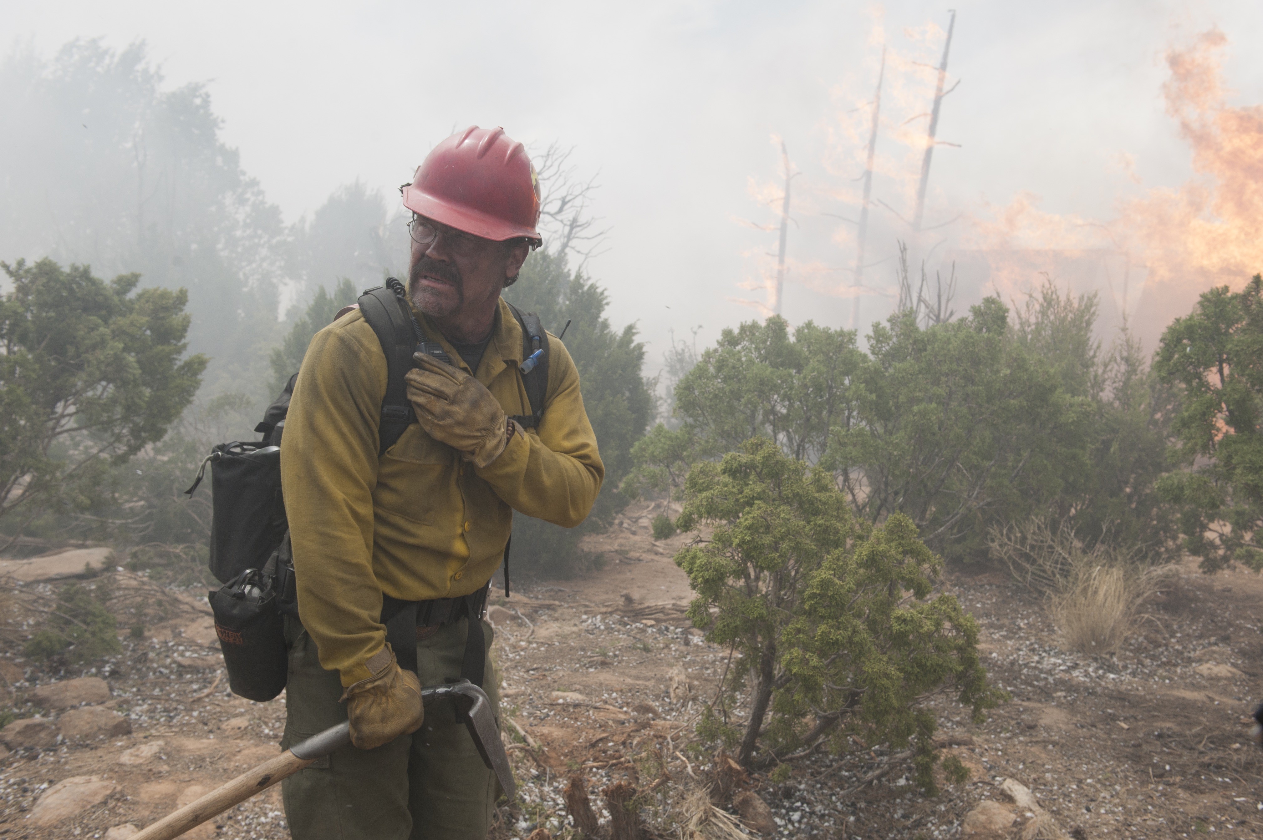
Josh Brolin starred in Hollywood's version of the Yarnell Hill Fire, Only the Brave.
Richard Foreman
He identified holes in supervision, planning and communications. Among them:
• The leadership transition was rushed, leading to a partial team.
• Removing the Hotshot crew's commander and assigning him command of a division.
• Lack of a safety officer.
• Bringing in a new incident commander hours before the deaths.
• Poor decision-making, including the inability to build firebreaks or communicate a strategy.
• No maps for firefighters.
• No incident plan for two days.
• A poor morning briefing.
• No analysis of the fire until three hours before the deaths.
• Failure for hotshots to report their movements.
Richard McCrea, a 32-year veteran of fire management with the U.S. Department of Interior wrote about the lessons from Yarnell last week in Wildfire Magazine.
He keyed on finding in the Arizona Division of Occupational Safety and Health report that came out after the fire, resulting in a $559,000 fine after finding the then Arizona State Forestry Division responsible for serious and willful safety violations. Specifically, he noted:
• Fire behavior exceeded all expectations of incident managers.
• State Forestry failed to implement a series of plans and safety assessments.
• Incident managers failed to acknowledge their efforts weren't working.
“The real story is YH (the Yarnell Hill Fire) was much like many other entrapments in the last 20 years and the mistakes made are nothing new. I might as well have been writing about the South Canyon Fire of 1994. Other reviews of entrapment fire during the last 20 years have pointed out many of the same deficiencies in team management and safety practices. Are we condemned to keep making the same mistakes far into the future?” McCrea said.
After the weather turned in the afternoon of June 30, 2013, the fire nearly doubled in size in one hour. At its worst, when it overran the Granite Mountain Hotshots, it moved at 15 miles per hour.
Some family members of the Granite Mountain Hotshots have sued for damages. The cases were dismissed but in one federal court document, the plaintiffs argued their case must continue in order to fill in the holes left by official reports, such as those released by ADOSH and by the Arizona Department of Forestry and Fire Management, then organized as the state forestry division.
“Allowing this matter to proceed to discovery could do significant public good as well by allowing the full story of what happened with the Yarnell Fire to become public knowledge to spur further changes to firefighting policy.
Key witnesses were not allowed by the federal government to be interviewed for the ADOSH investigation, and those witnesses’ comments were not referenced in the Forestry Division’s report," the plaintiffs' lawyers argued.
"These unanswered questions, compounded by redactions to reports and selective release of information and video footage, underscore the need to allow fair discovery in this matter.”
The families reached a settlement agreement when they sued in superior court. As a result of that agreement, the state offered to embark on reforms.
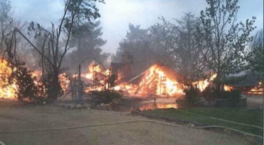
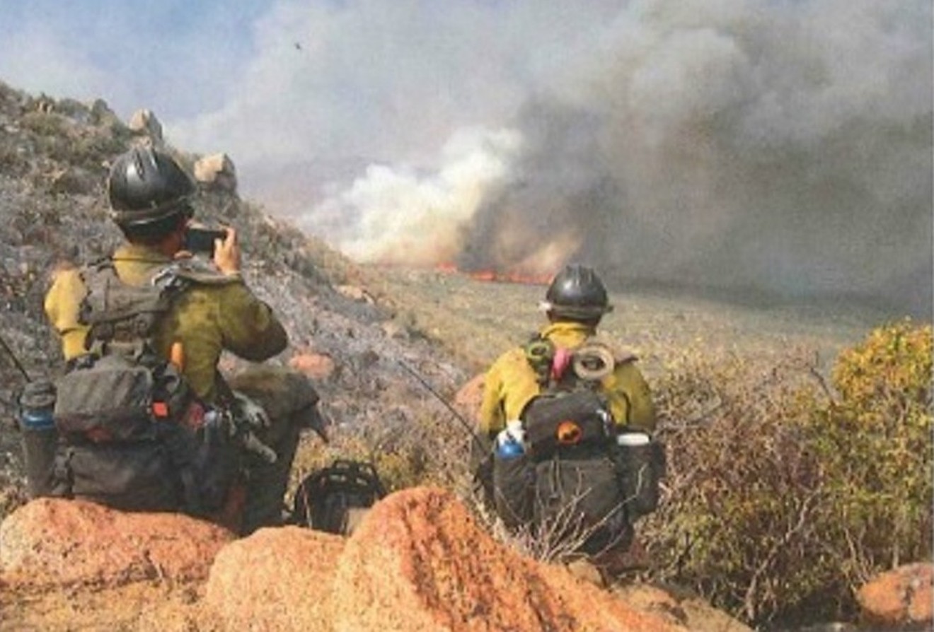
The north end of the Yarnell HIll Fire on June 30, 2013.
Arizona Division of Occupational Safety and Health
Based on those statistics, the state then rates each community for its fire risk.
According to data from the Arizona Forestry Department, of the 419 communities assessed, 195 are in the highest category for fire danger. Of those, 172 are not part of the Firewise program, which is managed by the National Fire Protection Association and helps communities with advice on protecting themselves against wildland fires. Overall, only 35 Arizona communities are registered with FIrewise.
The Forestry Department publishes a statewide map showing the risk. Based on it, its database of community rankings, and non-participation in Firewise, here are the five most threatened places in Arizona.
1. Pine Lake. This community of 138 people sits near Haulapai Mountain southeast of Kingman. There are 156 housing units, half of them vacant. Fire risk rating: 8.49. Fire threat level: 9 Extreme. Potential fire intensity: 4- to 12-foot flames, moderate to high.
2. Summerhaven. Nestled in the slopes of Mt. Lemon in the Santa Catalina Mountains above Tucson, this is home to 40 people and 259 housing units. Fewer than one in 10 are occupied. Fire risk rating: 8.33. Fire threat level: 9 Extreme. Potential fire intensity: 4- to 8-foot flames, moderate.
3. Six-Shooter Canyon. This town of 1,019 people sits just outside of Globe in Gila County. There are 469 homes there, of which more than three-quarters are occupied. Fire risk rating: 8.09. Fire threat level: 9 Extreme. Potential fire intensity: 4- to 8-foot flames, moderate.
4. R-C Boy Scout Ranch. The nearest community is Christopher Creek, just of State Route 260 in Gila County, where 156 people live. There are 388 housing units, of which two-thirds are vacant. Fire risk rating: 7.98. Fire threat level: 9 Extreme. Potential fire intensity: 4- to 12-foot flames, moderate to high.
5. Top of the World. The town in the mountains between Superior and Globe is home to 231 people. Of the 173 housing units there, almost three-quarters are occupied. Fire risk rating: 7.88. Fire threat level: 9 Extreme. Potential fire intensity: 4- to 8-foot flames, moderate.