
Cinyc Maps

Audio By Carbonatix
Ready to judge your neighbors?
Earlier this week, news organizations called Arizona’s Senate race, with Democrat Ruben Gallego handing MAGA Republican Kari Lake a second straight election loss. Now, thanks to online electoral map repository Cinyc Maps, you can see how your neighborhood voted in the race.
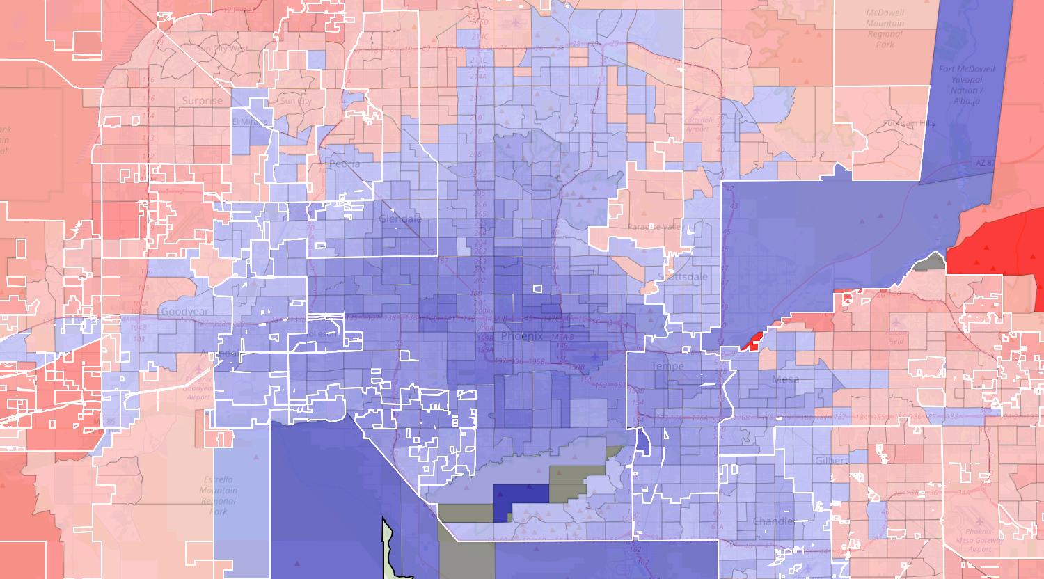
The bluer or redder the precinct, the more it went for Gallego or Lake, respectively.
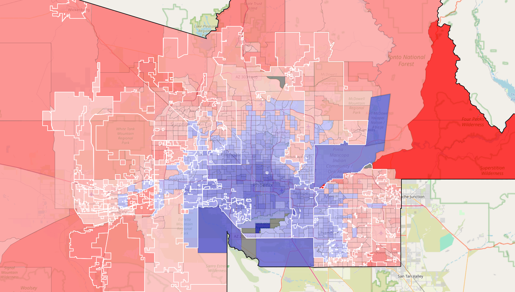
In Arizona’s Senate race in 2024, blue precincts went to Ruben Gallego while red ones went to Kari Lake.
Cinyc Maps
Maricopa County is what put Gallego over the top, and the map shows how he triumphed. In the center, a large blot of blue shows that Gallego dominated in the county’s most populous areas, including the vast majority of Phoenix, all of Tempe and large swaths of Mesa and Chandler. Even West Valley cities such as Glendale, Peoria and Goodyear leaned heavily toward Gallego.
Lake enjoyed majority support from the sparsely populated western parts of the county, East Valley cities such as Queen Creek and Fountain Hills, and wealthier northern areas such as North Phoenix and Scottsdale.
On Cinyc’s website, the map is interactive, allowing you to click specific precincts to see the exact voting breakdown. You can also view maps for other races — but not the presidential race — such as several of Arizona’s congressional races, mayoral races in Mesa and Scottsdale, and countywide races such as sheriff and recorder.
For instance, you can see how three prominent Republicans who won county positions – Rachel Mitchell (county attorney), Jerry Sheridan (sheriff) and Justin Heap (recorder) – won more of Chandler and north Phoenix than Lake did.
It’s a great way to kill some time – or, if you’d prefer your neighborhood be shaded differently, see where to move.