
Google Maps

Audio By Carbonatix
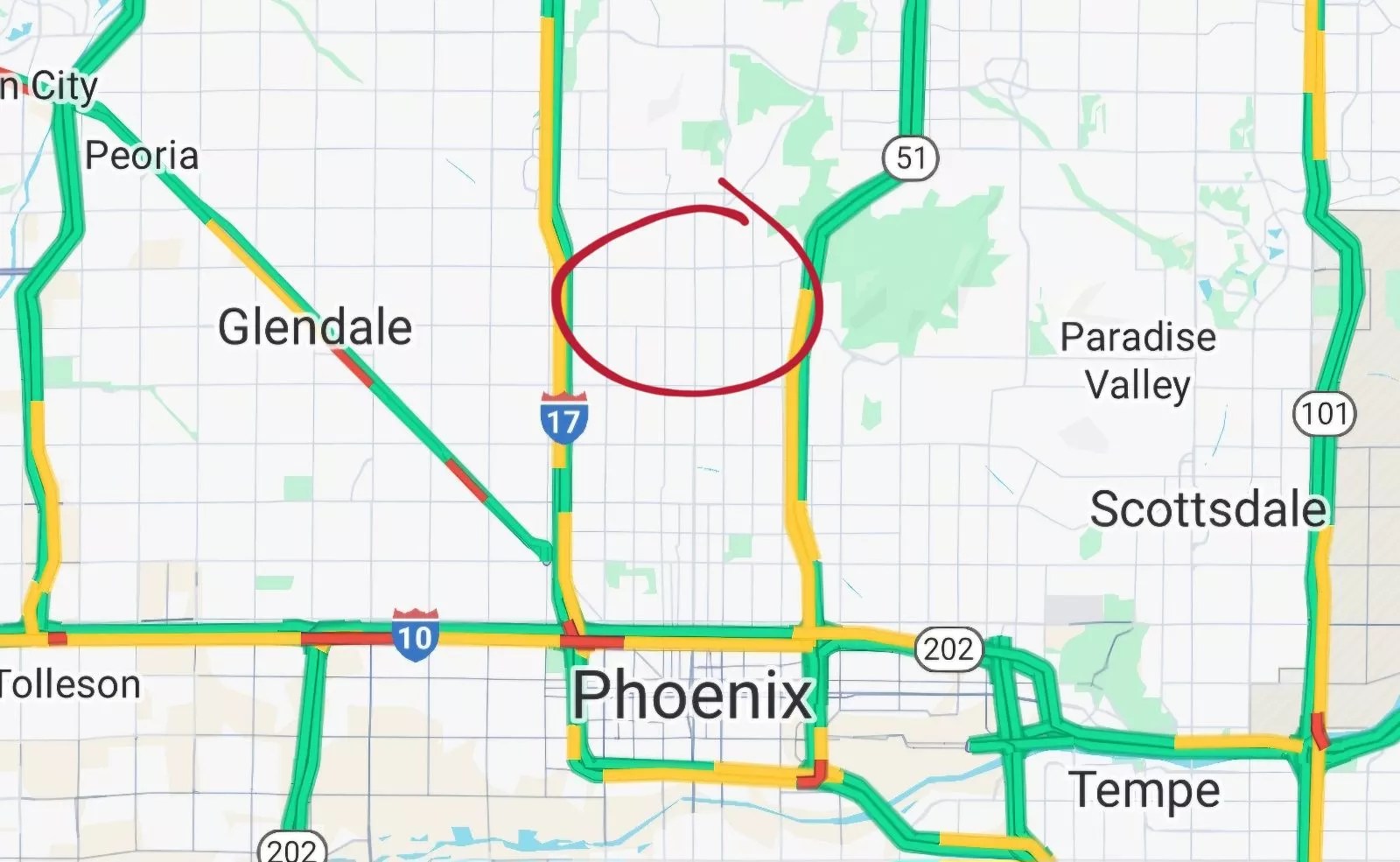
We all know how to define Central City. Maryvale. Deer Valley. Ahwatukee. These are clearly understood parts of Phoenix. But one area evades a simple definition.
That area is … well, it has no clear name. Its boundaries are Interstate 17 to the west and State Route 51 to the east. It runs from Bethany Home Road north to Dunlap Avenue.
That area is “noticeably different (from) its surrounding area,” as one Phoenix Redditor recently noted. “How it’s much more affluent and wealthy.”
But what is it called?
“Old money,” wrote one user.
“Greenville,” said another. “For (its) greenery and for how rich people are.”
But the most common answers included the words “North Central.”
“North Central Phoenix is what I’ve always called it,” said one Redditor. “It exists north of uptown and South of Sunnyslope.”
“North central corridor,” someone else suggested. Another said it was “North Central into Sunny Slope.”
Then discussion turned to another burning question: What does one call the area between 7th Street and 7th Avenue?
“You normally hear this area referred to as North Central Phoenix or ‘Between the 7’s,’ wrote one person. Another called it the “Central Corridor” because “that’s what my mother in law, who was born here and a real estate agent, has always called it.”
One user posted a map of Phoenix’s official “villages,” which divides the area into two zones. There’s a southern expanse called Alhambra and a northern region called North Mountain, with Northern Avenue serving as the border between them.
Those names may be official, but they weren’t satisfying. One user insisted that the Alhambra area is really Uptown. Another concurred, defining Uptown as “camelback to northern generally.”
The post, which went up last week, now has more than 300 comments, so don’t expect consensus any time soon. Anyway, as one person pointed out, what you call a place is less important than what it means to you.
“I call it,” one user wrote, “where I used to get high.”