
Abbee Day/Flickr/CC BY-NC-ND 2.0

Audio By Carbonatix
Independent Journalism in Phoenix Needs You
We need to raise $15,000 by August 9 to support the reporting our community depends on. Reader support keeps us independent and is playing a larger role in funding local journalism and shaping what comes next. If you believe independent local journalism matters, make a contribution today.
A rare “Super” El Niño is expected to hit the Pacific Ocean this fall, according to a National Oceanic and Atmospheric Administration update that found there’s a two in three chance that the weather pattern’s peak strength will be strong or very strong.
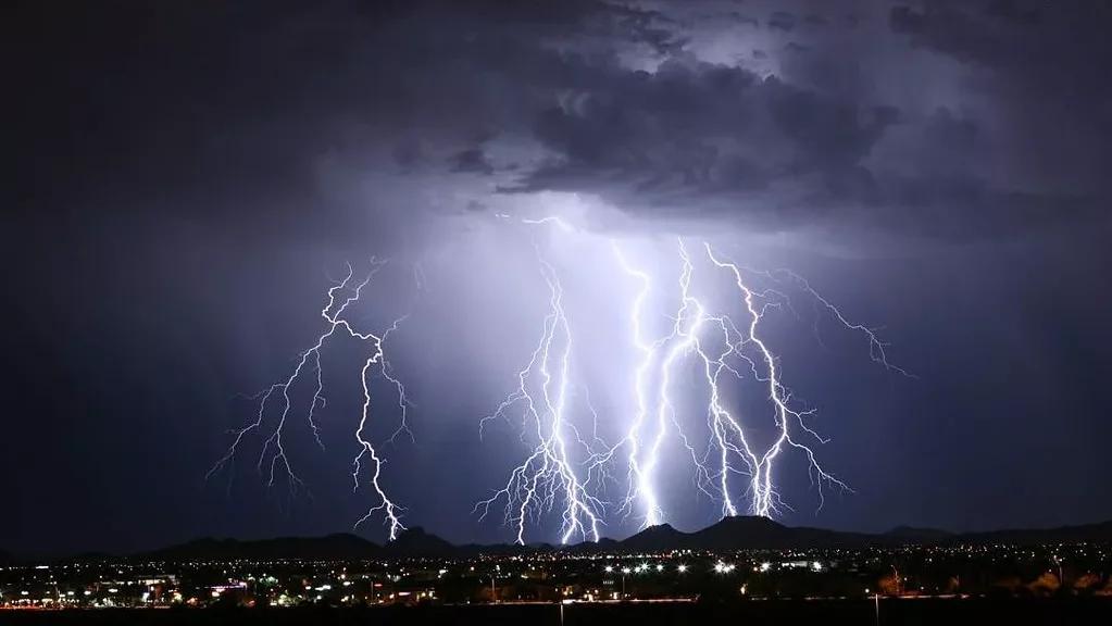
But what will that mean for Phoenix? According to National Weather Service meteorologist Gabriel Lojero, a super El Niño would likely mean a stronger monsoon season, bringing heavier rainfall and stronger thunderstorms to the Valley.
“Potentially that August to October time frame could be very active for us,” Lojero said, clarifying that NWS prefers the term “very strong” El Niño over “super” El Niño. “But everything is going to be dependent on how the overall pattern develops and how active of a monsoon that it turns out to be.”
What is El Niño?
El Niño is a natural climate phenomenon that occurs when ocean surface temperatures warm in the tropical Pacific, specifically in the central and eastern regions. The warming temperatures often cause hurricanes from late August through September. If these hurricanes form along the southwest coast of Mexico, they can bring heavier rainfall and stronger storms to the desert southwest as they track northward and inland.
Arizona’s monsoon season runs officially from June 15 to September 30, and a super El Niño could bring heavier storms and more “active conditions” in the back half of that season and into October, Lojero said. But just how active potential storms will be depends on activity in the eastern tropical Pacific.
“If we get the deep tropical moisture, that could be a recipe for more heavy rain-producing events, and thus the heightened risk of flash flooding,” Lojero said.
During last year’s monsoon, the eastern Arizona cities of Globe and Miami were hit especially hard by heavy rain and flash floods in late September, leaving at least three people dead. Under super El Niño conditions, storms could be even worse this year. Lojero recommended that residents have a plan in place in case of flash flooding, including evacuation routes, and advised against driving into flooded roadways.
Will Phoenix be cooler this summer?
Outside of intense storms, the El Niño could also bring cooler temperatures and increase humidity. While the correlation between temperature and El Niño isn’t as strong as that with rainfall, the phenomenon’s increased moisture could help mitigate Phoenix’s extreme heat. With temperatures cooled off by rain, Phoenix could see fewer triple-digit degree days, Lojero said. However, there’d be less relief at night, as increased humidity could limit the “amount of overnight cooling.”
The impacts of a super El Niño will also be seen beyond October. The system, which typically begins in the fall and continues into winter, could also bring wetter conditions through Phoenix’s winter months. A wetter winter would be a departure from the last couple of winters, which have been very dry.
“It’s way too early to speculate what next winter is going to bring,” Lojero said. “Historically speaking, usually when there are El Niño events, the winters tend to be a bit wetter than normal.”