
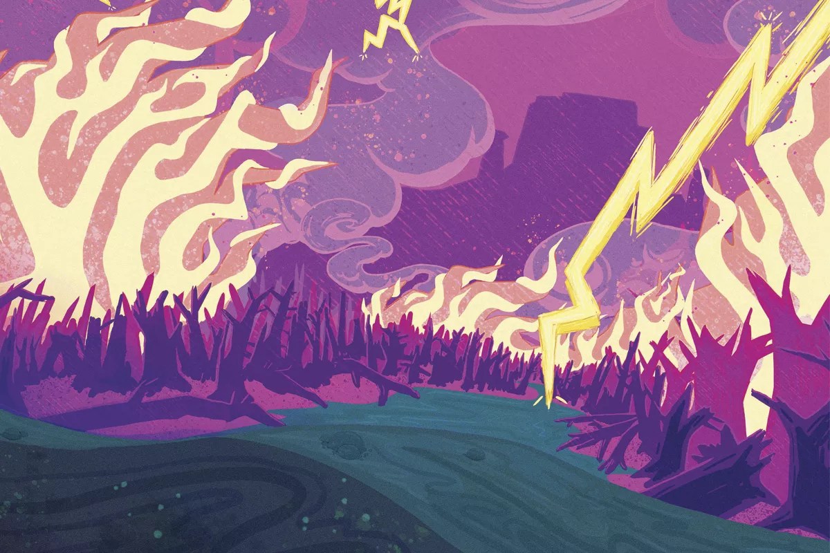
Illustration by Mandy Matthews

Audio By Carbonatix
This story is an updated version of a piece that originally ran July 11, 2019.
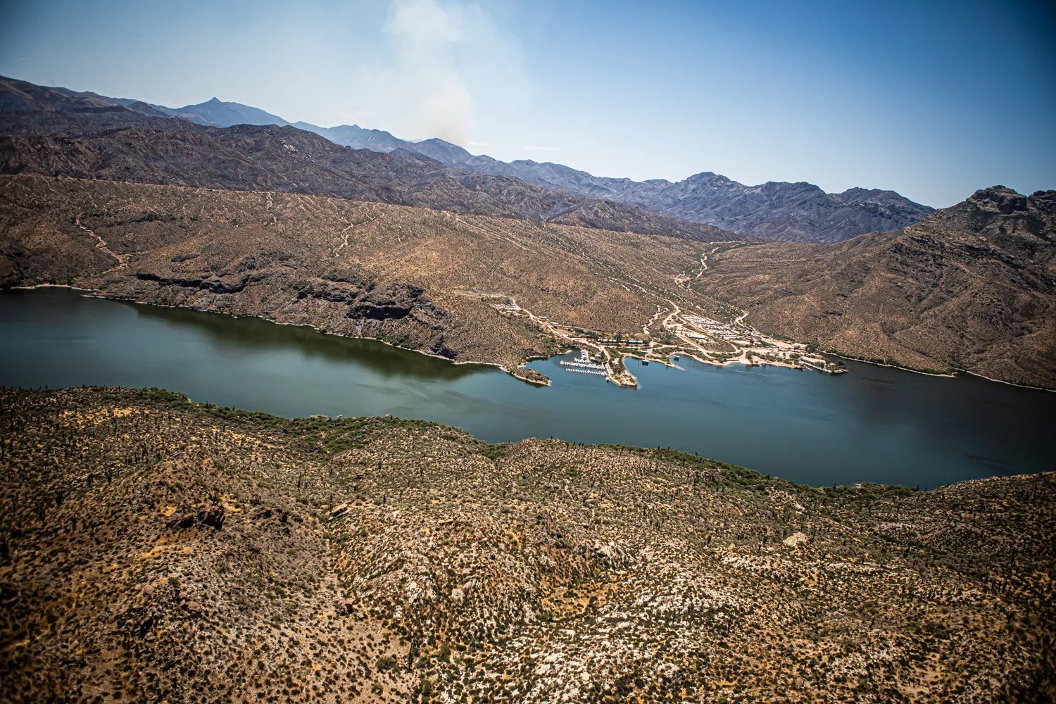
The southern bank of the Salt River rises out of Apache Lake in a palette of tans and browns dotted with green stubble. Partway up the slope, the summer desert hues stop abruptly at a horizontal fire line. Above it, the land converts to a purplish-black – summer desert, singed by wildfire.
The Woodbury Fire, which began in early June in the Superstition Mountains east of Phoenix, was fully contained as of July 16, when the U.S. Forest Service delivered its final update on the fire. No one died or was injured, although residents in a few areas were ordered to evacuate, and while the nearly 124,000-acre fire was large, it was not particularly intense, as wildfires go. The vast majority of it burned at a severity deemed low or very low.
But while the most-immediate threats died down with the fire, the lasting consequences have yet to set in. Around the Salt River, of particular concern are the potential combined impacts of monsoons and the lowland Woodbury Fire on the river system, which is an important supply of water for the Valley. Torrential rains from these summer storms could wash ash, soil, charred remnants of cacti and brush, and any number of other things out of the burnt watershed and into the water.
“That’s a very vulnerable time, after a fire,” said Sheila Murphy, a Denver-based research hydrologist with the U.S. Geological Survey. “In Arizona, you’ve really got to worry around monsoon season.”
The Woodbury Fire burns just south of Apache Lake on the Salt River on June 28, 2019.
Jim Louvau
The Salt River runs east to west, just north of the Superstitions and through the Tonto National Forest. It gathers in Roosevelt Lake, confined by a dam of the same name, before traveling through a series of reservoirs and dams that track north of State Route 88. A few miles south of the Fort McDowell Casino, it is joined by the Verde River; a few more miles downstream, those waters are diverted into canals to go to cities like Phoenix and Scottsdale, which treat it before distributing it to people, homes, and businesses. The more murky and contaminated the water, the more chemicals – and money – are needed to clean it up.
As of late July, scientists and water managers were in wait-and-see mode following the Woodbury Fire. Monsoons are unpredictable and highly localized, coming in columns of rain rather than blankets. Experts can use past experience to speculate, but no one knows how severe the water-quality problems following a monsoon could be. The Valley received its first monsoon in mid-July, and while those rains didn’t cause flash flooding into the Salt River system, water managers expected active monsoons starting at the end of July.
“We’re not entirely sure what Mother Nature’s going to do,” said Mike Ploughe, an environmental compliance scientist with the Salt River Project, which manages the water supply from the Salt and Verde rivers. The primary concerns about post-wildfire runoff have to do with organic materials – charred wood and other debris – and nutrients that could increase the turbidity of the water or fuel the growth of algae. But those outcomes depend on where the rain falls, and how heavily, he said.
In the short term, humans have little power to prevent potential devastation of the water supply. For example, the Museum Fire in Flagstaff, which began on July 21, one mile north of the city, quickly spread to nearly 2,000 acres. As of this writing, it was nearly contained. Local officials warned residents to prepare for flash flooding from monsoons, handing out free sandbags. SRP officials say the fire poses a greater threat to Flagstaff’s water supply than to the Verde watershed.
In the long run, wildfires pose an ever-greater threat to water quality, not to mention a danger to human life and the environment. Humans are responsible for these fires’ growing destructiveness. Last year, the U.S. government’s climate assessment noted that in the Southwest, climate change is increasing wildfires in a way that is “statistically different from natural variation,” and that among the risks of these changes are “post-wildfire effects on ecosystems and infrastructure.”
While their hands are tied in the immediate aftermath of a wildfire, water managers are trying to find ways – the kind of long-term effort and investment that takes years to pay off – to protect forests and the water that cycles through them.
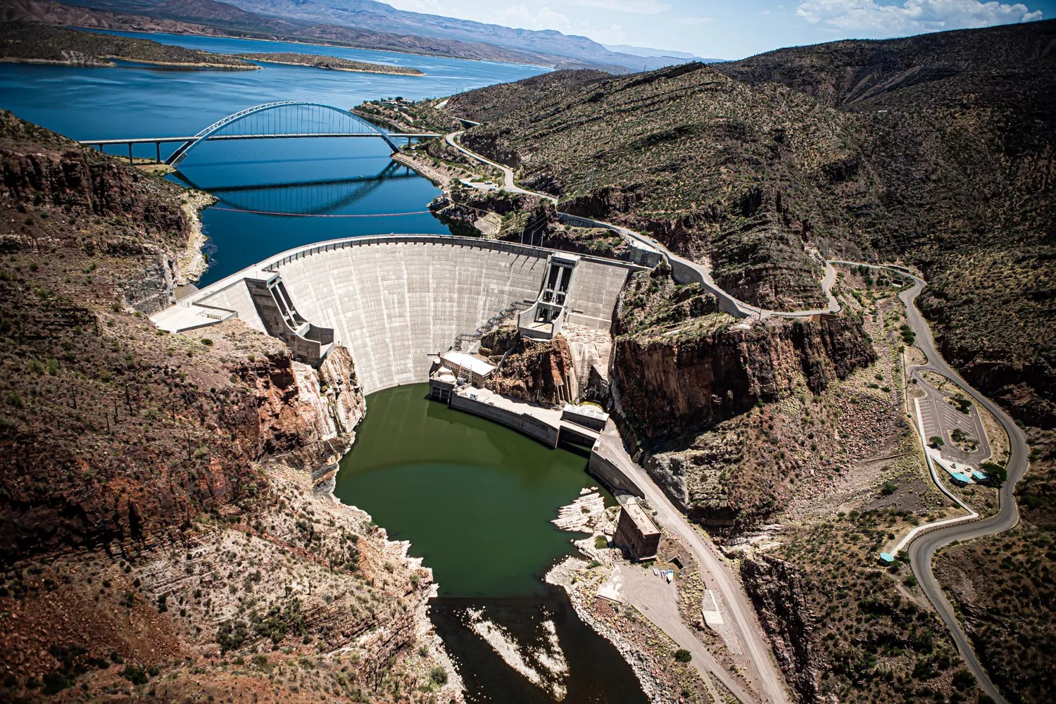
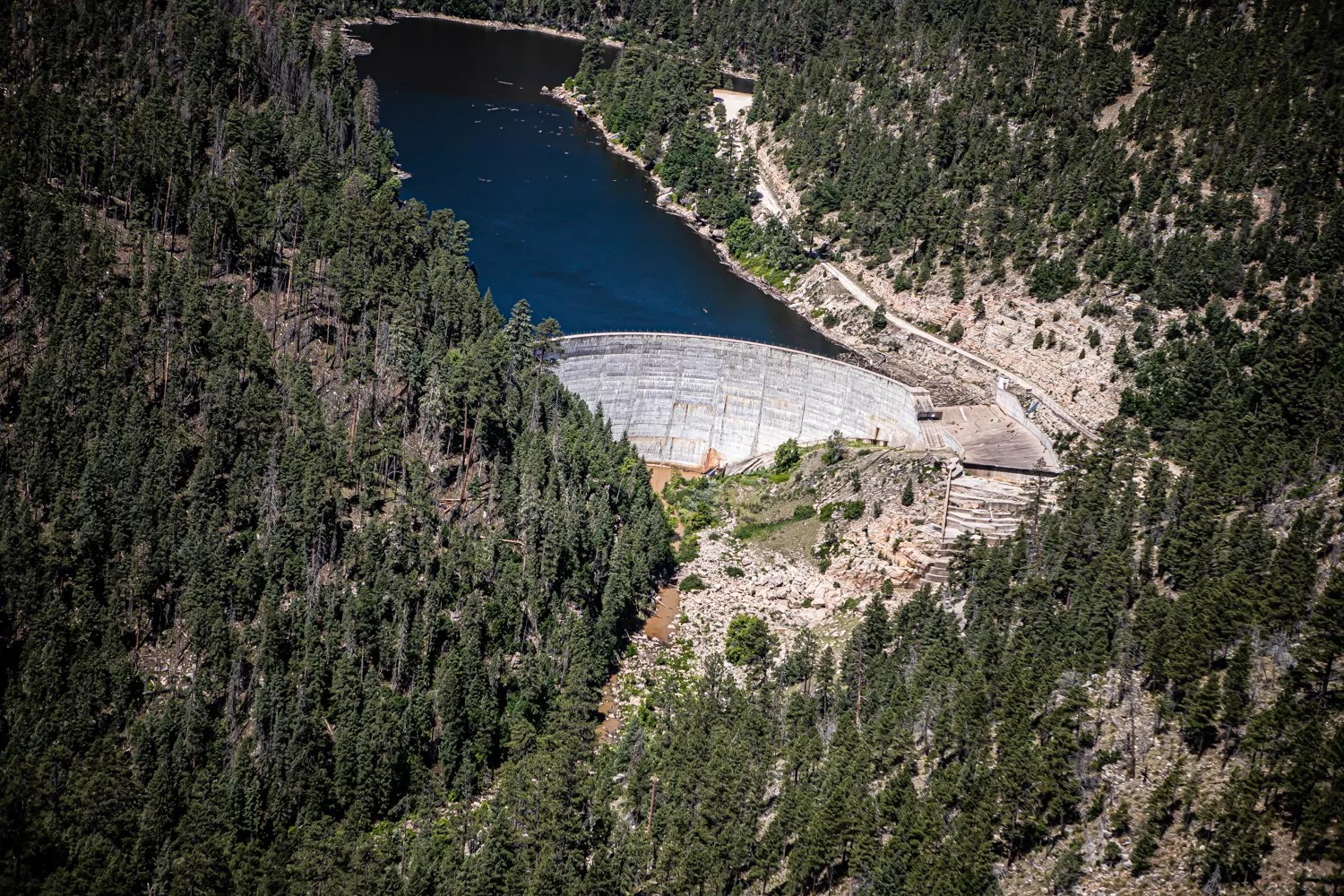
The Roosevelt Dam marks the start of a series of reservoirs and dams that make up the Salt River system.
Jim Louvau
Waiting for the Rains
Ploughe spent the morning of July 3 at Apache Lake, collecting samples of clear water to establish baseline levels of water quality before the monsoons hit. Apache Lake is the second-biggest reservoir on the Salt River, directly downstream from Roosevelt Lake, the largest. Downstream from Apache is Canyon Lake, followed by Saguaro.
“The whole system is clean right now,” Ploughe said, a few hours after returning from Apache Lake.
This summer is the first time SRP has taken samples rigorously from the smaller reservoirs below Roosevelt Lake, he added, and it is doing so because of the Woodbury Fire. Runoff from past wildfires farther north and east has typically emptied into Roosevelt Lake, which holds so much water that usually, contamination from wildfires is quickly diluted.
“In Arizona, you’ve really got to worry around monsoon season.” — Sheila Murphy
The Woodbury Fire is different. It burned at a low elevation, coming within a few miles or less of Apache and Canyon’s shorelines, and potential runoff from the burned area will likely empty into those lakes, which are much smaller than Roosevelt. Ploughe and his colleagues at SRP hope that the combined capacities of Apache, Canyon, and Saguaro lakes will be sufficient to water down any contamination, but they don’t know for sure. As a result, SRP plans to test those smaller lakes’ ability to handle runoff from the burned desert, which is unlike the forested areas that fires have consumed closer to Roosevelt.
“We really don’t know what kind of loading we’re going to get in the lakes. It’s a different kind of landscape that’s burned,” said Ploughe, naming grasses, desert brush, and cactus. “You don’t have the organic mass that you’d have in a ponderosa, pinyon-type forest,” he added.
Ploughe expected to see at least some changes in turbidity in the smaller reservoirs downstream from Roosevelt. How long those changes will take – a few days, a week, longer – also remains to be seen, as they depend on where the rain falls, and how much. If a light rain hits a small area of the burned watershed, the reservoirs might be affected minimally. If monsoon rains are heavier and more widespread, the consequences are likely to be greater.
Luckily, Ploughe pointed out, the Woodbury Fire was primarily in a wilderness area. It has not been heavily mined or otherwise touched by industrial activities, and hazardous chemicals are unlikely to enter the water supply. “I don’t foresee a real issue there,” Ploughe said.
Above Roosevelt Lake, the fireline of the Woodbury Fire is visible.
Jim Louvau
About 80 to 85 percent of the Woodbury Fire fell within the Salt River’s watershed, the area from which water runs off the land and into the river. The fire itself constituted only about 3 percent of the watershed, according to Charlie Ester, surface water resources manager for SRP.
Ester was hopeful that once the monsoons arrive, the Woodbury Fire would not prove too destructive. He cited several reasons.
The hotter a fire, the more hydrophobic the soil becomes, and the more rain it will repel. It becomes a slide instead of a sponge, sending silt and sediment gushing downhill rather than absorbing water as it falls. But when fires burn at a low severity, only 10 to 30 percent of the ground cover is burned, and the earth is less hydrophobic, according to the U.S. Forest Service. In other words, the ground is more likely to absorb water than it would after a searingly hot blaze.
Most of the Woodbury Fire maintained a relatively low intensity – 75 percent was either low, very low, or unburned – in part because there wasn’t much desert vegetation to burn. If the soil wasn’t too hydrophobic, according to Ester, the runoff might not overwhelm the reservoirs with gunk.
The Forest-Water-Fire Connection
Scientists still understand relatively little about the mechanisms linking wildfires and water quality, but they do know that in watersheds, healthy forests and ecosystems are crucial.
“Forests are both a filter and a sponge,” said Murphy, the USGS hydrologist. Forests soak up water and allow it to strain slowly into streams and waterways. When wildfires tear through, burning brush and vegetation, they hamper the forest’s ability to absorb and process the rain that falls afterward.
Little research existed when she started in the field about a decade ago, Murphy said. Since then, the science has developed, but many questions remain unanswered.
“We need to better understand the process in different areas of the country and different land covers,” Murphy said.
Those factors include the timing and type of precipitation, the location, land cover (trees, brush, cacti, and other plants and growth), the slope of the land, and previous land uses. Murphy said she is trying to study weather patterns that impair water quality after wildfires.
One study that Murphy led, published in 2015, found that the most substantial changes to water quality in one post-wildfire area in Colorado came after intense rainfall. That study also concluded that wildfires can affect water quality in the surrounding area for years.
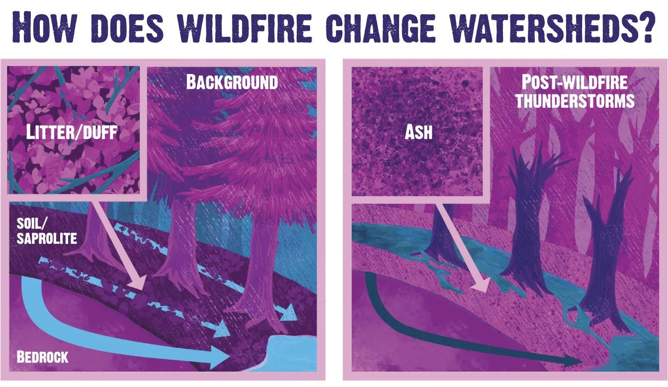
An illustration adapted from a diagram in one of Murphy’s studies shows how wildfires change the relationship between the ground and water.
Illustration by Mandy Matthews
A Shock to the System
In Arizona, severe wildfires have, in the past, temporarily rocked the Salt River water system.
In May 2012, the Sunflower Fire crackled through about 17,500 acres of the Tonto National Forest. Subsequent rains sent charred debris down Sycamore Creek, which feeds into the Verde River, which in turn converges with the Salt River below the reservoirs. The location of the fire and confluence of the Verde with the Salt River meant that the char-riddled water went straight into the canals.
“I remember, after the Sunflower Fire, the turbidity levels were just astronomical,” Ester said. The water was so murky that SRP had to take water from the Central Arizona Project, which brings Colorado River water to central Arizona, in order to dilute it.
Scottsdale operates the municipal water treatment plant that is first in line to receive water from an SRP canal. Brian Biesemeyer, the director of Scottsdale Water, said that after the Sunflower Fire, the plant had to shut down because the water contained too much organic material to be treatable.
That was one of two times that wildfires forced the plant to close, Biesemeyer recalled. The other followed the 2011 Wallow Fire, which scorched more than 522,000 acres in Arizona.
Scottsdale doesn’t receive all of its water from SRP; it also gets water from the Central Arizona Project and from groundwater, so on the rare occasion that it can’t take water from the Salt and Verde system, it relies more heavily on those other sources.
But when it can treat water that contains organic materials from wildfire runoff, the treatment is more complicated. It also costs more, in part because the city has to add more chemicals to remove extra carbon or excess silt.
“Those costs are passed on to the customers, and I don’t have any specifics on how much that is,” Biesemeyer said.
The C.C. Cragin Dam, on the Mogollon Rim, was built in 1965 by Phelps Dodge. Today, the Salt River Project operates it.
Jim Louvau
Back to the Forest
Biesemeyer, Ester, and Ploughe, along with others involved in managing the Valley’s precious water supplies, can do little about the Woodbury Fire and monsoons. But they say they’ve come to recognize the importance of healthy forests for water quality. They’ve begun chipping in to bolster forest management and restoration activities, which they hope will help mitigate the impact of wildfires on surrounding watersheds.
Scottsdale Water gives $50,000 a year to the Northern Arizona Forest Fund, Biesemeyer said. SRP, meanwhile, partners with the affiliated National Forest Foundation, the U.S. Forest Service, the Arizona Forestry Department, and other groups to thin and restore forests in northern Arizona. But those efforts are still in the early stages.
In 2013, SRP also began monitoring precipitation and stream flow in its watershed areas, using cameras and other tools to track changes in water flows, especially as forest restoration efforts take root.
Lee Ester – elder brother to Charlie, and SRP’s water measurement chief – is in charge of that project. He said that in areas devastated by especially fierce wildfires, like the 2002 Rodeo-Chediski Fire, the watershed is still recovering.
“They were really hot fires. There’s almost no tree life remaining,” he said. “So, it’s not really understood, at least at SRP’s level, what the recovery level of that watershed will be. Certainly a very long time.”