

Audio By Carbonatix
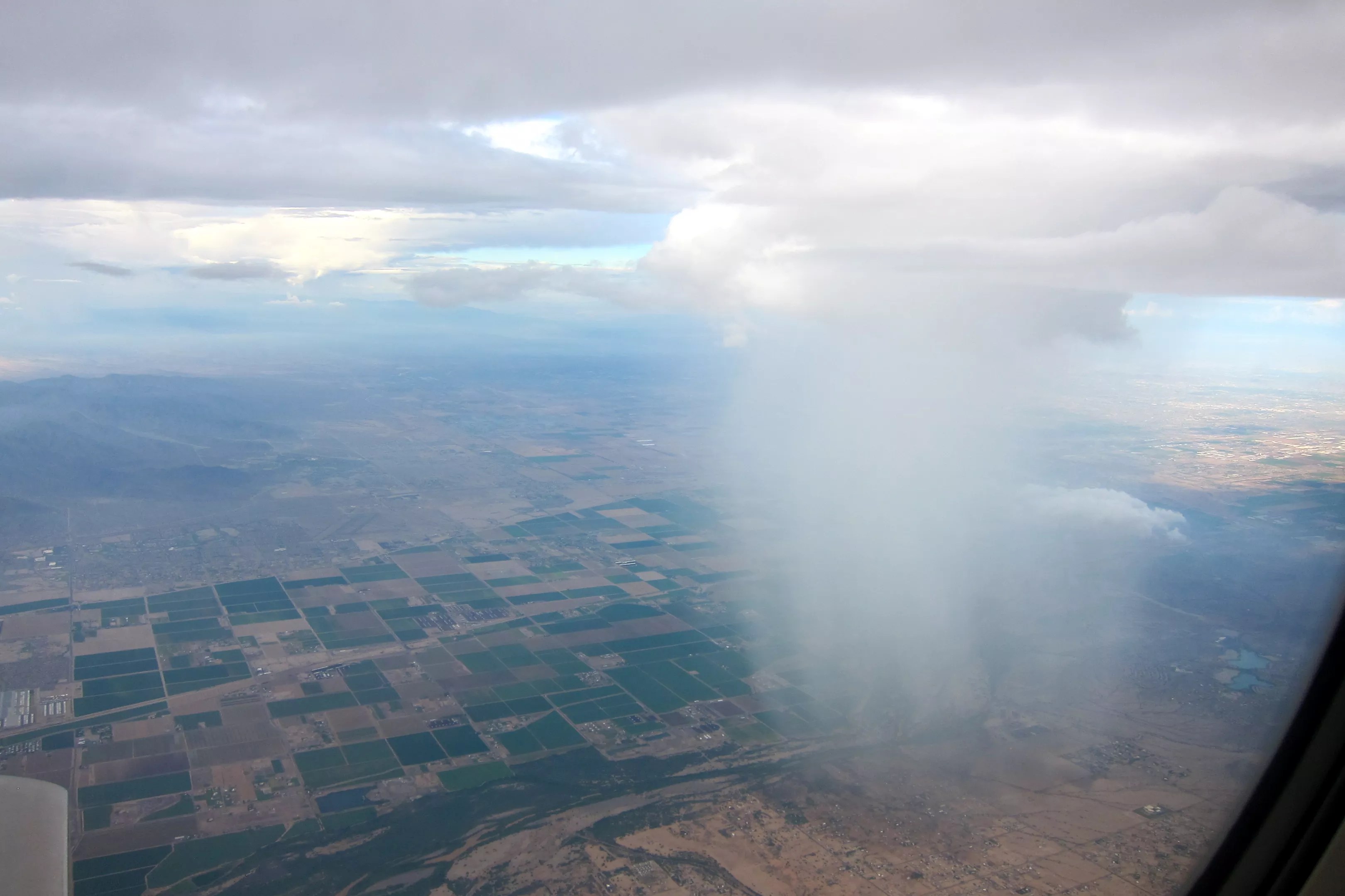
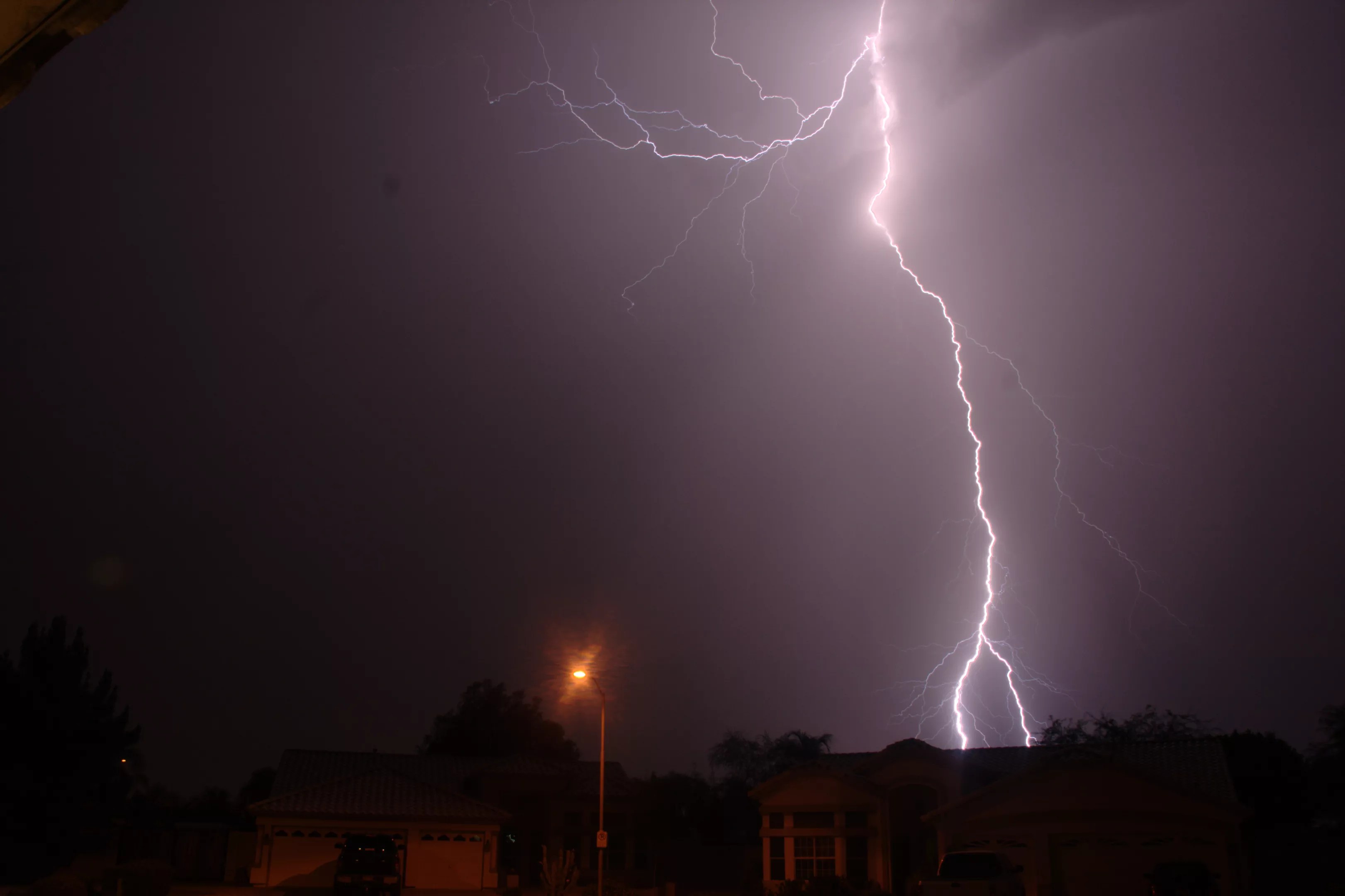
The much-anticipated first monsoon of the season hit Phoenix Monday night, whipping droplets of rain through the air and scattering strips of palm fronds and other debris around the roads. Lightning streaked brilliantly across the sky.
These stunning displays of nature are also destructive. More than 14,000 people in the Valley lost power because of Monday’s storm. Monsoons stir up dust that can cause car crashes. They can spur deadly flash floods.
These kinds of storms are growing more intense in Arizona and elsewhere in the southwest United States and northwest Mexico, according to new research by scientists based in Tucson. The storms also are becoming more frequent, they found.
The reason? You guessed it: climate change. Warming temperatures mean more evaporation, which means more precipitation. Precisely how serious these storms could become, though, remains an open question.
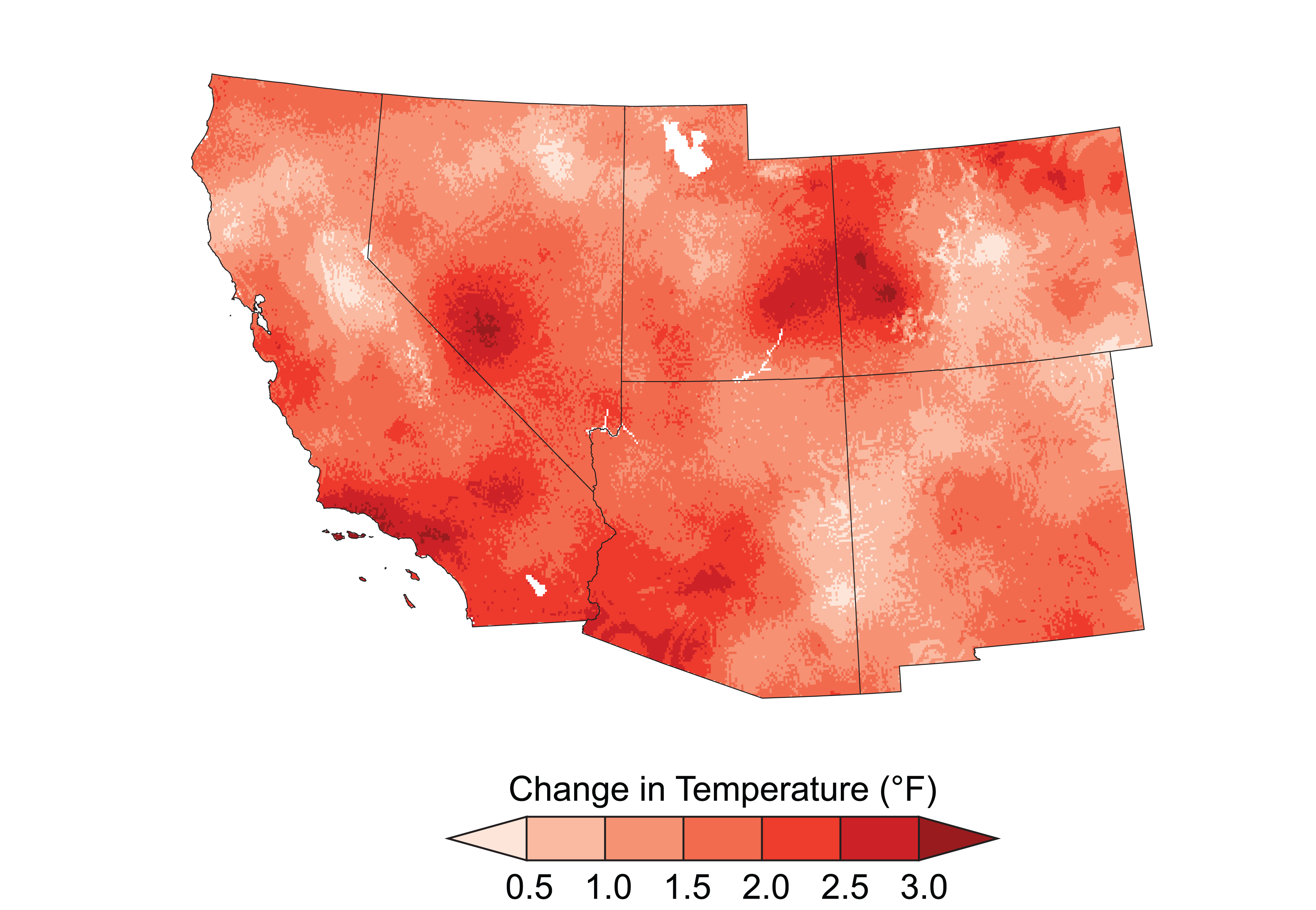
A map shows the differences in average temperatures between the period 1901 to 1960 and 1986 to 2016.
The team of six scientists, who are affiliated with the research arm of the U.S. Department of Agriculture and the University of Arizona, used decades of data from 59 rain gauges in a small swath of southeastern Arizona. The data showed that since the 1970s, monsoon rains have become more intense, dropping 6 to 11 percent more rain even though they last the same amount of time.
Those gauges are concentrated in the Walnut Gulch Experimental Watershed, an area of 57.5 square miles in southeastern Arizona, but the results likely hold true elsewhere in this part of the country.
“I’d say it’s applicable to – and this is a lot of the Southwest – where more than 50 percent of annual rainfall is derived from the summer monsoon thunderstorms,” said Dave Goodrich, a research hydraulic engineer with the USDA who worked on the study, which was published in the May edition of the scientific journal Geophysical Research Letters.
In the past, climate models and other data sets have not been able to show the changing intensity of these storms, because they’re too low-resolution – geographically and temporally – to capture detailed information about highly localized storms that are often finished in an hour.
“You get these very isolated columns of rainfall. You can’t see through these things, but on either side, it’s clear,” Goodrich said. “So you need a very dense rain gauge network to fully capture these localized storms.”
Rainfall gauges that are checked daily, for example, can’t tell you if the day’s rain fell over the course of an hour or 12. Models that use grids of several square miles can’t show precisely where the rain fell.
But the closely set gauges in the Walnut Gulch Experimental Watershed, which the USDA’s Agricultural Research Service began installing in the 1950s and had up and running by 1961, are each less than a mile apart. They capture data at one-minute intervals that can be clustered into longer periods of time.
When researchers looked at that data over time, they were able to discern the trends in increased intensity. Their findings help flesh out broader warnings that higher temperatures lead to projected increases in extreme summer precipitation, like monsoons.
“This is really the one mechanism that helps explain why you get higher-intensity rains,” said Goodrich. “You can hold more water vapor in [a hotter] atmosphere, so when storms are triggered, you can release a lot more water.”
Climate change models have projected that monsoon rains will become more intense in the American Southwest; the new study validated those projections with data.
The average annual temperature across the Southwest increased 1.6 degrees Fahrenheit from 1990 to 2016, according to the 2018 National Climate Assessment. That report pointed out that infrastructure is at risk of being damaged or failing completely in these storms. In 2014, it noted, flooding from monsoons shut down key streets and highways in Phoenix because pumping stations stopped working.
“Climate change has already altered the likelihood and intensity of some extreme events,” the report said, “and there is emerging evidence that many types of extreme events will increase in intensity, duration, and frequency in the future.”
In the Southwest, with monsoon rains accounting for the majority of the rainfall that the region receives, any changes to that rainfall are extremely important, not just for delicate ecosystems but for humans and the cities and communities they live in.
According to Goodrich, the biggest potential problems stemming from more intense monsoon rainfalls have to do with erosion and infrastructure.
Erosion primarily happens during intense storms, he explained. If monsoon rains get stronger, some people will need to do more to protect the soil and reduce erosion. For instance, they could take steps such as repairing buffer strips, increasing no-till farming, or improving ground cover to help keep the soil in place.
With infrastructure, planners tend to size vital structures like bridges and culverts using storms based on historical and current data. If they don’t take into account the trends that Goodrich and his colleagues have uncovered, they could build infrastructure that fails too soon, Goodrich worried.
It’s monsoon season.
“If you’re designing a bridge with, say, a 50-year life span, and you design it with current and historical data, and these trends of increasing intensity keep going up, you’ll under-design your system,” he said. “In 20 or 30 years, it may just get washed out.”
Although the rains were more intense and more frequent, they did not appear to be larger, the researchers found. They said that their work highlighted the need for more data-heavy research into the environmental impacts of climate change – not just monsoons.
Last year’s National Climate Assessment pointed to the dangers and expenses of more extreme weather events. Predicting the specific changes these storms will bring is “a challenge,” it said.
In other words, we know that these events are getting worse and more dangerous. We just aren’t able to forecast precisely how bad they’ll be.
“Global and regional models still can’t resolve and predict very well these isolated thunderstorms,” Goodrich said. “If you want to make a prediction into the future to say, ‘What are storms going to look like in 50 years?’ we can’t have much confidence in what those storms might look like.”
He added, “The models are quite good at temperature, but they still have a long, long, long way to go in terms of rainfall.”