As much as we love the Valley, we wish its founding fathers had seen fit to plant more curves in the roads. To find that long and winding road, it's best to leave town, of course — go to Bartlett Lake or Tortilla Flat. Takes hours to do that, though. We often need something to enjoy just for an hour or so after a slice of pepperoni. And that's where this ride comes in. From Tempe Marketplace we head west on Rio Salado Parkway, a twisty, divided road that's lit well at night. We take that to the Mill Avenue bridge — always an extra pleasure at sunset. From there, up the hill north on Galvin Parkway, which has nice curves, desert views and a perky roundabout. Keeping on 64th Street to Indian School Road we head west to find the only non-linear section on that road between there and Litchfield Park. Our short ride turns north again on 44th Street, with a right on McDonald Drive, which is straight but has roller-coaster dips that sweeten the view of Camelback Mountain. Leave your helmet on in case of photo-radar trucks on this section. When you get to Scottsdale Road, it's back to Straightsville.

Best Weekend Run
Paradise Valley Hills
With the exception of the two to three hottest months of the summer, Phoenix is a great city for outdoor activity. You can hike Camelback, South Mountain, the Mountain Preserve, or any number of other local trails. But for you runners out there, Phoenix can pose some problems. First, you have to contend with traffic, and then there's the distinct lack of hills to run on. If you're a runner in need of some hills, our favorite place to get away from the monotony of the flat, zero-grade streets is Paradise Valley.
A handful of other runners, and particularly bikers, usually find a place to park in one of the isolated residential areas near Paradise Valley Country Club (try somewhere near 54th Street), then hit the pavement. It's best to head up around Desert Vista and eventually down to Desert Fairways Drive, which will lead you to Camelback Resort and Spa, where you can get a drink of water and use the bathroom if you want.
Best Hiking Trail
National Trail, South Mountain
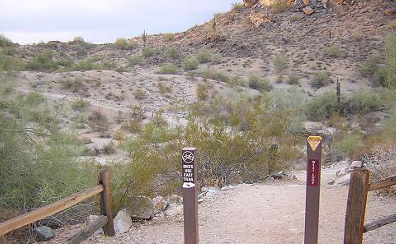
You'll get your bellyfull of dusty paths, rocks, and cactus on this 15-mile trail in prime Sonoran Desert real estate. Hiking all of National Trail — from one end of the 16,000-acre South Mountain Park to the other — is a Valley adventure not to be underestimated. Don't under-hydrate or hesitate to snack. And bring two cars unless you really want to walk 30 miles. Shuttle it between Pima Canyon on the east end and San Juan Road on the west (we recommend Pima because San Juan Road is sometimes open only for bicycles or pedestrians). Following the trail's a cinch, thanks to the frequent signs. You'll top out at Buena Vista Lookout, at about 2,700 feet, before dropping back down to the foothills. When you can't see the city below, you won't believe you're in one. You can take your mountain bike, but going on foot offers both a workout and a fuller sense of the desert's beauty. Sometimes, all you can hear is the muted crush of your own footsteps – and the yipping of a coyote over the next hill.
- 9904 S. 48th St., Ahwatukee, 85044 Map
- www.phoenix.gov/parks/trails/locations/south/
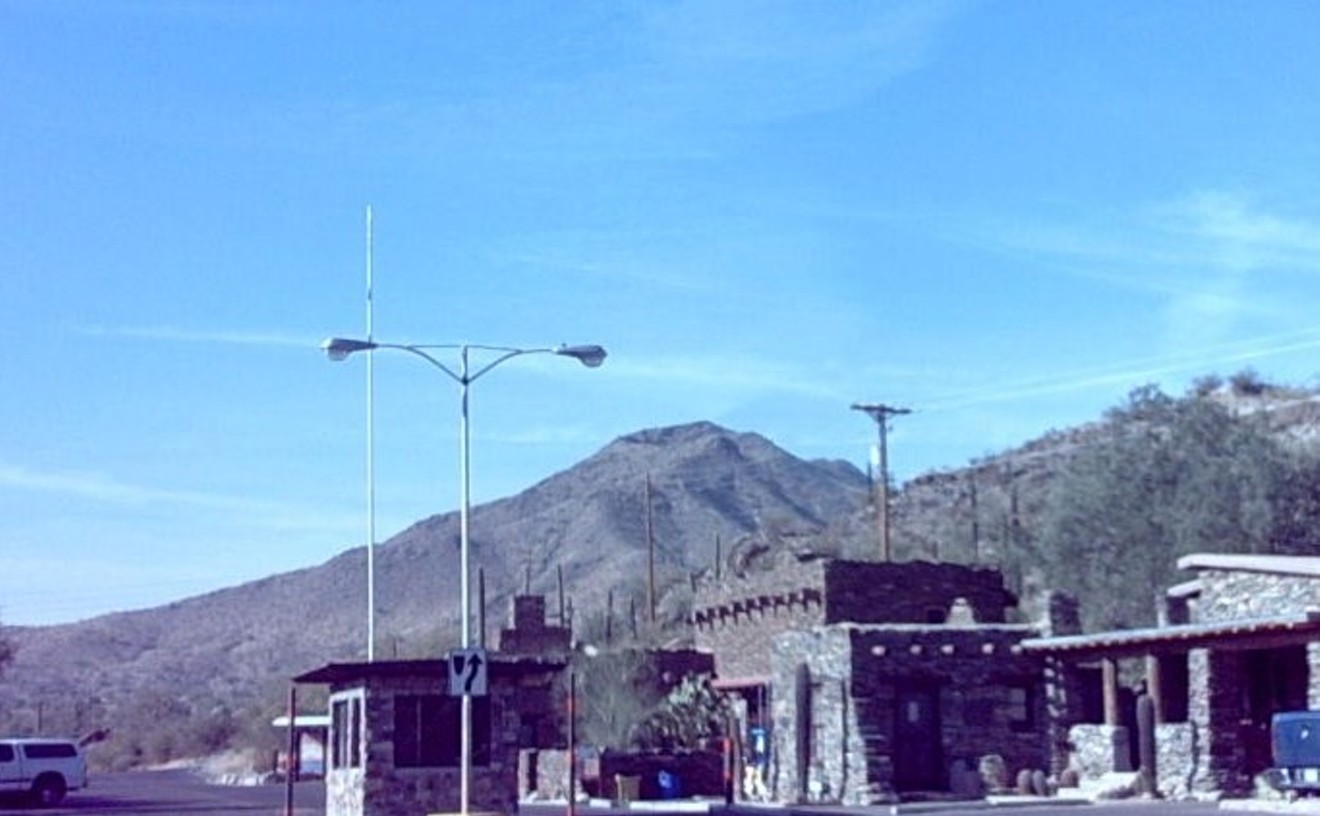
Best Winter Hike
Hunter Trail, Picacho Peak

Picacho Peak re-opened to the public on September 15, having been closed for the second time in two years for what state officials call the "summer season." Besides the decent camping facilities and yearly Civil War battle re-enactment at the site, Picacho's premier attraction is the spectacular Hunter Trail, which goes up to the precipitous summit. It's a four-mile-round-trip butt-kicker, harkening to the likes of Camelback Mountain and Piestewa Peak. Steel cables and planks help nervous hikers overcome the steepest parts, and the 360-degree view at the top of the surrounding desert and nearby mountains is well worth the effort. Problem is, only the buzzards saw that view during the closure, which ran from May 25 to September 14. Remember all that talk about state parks possibly closing due to the state's money problems? Almost all those other parks got to stay open all year. But the state is apparently hell-bent on doing these seasonal closures at Picacho Peak every year from now on, even though statistics show that thousands of people had been visiting the park during the May-September season. (Only one other park, Oracle State Park near Tucson, is also having part-time closures.) Picacho Peak is an easy, one-hour drive down Interstate 10 — better do it while you can.
- off Interstate 10 exit 219, Picacho, 85241 Map
- 520-466-3183
- www.azstateparks.com/Parks/PIPE/index.html
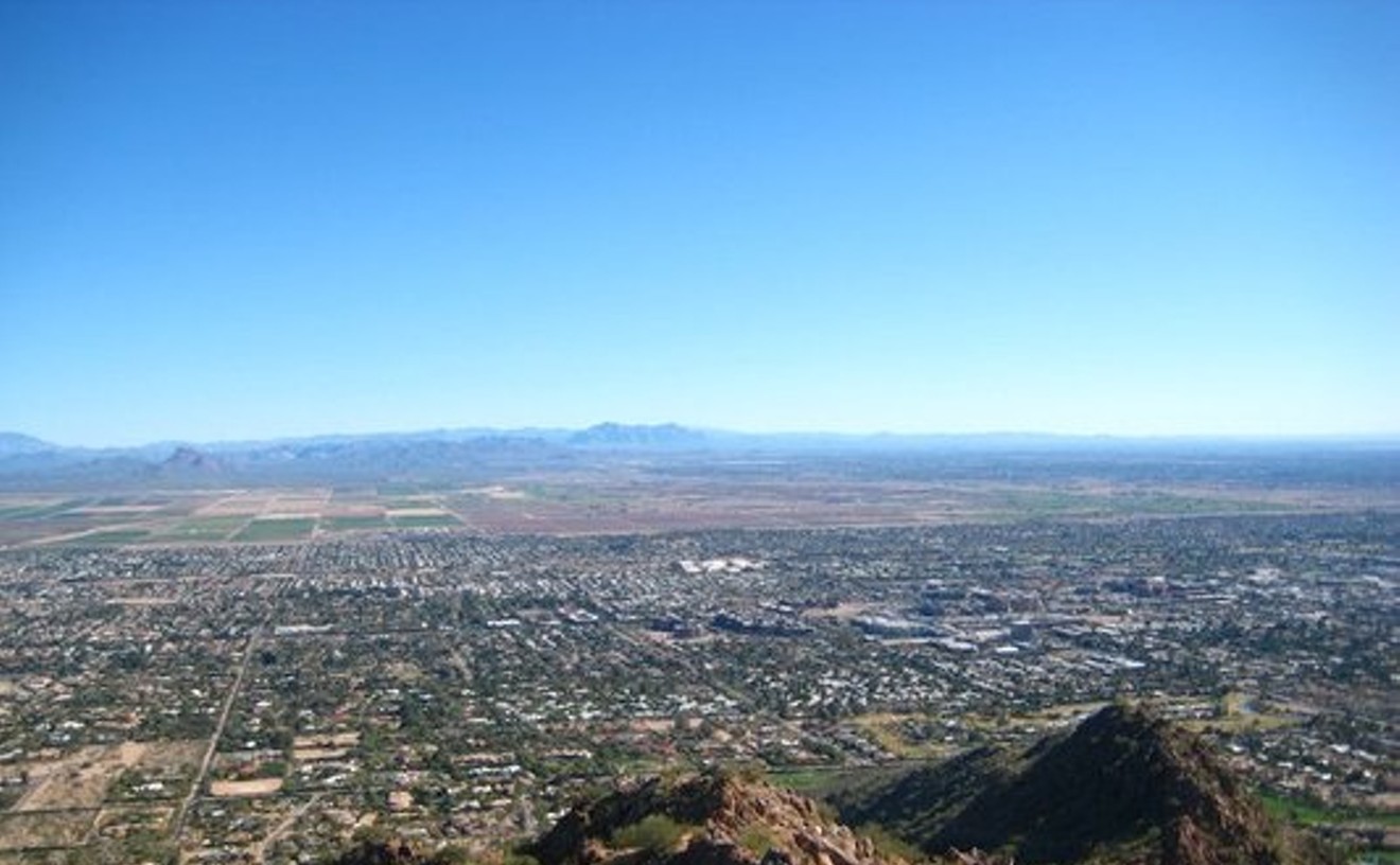
Best Fitness Hike
Piestewa Peak

It's not just the exercise our friends enjoy on our summer evening slogs up Piestewa Peak; it's the "camaraderie in pain." Indeed, we always suffer going up this one, at least a little. And that's the point. The long, rocky staircase leading to the 2,608-foot summit offers a phenomenal workout because of its stiff grade, ascending about 1,200 feet in 1.2 miles. Indeed, our heart's pounding from the very first steps at the trail head. Get to the top and you can scratch "exercise" from your daily goal list. Do it two or three times a week and you'll be ready for some serious adventure in the mountains — or at least have more energy for pushing a stroller through the mall.
- 2701 E. Squaw Peak Dr., Phoenix, 85016 Map
- 602-262-7901
- www.phoenix.gov/PARKS/hikephx.html
Best Tough Hike
Tom's Thumb

Built in 2009, the trail from the Gateway Access trailhead to the base of Tom's Thumb in the McDowell Mountains in Scottsdale is truly upscale. We're not just talking about the multimillion-dollar trailhead facility off Thompson Peak Parkway, a resort-worthy piece of architecture with shaded breezeways and a neat, rusted-steel low bridge that leads to several trails. "Up" is the essence of this long, steep hike. You'll have gone about six miles and gained about 2,100 feet of elevation if you take the "Rock Climbing Access Route" to the base of the Thumb, a 150-foot-tall, somewhat cylinder-shaped granite prominence. We didn't dawdle, but the trip still took about four hours. You can also turn around at the top of the Tom's Thumb trail, making it a nine-mile round trip. Either, way, make sure you bring enough water and a snack to sustain you. One bonus in the summer: The steep slopes of the mountain's west side enjoy shade well after dawn, making at least half the hike pleasant even when the afternoon is slated for 115 degrees.
- Thompson Peak Parkway between Bell Road and Legacy Blvd., Scottsdale, 85259 Map
- www.mcdowellsonoran.org
Best Scramble Hike
Cholla Trail, Camelback Mountain
Usually, we're with those Echo Canyon snobs who sneer at the wimps coming up the easier Cholla side. But this year, we've rediscovered the pleasures of Cholla Trail on Camelback Mountain — especially the killer scramble up the last fifth of the 1.75-mile hike to the summit. If you enjoy a hands-on hike like we do, this trail will make you smile in between grunts of effort. On Camelback, both the main trails offer terrific vistas, good people-watching, and a heart-pounding workout with a climb of more than 1,000 feet. Most of the Cholla Trail has lesser grades than the Echo Canyon Trail, but that changes near the top. Suddenly, the options for rock-crawling open up, allowing hikers to spread out and choose their own paths. Spray-painted blue dots on the boulders help guide the way, but you don't have to follow them. When a bottleneck of hikers slows your momentum, look for another semi-vertical surface to jump on. A committed scrambler can find numerous, alternate paths up that require the use of handholds, yet aren't exposed enough to necessitate breaking out a climbing rope. Since the mountain is centrally located, you'll still have plenty of day left after all that monkeying around.
- 6200 E. Cholla Way, Scottsdale, 85254 Map
- www.phoenix.gov/recreation/rec/parks/preserves/locations/camelback/cholla/index.html
Best Bouldering
South Mountain
At the end of a dirt road in South Mountain's Pima Canyon Entrance, tucked away in a quiet desert arroyo full of mesquite and cactus, you'll find a collection of boulders with names. These are the gems of South Mountain bouldering, a type of low-vertical climbing activity that usually involves rock shoes and a chalk bag but no rope. On nice days, you're likely to find climbers scampering around the Entrance, Africa and World boulders, or the "Amphitheater."
The routes here are mostly "clean," which in climber-speak means that the hand- and footholds aren't too likely to break off. South Mountain rock is notorious for coming apart, though, so be forewarned. This isn't Hueco Tanks or Red Rocks. But this area, reportedly developed by locals in the mid-1990s, does offer dozens of established routes, ranging from easy (VO) to ridiculously tough (V7). Basic route descriptions can be found in a popular pamphlet published by local climber Marty Karabin. When not crumbling, the rock here has a smooth yet textured feel that doesn't rip apart the skin as easily as the razor-rock of the popular Queen Creek bouldering area two hours east of Phoenix. Plus, the wash inhabited by the boulders can be a wonderfully peaceful and beautiful hangout — if you don't mind sharing it with the occasional rattlesnake.- 10919 S. Central Ave., Phoenix, 85042 Map
- 602-262-7393
- www.phoenix.gov/parks/southmnt.html
Best Rock Climbing
Little Granite Mountain
Without a state land permit, you may get harassed and ticketed by The Man on this crag. (If you want to keep it legit, call 602-542-2119 for permit info.) Either way, you'll enjoy some of the Valley's finest climbing if you head out to Little Granite Mountain in Scottsdale.
Called "little" to distinguish it from a much more impressive rock pile in Prescott, this granite mountain nonetheless has some walls that are higher than a 10-story building. That would include the moderately rated "Young Monkeys," a 120-foot slab with a couple of long blank sections a climber would not want to slip on. Another awesome moderate, "Sweet Surprise," offers a perfect hand-crack that thins to a finger-crack over 100 feet of climbing. Beginning and experienced lead climbers will find dozens of challenging, sometimes adventurous routes in the area, which includes several distinct crags used by climbers. The drive in is best done with a high-clearance and/or four-wheel-drive vehicle. From Dynamite Road, drive north on 136th Street on the dirt road to Powerline, go through a gate, then drive a little more until you find a place to park. Once you're on the trail system that wends its way through the various climbing areas (go online or find a guidebook, such as Phoenix Rock 2, for details) it should be easy going. As long as you brought that permit.Best Rock Climbing Gym
Phoenix Rock Gym
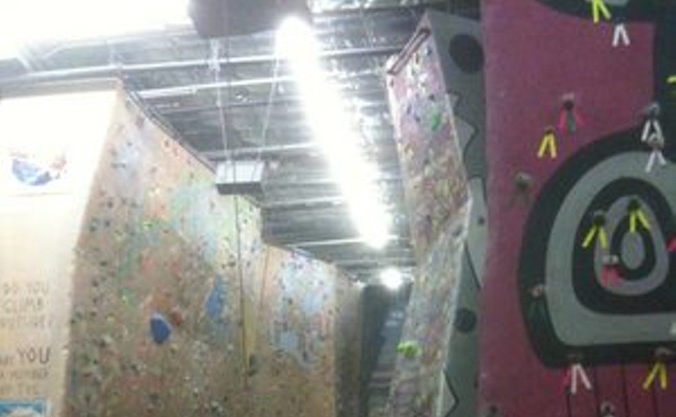
Rock climbing is a perishable skill. Thankfully, each time we find ourselves in too pathetic a state, we have the Phoenix Rock Gym to help with the necessary repairs. The two bouldering areas, including an upstairs room with sharply overhanging walls, are perfect for muscle-building and fingertip-hardening. Once we get back in shape, we usually can then find a partner who'll be willing to belay us on the 30-foot faces of the gym's main walls. Despite its friendly ambiance, the Valley's oldest rock gym has a hard side — we've ripped skin there, tweaked a limb on the lead wall, and worked our forearms until our hands could barely close. But it's all good. For inspiration, we look to the teens and tweens of Team Thrashers, the competitive climbing outfit that trains at the PRG under the tutelage of coach Jeremy Cox. Nothing motivates us to work out harder than watching a kid do 30 pull-ups without breaking a sweat.
- 1353 E. University Dr., Tempe, 85281 Map
- 480-921-8322
- www.phoenixrockgym.com
Best Of Phoenix®

-
La Vida
-
Best Mexican Restaurant in a Bowling Alley
Oaxaca Restaurant (at Let It Roll Bowl)
-
Best Mexican/Chinese Fusion Fast Food
Chino Bandido Takee-Outee
-
Best Upscale Mexican Restaurant
The Mission
-
Best Neighborhood Restaurant, Central Phoenix
Tacos Atoyac
-
Best Neighborhood Mexican Restaurant, Downtown Phoenix
Rito's
-
Best Neighborhood Mexican Restaurant, North Phoenix
El Rinconcito del D.F.
-
Best Neighborhood Mexican Restaurant, South Phoenix
Los Taquitos
-
Best Neighborhood Mexican Restaurant, West Valley
Mama Lupita's
-
Best Neighborhood Mexican Restaurant, Southeast Valley
Taquitos Jalisco
-
Best Neighborhood Mexican Restaurant, Tempe
El Tlacoyo
-
Best Neighborhood Mexican Restaurant, Scottsdale
Tacos Jalisco
-
Best Mexican Breakfast
La Barquita
-
Best Mexican Lunch
Carolina's
-
Best Latin Brunch
Rio Mirage Cafe y Cantina
-
Best Salsa
La Condesa Gourmet Taco Shop
-
Best Guacamole
Rita's Kitchen at The Camelback Inn
-
Best Tortillas
Red Eagle El Porvenir Tortilla Factory
-
Best Pozole
Pozoleria Mi Casita
-
Best Elote
La Carreta de Lily
-
Best Tacos
Barrio Queen
-
Best Burritos
Asadero Norte de Sonora
-
Best Tamales
El Bravo
-
Best Chiles Rellenos
Los Jarritos Restaurant
-
Best Pupusas
Restaurante Salvadoreño #3
-
Best Tortas
Tortas El Guero
-
Best Mariscos
Las Glorias Restaurante de Mariscos Mexicanos
-
Best Mole
El Conquistador
-
Best Carne Asada
Ta' Carbon, The Real Mexican Grill
-
Best Carne Adovada
Los Dos Molinos
-
Best Sonoran Hot Dog
Nogales Hot Dog
-
Best Aguas Frescas
Birrieria Obregon
-
Best Paletas
Paletas Betty
-
Best Artisan Mexican Sweets
Muñeca Mexicana
-
Best Mexican Candy Store
Pico Rico Dulceria
-
Best Panaderia
La Purisima Bakery
-
Best Carniceria
Carniceria Sonora
-
Best Mexican Market
La Tolteca
-
Best Mexican Swap Meet
The Glendale Public Market
-
Best Day of the Dead Celebration
Desert Botanical Garden
-
Best Tequila
3 Amigos Tequila
-
Best Tequila Selection
Canteen Modern Tequila Bar
-
Best Margarita
Margarita Classico at Gallo Blanco
-
Best Latin Dance Night
Latin Passion Fridays
-
Best Latin Nightclub
DWNTWN
-
Best Latin DJ
DJ Kyko
-
Best Anti-SB 1070 Hip-Hop Group
Shining Soul
-
Best Mariachi
Mariachi Valle del Sol
-
Best Pro-Immigration Mormon
Daryl Williams
-
Best Token Republican Hispanic
State Representative Steve Montenegro
-
Best Spanish-Language Journalist
Maritza Lizeth Felix
-
Best DREAM-er
President Barack Obama
-
Best Basketball-Playing Robot Named for an Undocumented Immigrant
Angelica's Dream
-
Best Immigration Documentary
Two Americans
-
Best Place to Observe the Science of Xenophobia
Arizona
-
Best Place to Find Mexican Jumping Beans
Mexican Import
-
Best Science Experiment in a Mexican Dish
Huitlacoche (a.k.a. corn smut)
-
Best Scientist Incubator
AGUILA Youth Leadership Institute
-
Best Use of Computers to Terrify Visitors to Our State
Automated Virtual Agent for Truth Assessments in Real-Time
-
-
Food & Drink
-
Best New Restaurant
ShinBay
-
Best James Beard-Sanctioned Lunch
The Fry Bread House
-
Best Place to Take a Foodie
Distrito
-
Best Place to Take a Scenester
Lux Central
-
Best Place to Take an Out-of-Towner
Kai
-
Best Food Truck
Hey Joe! Filipino Street Food Truck
-
Best Steak House
J&G Steakhouse
-
Best Old-School Steak House
Pink Pony
-
Best Authentic Arizona Restaurant
House at Secret Garden
-
Best Contemporary Arizona Restaurant
Citizen Public House
-
Best Vegetarian Restaurant
Woodlands Vegetarian South Indian Kitchen
-
Best Vegan Restaurant
Pomegranate Cafe
-
Best Latin American Restaurant
Villa Peru
-
Best Soul Food Restaurant
Mrs. White's Golden Rule Cafe
-
Best Hawaiian Restaurant
Aloha Kitchen
-
Best Chinese Restaurant
Chou's Kitchen
-
Best Korean Restaurant
Cafe Ga Hyang
-
Best Thai Restaurant
Yupha's Thai Kitchen
-
Best Vietnamese Restaurant
Hue Gourmet
-
Best Japanese Restaurant
Nobuo at Teeter House
-
Best Indian Restaurant
Curry Corner
-
Best Ethiopian Restaurant
Ethiopian Famous Restaurant & Coffee
-
Best Mediterranean Restaurant
Eden's Grill
-
Best Greek Restaurant
Greektown
-
Best French Restaurant
Christopher's and Crush Lounge
-
Best Scandinavian Restaurant
Beaver Choice
-
Best German Restaurant
Zur Kate
-
Best Italian Restaurant
Italian Restaurant
-
Best Corner Italian Restaurant
Andreoli Italian Grocer
-
Best Gourmet Pizza
Pizzeria Bianco
-
Best Slice of Pizza
Pino's Pizza Al Centro
-
Best Neighborhood Pizza, Central Phoenix
The Parlor Pizzeria
-
Best Neighborhood Pizza, Downtown Phoenix
Cibo Urban Wine Cafe & Pizzeria
-
Best Neighborhood Pizza, North Phoenix
Isa's Pizza
-
Best Neighborhood Pizza, South Phoenix
Amano Pizza Bistro
-
Best Neighborhood Pizza, West Valley
La Piazza al Forno
-
Best Neighborhood Pizza, Southeast Valley
Nello's Pizza & Italian Restaurant
-
Best Neighborhood Pizza, Tempe
Classic Italian Pizza
-
Best Neighborhood Pizza, Scottsdale
Pomo Pizzeria
-
Best Italian Deli
Niccoli's Italian Grocery
-
Best Jewish Deli
Goldman's Deli
-
Best English Pub
The Rose & Crown Pub
-
Best Irish Pub
Rosie McCaffrey's
-
Best Fish and Chips
Tom's Tavern & 1929 Grill
-
Best Seafood
Ocean Trail at Talking Stick Resort
-
Best Bring Your Own Seafood
Asian Cafe Express
-
Best Sushi
Hiro Sushi
-
Best Alternative to Sushi
Gyuniku Tempura Roll at Hana Japanese Eatery
-
Best French Toast
Caramelized Banana & Pecan Brioche French Toast at Over Easy
-
Best Sandwich
Pane Bianco
-
Best Grilled Cheese
O.H.S.O. Eatery + nanoBrewery
-
Best Fried Chicken
Lo-Lo's Chicken & Waffles
-
Best Hamburger
New York Flavor
-
Best Hot Dog
Pittsburgh Willy's
-
Best BBQ
Bryan's Black Mountain Barbecue
-
Best Jerk
The Jerk Hut
-
Best Ribs
Texas BBQ House
-
Best Wings
Teakwoods Chandler
-
Best Fried Food
Zaidi's Grill
-
Best Mac 'n' Cheese
Bacon & Caramelized Onion Mac & Cheese at Cheuvront
-
Best Crepes
The Crepe Bar
-
Best Use of PB&J
Peanut Butter and Jelly Foie Gras at The Praying Monk
-
Best Bagels
New York Bagels 'N Bialys
-
Best Bread
Timo
-
Best Bread Pudding
Southern Bread Pudding with Kentucky Bourbon Sauce at Tarbell's
-
Best Doughnuts
Fu-Fu Cuisine
-
Best Cookie
Salted Chocolate Chip at La Grande Orange
-
Best Cupcake
Blue Moon Cupcake from Kreative Kupcakes
-
Best Bakery
New York West Pastry & Bake Shop
-
Best Gelato
Cool Gelato Italiano
-
Best Dessert
Francesca Bianco
-
Best Ice Cream
Churn
-
Best Vegan Coffee and Dessert Shop
Nami
-
Best Place to Be Gluten-Free
Gluten Free Creations
-
Best Juice Bar
24 Carrots
-
Best Bar Food
Old Town Whiskey
-
Best Airport Food
Zulu Caffe
-
Best Case for a Limited Menu
Baratin
-
Best Move
Crudo
-
Best Rise from the Ashes
Ranch House Grille
-
Best Restaurant for Kids
China Magic Noodle House
-
Best Romantic Dinner
Quiessence Restaurant & Wine Bar
-
Best View
Different Pointe of View
-
Best Patio Dining
Lon's at the Hermosa
-
Best Patio Dining in the Summer
Hillstone
-
Best Summer Dish
The Caribbean Salad at Pita Jungle
-
Best Outdoor Dining
House of Tricks
-
Best Restaurant with a Drive-Thru
D'Lish Drive-Thru Tempe
-
Best Neighborhood Breakfast, Downtown Phoenix
Astor House
-
Best Neighborhood Breakfast, Central Phoenix
Dick's Hideaway
-
Best Neighborhood Breakfast, North Phoenix
Perk Eatery
-
Best Neighborhood Breakfast, South Phoenix
Morning Glory Cafe
-
Best Neighborhood Breakfast, West Valley
Amuse Bouche
-
Best Neighborhood Breakfast, Southeast Valley
Liberty Market
-
Best Neighborhood Breakfast, Tempe
Essence Bakery Cafe
-
Best Neighborhood Breakfast, Scottsdale
Orange Table
-
Best Place for a Hangover Breakfast
Harlow's
-
Best Sunday Brunch
Wrigley Mansion
-
Best Downtown Lunch
Blue Hound Kitchen & Cocktails
-
Best Multi-Task Lunch
Campfire Grill, inside Tom's Thumb Fresh Market
-
Best Sack Lunch
Noca's Nocawich
-
Best Lunch Between Phoenix and Tempe
The Stockyards
-
Best Place for a Twilight Drink
Jade Bar at The Sanctuary Resort & Spa
-
Best Place for a First Date
Rokerij
-
Best Industry Night
Roka Akor
-
Best Restaurant with an Invisible Dance Floor
SoChu House
-
Best Playlist
Windsor
-
Best Late-Night Nosh
FnB
-
Best Place to Buy a Live Chicken
The Stock Shop
-
Best CSA
Chow Locally/Chow Share
-
Best Boutique Farm
Singh Farms
-
Best Organic Farm
Crooked Sky Farms
-
Best Dairy Farm
Superstition Farm
-
Best U-Pick Farm
Schnepf Farms
-
Best Saturday Farmers Market
Old Town Scottsdale's Saturday Market
-
Best Sunday Farmers Market
Ahwatukee Sunday Market
-
Best Twilight Farmers Market
Open Air Market, Downtown Phoenix on Wednesday Nights
-
Best Farmers Market in a Park
Roadrunner Park Farmers Market
-
Best Health Food Store
Sprouts Farmers Market
-
Best Spice Shop
Penzey's Spices
-
Best Mediterranean Market
Baiz Market
-
Best Asian Market
Mekong Market
-
Best Meat Market
The Meat Shop
-
Best Baking Supplies
ABC Cake Decorating Supplies
-
Best Kitchen Supplies for an Artist
Practical Art
-
Best Vintage Kitchenware
Kitchen Switchin'
-
Best Knife Shop
Phoenix Knife House
-
Best Science Experiment on an Ice Cream Cone
Sub Zero Ice Cream
-
Best Molecular Gastronomist
Kevin Binkley at Binkley's Restaurant
-
Best Science-Themed Wine Dinner for a Cause
Beckett's Table "Feed Your Dreams" Gala
-
Best Backyard Farm
The McClungs' Garden Pool
-
Best Brain Food
Servery at Barrett, the Honors College, Arizona State University
-
Best Place to Learn the Science of Canning
Denise Is Cooking
-
Best Place to Learn About the Science of Composting
Valley Permaculture Alliance
-
Best Scientific-ish Reason to Eat Chocolate
Wei of Chocolate
-
Best Place to Stock Up for the End of the World as We Know It
Honeyville Farms
-
-
Bars & Clubs
-
Best Cocktail Named After a Haboob
The Haboob at Lon's at the Hermosa Inn
-
Best Place to Learn to Love Whiskey
Old Town Whiskey
-
Best Specialty Cocktails
Citizen R&D
-
Best Skinny Cocktail
Skinny Chola at Barrio Queen
-
Best Shot
The Pickle Back at Kitchen 56
-
Best Martini
MercBar
-
Best Bloody Mary
Maizie's Cafe
-
Best Sangria
Whiskey Sangria at Carly's Bistro
-
Best Wine Bar
Sun Devil Cellar and Pub
-
Best Beer Bar
The Hungry Monk
-
Best Local Beer
Four Peaks Hop Knot
-
Best Brewpub
Angels Trumpet Ale House
-
Best Pub Quiz
Brainstormer Pub Quiz at Rula Bula
-
Best Place to See a Comedy Show
Stand Up Live
-
Best Karaoke
Toby Keith's I Love This Bar and Grill
-
Best Jukebox
Shady's
-
Best Pool Hall
Q & Brew
-
Best Bar with a Pool
El Santo Cantina
-
Best Bar for Watching the Game
Time Out Lounge
-
Best Sports Bar, Central Phoenix
Arcadia Tavern
-
Best Sports Bar, Downtown Phoenix
Coach & Willie's
-
Best Sports Bar, South Phoenix
Teakwoods Chandler
-
Best Sports Bar, North Phoenix
Zipps Sports Grill
-
Best Sports Bar, West Valley
Stinger's Sports Bar
-
Best Sports Bar, Southeast Valley
Cactus Moon Sports Bar
-
Best Sports Bar, Tempe
Native New Yorker
-
Best Sports Bar, Scottsdale
Duke's Sports Bar
-
Best Dive Bar
Palo Verde Lounge
-
Best Rockabilly Bar
The Blooze Bar
-
Best Gay Bar
Kobalt
-
Best Lesbian Bar
Cash Inn Country
-
Best Hookah Lounge
Hookah Mania
-
Best Smoking Patio
Zoan
-
Best Neighborhood Bar, Central Phoenix
The Little Woody
-
Best Neighborhood Bar, Downtown Phoenix
FilmBar
-
Best Neighborhood Bar, North Phoenix
The Loft Again
-
Best Neighborhood Bar, South Phoenix
Brad's Place
-
Best Neighborhood Bar, West Valley
Enoch's Lounge
-
Best Neighborhood Bar, Southeast Valley
Groggy's
-
Best Neighborhood Bar, Tempe
Baer's Den
-
Best Neighborhood Bar, Scottsdale
Roadrunner Lounge
-
Best Happy Hour, North Phoenix
Cafe Bink
-
Best Happy Hour, Central Phoenix
Christopher's Restaurant & Crush Lounge
-
Best Happy Hour, Downtown Phoenix
The Main Ingredient Ale House & Cafe
-
Best Happy Hour, South Phoenix
Hillside Spot
-
Best Happy Hour, West Valley
Johnny Fox's Public House
-
Best Happy Hour, Southeast Valley
Vintage 95
-
Best Happy Hour, Tempe
Canteen Modern Tequila Bar
-
Best Happy Hour, Scottsdale
Mabel's on Main
-
Best Bartender
Venus Salin at Yucca Tap Room
-
Best Punk Bar
Johnny's Eastside Tap & Grill
-
Best Place to See an Underground Punk Show
Meat Market Garment Factory
-
Best Place to See a Metal Show
Hollywood Alley
-
Best Theater Show
Wilco at Gammage Auditorium
-
Best Club Show
Through and Through Gospel Review at Crescent Ballroom
-
Best Arena Show
The Beach Boys at Grand Canyon University Arena
-
Best Venue for National Acts
Comerica Theatre
-
Best Venue for Local Acts
Nile Theater/Underground
-
Best Local Music Booster
Emmanuel Tripodis, The Rogue Bar
-
Best New Music Venue
Crescent Ballroom
-
Best New Nightclub
Monarch Theatre
-
Best Rock Club
Yucca Tap Room
-
Best Hip-Hop Club
Club Red/Red Owl
-
Best Blues Club
The Rhythm Room
-
Best Country Nightclub
Handlebar J
-
Best Gay Dance Club
Amsterdam
-
Best All-Ages Club
Club Afterlife
-
Best Exclusive Club
Wild Knight
-
Best Hip-Hop Night
The Blunt Club, Thursdays at Yucca Tap Room
-
Best Dubstep Night
UK Thursdays at Monarch Theatre
-
Best Country and Western Night
Valley Fever, Sundays at Yucca Tap Room
-
Best Industrial Night
:Fallout.Shelter:, Wednesdays at Sanctum
-
Best Weekly Dance Night
The Palace @ FilmBar
-
Best Weekly Dance Night for Hipsters
Sticky Fingers, Saturdays at Bar Smith
-
Best Dance Floor
Axis-Radius
-
Best Dance Party
Decentralized Dance Party — Phoenix Edition
-
Best House DJs
Turner and Heit
-
Best Hipster DJ
Sean Watson
-
Best Goth DJ
DJ Noiz.fkr
-
Best Dubstep DJ
J. Paul
-
Best Moombahton DJs
Pickster One and DJ Melo
-
Best Hip-Hop DJ
Logan "Element" Howard
-
Best DJ Duo
TABS
-
Best Crate-Digging DJ
Djentrification
-
Best Local Band
St Ranger
-
Best Up-and-Comer
YUS
-
Best Tribute Band
Secret Fox
-
Best Traditional New Orleans Band
Bad Cactus Brass Band
-
Most Creative Band Marketers
Bears of Manitou
-
Best Remixer
Mercurius FM
-
Best Name-Dropper
Keith Jackson
-
Best Place to Catch EDM Stars Under the Stars
Bar Smith's Rooftop Lounge
-
Best Place to Be Seen
Dollhouse Cocktail Lounge
-
Best Place to People-Watch
The Mint
-
Best Place to Find a One-Night Stand
American Junkie
-
Best Place to Document Your Drunken Shenanigans
HotBoxx video booth at Smashboxx
-
Best After-Hours
The Firehouse Bar & Grill
-
Best Secret After-Hours
Quincy Ross
-
Best Way to Get Everything from Pizza to Condoms to Toilet Paper Delivered to Your Doorstep in the Middle of the Night
Nighttime Nosh
-
Best Quixotic Endeavor
Pavle Milic's Wine-Making Adventure
-
Best Place to Learn the Science of Guitar-Making
Roberto-Venn School of Luthiery
-
Best Mixologist
Shel Bourdon at Blue Hound Kitchen & Cocktails
-
Best Bitters
AZ Bitters Lab
-
Best Hologram
Tupac by AV Concepts
-
Best Shock Jock
Barry Schwartz
-
Best Mixer
John's Premium Tonic Syrup
-
Best Science Class with Suds
Birds 'n' Beer at Third Thursdays at Nina Mason Pulliam Rio Salado Audubon Center
-
Best Sleep-Based Debate
Lucid Dreaming with Dr. Gary Schwartz
-
-
People & Places
-
Best Urban Legend
The Tempe Fox
-
Best Send-Up of Arizona State University
Tosh.0's College Campus Invasion
-
Best Mention of Arizona in a Pop Song
Frank Ocean, "Thinking Bout You"
-
Best Un-Google-able Band Name
North Dakota
-
Best Music Festival
McDowell Mountain Music Festival
-
Best Culinary Festival
Devoured Culinary Festival, Phoenix Art Museum
-
Best Cultural Festival
Matsuri
-
Best Theater Festival
Latino Performing Arts Festival
-
Best Arts Festival
Sunnyslope Art Walk
-
Best Craft Festival
Crafeteria at Medlock Plaza
-
Best Place to Let Your Maker Flag Fly
Maker Faire
-
Best DIY Letterpress
Letterpress Central
-
Best Historic Neighborhood
Yaple Park
-
Best Home Tour
Modern Phoenix
-
Best New Lease on Life
The Icehouse
-
Best Downtown Building to Poke Your Head Into
Phoenix Financial Center Rotunda
-
Best Tourist Attraction
Tovrea Castle
-
Best Fake Landmark
The Marcos De Niza Inscription
-
Best Oddball Landmark
Phoenix Trotting Park
-
Best Bathroom
Liberty Market
-
Best Mall
Tempe Square
-
Best Shop Dog
Batman at Alterations and Creations
-
Best Place to Save a Life
Arizona Animal Welfare League
-
Best Attempted Foursome
Shane and Sarah Walker, Robert Aucker, and a golden shepherd mix
-
Best Comic Book Inspired by a Band
Unite and Take Over: Stories Inspired by Songs of The Smiths
-
Best Local News Coverage of Cats
KPHO-TV
-
Best Zine
Ziindi
-
Best Locals to Follow on Twitter
@poolboymagazine
-
Best Local to Follow on Instagram
@neweragone
-
Best Blog About the End of the World
Kevin Patterson's How to Get Ready for the Apocalypse
-
Best Phoenix Neighborhood Blog
The Joan D'Arc Crusader
-
Best Style Blog
Style Tutor
-
Best Food Blog
Skillet Doux
-
Best Music Blog
Club Fonograma
-
Best Facebook Debate Over Fried Rice
Pavle Milic
-
Best YouTube-Based Ad Campaign
Lovey & Lou Borenstein, Chompie's
-
Best Billboard Ad Campaign
Oregano's
-
Best Gadabout with a Facebook Page
Dapper Gatsby
-
Best Facebook Page About the Phoenix Art Scene
The Phoenix Remodernists
-
Best New Gallery
Por Vida Gallery
-
Best Gallery
Lisa Sette Gallery
-
Best Museum
Heard Museum
-
Best Thinking Outside the (Museum) Box
SMoCA Lounge
-
Best Place to Write Your Name
Phoenix Graffiti Tunnels
-
Best Street Art
Stuck on the Streets in Tempe
-
Best Public Art
IN FLUX:Scottsdale and Tempe Public Art
-
Best Mural
DOSE's Right to Remain on the Seed & Feed Warehouse
-
Best Wallace and Ladmo Mural
First Studio Building
-
Best Graffiti Artist
KAPER
-
Best Coffee Shop Curator
Ted Decker
-
Best Place to See Photography
Art Intersection
-
Best Stop on Art Detour
Legend City Studios
-
Best Bit of Art Detour Irony That Almost No One Witnessed
Bob Booker at eye lounge
-
Best First Friday Hangout
First Studio
-
Best Way to See Art You Missed on First Friday
Third Friday
-
Best Ephemeral Art Show
The BoneYard Project
-
Best Motorcycle Museum
Buddy Stubbs Arizona Harley-Davidson
-
Best Museum for Veterans
Arizona Military Museum
-
Best Museum for Geeks
Arizona Popular Culture Experience
-
Best Geekfest
Phoenix Comicon
-
Best Urban Oddity
Space-Alien Donald
-
Best Girl Gamer
Mel the Office Gamer Girl
-
Best Star Trek Tribute
Atwood European's Klingon-inspired signage
-
Best Costumed Mischiefmakers
Arizona Cacophony Society
-
Best Local Fantasy Author
Kevin Hearne
-
Best Local Porn Star
Priya Rai
-
Best Tutu
Bob Carey
-
Best Ballet Under the Desert Stars
Topia by Ballet Arizona
-
Best Contemporary Dance Collective
Scorpius Dance
-
Best Classical Avant-Garde Performances
Downtown Chamber Series
-
Best Independent Movie Theater
FilmBar
-
Best Luxury Movie Theater
AMC Esplanade 14
-
Best Budget Movie Theater
Pollack Tempe Cinemas
-
Best Actress
Susan Claassen in A Conversation with Edith Head
-
Best Actor
Mike Traylor in Race
-
Best Director
Damon Dering in Shakespeare's R & J
-
Best Risk-Taking Artistic Director
Matthew Wiener, Actors Theatre
-
Best Ethnic Theater
Teatro Bravo
-
Best Improv Collective
Torch Theatre
-
Best Community Theater
Black Theatre Troupe
-
Best Black Box
iTheatre Collaborative
-
Best Equity House
Actors Theatre
-
Best Alternative Theater
Nearly Naked Theater
-
Best Educational Theater
Childsplay
-
Best Puppet Theater
Great Arizona Puppet Theater
-
Best Culture on Your Lunch Hour
Lunch Time Theater at the Herberger Theater Center
-
Best Original Play by a Local Playwright
Dwayne Hartford's The Color of Stars
-
Best Actorly Homecoming
Kathy Fitzgerald in Gypsy
-
Best Didn't-See-That-Coming Performance
D. Scott Withers in Gypsy
-
Best Performance by an Actor Depicting a Differently Abled Person with Compassion
Tie: Will Hightower in Body Image and Travis Russell in The Pillowman
-
Best Surprise from a Local Troupe
Phoenix Theatre's co-production with Nearly Naked Theatre
-
Best Holiday Show We Didn't See Last Year
iTheatre's Christmas Cabaret with Jeff Kennedy
-
Best Record Label
Acetic House
-
Best Place to Become a Recording Engineer
Conservatory of Recording Arts & Sciences
-
Best Place to Become a DJ
The DJ Program at Scottsdale Community College
-
Best Place to Learn About Hip-Hop Culture
Cyphers: The Center for Urban Arts
-
Best R&B/Hip-Hop Radio Station
Power 98.3
-
Best Country Station
KNIX 102.5
-
Best Alternative/Rock Radio Station
KWSS 106.7 FM
-
Best Classic Rock Station
KCDX 103.1 FM
-
Best Oldies Radio Station
KAZG 1440 AM
-
Best Blues/Jazz Radio Station
KJZZ 91.5 FM
-
Best Online Radio Station
KUKQ Phoenix
-
Best Internet Radio Personality
Craven Moorehead on www.kukq.com
-
Best Radio Personality
Jonathan L on KWSS 106.7 FM
-
Best Radio Morning Show
Holmberg's Morning Madness on 98 KUPD
-
Best Weekly Radio Program
Totally Jazzed with Johnny D.
-
Best Sports Radio Talk Show
Bickley & MJ
-
Best News Radio Station
KJZZ, 91.5 FM
-
Best TV Newscaster
Kari Lake at Fox 10 News
-
Best TV Journalist
Gilbert Zermeno at KPHO, Channel 5
-
Best Public Information Officers
Vincent Funari and Karen Arra, Maricopa County Superior Court
-
Best Power Couple
Kurt and Brenda Warner
-
Best Powerless Couple
Sheriff Paul Babeu and Jose Orozco
-
Best Politician(s)
Team Awesome
-
Best Endorsement
Arizona Governor Jan Brewer Endorses President Barack Obama
-
Best Activist
Randy Parraz
-
Best Delusional Crybaby
Andrew Thomas
-
Best Morality Cop
Maricopa County Attorney Bill Montgomery
-
Best Private Practice Lawyer Who Should Be County Attorney
Tom Ryan
-
Best Collection of Alter Kocker Wingnuts
Mesa's Red Mountain Tea Party
-
Best Raving Loon
Former State Senator Sylvia Allen
-
Best Stooge
Olivia Cortes
-
Best Example of a Worthless Federal Agency Operating in Arizona
Tie: The FBI and the DOJ
-
Best Pathological Liar
Russell Pearce
-
Best Antediluvian Politico
State Representative Debbie Lesko for her anti-birth control bill
-
Best Example of Political Courage
State Senator Jerry Lewis, for voting against Lesko's anti-birth control bill, twice
-
Best Example of Political Cowardice
Congressman Ben Quayle
-
Best Public Servant Payday
Maricopa County Supervisor Mary Rose Wilcox's $1 million lawsuit settlement
-
Best Public Servant Payday That Almost Was
Russell Pearce's attempt to gouge the state Legislature out of $260,000
-
Best Slimer
Michael Monti
-
Best Escape
Jairo Contreras, in a laundry cart
-
Best Reason to Abandon Maricopa County
Sheriff Joe Arpaio (if he wins)
-
Best Place to Brush Up on Your Chemistry
Noble Science and Engineering Library at ASU
-
Best Shock Value
Taser International
-
Best Bug Collection
The Hasbrouck Insect Collection
-
Best Sci-Fi Conference
International UFO Congress
-
Best Science Lecture Series
Adult's Night Out at Arizona Science Center
-
Best Way to Prepare for a Zombie Invasion
Zombie Research Society, Phoenix Chapter
-
Best Use of Technology in a Museum
The Musical Instrument Museum
-
Best Performance by a Robot in a Supporting Role
Aunt Julie-Bot in Heddatron Stray Cat Theatre
-
Best Musical Paleontology
Singing Hadrosaur
-
Best A/V Club
Orange Theatre Group
-
Best Rock Collection
Meteorite Vault at ASU
-
Best Neon Art
Sue Meyers at Bend a Light Neon Studio
-
Best Bee (Secret) Keeper
Dr. Gro Amdam, associate professor at ASU's School of Life Sciences
-
Best Robot Art
Aaron Voigt
-
Best Place to Watch Sci-Fi Movies in Arizona
International Horror Sci-Fi Film Festival at Harkins Scottsdale 101
-
Best Science Fiction Movie Filmed in Arizona
Bill & Ted's Excellent Adventure
-
Best Sci-Fi Convention
LepreCon
-
Best Use of an Old Chemistry Lab
OP-Tic
-
Best Scientific Boondoggle
Biosphere 2
-
Best Rocket Scientists
Orbital Sciences Corporation
-
Best Place to See a Rocket
Titan Missile Museum
-
Best Place for a Ride to Outer Space
Challenger Space Center
-
Best Arizona Astronomer
Percival Lowell
-
Best Place to See Other Worlds
East Valley Astronomy Club
-
Sci-Fi Author
Michael Stackpole
-
Best Mad Scientist
Lance Greathouse
-
Best Place to See Antique Medical Equipment
Phoenix Baptist Hospital Medical Museum
-
Best Hope for Surviving a Nerve Gas Attack
Bioscavenger Project, Mor Lab at ASU Biodesign Institute
-
Best Use of Dirty Pool Water to Save Humanity
ASU's Laboratory for Algae Research and Biotechnology
-
Best Place to Test Drive a Space Rover
Arizona -- NASA's Space Exploration Vehicle (SEV) and NASA's Desert Research and Technology Studies (D-RATS) team
-
Best Use of a Camera on Mars
Thermal Emission Imaging System (THEMIS) at Mars Space Flight Facility
-
Best Local Indiana Jones
Todd Bostwick, PaleoWest Solutions in Archaeology
-
Best Brain Surgeon
Dr. Robert F. Spetzler at Barrow Neurological Institute
-
Best Way to Learn How to Make Your Garden Really Grow
Maricopa County Master Gardener Program
-
Best School for a Mad Scientist in Training
Bioscience High School
-
Best Use of Technology to Make Being Lazy Even Easier
AdSkip
-
Best Animal Testing in the Name of Animals
Canine Hereditary Cancer Consortium at the Translational Genomics Research Institute (TGen)
-
Best (Creative) Use of Natural Light
James Turrell
-
Best Fire Man
Dr. Stephen Pyne
-
Best Meteorologist
Ken Waters, National Weather Service
-
Best Way to Brush Up on Your Anthropology
"Digging Arizona"
-
Best Earth-Shaking Science
"Seismicity Within Arizona During the Deployment of the EarthScope USArray Transportable Array"
-
Best Place to Play Doctor
University of Arizona College of Medicine-Phoenix
-
Best Science Fiction (Or Is It?) About Phoenix
The 33rd Parallel
-
Best Second Chance
ALCOR Life Extension Foundation
-
-
Shopping & Services
-
Best Shot of Espresso
Press Coffee Roasters
-
Best Coffee Beans
Black Market Espresso
-
Best Coffee House, Central Phoenix
Carmel's Coffee & Bakery
-
Best Coffee House, Downtown Phoenix
Lola Coffee
-
Best Coffee House, South Phoenix
Cupz N' Crepes
-
Best Coffee House, West Valley
Elevate Coffee Co.
-
Best Coffee House, Southeast Valley
The Coffee Shop
-
Best Coffee House, North Phoenix
Matador Coffee Roasting
-
Best Coffee House, Tempe
Cartel Coffee Lab
-
Best Coffee House, Scottsdale
Village Coffee Roastery
-
Best Brewery
Four Peaks Brewing Co.
-
Best Place to Fill a Growler
Flanny's Bar & Grill
-
Best Bottled Beer Selection
Whole Foods Market
-
Best Drive-Thru Liquor Store, East Valley
Sun Devil Liquors
-
Best Drive-Thru Liquor Store, West Valley
Henry's Liquors
-
Best Candy Store
Smeeks
-
Best Cigar Shop
Magnum's Cigar Wine & Spirits
-
Best Head Shop
Headquarters
-
Best Hydroponic Growing Supplies Store
weGrow
-
Best Nursery
Jackrabbit Nursery
-
Best Antique Shop for Gardening Supplies
Qcumberz
-
Best Vintage Lighting Fixtures
Stuff Antiques
-
Best Place to Buy an Antique Bathtub
Antique Trove
-
Best Vintage Furniture Reupholstering
UFO
-
Best Vintage Textiles
Retro Ranch
-
Best Vintage Christmas Stuff
Zinnias at Melrose
-
Best Antique Shop for Vintage Carnival Chalkware
Antique Centre
-
Best Thrift Store for Plaster Deities
Salvation Army
-
Best Thrift Store for Collectible Books
Goodwill
-
Best Thrift Store for Vintage Furniture
White Dove Thrift
-
Best Thrift Store for Vintage Dishware
Flo's on 7th
-
Best Thrift Store for Vintage Cookware
Goodwill
-
Best Thrift Store for Big, Ugly Lamps
Goodwill
-
Best Thrift Store for Small Appliances
Savers
-
Best Thrift Store for Cheap Gifts
Assistance League Thrift
-
Best Thrift Store Antique Department
Indian School Thrift
-
Best Thrift Store Nobody Knows About
Eve's Treasures
-
Best Midcentury Modern Furniture
Modern Manor
-
Best Monthly Vintage Sale
Sweet Salvage
-
Best Annual Parking Lot Sale of Vintage Goods
Antique Gatherings
-
Best Antiques Mall
Brass Armadillo
-
Best Place to Buy Antiques on a Budget
Antique Marketplace
-
Best Place to Buy High-End Antiques
Phoenix Lamp Repair
-
Best Place to Buy Vintage Clothing
Antique Sugar at Zinnias
-
Best Mobile Vintage Shop
Merry May Shoppe
-
Best Vintage Jewelry
Vintage by Misty
-
Best Splurge-Worthy Vintage Clothing
Fashion by Robert Black
-
Best Designer Consignment Store
Poor Little Rich Girl
-
Best Used Clothing for Kids
Love Child
-
Best Vintage Clothing on a Budget
Butter Toast Boutique
-
Best Boutique Thrift Shop
Sunset Clothing Xchange
-
Best New Boutique
Nostra Style House
-
Best Boutique
Frances
-
Best See and Be Seen Shopping
Biltmore Fashion Park
-
Best Inspiration in a Retail Setting
MADE
-
Best Shopping on Roosevelt Row
GreenHaus Gallery + Boutique
-
Best Shopping on Grand Avenue
Gallery Marsiglia
-
Best Place to Buy Western Boots
Saba's
-
Best Shopping on Mill Avenue
Meat Market Vintage
-
Best Men's Section
Bunky Boutique
-
Best Hardware Store
Six Points Hardware
-
Best Place to Get Your Typewriter Fixed
Mesa Typewriter Exchange
-
Best Cheap Vinyl
Revolver Records
-
Best CD Store
Stinkweeds
-
Best Movie Posters
Victor Moreno's Cult Classics
-
Best Costume Store
Easley's Fun Shop
-
Best Place to Buy Vinyl Toys
Lulubell Toy Bodega
-
Best Comic Book Shop
Gotham City Comics & Coffee
-
Best Bookstore
Changing Hands Bookstore
-
Best Used Bookstore
Bookmans
-
Best Specialty Bookstore
The Poisoned Pen
-
Best Art Supply Store
Arizona Art Supply
-
Best Bead Store
Beads Galore
-
Best Knitting Supplies
Knit Happens
-
Best Fabric Store
Tempe Sales Company
-
Best Fabric Store on a Budget
SAS Fabrics by the Pound
-
Best Pet Groomer
Mackie's Parlour
-
Best DIY Pet Groomer
Wag n' Wash
-
Best Beauty Products
Just B — B Just
-
Best Spa
Spa Avania
-
Best Car Wash
Clean Freak Carwash
-
Best Cab Company for Cheapskates
Sunrise Cab
-
Best Cab Company for Big Spenders
Euro Way Transportation
-
Best Place to Get Your Car Fixed by a Girl
180 Degrees Automotive
-
Best Place to Get Your Bike Fixed While at Work
PHX Bike
-
Best Bicycle Shop
Bicycle Haüs
-
Best Skateboard Shop
Cowtown Skateboards
-
Best Place to Get Lab Supplies
ChemLab Supply
-
Best Place to Buy a Pet That Actually Belongs in Phoenix
Phoenix Reptile Expo
-
Best Place to Prepare for the End of the World As We Know It
Arizona Survivalist Show
-
Best Place to Buy Wine by the Bottle
Sportsman's
-
Best Taxidermy
Kruger's Creations
-
Best Nose
Christina Carlino, founder of Philosophy
-
Best Vegan Taxidermy
Christy Puetz
-
Best Bird's Eye View of Phoenix
Kenney Aerial Mapping
-
Best Locally Made Reason to Smile
Restylane
-
Best Science Experiment in a Nail Polish Bottle
Scotch Natural Nail Polish
-
Best Place to Buy Used Science Equipment
ASU Surplus
-
Best Place to Build Your Dream Car
Local Motors
-
Best Supplies For Your Genetic Experiment
DNASU Plasmid Repository
-
-
Sports & Recreation
-
Best Place to Get Your Zen On
South Mountain Park and Preserve
-
Best Sunset Drive
Grand Avenue
-
Best Off-the-Beaten-Path Drive
Vekol Valley Road
-
Best Day Trip
Miami/Globe
-
Best Summer Day Trip
Fossil Creek Ranch
-
Best Weekend Road Trip
Northern Arizona, for National Parks Days
-
Best Casino
Talking Stick Resort
-
Best Hotel
The Boulders
-
Best Hotel Pool
Oasis Pool at the Clarendon Hotel
-
Best Public Pool
Encanto Park
-
Best Splash Pad
Tempe Beach Park
-
Best Water Park
Big Surf
-
Best Playground
Makutu's Island
-
Best Dog Park, East Valley
Cosmo Dog Park
-
Best Dog Park, West Valley
PetSmart Dog Park at Washington Park
-
Best Indoor Skate Park
Kids That Rip Indoor Skatepark
-
Best Outdoor Skate Park
McDowell Mountain Ranch Skate Park
-
Best Road Bike Ride
BOS Ride, Scottsdale
-
Best Mountain Bike Ride
Hawes Trail Loops, Mesa
-
Best Urban Bike Ride
Central Phoenix Mural Tour
-
Best Nighttime Bike Ride
CRAP Ride Tempe
-
Best Wind Tunnel
Faster
-
Best Bike Rack
Bicycle Cellar
-
Best Bike Lift
Gnar Gnar Tours
-
Best Bike Escape
Tucson
-
Best Golf Course
Las Sendas Golf Club
-
Best Winter Golf Course
Southern Dunes Golf Club
-
Best Summer Golf Course
Talking Stick Resort
-
Best Miniature Golf
Castles N' Coasters
-
Best Place to Hang With Fellow Geeks
N.E.R.D.S.
-
Best Place to Hang with Role-Play Game Geeks
Imperial Outpost
-
Best Bowling
Let It Roll Bowl
-
Best Go Karts
Octane Raceway
-
Best Motorcycle Ride
Rio Salado and Galvin Parkways to McDonald Drive
-
Best Weekend Run
Paradise Valley Hills
-
Best Hiking Trail
National Trail, South Mountain
-
Best Winter Hike
Hunter Trail, Picacho Peak
-
Best Fitness Hike
Piestewa Peak
-
Best Tough Hike
Tom's Thumb
-
Best Scramble Hike
Cholla Trail, Camelback Mountain
-
Best Bouldering
South Mountain
-
Best Rock Climbing
Little Granite Mountain
-
Best Rock Climbing Gym
Phoenix Rock Gym
-
Best Batting Cages
The Cages
-
Best Place to See a Spring Training Game
Goodyear Ballpark
-
Best Place to See Former WWE Superstars
Future Stars of Wrestling's Adrenaline Rush
-
Best Mascot
The Gorilla
-
Best Superfan
Cindy "The Flag Lady" McBride
-
Best Play-by-Play Announcer
Al McCoy, Phoenix Suns
-
Best Coach
Dave Tippett
-
Best Female Athlete
Georganne Moline
-
Best Male Athlete
Shane Doan, Phoenix Coyotes
-
Best Sports Legend
Muhammad Ali
-
Best Sports Ambassador for Arizona
Charles Barkley
-
Best Local Semi-Pro Team
Arizona Rampage
-
Best Strong(woman)
Sarah Robles, U.S. Olympic Team
-
Best Sports Trailblazer
Shannon Eastin, NFL referee
-
Best Basketball Player
Diana Taurasi
-
Best Beard in Sports
Former ASU basketball player James Harden
-
Best Sports Traitor
Steve Nash, Los Angeles Lakers
-
Best Defender in Sports
Mike Smith, Phoenix Coyotes
-
Best Wide Receiver in Pro Football
Larry Fitzgerald, Arizona Cardinals
-
Best Quarterback, Arizona Cardinals
John Skelton
-
Best Hope for the Diamondbacks' Future
Wade Miley, Arizona Diamondbacks
-
Best Attitude in Valley Sports
J.J. Putz
-
Best Sports Field General
Miguel Montero, Arizona Diamondbacks
-
Best All-Around Baseball Player
Paul Goldschmidt
-
Best Slugger
Jason Kubel, Arizona Diamondbacks
-
Best Disappointment in Valley Sports
Justin Upton, Arizona Diamondbacks
-
Best Sports Eccentric
Trevor Bauer, Arizona Diamondbacks
-
Best Sports Expatriate
Andre Ethier, Los Angeles Dodgers
-
Best Hard Worker in Valley Sports
Jared Dudley, Phoenix Suns
-
Best Hope for the Phoenix Suns
Goran Dragic
-
Best Geek Hangout
HeatSync Labs
-
Best Masters of the Science of Gaming
Evil Controllers
-
Best Science Fair Project
Joe Hudy's extreme marshmallow cannon
-
Best Place to See a Penguin
World Wildlife Zoo
-
Best Place to See a Bear
Bearizona
-
Best Place to See a Dinosaur
Arizona Museum of Natural History
-
Best Place to See a Snake
Living Collection
-
Best Place to See a Dragon
Land of the Dragons at Phoenix Zoo
-
Best Crater You Can Visit
Meteor Crater
-
Best Crater You Can't Visit
Roden Crater
-
Best Place to Perfect Your Swing
Ping Swing Analysis Lab
-
Best Place to See Tech Geeks in Action
Avnet Tech Games
-
Best Place for a Sure Thing
Sedona Rainbow Trout Farm
-
Best Place to See a Butterfly
Desert Botanical Garden
-
Best Of
-
La Vida
-
Best Mexican Restaurant in a Bowling Alley
Oaxaca Restaurant (at Let It Roll Bowl)
-
Best Mexican/Chinese Fusion Fast Food
Chino Bandido Takee-Outee
-
Best Upscale Mexican Restaurant
The Mission
-
Best Neighborhood Restaurant, Central Phoenix
Tacos Atoyac
-
Best Neighborhood Mexican Restaurant, Downtown Phoenix
Rito's
-
Best Neighborhood Mexican Restaurant, North Phoenix
El Rinconcito del D.F.
-
Best Neighborhood Mexican Restaurant, South Phoenix
Los Taquitos
-
Best Neighborhood Mexican Restaurant, West Valley
Mama Lupita's
-
Best Neighborhood Mexican Restaurant, Southeast Valley
Taquitos Jalisco
-
Best Neighborhood Mexican Restaurant, Tempe
El Tlacoyo
-
Best Neighborhood Mexican Restaurant, Scottsdale
Tacos Jalisco
-
Best Mexican Breakfast
La Barquita
-
Best Mexican Lunch
Carolina's
-
Best Latin Brunch
Rio Mirage Cafe y Cantina
-
Best Salsa
La Condesa Gourmet Taco Shop
-
Best Guacamole
Rita's Kitchen at The Camelback Inn
-
Best Tortillas
Red Eagle El Porvenir Tortilla Factory
-
Best Pozole
Pozoleria Mi Casita
-
Best Elote
La Carreta de Lily
-
Best Tacos
Barrio Queen
-
Best Burritos
Asadero Norte de Sonora
-
Best Tamales
El Bravo
-
Best Chiles Rellenos
Los Jarritos Restaurant
-
Best Pupusas
Restaurante Salvadoreño #3
-
Best Tortas
Tortas El Guero
-
Best Mariscos
Las Glorias Restaurante de Mariscos Mexicanos
-
Best Mole
El Conquistador
-
Best Carne Asada
Ta' Carbon, The Real Mexican Grill
-
Best Carne Adovada
Los Dos Molinos
-
Best Sonoran Hot Dog
Nogales Hot Dog
-
Best Aguas Frescas
Birrieria Obregon
-
Best Paletas
Paletas Betty
-
Best Artisan Mexican Sweets
Muñeca Mexicana
-
Best Mexican Candy Store
Pico Rico Dulceria
-
Best Panaderia
La Purisima Bakery
-
Best Carniceria
Carniceria Sonora
-
Best Mexican Market
La Tolteca
-
Best Mexican Swap Meet
The Glendale Public Market
-
Best Day of the Dead Celebration
Desert Botanical Garden
-
Best Tequila
3 Amigos Tequila
-
Best Tequila Selection
Canteen Modern Tequila Bar
-
Best Margarita
Margarita Classico at Gallo Blanco
-
Best Latin Dance Night
Latin Passion Fridays
-
Best Latin Nightclub
DWNTWN
-
Best Latin DJ
DJ Kyko
-
Best Anti-SB 1070 Hip-Hop Group
Shining Soul
-
Best Mariachi
Mariachi Valle del Sol
-
Best Pro-Immigration Mormon
Daryl Williams
-
Best Token Republican Hispanic
State Representative Steve Montenegro
-
Best Spanish-Language Journalist
Maritza Lizeth Felix
-
Best DREAM-er
President Barack Obama
-
Best Basketball-Playing Robot Named for an Undocumented Immigrant
Angelica's Dream
-
Best Immigration Documentary
Two Americans
-
Best Place to Observe the Science of Xenophobia
Arizona
-
Best Place to Find Mexican Jumping Beans
Mexican Import
-
Best Science Experiment in a Mexican Dish
Huitlacoche (a.k.a. corn smut)
-
Best Scientist Incubator
AGUILA Youth Leadership Institute
-
Best Use of Computers to Terrify Visitors to Our State
Automated Virtual Agent for Truth Assessments in Real-Time
-
-
Food & Drink
-
Best New Restaurant
ShinBay
-
Best James Beard-Sanctioned Lunch
The Fry Bread House
-
Best Place to Take a Foodie
Distrito
-
Best Place to Take a Scenester
Lux Central
-
Best Place to Take an Out-of-Towner
Kai
-
Best Food Truck
Hey Joe! Filipino Street Food Truck
-
Best Steak House
J&G Steakhouse
-
Best Old-School Steak House
Pink Pony
-
Best Authentic Arizona Restaurant
House at Secret Garden
-
Best Contemporary Arizona Restaurant
Citizen Public House
-
Best Vegetarian Restaurant
Woodlands Vegetarian South Indian Kitchen
-
Best Vegan Restaurant
Pomegranate Cafe
-
Best Latin American Restaurant
Villa Peru
-
Best Soul Food Restaurant
Mrs. White's Golden Rule Cafe
-
Best Hawaiian Restaurant
Aloha Kitchen
-
Best Chinese Restaurant
Chou's Kitchen
-
Best Korean Restaurant
Cafe Ga Hyang
-
Best Thai Restaurant
Yupha's Thai Kitchen
-
Best Vietnamese Restaurant
Hue Gourmet
-
Best Japanese Restaurant
Nobuo at Teeter House
-
Best Indian Restaurant
Curry Corner
-
Best Ethiopian Restaurant
Ethiopian Famous Restaurant & Coffee
-
Best Mediterranean Restaurant
Eden's Grill
-
Best Greek Restaurant
Greektown
-
Best French Restaurant
Christopher's and Crush Lounge
-
Best Scandinavian Restaurant
Beaver Choice
-
Best German Restaurant
Zur Kate
-
Best Italian Restaurant
Italian Restaurant
-
Best Corner Italian Restaurant
Andreoli Italian Grocer
-
Best Gourmet Pizza
Pizzeria Bianco
-
Best Slice of Pizza
Pino's Pizza Al Centro
-
Best Neighborhood Pizza, Central Phoenix
The Parlor Pizzeria
-
Best Neighborhood Pizza, Downtown Phoenix
Cibo Urban Wine Cafe & Pizzeria
-
Best Neighborhood Pizza, North Phoenix
Isa's Pizza
-
Best Neighborhood Pizza, South Phoenix
Amano Pizza Bistro
-
Best Neighborhood Pizza, West Valley
La Piazza al Forno
-
Best Neighborhood Pizza, Southeast Valley
Nello's Pizza & Italian Restaurant
-
Best Neighborhood Pizza, Tempe
Classic Italian Pizza
-
Best Neighborhood Pizza, Scottsdale
Pomo Pizzeria
-
Best Italian Deli
Niccoli's Italian Grocery
-
Best Jewish Deli
Goldman's Deli
-
Best English Pub
The Rose & Crown Pub
-
Best Irish Pub
Rosie McCaffrey's
-
Best Fish and Chips
Tom's Tavern & 1929 Grill
-
Best Seafood
Ocean Trail at Talking Stick Resort
-
Best Bring Your Own Seafood
Asian Cafe Express
-
Best Sushi
Hiro Sushi
-
Best Alternative to Sushi
Gyuniku Tempura Roll at Hana Japanese Eatery
-
Best French Toast
Caramelized Banana & Pecan Brioche French Toast at Over Easy
-
Best Sandwich
Pane Bianco
-
Best Grilled Cheese
O.H.S.O. Eatery + nanoBrewery
-
Best Fried Chicken
Lo-Lo's Chicken & Waffles
-
Best Hamburger
New York Flavor
-
Best Hot Dog
Pittsburgh Willy's
-
Best BBQ
Bryan's Black Mountain Barbecue
-
Best Jerk
The Jerk Hut
-
Best Ribs
Texas BBQ House
-
Best Wings
Teakwoods Chandler
-
Best Fried Food
Zaidi's Grill
-
Best Mac 'n' Cheese
Bacon & Caramelized Onion Mac & Cheese at Cheuvront
-
Best Crepes
The Crepe Bar
-
Best Use of PB&J
Peanut Butter and Jelly Foie Gras at The Praying Monk
-
Best Bagels
New York Bagels 'N Bialys
-
Best Bread
Timo
-
Best Bread Pudding
Southern Bread Pudding with Kentucky Bourbon Sauce at Tarbell's
-
Best Doughnuts
Fu-Fu Cuisine
-
Best Cookie
Salted Chocolate Chip at La Grande Orange
-
Best Cupcake
Blue Moon Cupcake from Kreative Kupcakes
-
Best Bakery
New York West Pastry & Bake Shop
-
Best Gelato
Cool Gelato Italiano
-
Best Dessert
Francesca Bianco
-
Best Ice Cream
Churn
-
Best Vegan Coffee and Dessert Shop
Nami
-
Best Place to Be Gluten-Free
Gluten Free Creations
-
Best Juice Bar
24 Carrots
-
Best Bar Food
Old Town Whiskey
-
Best Airport Food
Zulu Caffe
-
Best Case for a Limited Menu
Baratin
-
Best Move
Crudo
-
Best Rise from the Ashes
Ranch House Grille
-
Best Restaurant for Kids
China Magic Noodle House
-
Best Romantic Dinner
Quiessence Restaurant & Wine Bar
-
Best View
Different Pointe of View
-
Best Patio Dining
Lon's at the Hermosa
-
Best Patio Dining in the Summer
Hillstone
-
Best Summer Dish
The Caribbean Salad at Pita Jungle
-
Best Outdoor Dining
House of Tricks
-
Best Restaurant with a Drive-Thru
D'Lish Drive-Thru Tempe
-
Best Neighborhood Breakfast, Downtown Phoenix
Astor House
-
Best Neighborhood Breakfast, Central Phoenix
Dick's Hideaway
-
Best Neighborhood Breakfast, North Phoenix
Perk Eatery
-
Best Neighborhood Breakfast, South Phoenix
Morning Glory Cafe
-
Best Neighborhood Breakfast, West Valley
Amuse Bouche
-
Best Neighborhood Breakfast, Southeast Valley
Liberty Market
-
Best Neighborhood Breakfast, Tempe
Essence Bakery Cafe
-
Best Neighborhood Breakfast, Scottsdale
Orange Table
-
Best Place for a Hangover Breakfast
Harlow's
-
Best Sunday Brunch
Wrigley Mansion
-
Best Downtown Lunch
Blue Hound Kitchen & Cocktails
-
Best Multi-Task Lunch
Campfire Grill, inside Tom's Thumb Fresh Market
-
Best Sack Lunch
Noca's Nocawich
-
Best Lunch Between Phoenix and Tempe
The Stockyards
-
Best Place for a Twilight Drink
Jade Bar at The Sanctuary Resort & Spa
-
Best Place for a First Date
Rokerij
-
Best Industry Night
Roka Akor
-
Best Restaurant with an Invisible Dance Floor
SoChu House
-
Best Playlist
Windsor
-
Best Late-Night Nosh
FnB
-
Best Place to Buy a Live Chicken
The Stock Shop
-
Best CSA
Chow Locally/Chow Share
-
Best Boutique Farm
Singh Farms
-
Best Organic Farm
Crooked Sky Farms
-
Best Dairy Farm
Superstition Farm
-
Best U-Pick Farm
Schnepf Farms
-
Best Saturday Farmers Market
Old Town Scottsdale's Saturday Market
-
Best Sunday Farmers Market
Ahwatukee Sunday Market
-
Best Twilight Farmers Market
Open Air Market, Downtown Phoenix on Wednesday Nights
-
Best Farmers Market in a Park
Roadrunner Park Farmers Market
-
Best Health Food Store
Sprouts Farmers Market
-
Best Spice Shop
Penzey's Spices
-
Best Mediterranean Market
Baiz Market
-
Best Asian Market
Mekong Market
-
Best Meat Market
The Meat Shop
-
Best Baking Supplies
ABC Cake Decorating Supplies
-
Best Kitchen Supplies for an Artist
Practical Art
-
Best Vintage Kitchenware
Kitchen Switchin'
-
Best Knife Shop
Phoenix Knife House
-
Best Science Experiment on an Ice Cream Cone
Sub Zero Ice Cream
-
Best Molecular Gastronomist
Kevin Binkley at Binkley's Restaurant
-
Best Science-Themed Wine Dinner for a Cause
Beckett's Table "Feed Your Dreams" Gala
-
Best Backyard Farm
The McClungs' Garden Pool
-
Best Brain Food
Servery at Barrett, the Honors College, Arizona State University
-
Best Place to Learn the Science of Canning
Denise Is Cooking
-
Best Place to Learn About the Science of Composting
Valley Permaculture Alliance
-
Best Scientific-ish Reason to Eat Chocolate
Wei of Chocolate
-
Best Place to Stock Up for the End of the World as We Know It
Honeyville Farms
-
-
Bars & Clubs
-
Best Cocktail Named After a Haboob
The Haboob at Lon's at the Hermosa Inn
-
Best Place to Learn to Love Whiskey
Old Town Whiskey
-
Best Specialty Cocktails
Citizen R&D
-
Best Skinny Cocktail
Skinny Chola at Barrio Queen
-
Best Shot
The Pickle Back at Kitchen 56
-
Best Martini
MercBar
-
Best Bloody Mary
Maizie's Cafe
-
Best Sangria
Whiskey Sangria at Carly's Bistro
-
Best Wine Bar
Sun Devil Cellar and Pub
-
Best Beer Bar
The Hungry Monk
-
Best Local Beer
Four Peaks Hop Knot
-
Best Brewpub
Angels Trumpet Ale House
-
Best Pub Quiz
Brainstormer Pub Quiz at Rula Bula
-
Best Place to See a Comedy Show
Stand Up Live
-
Best Karaoke
Toby Keith's I Love This Bar and Grill
-
Best Jukebox
Shady's
-
Best Pool Hall
Q & Brew
-
Best Bar with a Pool
El Santo Cantina
-
Best Bar for Watching the Game
Time Out Lounge
-
Best Sports Bar, Central Phoenix
Arcadia Tavern
-
Best Sports Bar, Downtown Phoenix
Coach & Willie's
-
Best Sports Bar, South Phoenix
Teakwoods Chandler
-
Best Sports Bar, North Phoenix
Zipps Sports Grill
-
Best Sports Bar, West Valley
Stinger's Sports Bar
-
Best Sports Bar, Southeast Valley
Cactus Moon Sports Bar
-
Best Sports Bar, Tempe
Native New Yorker
-
Best Sports Bar, Scottsdale
Duke's Sports Bar
-
Best Dive Bar
Palo Verde Lounge
-
Best Rockabilly Bar
The Blooze Bar
-
Best Gay Bar
Kobalt
-
Best Lesbian Bar
Cash Inn Country
-
Best Hookah Lounge
Hookah Mania
-
Best Smoking Patio
Zoan
-
Best Neighborhood Bar, Central Phoenix
The Little Woody
-
Best Neighborhood Bar, Downtown Phoenix
FilmBar
-
Best Neighborhood Bar, North Phoenix
The Loft Again
-
Best Neighborhood Bar, South Phoenix
Brad's Place
-
Best Neighborhood Bar, West Valley
Enoch's Lounge
-
Best Neighborhood Bar, Southeast Valley
Groggy's
-
Best Neighborhood Bar, Tempe
Baer's Den
-
Best Neighborhood Bar, Scottsdale
Roadrunner Lounge
-
Best Happy Hour, North Phoenix
Cafe Bink
-
Best Happy Hour, Central Phoenix
Christopher's Restaurant & Crush Lounge
-
Best Happy Hour, Downtown Phoenix
The Main Ingredient Ale House & Cafe
-
Best Happy Hour, South Phoenix
Hillside Spot
-
Best Happy Hour, West Valley
Johnny Fox's Public House
-
Best Happy Hour, Southeast Valley
Vintage 95
-
Best Happy Hour, Tempe
Canteen Modern Tequila Bar
-
Best Happy Hour, Scottsdale
Mabel's on Main
-
Best Bartender
Venus Salin at Yucca Tap Room
-
Best Punk Bar
Johnny's Eastside Tap & Grill
-
Best Place to See an Underground Punk Show
Meat Market Garment Factory
-
Best Place to See a Metal Show
Hollywood Alley
-
Best Theater Show
Wilco at Gammage Auditorium
-
Best Club Show
Through and Through Gospel Review at Crescent Ballroom
-
Best Arena Show
The Beach Boys at Grand Canyon University Arena
-
Best Venue for National Acts
Comerica Theatre
-
Best Venue for Local Acts
Nile Theater/Underground
-
Best Local Music Booster
Emmanuel Tripodis, The Rogue Bar
-
Best New Music Venue
Crescent Ballroom
-
Best New Nightclub
Monarch Theatre
-
Best Rock Club
Yucca Tap Room
-
Best Hip-Hop Club
Club Red/Red Owl
-
Best Blues Club
The Rhythm Room
-
Best Country Nightclub
Handlebar J
-
Best Gay Dance Club
Amsterdam
-
Best All-Ages Club
Club Afterlife
-
Best Exclusive Club
Wild Knight
-
Best Hip-Hop Night
The Blunt Club, Thursdays at Yucca Tap Room
-
Best Dubstep Night
UK Thursdays at Monarch Theatre
-
Best Country and Western Night
Valley Fever, Sundays at Yucca Tap Room
-
Best Industrial Night
:Fallout.Shelter:, Wednesdays at Sanctum
-
Best Weekly Dance Night
The Palace @ FilmBar
-
Best Weekly Dance Night for Hipsters
Sticky Fingers, Saturdays at Bar Smith
-
Best Dance Floor
Axis-Radius
-
Best Dance Party
Decentralized Dance Party — Phoenix Edition
-
Best House DJs
Turner and Heit
-
Best Hipster DJ
Sean Watson
-
Best Goth DJ
DJ Noiz.fkr
-
Best Dubstep DJ
J. Paul
-
Best Moombahton DJs
Pickster One and DJ Melo
-
Best Hip-Hop DJ
Logan "Element" Howard
-
Best DJ Duo
TABS
-
Best Crate-Digging DJ
Djentrification
-
Best Local Band
St Ranger
-
Best Up-and-Comer
YUS
-
Best Tribute Band
Secret Fox
-
Best Traditional New Orleans Band
Bad Cactus Brass Band
-
Most Creative Band Marketers
Bears of Manitou
-
Best Remixer
Mercurius FM
-
Best Name-Dropper
Keith Jackson
-
Best Place to Catch EDM Stars Under the Stars
Bar Smith's Rooftop Lounge
-
Best Place to Be Seen
Dollhouse Cocktail Lounge
-
Best Place to People-Watch
The Mint
-
Best Place to Find a One-Night Stand
American Junkie
-
Best Place to Document Your Drunken Shenanigans
HotBoxx video booth at Smashboxx
-
Best After-Hours
The Firehouse Bar & Grill
-
Best Secret After-Hours
Quincy Ross
-
Best Way to Get Everything from Pizza to Condoms to Toilet Paper Delivered to Your Doorstep in the Middle of the Night
Nighttime Nosh
-
Best Quixotic Endeavor
Pavle Milic's Wine-Making Adventure
-
Best Place to Learn the Science of Guitar-Making
Roberto-Venn School of Luthiery
-
Best Mixologist
Shel Bourdon at Blue Hound Kitchen & Cocktails
-
Best Bitters
AZ Bitters Lab
-
Best Hologram
Tupac by AV Concepts
-
Best Shock Jock
Barry Schwartz
-
Best Mixer
John's Premium Tonic Syrup
-
Best Science Class with Suds
Birds 'n' Beer at Third Thursdays at Nina Mason Pulliam Rio Salado Audubon Center
-
Best Sleep-Based Debate
Lucid Dreaming with Dr. Gary Schwartz
-
-
People & Places
-
Best Urban Legend
The Tempe Fox
-
Best Send-Up of Arizona State University
Tosh.0's College Campus Invasion
-
Best Mention of Arizona in a Pop Song
Frank Ocean, "Thinking Bout You"
-
Best Un-Google-able Band Name
North Dakota
-
Best Music Festival
McDowell Mountain Music Festival
-
Best Culinary Festival
Devoured Culinary Festival, Phoenix Art Museum
-
Best Cultural Festival
Matsuri
-
Best Theater Festival
Latino Performing Arts Festival
-
Best Arts Festival
Sunnyslope Art Walk
-
Best Craft Festival
Crafeteria at Medlock Plaza
-
Best Place to Let Your Maker Flag Fly
Maker Faire
-
Best DIY Letterpress
Letterpress Central
-
Best Historic Neighborhood
Yaple Park
-
Best Home Tour
Modern Phoenix
-
Best New Lease on Life
The Icehouse
-
Best Downtown Building to Poke Your Head Into
Phoenix Financial Center Rotunda
-
Best Tourist Attraction
Tovrea Castle
-
Best Fake Landmark
The Marcos De Niza Inscription
-
Best Oddball Landmark
Phoenix Trotting Park
-
Best Bathroom
Liberty Market
-
Best Mall
Tempe Square
-
Best Shop Dog
Batman at Alterations and Creations
-
Best Place to Save a Life
Arizona Animal Welfare League
-
Best Attempted Foursome
Shane and Sarah Walker, Robert Aucker, and a golden shepherd mix
-
Best Comic Book Inspired by a Band
Unite and Take Over: Stories Inspired by Songs of The Smiths
-
Best Local News Coverage of Cats
KPHO-TV
-
Best Zine
Ziindi
-
Best Locals to Follow on Twitter
@poolboymagazine
-
Best Local to Follow on Instagram
@neweragone
-
Best Blog About the End of the World
Kevin Patterson's How to Get Ready for the Apocalypse
-
Best Phoenix Neighborhood Blog
The Joan D'Arc Crusader
-
Best Style Blog
Style Tutor
-
Best Food Blog
Skillet Doux
-
Best Music Blog
Club Fonograma
-
Best Facebook Debate Over Fried Rice
Pavle Milic
-
Best YouTube-Based Ad Campaign
Lovey & Lou Borenstein, Chompie's
-
Best Billboard Ad Campaign
Oregano's
-
Best Gadabout with a Facebook Page
Dapper Gatsby
-
Best Facebook Page About the Phoenix Art Scene
The Phoenix Remodernists
-
Best New Gallery
Por Vida Gallery
-
Best Gallery
Lisa Sette Gallery
-
Best Museum
Heard Museum
-
Best Thinking Outside the (Museum) Box
SMoCA Lounge
-
Best Place to Write Your Name
Phoenix Graffiti Tunnels
-
Best Street Art
Stuck on the Streets in Tempe
-
Best Public Art
IN FLUX:Scottsdale and Tempe Public Art
-
Best Mural
DOSE's Right to Remain on the Seed & Feed Warehouse
-
Best Wallace and Ladmo Mural
First Studio Building
-
Best Graffiti Artist
KAPER
-
Best Coffee Shop Curator
Ted Decker
-
Best Place to See Photography
Art Intersection
-
Best Stop on Art Detour
Legend City Studios
-
Best Bit of Art Detour Irony That Almost No One Witnessed
Bob Booker at eye lounge
-
Best First Friday Hangout
First Studio
-
Best Way to See Art You Missed on First Friday
Third Friday
-
Best Ephemeral Art Show
The BoneYard Project
-
Best Motorcycle Museum
Buddy Stubbs Arizona Harley-Davidson
-
Best Museum for Veterans
Arizona Military Museum
-
Best Museum for Geeks
Arizona Popular Culture Experience
-
Best Geekfest
Phoenix Comicon
-
Best Urban Oddity
Space-Alien Donald
-
Best Girl Gamer
Mel the Office Gamer Girl
-
Best Star Trek Tribute
Atwood European's Klingon-inspired signage
-
Best Costumed Mischiefmakers
Arizona Cacophony Society
-
Best Local Fantasy Author
Kevin Hearne
-
Best Local Porn Star
Priya Rai
-
Best Tutu
Bob Carey
-
Best Ballet Under the Desert Stars
Topia by Ballet Arizona
-
Best Contemporary Dance Collective
Scorpius Dance
-
Best Classical Avant-Garde Performances
Downtown Chamber Series
-
Best Independent Movie Theater
FilmBar
-
Best Luxury Movie Theater
AMC Esplanade 14
-
Best Budget Movie Theater
Pollack Tempe Cinemas
-
Best Actress
Susan Claassen in A Conversation with Edith Head
-
Best Actor
Mike Traylor in Race
-
Best Director
Damon Dering in Shakespeare's R & J
-
Best Risk-Taking Artistic Director
Matthew Wiener, Actors Theatre
-
Best Ethnic Theater
Teatro Bravo
-
Best Improv Collective
Torch Theatre
-
Best Community Theater
Black Theatre Troupe
-
Best Black Box
iTheatre Collaborative
-
Best Equity House
Actors Theatre
-
Best Alternative Theater
Nearly Naked Theater
-
Best Educational Theater
Childsplay
-
Best Puppet Theater
Great Arizona Puppet Theater
-
Best Culture on Your Lunch Hour
Lunch Time Theater at the Herberger Theater Center
-
Best Original Play by a Local Playwright
Dwayne Hartford's The Color of Stars
-
Best Actorly Homecoming
Kathy Fitzgerald in Gypsy
-
Best Didn't-See-That-Coming Performance
D. Scott Withers in Gypsy
-
Best Performance by an Actor Depicting a Differently Abled Person with Compassion
Tie: Will Hightower in Body Image and Travis Russell in The Pillowman
-
Best Surprise from a Local Troupe
Phoenix Theatre's co-production with Nearly Naked Theatre
-
Best Holiday Show We Didn't See Last Year
iTheatre's Christmas Cabaret with Jeff Kennedy
-
Best Record Label
Acetic House
-
Best Place to Become a Recording Engineer
Conservatory of Recording Arts & Sciences
-
Best Place to Become a DJ
The DJ Program at Scottsdale Community College
-
Best Place to Learn About Hip-Hop Culture
Cyphers: The Center for Urban Arts
-
Best R&B/Hip-Hop Radio Station
Power 98.3
-
Best Country Station
KNIX 102.5
-
Best Alternative/Rock Radio Station
KWSS 106.7 FM
-
Best Classic Rock Station
KCDX 103.1 FM
-
Best Oldies Radio Station
KAZG 1440 AM
-
Best Blues/Jazz Radio Station
KJZZ 91.5 FM
-
Best Online Radio Station
KUKQ Phoenix
-
Best Internet Radio Personality
Craven Moorehead on www.kukq.com
-
Best Radio Personality
Jonathan L on KWSS 106.7 FM
-
Best Radio Morning Show
Holmberg's Morning Madness on 98 KUPD
-
Best Weekly Radio Program
Totally Jazzed with Johnny D.
-
Best Sports Radio Talk Show
Bickley & MJ
-
Best News Radio Station
KJZZ, 91.5 FM
-
Best TV Newscaster
Kari Lake at Fox 10 News
-
Best TV Journalist
Gilbert Zermeno at KPHO, Channel 5
-
Best Public Information Officers
Vincent Funari and Karen Arra, Maricopa County Superior Court
-
Best Power Couple
Kurt and Brenda Warner
-
Best Powerless Couple
Sheriff Paul Babeu and Jose Orozco
-
Best Politician(s)
Team Awesome
-
Best Endorsement
Arizona Governor Jan Brewer Endorses President Barack Obama
-
Best Activist
Randy Parraz
-
Best Delusional Crybaby
Andrew Thomas
-
Best Morality Cop
Maricopa County Attorney Bill Montgomery
-
Best Private Practice Lawyer Who Should Be County Attorney
Tom Ryan
-
Best Collection of Alter Kocker Wingnuts
Mesa's Red Mountain Tea Party
-
Best Raving Loon
Former State Senator Sylvia Allen
-
Best Stooge
Olivia Cortes
-
Best Example of a Worthless Federal Agency Operating in Arizona
Tie: The FBI and the DOJ
-
Best Pathological Liar
Russell Pearce
-
Best Antediluvian Politico
State Representative Debbie Lesko for her anti-birth control bill
-
Best Example of Political Courage
State Senator Jerry Lewis, for voting against Lesko's anti-birth control bill, twice
-
Best Example of Political Cowardice
Congressman Ben Quayle
-
Best Public Servant Payday
Maricopa County Supervisor Mary Rose Wilcox's $1 million lawsuit settlement
-
Best Public Servant Payday That Almost Was
Russell Pearce's attempt to gouge the state Legislature out of $260,000
-
Best Slimer
Michael Monti
-
Best Escape
Jairo Contreras, in a laundry cart
-
Best Reason to Abandon Maricopa County
Sheriff Joe Arpaio (if he wins)
-
Best Place to Brush Up on Your Chemistry
Noble Science and Engineering Library at ASU
-
Best Shock Value
Taser International
-
Best Bug Collection
The Hasbrouck Insect Collection
-
Best Sci-Fi Conference
International UFO Congress
-
Best Science Lecture Series
Adult's Night Out at Arizona Science Center
-
Best Way to Prepare for a Zombie Invasion
Zombie Research Society, Phoenix Chapter
-
Best Use of Technology in a Museum
The Musical Instrument Museum
-
Best Performance by a Robot in a Supporting Role
Aunt Julie-Bot in Heddatron Stray Cat Theatre
-
Best Musical Paleontology
Singing Hadrosaur
-
Best A/V Club
Orange Theatre Group
-
Best Rock Collection
Meteorite Vault at ASU
-
Best Neon Art
Sue Meyers at Bend a Light Neon Studio
-
Best Bee (Secret) Keeper
Dr. Gro Amdam, associate professor at ASU's School of Life Sciences
-
Best Robot Art
Aaron Voigt
-
Best Place to Watch Sci-Fi Movies in Arizona
International Horror Sci-Fi Film Festival at Harkins Scottsdale 101
-
Best Science Fiction Movie Filmed in Arizona
Bill & Ted's Excellent Adventure
-
Best Sci-Fi Convention
LepreCon
-
Best Use of an Old Chemistry Lab
OP-Tic
-
Best Scientific Boondoggle
Biosphere 2
-
Best Rocket Scientists
Orbital Sciences Corporation
-
Best Place to See a Rocket
Titan Missile Museum
-
Best Place for a Ride to Outer Space
Challenger Space Center
-
Best Arizona Astronomer
Percival Lowell
-
Best Place to See Other Worlds
East Valley Astronomy Club
-
Sci-Fi Author
Michael Stackpole
-
Best Mad Scientist
Lance Greathouse
-
Best Place to See Antique Medical Equipment
Phoenix Baptist Hospital Medical Museum
-
Best Hope for Surviving a Nerve Gas Attack
Bioscavenger Project, Mor Lab at ASU Biodesign Institute
-
Best Use of Dirty Pool Water to Save Humanity
ASU's Laboratory for Algae Research and Biotechnology
-
Best Place to Test Drive a Space Rover
Arizona -- NASA's Space Exploration Vehicle (SEV) and NASA's Desert Research and Technology Studies (D-RATS) team
-
Best Use of a Camera on Mars
Thermal Emission Imaging System (THEMIS) at Mars Space Flight Facility
-
Best Local Indiana Jones
Todd Bostwick, PaleoWest Solutions in Archaeology
-
Best Brain Surgeon
Dr. Robert F. Spetzler at Barrow Neurological Institute
-
Best Way to Learn How to Make Your Garden Really Grow
Maricopa County Master Gardener Program
-
Best School for a Mad Scientist in Training
Bioscience High School
-
Best Use of Technology to Make Being Lazy Even Easier
AdSkip
-
Best Animal Testing in the Name of Animals
Canine Hereditary Cancer Consortium at the Translational Genomics Research Institute (TGen)
-
Best (Creative) Use of Natural Light
James Turrell
-
Best Fire Man
Dr. Stephen Pyne
-
Best Meteorologist
Ken Waters, National Weather Service
-
Best Way to Brush Up on Your Anthropology
"Digging Arizona"
-
Best Earth-Shaking Science
"Seismicity Within Arizona During the Deployment of the EarthScope USArray Transportable Array"
-
Best Place to Play Doctor
University of Arizona College of Medicine-Phoenix
-
Best Science Fiction (Or Is It?) About Phoenix
The 33rd Parallel
-
Best Second Chance
ALCOR Life Extension Foundation
-
-
Shopping & Services
-
Best Shot of Espresso
Press Coffee Roasters
-
Best Coffee Beans
Black Market Espresso
-
Best Coffee House, Central Phoenix
Carmel's Coffee & Bakery
-
Best Coffee House, Downtown Phoenix
Lola Coffee
-
Best Coffee House, South Phoenix
Cupz N' Crepes
-
Best Coffee House, West Valley
Elevate Coffee Co.
-
Best Coffee House, Southeast Valley
The Coffee Shop
-
Best Coffee House, North Phoenix
Matador Coffee Roasting
-
Best Coffee House, Tempe
Cartel Coffee Lab
-
Best Coffee House, Scottsdale
Village Coffee Roastery
-
Best Brewery
Four Peaks Brewing Co.
-
Best Place to Fill a Growler
Flanny's Bar & Grill
-
Best Bottled Beer Selection
Whole Foods Market
-
Best Drive-Thru Liquor Store, East Valley
Sun Devil Liquors
-
Best Drive-Thru Liquor Store, West Valley
Henry's Liquors
-
Best Candy Store
Smeeks
-
Best Cigar Shop
Magnum's Cigar Wine & Spirits
-
Best Head Shop
Headquarters
-
Best Hydroponic Growing Supplies Store
weGrow
-
Best Nursery
Jackrabbit Nursery
-
Best Antique Shop for Gardening Supplies
Qcumberz
-
Best Vintage Lighting Fixtures
Stuff Antiques
-
Best Place to Buy an Antique Bathtub
Antique Trove
-
Best Vintage Furniture Reupholstering
UFO
-
Best Vintage Textiles
Retro Ranch
-
Best Vintage Christmas Stuff
Zinnias at Melrose
-
Best Antique Shop for Vintage Carnival Chalkware
Antique Centre
-
Best Thrift Store for Plaster Deities
Salvation Army
-
Best Thrift Store for Collectible Books
Goodwill
-
Best Thrift Store for Vintage Furniture
White Dove Thrift
-
Best Thrift Store for Vintage Dishware
Flo's on 7th
-
Best Thrift Store for Vintage Cookware
Goodwill
-
Best Thrift Store for Big, Ugly Lamps
Goodwill
-
Best Thrift Store for Small Appliances
Savers
-
Best Thrift Store for Cheap Gifts
Assistance League Thrift
-
Best Thrift Store Antique Department
Indian School Thrift
-
Best Thrift Store Nobody Knows About
Eve's Treasures
-
Best Midcentury Modern Furniture
Modern Manor
-
Best Monthly Vintage Sale
Sweet Salvage
-
Best Annual Parking Lot Sale of Vintage Goods
Antique Gatherings
-
Best Antiques Mall
Brass Armadillo
-
Best Place to Buy Antiques on a Budget
Antique Marketplace
-
Best Place to Buy High-End Antiques
Phoenix Lamp Repair
-
Best Place to Buy Vintage Clothing
Antique Sugar at Zinnias
-
Best Mobile Vintage Shop
Merry May Shoppe
-
Best Vintage Jewelry
Vintage by Misty
-
Best Splurge-Worthy Vintage Clothing
Fashion by Robert Black
-
Best Designer Consignment Store
Poor Little Rich Girl
-
Best Used Clothing for Kids
Love Child
-
Best Vintage Clothing on a Budget
Butter Toast Boutique
-
Best Boutique Thrift Shop
Sunset Clothing Xchange
-
Best New Boutique
Nostra Style House
-
Best Boutique
Frances
-
Best See and Be Seen Shopping
Biltmore Fashion Park
-
Best Inspiration in a Retail Setting
MADE
-
Best Shopping on Roosevelt Row
GreenHaus Gallery + Boutique
-
Best Shopping on Grand Avenue
Gallery Marsiglia
-
Best Place to Buy Western Boots
Saba's
-
Best Shopping on Mill Avenue
Meat Market Vintage
-
Best Men's Section
Bunky Boutique
-
Best Hardware Store
Six Points Hardware
-
Best Place to Get Your Typewriter Fixed
Mesa Typewriter Exchange
-
Best Cheap Vinyl
Revolver Records
-
Best CD Store
Stinkweeds
-
Best Movie Posters
Victor Moreno's Cult Classics
-
Best Costume Store
Easley's Fun Shop
-
Best Place to Buy Vinyl Toys
Lulubell Toy Bodega
-
Best Comic Book Shop
Gotham City Comics & Coffee
-
Best Bookstore
Changing Hands Bookstore
-
Best Used Bookstore
Bookmans
-
Best Specialty Bookstore
The Poisoned Pen
-
Best Art Supply Store
Arizona Art Supply
-
Best Bead Store
Beads Galore
-
Best Knitting Supplies
Knit Happens
-
Best Fabric Store
Tempe Sales Company
-
Best Fabric Store on a Budget
SAS Fabrics by the Pound
-
Best Pet Groomer
Mackie's Parlour
-
Best DIY Pet Groomer
Wag n' Wash
-
Best Beauty Products
Just B — B Just
-
Best Spa
Spa Avania
-
Best Car Wash
Clean Freak Carwash
-
Best Cab Company for Cheapskates
Sunrise Cab
-
Best Cab Company for Big Spenders
Euro Way Transportation
-
Best Place to Get Your Car Fixed by a Girl
180 Degrees Automotive
-
Best Place to Get Your Bike Fixed While at Work
PHX Bike
-
Best Bicycle Shop
Bicycle Haüs
-
Best Skateboard Shop
Cowtown Skateboards
-
Best Place to Get Lab Supplies
ChemLab Supply
-
Best Place to Buy a Pet That Actually Belongs in Phoenix
Phoenix Reptile Expo
-
Best Place to Prepare for the End of the World As We Know It
Arizona Survivalist Show
-
Best Place to Buy Wine by the Bottle
Sportsman's
-
Best Taxidermy
Kruger's Creations
-
Best Nose
Christina Carlino, founder of Philosophy
-
Best Vegan Taxidermy
Christy Puetz
-
Best Bird's Eye View of Phoenix
Kenney Aerial Mapping
-
Best Locally Made Reason to Smile
Restylane
-
Best Science Experiment in a Nail Polish Bottle
Scotch Natural Nail Polish
-
Best Place to Buy Used Science Equipment
ASU Surplus
-
Best Place to Build Your Dream Car
Local Motors
-
Best Supplies For Your Genetic Experiment
DNASU Plasmid Repository
-
-
Sports & Recreation
-
Best Place to Get Your Zen On
South Mountain Park and Preserve
-
Best Sunset Drive
Grand Avenue
-
Best Off-the-Beaten-Path Drive
Vekol Valley Road
-
Best Day Trip
Miami/Globe
-
Best Summer Day Trip
Fossil Creek Ranch
-
Best Weekend Road Trip
Northern Arizona, for National Parks Days
-
Best Casino
Talking Stick Resort
-
Best Hotel
The Boulders
-
Best Hotel Pool
Oasis Pool at the Clarendon Hotel
-
Best Public Pool
Encanto Park
-
Best Splash Pad
Tempe Beach Park
-
Best Water Park
Big Surf
-
Best Playground
Makutu's Island
-
Best Dog Park, East Valley
Cosmo Dog Park
-
Best Dog Park, West Valley
PetSmart Dog Park at Washington Park
-
Best Indoor Skate Park
Kids That Rip Indoor Skatepark
-
Best Outdoor Skate Park
McDowell Mountain Ranch Skate Park
-
Best Road Bike Ride
BOS Ride, Scottsdale
-
Best Mountain Bike Ride
Hawes Trail Loops, Mesa
-
Best Urban Bike Ride
Central Phoenix Mural Tour
-
Best Nighttime Bike Ride
CRAP Ride Tempe
-
Best Wind Tunnel
Faster
-
Best Bike Rack
Bicycle Cellar
-
Best Bike Lift
Gnar Gnar Tours
-
Best Bike Escape
Tucson
-
Best Golf Course
Las Sendas Golf Club
-
Best Winter Golf Course
Southern Dunes Golf Club
-
Best Summer Golf Course
Talking Stick Resort
-
Best Miniature Golf
Castles N' Coasters
-
Best Place to Hang With Fellow Geeks
N.E.R.D.S.
-
Best Place to Hang with Role-Play Game Geeks
Imperial Outpost
-
Best Bowling
Let It Roll Bowl
-
Best Go Karts
Octane Raceway
-
Best Motorcycle Ride
Rio Salado and Galvin Parkways to McDonald Drive
-
Best Weekend Run
Paradise Valley Hills
-
Best Hiking Trail
National Trail, South Mountain
-
Best Winter Hike
Hunter Trail, Picacho Peak
-
Best Fitness Hike
Piestewa Peak
-
Best Tough Hike
Tom's Thumb
-
Best Scramble Hike
Cholla Trail, Camelback Mountain
-
Best Bouldering
South Mountain
-
Best Rock Climbing
Little Granite Mountain
-
Best Rock Climbing Gym
Phoenix Rock Gym
-
Best Batting Cages
The Cages
-
Best Place to See a Spring Training Game
Goodyear Ballpark
-
Best Place to See Former WWE Superstars
Future Stars of Wrestling's Adrenaline Rush
-
Best Mascot
The Gorilla
-
Best Superfan
Cindy "The Flag Lady" McBride
-
Best Play-by-Play Announcer
Al McCoy, Phoenix Suns
-
Best Coach
Dave Tippett
-
Best Female Athlete
Georganne Moline
-
Best Male Athlete
Shane Doan, Phoenix Coyotes
-
Best Sports Legend
Muhammad Ali
-
Best Sports Ambassador for Arizona
Charles Barkley
-
Best Local Semi-Pro Team
Arizona Rampage
-
Best Strong(woman)
Sarah Robles, U.S. Olympic Team
-
Best Sports Trailblazer
Shannon Eastin, NFL referee
-
Best Basketball Player
Diana Taurasi
-
Best Beard in Sports
Former ASU basketball player James Harden
-
Best Sports Traitor
Steve Nash, Los Angeles Lakers
-
Best Defender in Sports
Mike Smith, Phoenix Coyotes
-
Best Wide Receiver in Pro Football
Larry Fitzgerald, Arizona Cardinals
-
Best Quarterback, Arizona Cardinals
John Skelton
-
Best Hope for the Diamondbacks' Future
Wade Miley, Arizona Diamondbacks
-
Best Attitude in Valley Sports
J.J. Putz
-
Best Sports Field General
Miguel Montero, Arizona Diamondbacks
-
Best All-Around Baseball Player
Paul Goldschmidt
-
Best Slugger
Jason Kubel, Arizona Diamondbacks
-
Best Disappointment in Valley Sports
Justin Upton, Arizona Diamondbacks
-
Best Sports Eccentric
Trevor Bauer, Arizona Diamondbacks
-
Best Sports Expatriate
Andre Ethier, Los Angeles Dodgers
-
Best Hard Worker in Valley Sports
Jared Dudley, Phoenix Suns
-
Best Hope for the Phoenix Suns
Goran Dragic
-
Best Geek Hangout
HeatSync Labs
-
Best Masters of the Science of Gaming
Evil Controllers
-
Best Science Fair Project
Joe Hudy's extreme marshmallow cannon
-
Best Place to See a Penguin
World Wildlife Zoo
-
Best Place to See a Bear
Bearizona
-
Best Place to See a Dinosaur
Arizona Museum of Natural History
-
Best Place to See a Snake
Living Collection
-
Best Place to See a Dragon
Land of the Dragons at Phoenix Zoo
-
Best Crater You Can Visit
Meteor Crater
-
Best Crater You Can't Visit
Roden Crater
-
Best Place to Perfect Your Swing
Ping Swing Analysis Lab
-
Best Place to See Tech Geeks in Action
Avnet Tech Games
-
Best Place for a Sure Thing
Sedona Rainbow Trout Farm
-
Best Place to See a Butterfly
Desert Botanical Garden
-

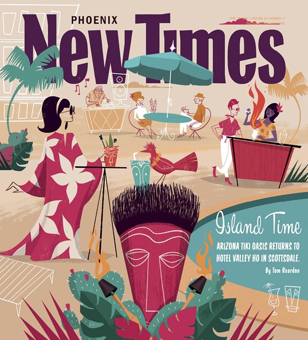
Do Not Sell or Share My Information
